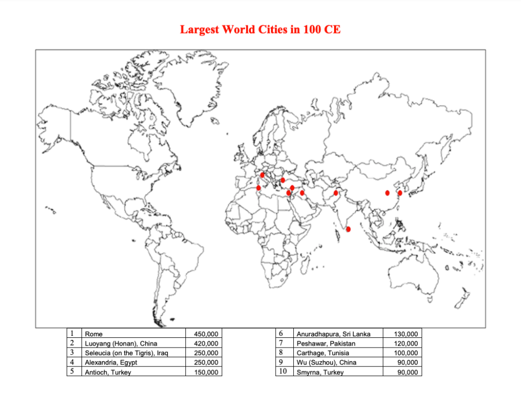
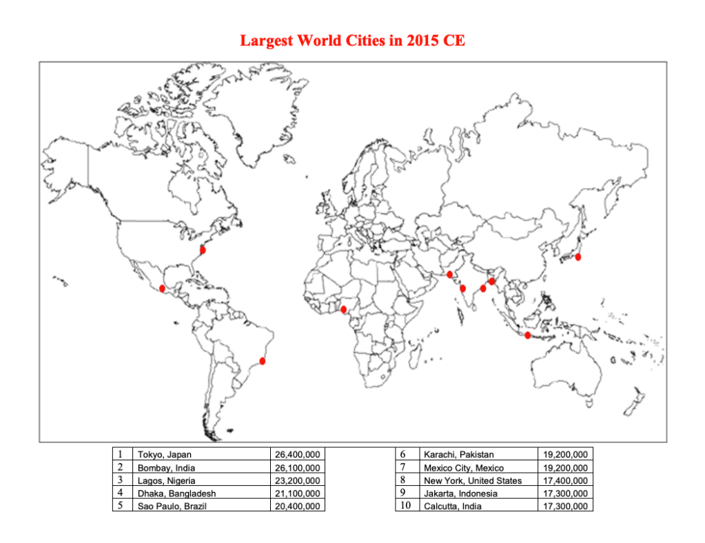
I just discovered this set of maps (via Brian Potter) looking at the largest cities in the world from 100 CE all the way through to today (well 2015 CE). Here are what the two bookends of this map series look like:


It is an interesting reminder of just how centralized the world was around the Mediterranean and parts of Asia, and also how nothing is guaranteed. As recent as 1900, cities like Manchester and Philadelphia were among the top 10 largest cities. Today they aren’t even close.
For the full map collection, click here.
UPDATE: The data behind these maps has been called into question. Look out for a follow-up post.

Quite impressive how my favorite city in the world, Istanbul/Constantinople, stayed on that list for almost 1500 years and is still one of the largest cities in the world today (albeit not in the top 10). No wonder that Napoleon said, “if the world was one country, Istanbul will be its capital”.
LikeLiked by 1 person
Neat, but the notion that Lagos had more people than Shanghai, which is somehow completely missing from the map, in 2015 is laughable. Sort of throws all the data into question.
LikeLiked by 1 person
Yeah, this post needs a v2
LikeLiked by 1 person
Pingback: Largest cities in the world — revisited – BRANDON DONNELLY