Daily insights for city builders, delivered every morning at 6 AM ET. I’m Brandon Donnelly — a Toronto-based real estate developer and founder of Globizen. I’ve been writing here since 2013.
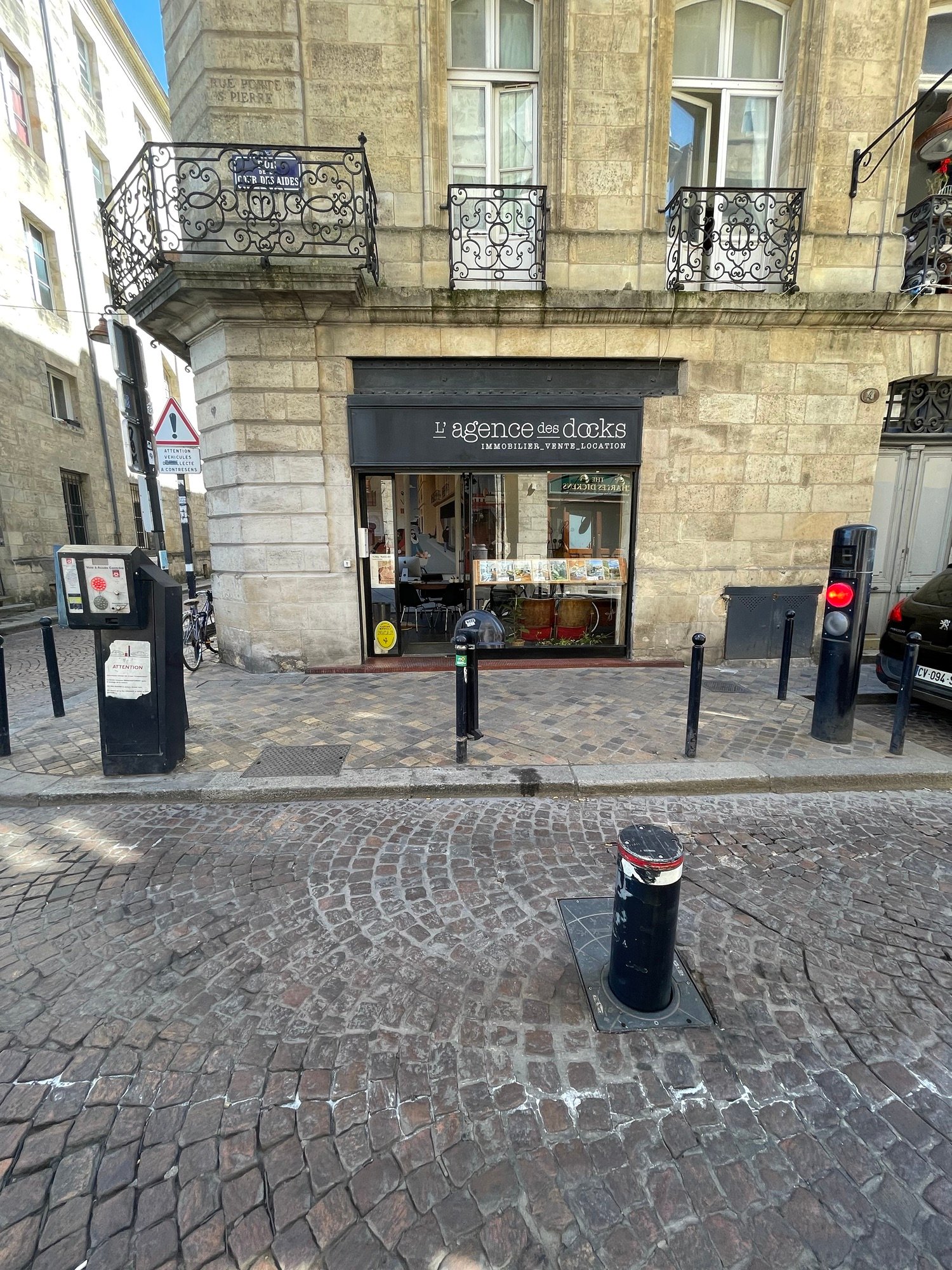
The mighty — and automatic — bollard is an important city-building tool that isn’t employed nearly enough in North America. It’s typically used to control car access to small pedestrian-only or pedestrian-first streets. But I guess if you don’t have any of these, then you may not feel the need to install such a device. The above photos are from Bordeaux. And if you want to gain access, you need to hit the intercom button and explain why you’re local traffic. Can you think of any streets in your city that could use a system like this? I can think of many in Toronto.
The 15-minute city is a popular topic these days. So here is a recent study that used GPS data from 40 million US mobile phones to estimate the percentage of consumption-related trips that actually adhere to this concept. The unsurprising result:
The overwhelming majority of Americans have never experienced anything resembling a 15-minute city. The median resident, we found, makes only 14% of their consumption trips within a 15-minute walking radius.
There is, of course, regional variation. For New York City, the data suggests that 42% of consumption-related trips occur within a 15-minute walking radius. Whereas in more sprawling cities like Atlanta, it’s only 10% of trips. Again, this is not surprising. But it begs the question: What should we do?
The challenge is that 15-minute cities generally require built environments that are dense, conducive to walking, and filled with a concentration of different amenities. And this is more or less the opposite of the prototypical suburban model, where the car and single-use zoning tends to spread everything out.
The good news is that zoning is relatively easy to change. For instance, if we want to allow corner stores in our residential neighborhoods, that is a decision we can make. The greater hurdle will be transforming car-oriented communities into places where people might actually want to walk. This is much more difficult.
Dave LeBlanc recently published an article in the Globe and Mail called, “How wide is your sidewalk?” And in it, he links to this sidewalk map of Toronto (pictured above), which uses open data from the city to plot sidewalk widths.
It was originally intended as a map of where social distancing is possible (oh, how far we’ve come), but today it serves as a really interesting way of looking at the city. What it makes clear to me is that we could use a lot more sidewalk, and that too many areas of the city have a discontinuous public realm.
Sometimes there’s very little that can be done until an adjacent property gets redeveloped. And when this does happen, the city will demand pedestrian widenings. But in other cases, there are solutions that could be implemented today, without private participation.
So I sure hope that someone is looking at a map like this and trying to come up with holistic solutions for making Toronto a more walkable and more pedestrian-friendly city.
Note: Sometimes a narrow sidewalk does not necessarily equal an inhospitable street. I mean, look at this example.
I have remarked this before, but I’ll say it again anyways: sneakers are very popular in Paris. Everybody seems to be wearing cool and colorful sneakers, regardless of what the rest of their outfit happens to look like.
Full business suit? Why yes, you should be wearing cool sneakers.
But why is that?
Paris is a famously walkable city. At any given time, you’re on average just about 500m from the closest subway station. So my entirely unproven sneaker theory is this: shoes follow built form.
If you build a city around people walking everywhere, one will ultimately choose the most appropriate kind of footwear.
Back when Toronto was debating the future of the eastern portion of the elevated Gardiner Expressway, I was an annoying and vocal supporter of tearing it down and replacing it with an at-grade boulevard. I was blogging about it ad nauseam. I participated in Jane’s Walks where I spoke about the merits of removal. And I even created a petition that went to City Council the day the decision was being made.
But throughout all of this, I felt like I was in the minority. Most people said I was crazy (though former mayor John Sewell agreed with me). How will people and services get to downtown Toronto? This is critical infrastructure, they said. And indeed, Toronto voted not to remove it.
Whatever you feel was the right decision at the time, that ship has sailed. We tore down a leg of the Gardiner east of the Don River, at that was positive; but the rest of it is either staying intact or being relocated. In both cases, it will be elevated.
But I believe in looking forward, not backwards. And so with that, I think we should be doing everything we can urbanistically to make the Gardiner as nice as it can be. It is for this reason that I think The Bentway is an extraordinarily important project. And it is for this reason that I wish we would light the underside of the Gardiner so that when you’re driving on Lake Shore it makes you feel happy.
We should light the underside of the Gardiner so that when you’re on Lake Shore it’s less depressing. pic.twitter.com/qT6xVUOw2q
But let me be clear before my inbox lights on fire: I am not suggesting that this is an approach to urbanism that is in any way desirable or worth emulating. I am not advocating for elevated highways running through the middle of dense downtowns and walkable city centers. All I am saying is that if we are stuck with something as dreary and as utilitarian as the Gardiner Expressway, the least we can do is make it kind of cool. And lighting can be a relatively cost effective way of doing that.
Berlin is considering something pretty radical. A grass roots movement called Volksentscheid Berlin Autofrei, or the People’s Decision for Auto-Free Berlin, is trying to turn the entire core of the city into a car-free zone. (There would be some exceptions and so we should maybe call it primarily car free.)
The area in question is everything inside of the city’s circular S-Bahn train line (pictured above), which would make it the largest car-free zone or mostly car-free zone in the world. It’s larger than Manhattan and it’s about the size of London’s zones 1 and 2, to help give you a sense of the scale.
So far the group has collected about 50,000 supportive signatures and, according to Fast Company, the Senate of Berlin is set to make a decision on the proposal next month. I have no idea how much community and/or political momentum this actually has, but I love how bold of an idea this is.
Is it too bold?
Again, it is perhaps useful to flip the question and use Seth Godin’s status-quo-bias-checker model when thinking about this. If the center of Berlin was already car free and a community group had just come forward with a plan to now allow vehicles, how do you think you’d feel? I could see that being contentious.
Next to the St. Lawrence Market (here in Toronto) is an appropriately named street called Market Street. It is a lovely street — perhaps one of the nicest in the city. It’s old and historic and it was completely redone several years ago (evidence here) with nice unit pavers, bollards, a curbless design, and seasonal restaurant patios.
In the winter months, the restaurant patios are packed up and additional parking is added to that side of the street. It was designed to be adaptable and in my experience it seems to be working quite well.
Right now the local Business Improvement Area is running a pilot project to see what this street might be like if it were to be pedestrianized. It was closed to vehicles this past weekend and the same will happen this upcoming weekend. Here’s a photo of what that looked like on Saturday:
It’s not perfect. A number of people commented on Twitter that the seating needs some shade. But hey, it’s a pilot project. It is about giving people a taste of what the future could be.
I am a fan of pedestrianized streets in the right locations and when executed well. And I think this stretch of Market Street is a perfect candidate. It’s already pedestrian-only to the north of Front Street and it has the right kind of “edges” to ensure that it can be properly animated.
If you feel the same way, I would encourage you to fill out this short survey that the St. Lawrence BIA has put out. I would also be curious to hear your thoughts on pedestrianized streets in general. Leave a comment below.
The North American rule of thumb is that young people — specifically people in their 20s — are the most likely to to live in an urban neighborhood. After that it’s all down hill and, broadly speaking, the percentages decline. But at some point, much later in life, the data suggests that there is a reversal and people start to return to urban neighborhoods, albeit not to the same extent. Part of the explanation for this is that as people age they start to look to more walkable neighborhoods where they don’t need to get a car to get around.
But in this recent NY Times article, Jed Kolko points out two interesting trends. One, the “urban boomer” appears to be on the decline in the US. In 1990, about 21.6% of Americans aged 54 to 72 lived in an urban neighborhood (categorized by density). As of 2018, this number had dropped to around 17.8%. And two, the age at which there is a reversal (and people start returning to denser neighborhoods) is also increasing. Perhaps because people are living longer.
Jed’s conclusion: American boomers, today, are actually less urban than previous generations.
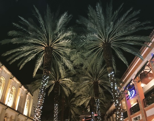
Last night I was in CityPlace, West Palm Beach. Completed in 2000, CityPlace is a quintessential example of New Urbanism. (For those of you from Toronto, this is a different kind of a CityPlace.)
In case you’re unfamiliar with this movement, here’s a snippet from The Charter of New Urbanism (via Wikipedia):
“We advocate the restructuring of public policy and development practices to support the following principles: neighborhoods should be diverse in use and population; communities should be designed for the pedestrian and transit as well as the car; cities and towns should be shaped by physically defined and universally accessible public spaces and community institutions; urban places should be framed by architecture and landscape design that celebrate local history, climate, ecology, and building practice.”
At a high level, New Urbanism makes a lot of sense. American cities were sprawling uncontrollably and so advocates had decided that something had to change. The Congress for New Urbanism was founded in 1993.
But the New Urbanism movement has had its share of critics. Here’s how Witold Rybczynski – professor at the University of Pennsylvania – talked about it on his blog:
“What are the important ideas that have affected American cities in the last 20 years? The development of waterfronts. The renaissance in constructing urban parks. The move of genXers and retirees into downtowns. High-rise urban living and Vancouverism. The popularity of urban bicycling and bike-rental programs. Ditto for Zipcars. Urban farmers markets and community gardens. Urban charter schools. The dramatic expansion in attendance of urban cultural institutions, especially art museums. Urban tourism. Downtown trophy buildings. The emergence of influential big-city mayors. Have any of these been the result of the new urbanism movement?”
Frankly, I have never been a big follower of New Urbanism. It has always felt artificial to me. But I recognize the immense challenge in transforming car-oriented cities and communities into walkable ones. It’s one of the greatest challenges in city building. You’re asking people to change their habits.
If any of you are experts on New Urbanism (because I am certainly not), I would love to hear from you in the comment section below.
Last month it was announced that Amazon will be taking 127,000 square feet across 5 floors in a new office tower in Toronto’s emerging South Core neighborhood. The space will be used for about 800 employees and they’re expected to take occupancy this fall.
At the same time, I learned that Amazon will be joining Apple (positioned 6 floors below them in the same tower) and Cisco in South Core.
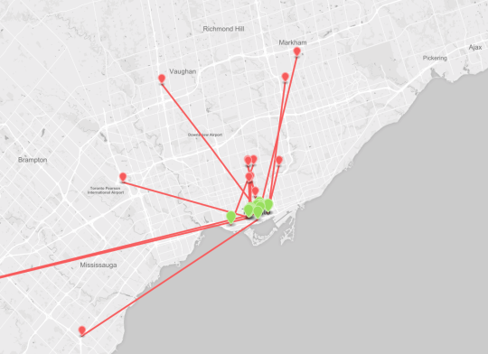
The first thing I noticed when I looked at the data is that there’s a clear trend towards downtown. Perhaps that was the point of the study, but it’s still interesting nonetheless.
From Google and Deloitte to eBay and Aol, every single tenant in the CBRE list is or will be moving downtown (or to the shoulders of downtown).
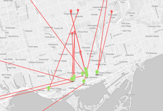
Here’s what that looks like from a regional scale (red marker is where they were; green marker is where they are going):
Companies know that their greatest asset is human capital. And they have quickly realized that a lot of young smart people want to live and work in dense walkable communities. They’re simply moving to where people already want to be.
So here’s a question for the Architect This City community: On a scale of 1 to 10, how important is a company’s location when determining whether or not you’d like to work for them? Let’s talk about it in comment section below.