Daily insights for city builders, delivered every morning at 6 AM ET. I’m Brandon Donnelly — a Toronto-based real estate developer and founder of Globizen. I’ve been writing here since 2013.

Category: Planning

  • Squatters, not planners, created Bologna’s beloved porticoes

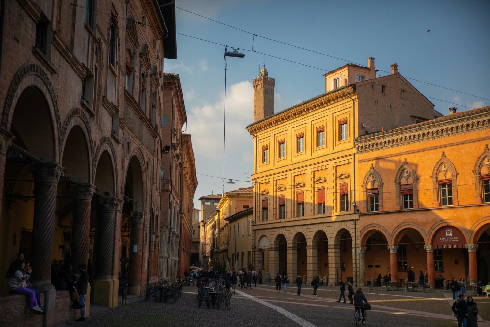
    Bologna, I’m told, is a city famous for its colonnades or porticoes. I’ve never been, but it’s a city that’s on my list. Bologna has 62 km of covered walkways, 40 km of which are in the city centre, and they are designated as a UNESCO World Heritage Site. They provide shade in the summer, and protection from rain during the winter. But how did this happen? What’s the legal structure underpinning them?

    Bologna’s porticoes go back roughly a thousand years and, interestingly enough, they are a result not of some grand, top-down master plan, but of a ground-up, market response. Bologna was a dense, walled city, with a growing population. Space was at a premium and so unscrupulous developers and landlords started encroaching into the public right-of-way and cantilevering their buildings outward. Few people were apparently fussed.

    The earliest evidence of a portico in Bologna seems to date back to the year 1041 — an example of private use of public land. But over time, the utility of these colonnades started to be more broadly appreciated. Not only did they protect pedestrians from the elements, but they allowed craftsmen to work outside of their workshops with natural light and with similar shelter.

    Gradually, porticoes became obligatory (at least in some areas and on some sites). This then transferred the porticoes from private use of public land to public use of private land. Developers were forced to build them.

    My understanding is that the vast majority of the porticoes exist today with this legal structure. The land is private, but the public enjoys an access easement in perpetuity. This means that private owners must pay to maintain these colonnades. It’s an example of what we often call here in Toronto a POPS space — a privately-owned, publicly accessible space.

    These spaces took many centuries to become codified, but what I find most interesting is that they are a product of ground-up innovation. A more contemporary example of this is Tokyo, which is often considered to be an example of bottom-up planning. Here’s a book on the topic called Emergent Tokyo — Designing the Spontaneous City.

    Turns out, Bologna’s beloved colonnades weren’t the product of visionary planning, but of Medieval squatters.


    Photo by Ryan Ladd on Unsplash

  • Why do cities build skyscrapers?

    Very generally speaking, cities build skyscrapers because of some mix of natural market forces and symbolic prestige. In cities like New York and Hong Kong, where land is extremely scarce and valuable, the only option is to go up. Tall buildings are essential. And in cities like Dubai, I think it’s fair to say that symbolic prestige has been the greater motivator, at least at the outset of the city’s modern reinvention as a global city. Tall, over-the-top buildings helped put the city on the map, even when tall, over-the-top buildings weren’t necessary from a direct economic standpoint.

    Another way to encourage tall buildings is to simply restrict everything else. Ontario’s Places to Grow Act of 2005 was well-intentioned. It was designed to encourage intensification, support transit investment, and curb urban sprawl. I believe that all of these things are desirable planning outcomes. But one of the ways that intensification was sold, politically, was that growth would only be directed to specific areas and that the preeminence of single-family housing in the region would not be in any way threatened.

    The result is what has been pejoratively referred to as “tall and sprawl,” meaning tall buildings surrounded by vast swaths of low-density housing. It’s a built-form contrast that feels unnatural precisely because it is a market distortion created by policy. In a pure market without zoning constraints, the likely built-form outcome would be a smoother density gradient down from major urban nodes and transit stations (where land values tend to be higher). Of course, the Toronto region is filled with countless counterexamples of this.

    Now, to be fair, good work is being done to address this missing layer of medium density, but we’re not there yet. And we’re still working through the supply of the last cycle. Rachelle Younglai recently published an article in The Globe and Mail called “Condo developers outside Toronto feeling the biggest strain from market’s downturn.” This is not surprising. Peripheral markets generally get hit the hardest during real estate downturns and take the longest to bounce back. But on top of this, there are suburban towers that probably didn’t need to get built. The economic imperative was tenuous but for the planning restrictions and the pre-construction condo market.

    My suggestion would be to upzone the areas surrounding these towers and remove as many development constraints as possible, especially around transit nodes. This may seem paradoxical given we’re currently talking about excess supply, but the glut is likely a product mismatch problem. Allowing the surrounding areas to fill in invites the market to build what is most in demand, smooth out the density gradient, build amenities, and create destinations that could then lift the value of the entire node.

    This is not an immediate solution, but it’s a path toward a more natural market outcome. Need a case study to point to? Look to Tokyo. Flexible permissions, mixed-use zones by default, and an orientation around rail have allowed Tokyo to organically evolve into one of the most livable global cities on the planet.

  • Density is a feature of cities

    My sense is that density is a misunderstood characteristic of successful cities. I think most people see it as a bug. They see some of the negative externalities associated with cities, such as traffic congestion, and they assume that the culprit is too many people.

    But they are confusing population density with land-use inefficiencies. This, I can only assume, is why some people arrive at the selfish conclusion that their city is full.

    There are, of course, many counterexamples to this line of thinking. Paris, Seoul, Barcelona, Singapore, Tokyo, and many others have both high population density and are viewed as being highly livable and desirable cities.

    Not all high-density cities are livable, but that’s because other ingredients are missing. I will remind you that Tokyo once again placed first in Monocle’s annual quality-of-life survey this year.

    What I think gets missed are the following three key features of urban density.

    One, dense cities dramatically lower the cost of delivering infrastructure over the long term and reduce per capita energy consumption.

    Two, cities are wealth-generating machines and density drives “agglomeration economies.” Put smart and entrepreneurial people in close proximity to one another, and good things happen.

    Three, the only way to create an enormous, well-functioning city like Tokyo is on the backbone of transit. And the only way to make transit viable and convenient for most people is to build density all around it. Density is the unlock that makes it all possible.

    Ironically, then, density is what can make cities feel less congested and more livable.

  • What does Toronto want to be?

    So, what bold and uncomfortable 21st-century master plan should Toronto adopt? I don’t know exactly, but what I was getting at in my lead-up post is that it’s hard not to sometimes feel like Toronto is trying to run a 21st-century global city on a 19th-century Victorian street grid, surrounded by Houston.

    In the core of the city, we have narrow, generally 20-metre rights-of-way. Many of these east-west arteries are beautiful streets to walk on with fine-grained retail patterns, but the streets themselves have slow-moving streetcars in the middle two lanes and on-street parking on both sides. The result is streets that don’t move and are frustrating to navigate for all users: drivers, transit riders, and cyclists. It can take an hour to drive 10 km.

    Other major streets don’t have streetcars or much retail activity, but the land-use pattern reflects a bygone era. It doesn’t make sense to have only single-family housing on Toronto’s busiest arteries. It’s time for these streets to grow up. (To be fair, the City of Toronto is trying to achieve this with its new Major Streets policies, but the development economics do not make these changes feasible at scale.)

    As you move out of the core, Toronto’s major streets naturally widen along with the recency in which they were built. Now we have the opposite problem where we’re faced with “stroads” with little to no urbanity. Overall, it’s the result of a city that grew organically over time without the same kind of defined plan seen in cities like New York, Barcelona, and Paris (after it had already been built out).

    Here’s the thing: Toronto’s low-rise single-family era is over. Virtually the only single-family housing that gets built nowadays is when somebody demolishes an existing house and builds anew. The future is a uniformly higher-density city built on the backbone of robust transit, vehicular, and cycling networks; not a monocentric downtown that people commute to.

    So what might that mean exactly?

    To start, I believe it means getting our transit vehicles onto their own dedicated lanes, widening certain major streets (for the benefit of cars), shrinking and pedestrianizing others (for the benefit of human-scaled urbanism), carving through new major streets to fix connectivity gaps, and pricing congestion as a means of funding constant transit expansion. My fellow urbanists may not want to hear me advocate for the selective widening and creation of arterial roads, but we have to stop pretending that cars are going to disappear.

    Once the bones are in place, it’s then a matter of getting the land-use policies right and letting the private sector do what it does best — build for the future. Now, I don’t profess to know the exact combination of major street widths, one-way patterns, and whatever else should be done, but I do feel strongly that it’s time for a bold and uncomfortable 21st-century master plan for Toronto.

    What does Toronto want to be? We should host an international design competition and find out.


    Cover photo by Oles Borys

  • Toronto needs a bold and uncomfortable 21st-century master plan

    Earlier this week, I tweeted that Toronto needs a Haussmann moment where we make some bold and uncomfortable changes in order to set ourselves up to be a dominant 21st-century global city. I mentioned Haussmann because his work is perhaps the most notable, but that is just one example.

    In addition to Haussmann’s renovation of Paris (1853-1870), I was also thinking about the Commissioners’ Plan for New York City (1811), and Ildefons Cerdà’s grid system of octagonal blocks for Barcelona (1859), as well as some more contemporary examples.

    In recent years, Barcelona has revisited its grid system and pioneered a new set of “superblocks” that focus traffic along the periphery and create pedestrian-focused spaces on their interior.

    The common thread among these examples is that they all represent a grand master plan. In the case of Barcelona and New York, it was a plan that served to guide development as the city grew. And in the case of Paris, it was a destructive plan that went back and redid what was deemed to have not been working. (In thinking about this now, it’s probably best that I used Haussmann as the example in my tweet).

    Toronto has never had such a plan. We flirted with the City Beautiful movement at the beginning of the 20th century — a movement intent on beautifying and introducing monumental grandeur to our cities — but, not surprisingly, we ultimately saw it as a superfluous and frivolous spending exercise.

    Instead, Toronto has grown incrementally, becoming what I see as an accidental global city. We are no longer the ultra-conservative, deeply Protestant city that we once were, but at the same time, it’s hard not to feel like we have a grid and public realm that doesn’t reflect the city we have become today.

    Toronto needs a bold master plan. And over the coming weeks, I’ll put some of my ideas to paper. In the meantime, if you have any of your own, please feel free to share them in the comment section below.

  • Environmental Defence publishes new mid-rise building manual

    Ontario’s goal is to build 1.5 million new homes by 2031. It is widely understood that we need a lot more housing. But it’s a bit of a curious thing, because we do actually have homes available right now. There are developers with standing condominium inventory; landlords with vacant apartments; and many other options. So what is it that we need exactly? A more precise description would be that we need a diverse mixture of more attainable housing.

    For this to happen, we’re going to need to make some structural changes to the way we deliver new homes. The above image is taken from a recent report by Environmental Defence and Robert Eisenberg (in collaboration with LGA Architectural Partners and SvN Architects + Planners). The report is called the Mid-Rise Manual and it’s a comprehensive look at we can and should be doing to unlock more of this housing type.

    What I love about this image (and the report) is that it speaks to a very different kind of city than the one we have grown accustomed to in North America. Instead of towers in a sea of low-rise houses, it shows a diversity of building types — in a way where you could also imagine a diversity of individual home types. This is unequivocally where cities like Toronto and others are headed. It’s just a question of how soon we follow the manual.

    Click here to download a copy of the report. (There’s also a summary report of key takeaways if you’re looking for something quick to read.)

  • Paris introduces new limited traffic zone

    As counterintuitive as it may sound, one way you could try and improve traffic congestion is to discourage people from riding their bikes and instead encourage them to drive more. That’s what’s happening in Toronto right now. Another way is to dramatically restrict car usage. And starting this Monday, that’s what Paris will be doing with its new limited traffic zone (zone à trafic limité) in the center of the city:

    This new ZTL is approximately 5 square kilometers. About 100,000 people live within its boundaries, and it is estimated that somewhere between 350,000 to 500,000 vehicles enter it each day. But according to the city, it is estimated that only around 30% of these trips are absolutely necessary (because of a lack of alternatives, for example). The purpose of the ZTL is to reduce the unnecessary ones.

    The way it will work is that drivers will no longer be allowed to drive through this zone. You’ll only be able to enter if you plan on stopping for a legitimate reason. It’s not yet clear what this exact list of approved reasons will be, but the general idea is that if you want to drive in for dinner or to attend a meeting, that’s fine. What you can’t do, though, is just drive around in a souped-up Honda Civic blasting Taylor Swift.

    The next 6 months are planned to be a period of education. Drivers exiting the zone are just going to be told that there’s this new ZTL and that they better have stopped somewhere. But eventually there will be a 135 euro fine and eventually drivers will be expected to furnish some sort of supporting evidence for their stop, such as a restaurant receipt. There’s also talk of adding automatic cameras.

    Of course, this creates a lot of gray areas. What about if you’re just going over to a friend’s place for dinner? Will they then need to write you a note saying that you went over for some homemade bouillabaisse? Yeah, I don’t know the answer to this. But you have to admit that this is a bold city-building move, and a far more effective way of improving traffic flows.

    Unlike removing bike lanes, this plan will actually work.

  • Dupont Street to become a complete street

    The City of Toronto is proposing to turn Dupont Street — between Dundas Street West and Davenport Road — into a “complete street.”

    Here’s the area in question:

    It’s 4.7 kilometers long.

    And here’s how the city thinks about complete streets:

    “Complete streets” are streets that are designed to be safe for all users: people who walk, bicycle, take transit or drive, and people of varying ages and levels of ability. They also consider other uses like sidewalk cafés, street furniture, street trees, utilities, and stormwater management.

    Right now, the city is in the public consultation phase. If you’d like to provide your feedback, you can do that here. You have until October 30th. The online tool is also pretty neat. You can drop comments on specific areas of the street. And already the map has been totally filled up.

    This is an important and busy artery in midtown. I use it all the time as a pedestrian, cyclist, and driver. It’s not the best street, though. Yesterday it took me 45 minutes to drive from one end of it to the other. Along with better street design, this part of the city could use better transit.

    I’m looking forward to seeing how Dupont ultimately gets designed.

  • Density is good

    Here is an interesting chart (source) showing housing starts in Canada, by type, between 2000 and 2023:

    As recent as 2000, single-family houses accounted for 61% of total starts and multi-family housing accounted for 39%. This flipped somewhere around the financial crisis and, last year in 2023, the percentages were 23% and 77%, respectively. This is a meaningful inversion which has helped our cities become more vibrant and more conducive to non-car modes of transport.

    But in this recent article about Canadian housing, Donald Wright more or less argues: so what? We’ve been densifying our cities for all these years, but it hasn’t helped our affordability problem. Supply must not be the answer to our housing crisis.

    I’m not exactly sure what he believes to be the solution, but I don’t think this problem is as simple as “we’ve built some housing, we made our cities denser, and yet housing is still expensive — more supply must not be the answer. Let’s move on.”

    Among many other things, it’s important to understand what kind of density we’ve been building. Because up until very recently, we’ve basically taken the position that single-family neighborhoods should never be touched, and that density should only go in very specific areas — and only after a lengthy and expensive rezoning process has been completed.

    We’ve designed new housing to be expensive.

    But attitudes are changing all across North America. We are now starting to do two very important things: (1) we are opening up more of our cities to intensification and (2) we are now allowing more multi-family housing on an as-of-right basis. Meaning, no lengthy rezoning exercises and no risk of community opposition.

    These are two fundamental changes that should alter the kind of density that gets built. And in my view, it’s going to be a positive thing for Canadian cities.

  • Leslie Lookout Park

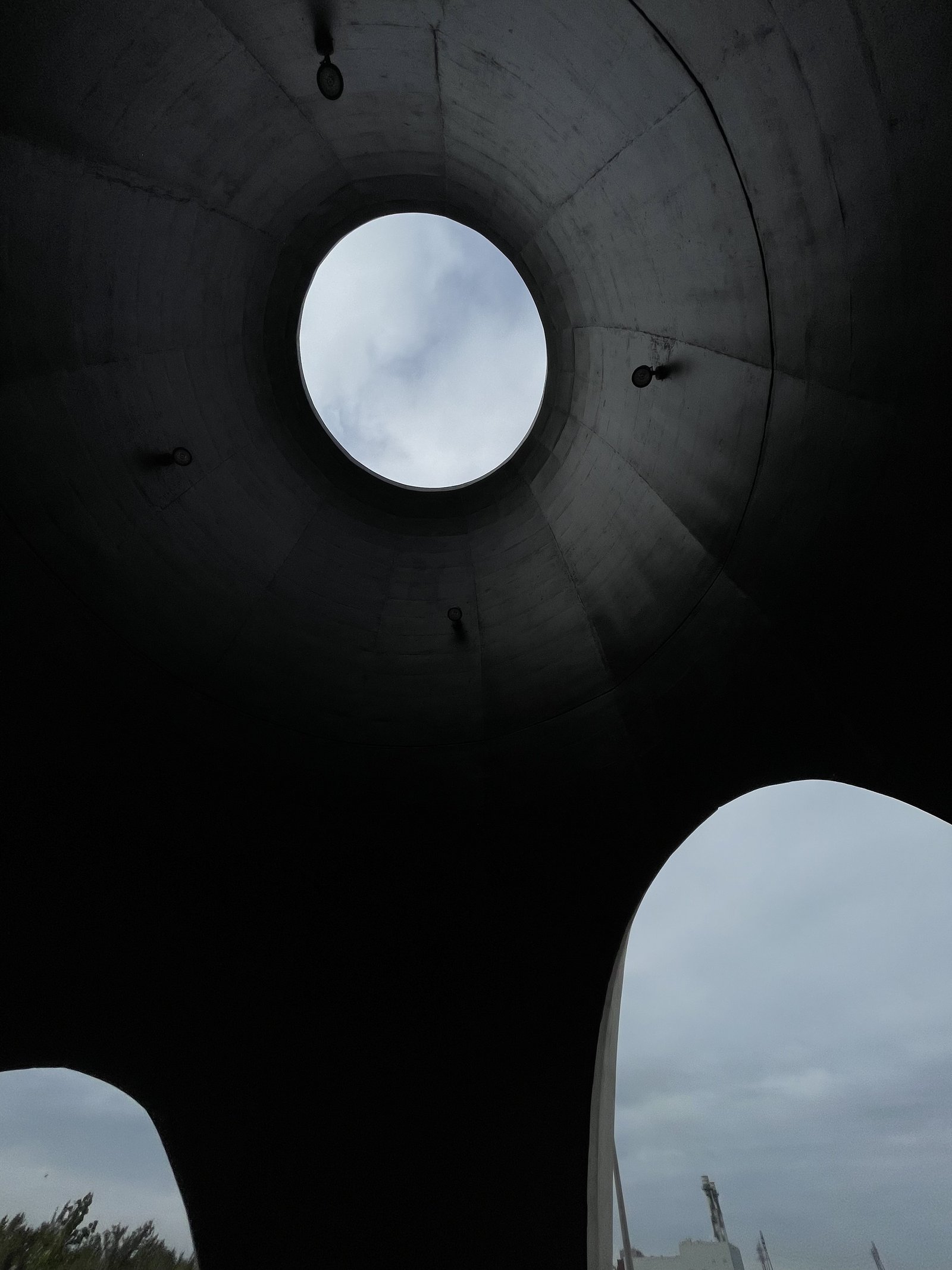
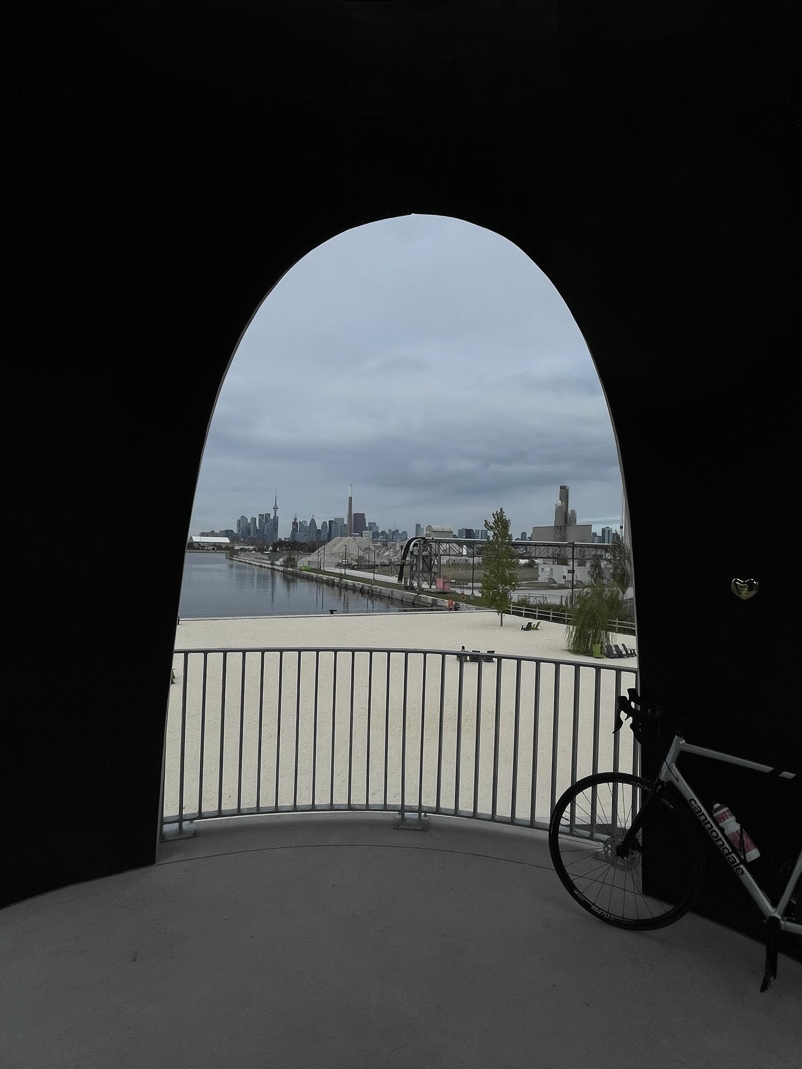
    This morning I rode out to Toronto’s new Leslie Lookout Park, which opened two weeks ago. I came down Cherry Street, crossing the new north bridge, and then I went all along Commissioners Street, crossing its new bridge.

    It’s great to see the Port Lands area continue to develop. Every time I’m down there, it feels more and more real — like an extension of the city. Now we just need to start developing within the blocks.

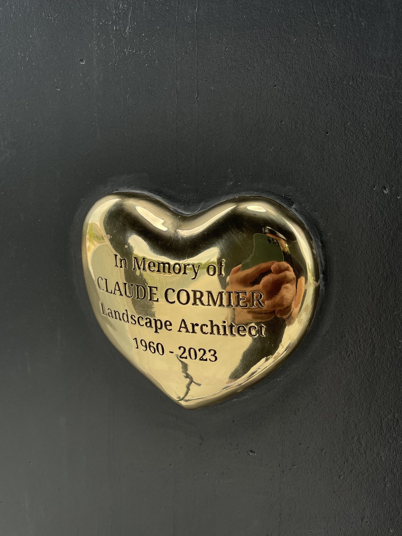
    If you find yourself at Leslie Lookout, make sure you locate Claude Cormier’s heart up in the tower. Claude’s firm CCxA was the landscape architect behind the project; but sadly, he passed away last year.

    Exactly 1 year before the opening of this park.