Daily insights for city builders, delivered every morning at 6 AM ET. I’m Brandon Donnelly — a Toronto-based real estate developer and founder of Globizen. I’ve been writing here since 2013.

Category: Places

  • Old Toronto is unlike anywhere else in Ontario

    May 8, 2026 · View original
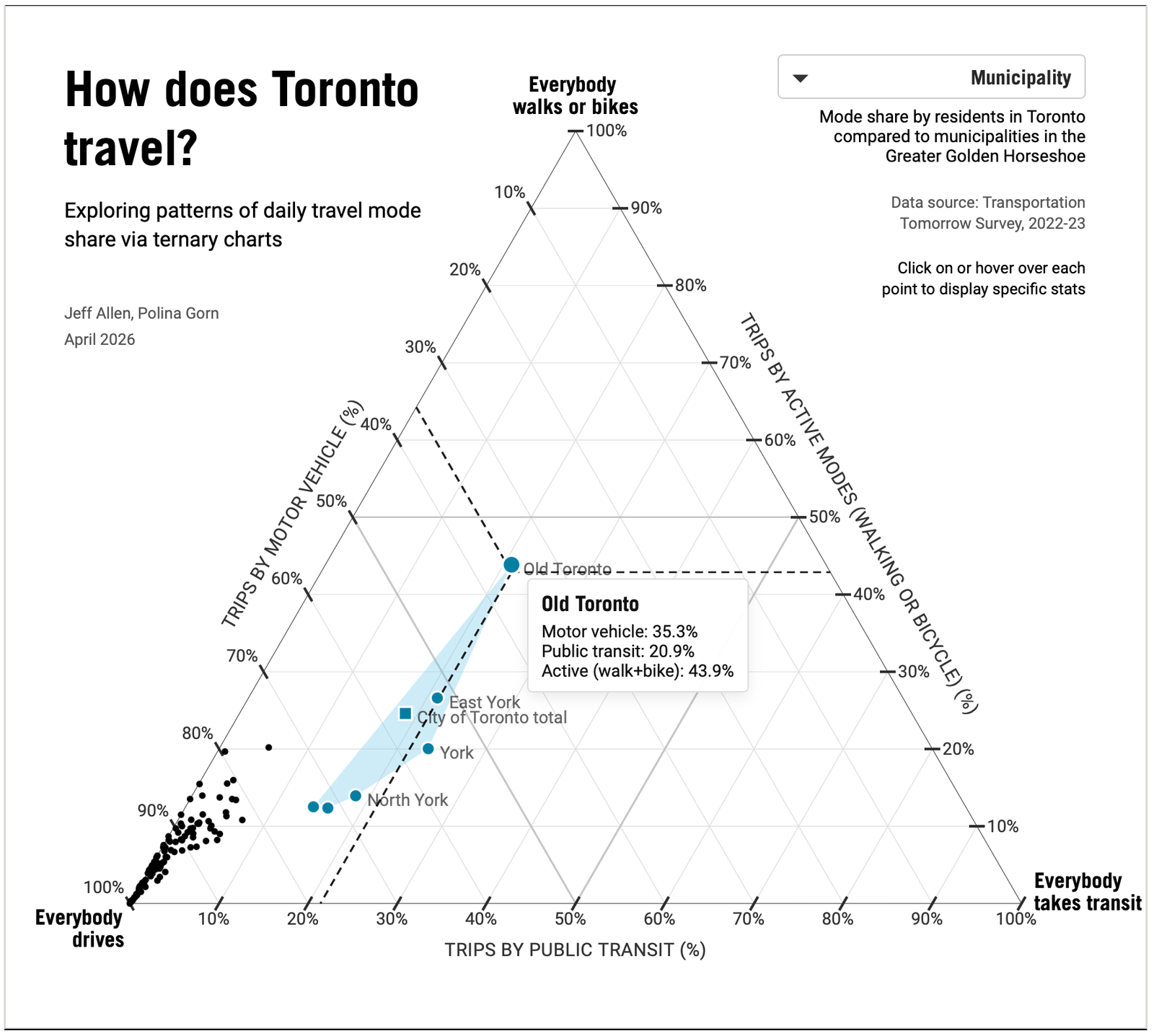

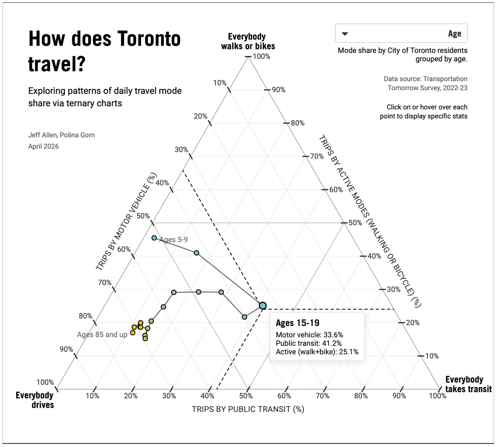
    These charts, from the School of Cities at the University of Toronto, are an excellent use case for a ternary chart. A ternary chart is a triangular plot with three different variables that all sum to a constant. In this case, the charts compare driving, walking/biking (active transport), and taking transit, with the constant being 100%. The data is from the 2022-23 Transportation Tomorrow Survey.

    What is clear from the first image above is that Old Toronto (also known as the former City of Toronto before amalgamation) is unlike any other municipality in Ontario. Its tight, pre-car urban fabric and transit coverage mean that nearly 65% of people walk, bike, or take transit! This is compared to about 43% for the entirety of the city today; meaning, Old Toronto is the only place where driving isn’t the majority mode.

    The second chart above shows mode share by age. What is interesting to see, though not surprising, is that younger people are more likely to walk, bike, and take transit. Here, the figures peak between the ages of 15-19 with over 66% of trips falling into these categories, which is just slightly above the Old Toronto figure. Then, as people get older and have greater incomes (which is another one of the charts), they move toward driving.

    Of course, this doesn’t mean that all older people must drive. There are lots of older people who live in Old Toronto where doing something other than driving makes up the majority of trips. Urban form, density, and access to transit play the most important roles in determining what modes of transport people will choose and what they find most convenient.


    Cover photo by Mitch Hodiono on Unsplash

    Charts from the School of Cities

  • ULI Toronto visits One Delisle

    May 7, 2026 · View original


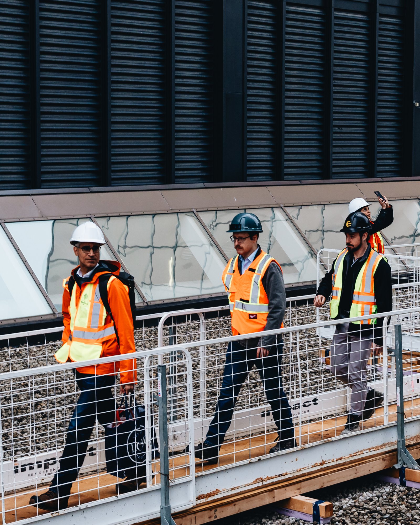
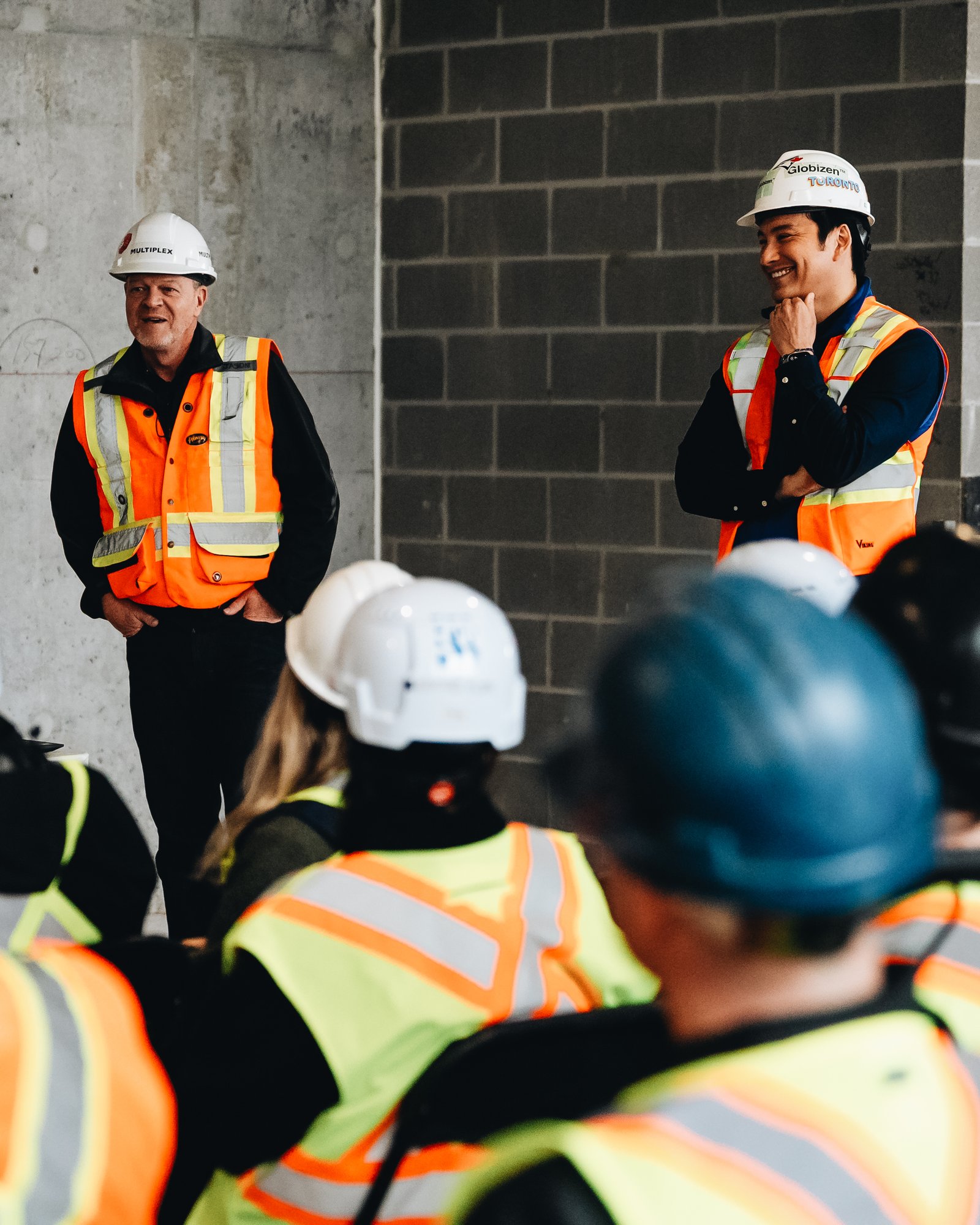
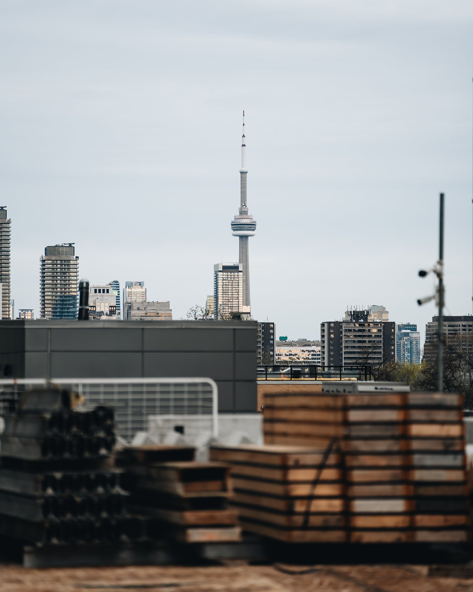
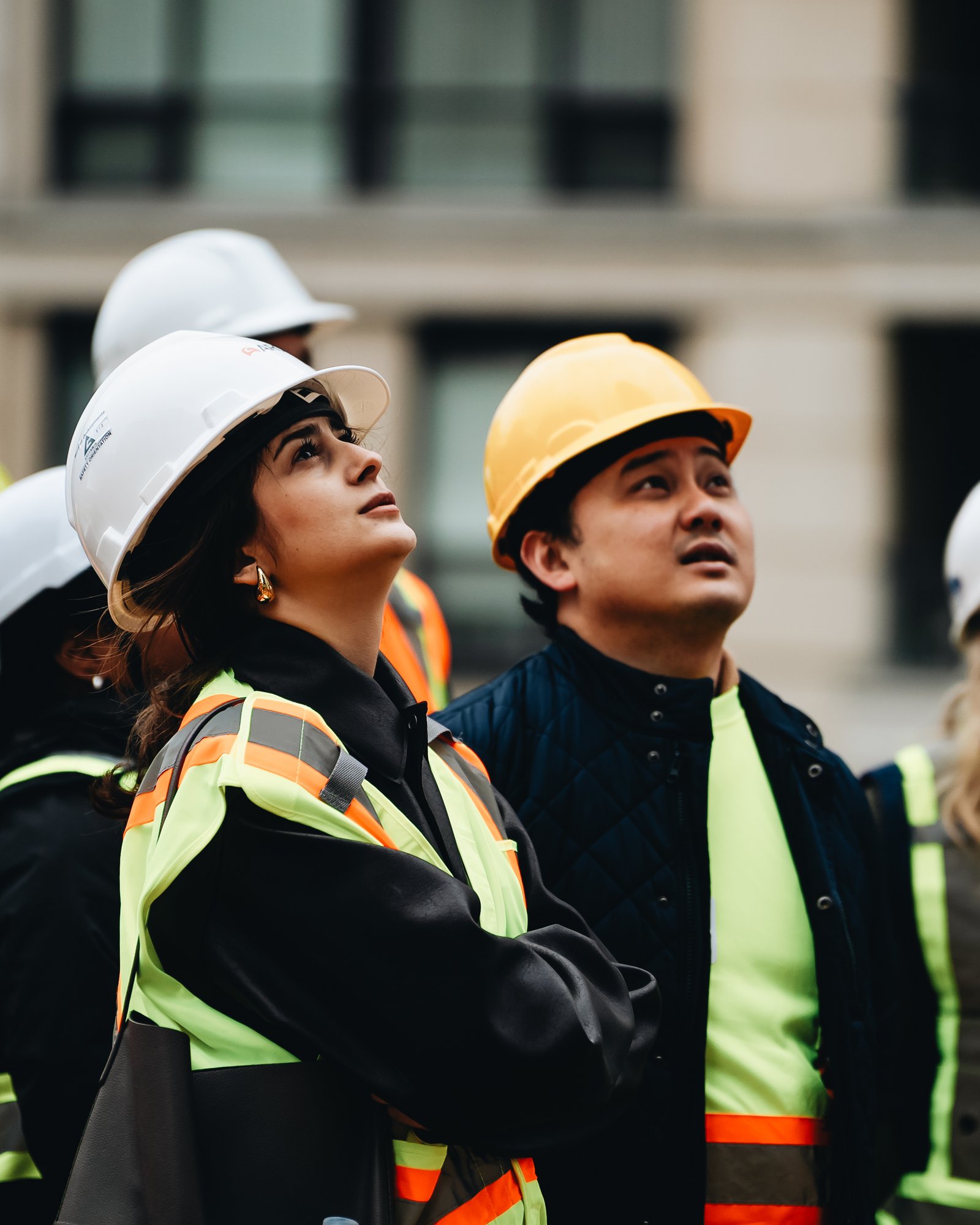
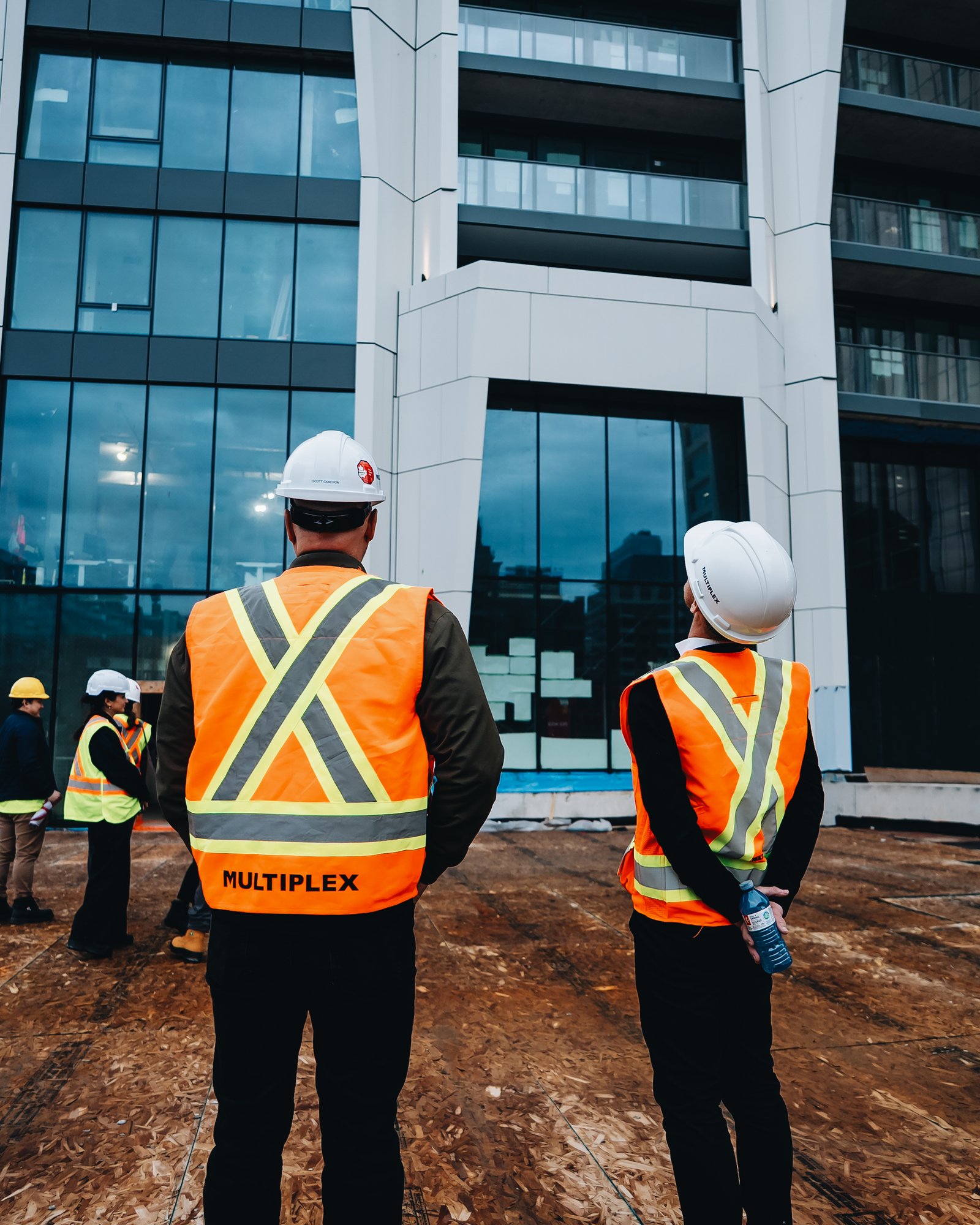
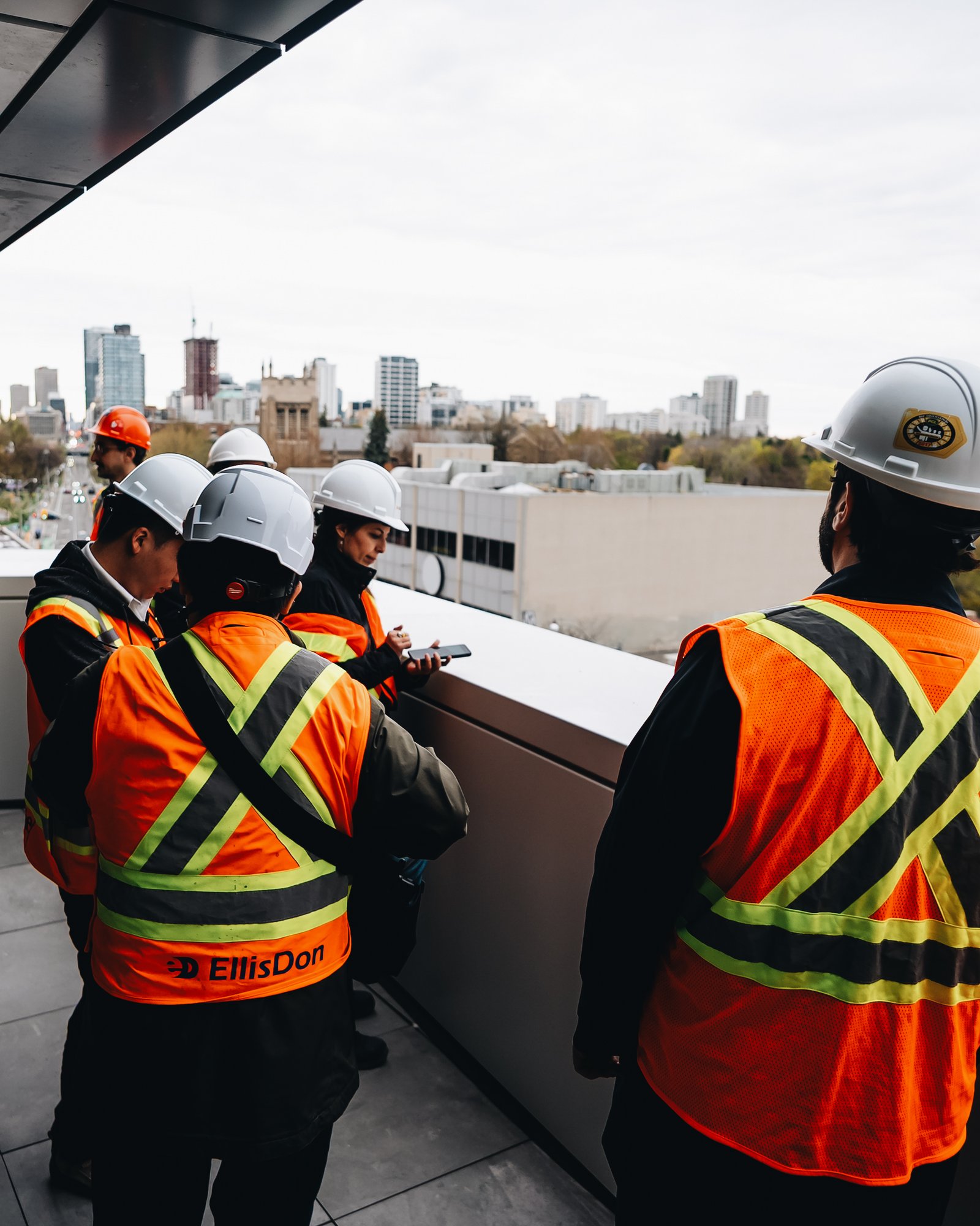
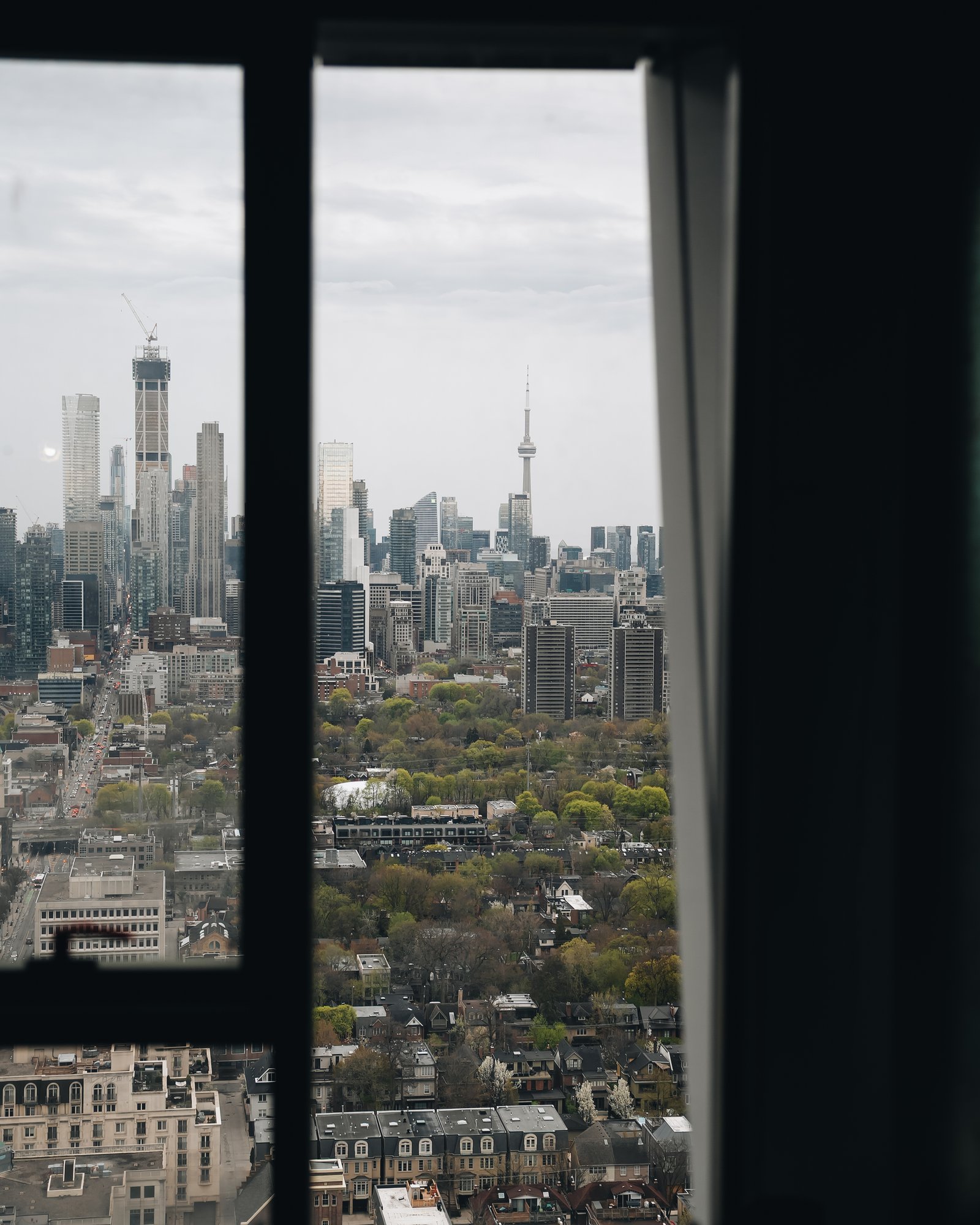
    This week, ULI Toronto visited One Delisle for a behind-the-scenes look at what we believe is this city’s next global landmark. The tour sold out in under 24 hours, and it was great to see so much interest from our industry peers. For those of you who made it out, thanks for taking the time! Here are some photos from the event, all courtesy of Multiplex Construction Canada.

  • Inside the plan for Toronto’s longest car-free street

    May 2, 2026 · View original


    Toronto, by and large, does not like car-free urban streets. I mean, we have very few of them. Let’s try and name them. The most notable would be the Distillery District. Next to this would perhaps be the intersection of Gould Street & Victoria Street on TMU’s campus. Then there’s Willcocks Commons at the University of Toronto, though it’s not the prettiest.

    After this, I can only think of small, unremarkable or temporary ones. I’m not counting seasonal closures. Technically, the Toronto Islands are the largest car-free community in North America, but I wouldn’t call this urban. So I’m now at a loss. If I’ve missed any noteworthy ones, I would be happy to be corrected.

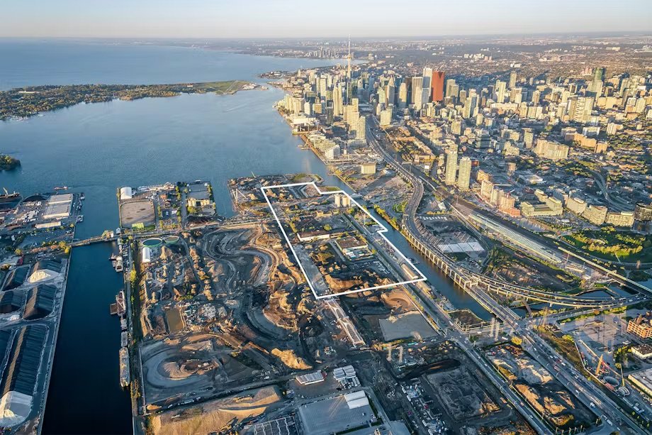
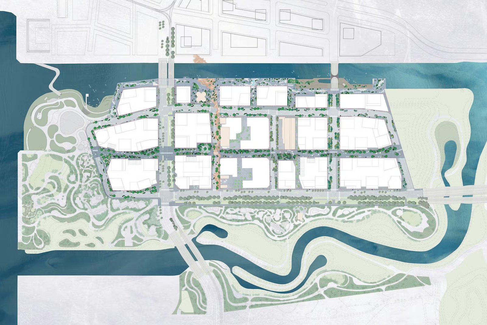
    This concise list makes the recently revealed masterplan for the island formerly known as Villiers — now called Ookwemin Minising (or OM) — all the more exciting. The 16-block plan now includes a 760-metre-long, fully pedestrianized public space called Centre Commons. It runs east-west in the site plan below, and is intersected by a north-south street called The Sandbar Trail.

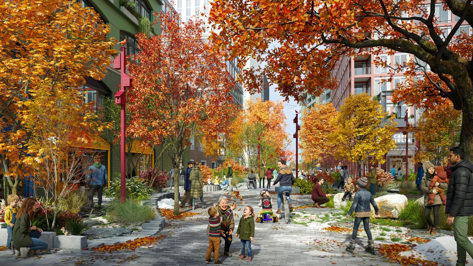
    As designed, Centre Commons is expected to be the longest car-free street in the city and look something like this:

    This is the space in between the buildings. Equally important is the fact that the new masterplan unlocks a 27% increase in finer-grained density, without compromising on the quality or quantity of public space on the island. This is a major improvement over the previous masterplan, which had all the hallmarks of bland pseudo-urbanism. Meaning, it was supposed to be urban, but it wasn’t actually.

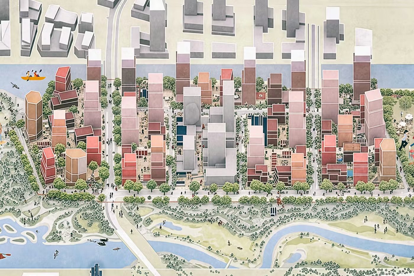
    I love the above massing diagram because it feels like a real, organic city, as opposed to just a series of repeating towers on podiums. It has a variety of scales and a more fine-grained urban pattern. This, as we have talked about, is notoriously difficult to achieve in new master-planned communities. But it is possible: loop transit through the island, lower the parking requirements, and give developers the freedom to build.

    The design team includes SLA of Copenhagen (landscape architects), Trophic (Indigenous-owned landscape architects), GHD (prime consultant and technical lead) and Allies and Morrison of London (architectural lead). And when built out, OM is expected to support approximately 12,000 new homes (including 3,000 affordable homes) and 2,900 new jobs.

    I say we build it.


    Cover photo by Allies and Morrison

    Aerial image from Waterfront Toronto

    Centre Commons rendering by Norm Li via SLA

    Area plan and massing diagram by SLA

  • The movable icon of Paris

    April 27, 2026 · View original


    Movable chairs have been a feature of Parisian parks since the 18th century. Chairs are more comfortable than benches, and movable ones allow you to direct yourself toward the sun, cluster in groups, or just situate yourself so that you can prop your legs up and read a book.

    Now, here’s a brief story of how this came to be.

    At the outset of this innovation, park chairs weren’t free. If you wanted a bench upgrade, you had to pay. Private concessionaires would rent them out to visitors (like umbrellas at a beach), maintain them, and presumably ensure that things were kept generally tidy around the grounds.

    Then, around 1923, the iconic green Sénat chair was designed by the Ateliers de la Ville de Paris. If you’ve ever been to Paris, you know this chair (see cover photo). It comes in only three models: chair, armchair, and recliner, all of which are green. RAL 6013 green, to be exact.

    Eventually, the Sénat chair was imposed as the Parisian park chair. By 1955, it was the only possible option that could be rented out by concessionaires in places like the Jardin du Luxembourg. This set the stage for it to become one of the most recognizable symbols of the city.

    But due to the popularity of these chairs and the fact that people would rather not have to pay to sit in a park, it was decided in 1974 that the chairs should be free, and they were bought from the concessionaires.

    In 2002, Frédéric Sofia designed an offshoot of the chair called the “Luxembourg.” The Luxembourg is made of aluminum, as opposed to steel, and is therefore lighter. It’s also available for sale to the general public, whereas the Sénat chair is exclusively for city parks.

    The result of this centuries-long tradition is an iconic symbol for the city and an established culture of employing movable chairs in public spaces. A humble movable chair may not seem like a big deal, but in the world of public spaces, it is.

    Try to incorporate movable chairs into a park or public space today and, invariably, someone will tell you that it can’t or shouldn’t be done. They will say the chairs will be stolen, vandalized, and/or weaponized by hooligans. Perhaps not.

    Today, there are some 4,500 movable chairs in the Jardin du Luxembourg alone. Paris shows us that it can be done.


    Cover photo by Brigi Harkányi on Unsplash

  • The market logic of Japanese rail

    April 21, 2026 · View original


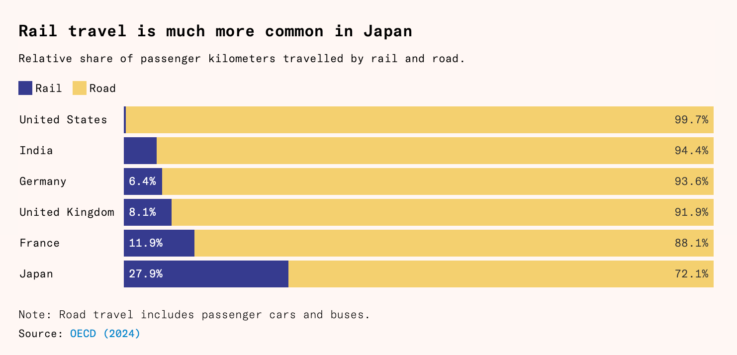
    We have spoken many times before about the fact that Japan is built around rail-oriented urbanism. But if you have the time right now, I’m going to suggest that you read this longish article by Matthew Bornholt & Benedict Springbett called “Why Japan has such good railways,” because nowhere else in the developed world uses rail for passenger kilometres more than Japan, and they explain why.

    One common hypothesis, which is mentioned in the article, is that it’s largely cultural. The Japanese are rule-abiding collectivists who are more willing to take public transit compared to us selfish and individualistic North Americans. But this doesn’t seem right. In fact, one could argue that the Japanese solution is actually more free-market oriented.

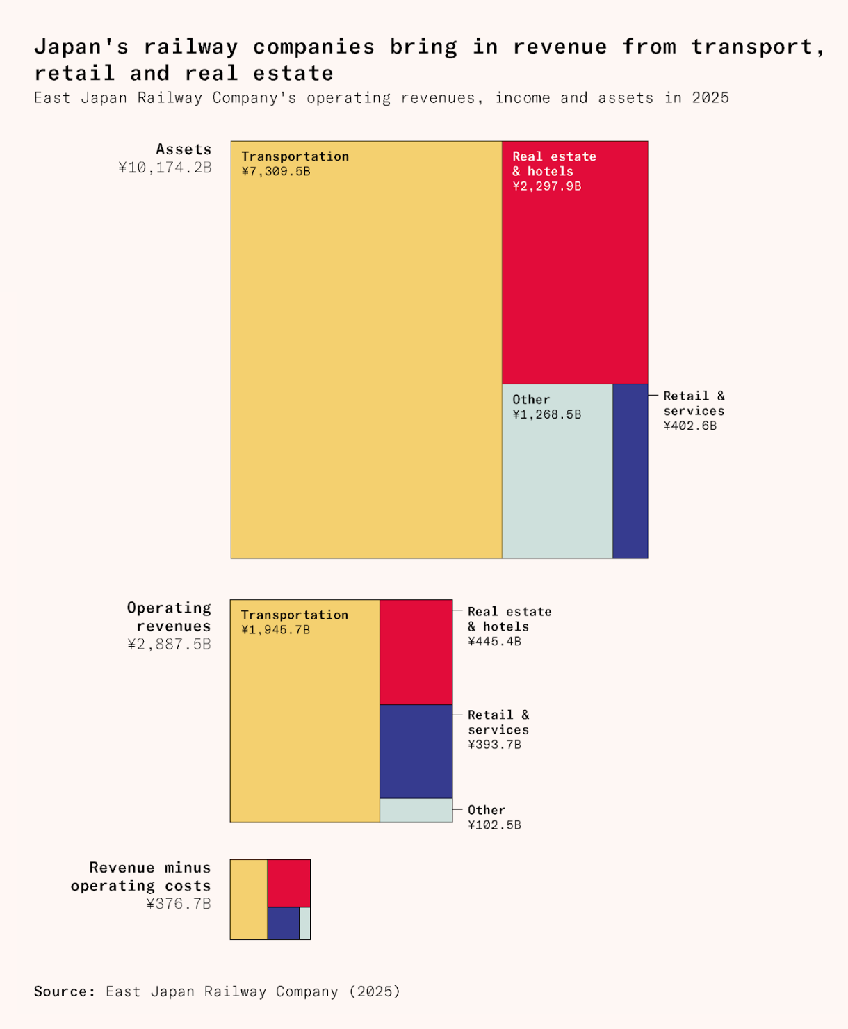
    The Japanese rail model seems to work so well because (1) most of the network is private, (2) liberal land-use policies have allowed Japan’s urban centres to develop enough density to properly support the use of rail, and (3) the rail operators make money in a bunch of other ways beyond rail. They’re typically also in the business of real estate.

    Here’s a quote from the article by the president of the Tokyu Group that I absolutely love:

    > I think that though we are a railway company, we consider ourselves a city-shaping company. In Europe for instance, railway companies simply connect cities through their terminals. That is a pretty normal way of operating in this industry, whereas what we do is completely different: we create cities and then, as a utility facility, we add the stations and the railways to connect them one with another.

    This is a fundamentally different model that allows rail companies to capture some of the value that they inherently create. To use the example of Toronto’s Eglinton Crosstown line, it’s the difference between saying, “I’m going to build a rail line and then, presumably, other stuff will happen,” and, “I’m going to develop this midtown corridor and then I’m going to run rail underneath it to maximize value creation.”

    If Japan can do it, so can we. Ironically, a big part of it means easing land-use controls and allowing transit-oriented development to simply be what it wants to be — dense and proximate to rail.


    Cover photo by Mylène Larnaud on Unsplash

    Charts from Work in Progress

  • Toronto cycling year in review

    April 17, 2026 · View original


    The City of Toronto just released its 2025 Cycling Year in Review report. You can download it here. At the highest level, Toronto is now considered to be the 7th most bike-friendly city in North America, according to the Copenhagenize Index. Our snowier sibling, Montréal, is number one on the continent. And globally, we’re ranked 55th.

    Neither of these positions is particularly impressive given our scale and prominence as a global city, but progress is being made. In 2025, City Council approved 33 km of new bikeways, installed 14.11 km, and upgraded 9.02 km. Our infrastructure continues to get better.

    What I find particularly noteworthy and telling, though, is the adoption of the city’s bike share network. 2025 was another record year, with 7.8 million rides, representing a 13% increase from 2024. We’re still not at the level of Montréal, which recorded 13 million rides in 2024, but adoption is growing quickly.

    We have gone from around 665,000 rides in 2015 to nearly 8 million in the span of a decade. That’s a compounded annual growth rate of approximately 28%! Once again, we are reminded that if you build it, and make it easy and safe, more people will ride bicycles.


    Cover photo by Jason Ng on Unsplash

  • Most people don’t want Paris, they want a city that looks like Paris

    April 11, 2026 · View original


    I recently came across this tweet by Patrick Collison, the CEO of Stripe, where he argues that the YIMBY movement “employs an inadvertently dishonest sleight-of-hand” when it promises “Paris-scale density” only to ultimately deliver something quite different in cities.

    In the post, he shares a fairly banal mid-rise development that looks nothing like Paris, and then says that if we’re talking about Paris-style building, he’d be all for it, and likely voters would be too. His point seems to be that if only we made developments more beautiful, fewer people would oppose them.

    I had to read the tweet a few times to make sure I was understanding it correctly because the “Paris-scale density” language was throwing me off. Paris is not a medium-density city. It’s a high-density city and generally considered to be the highest-density city in Europe. Is this the Paris promise?

    I don’t actually think most people want Paris; they want a city that looks like Paris, and that’s because they ignore most of its urban ingredients and only focus on the two most obvious things: (1) its outward architectural expressions and (2) its modest building heights.

    Paris-scale density is single-stair buildings with minimal setbacks and stepbacks, dark light wells, tiny 130-square-foot studios in the penthouse, no parking minimums, and area population densities that can exceed 50,000 people per km2. Is this what most voters want, provided they look pretty?

    For the purposes of this post, let’s just run with the argument that urban environments people broadly feel are beautiful would elicit less NIMBY opposition. Just build Paris-like buildings. Unfortunately, I also don’t think the answer is as simple as this.

    As Sam Deutsch of Better Cities points out, this runs counter to NIMBY history. Let’s not forget that the Paris everyone visits today was vehemently opposed during the time of its initial development and that the city’s most iconic structure was called a hateful column of bolted sheet metal, among other things.

    Beautiful buildings and great places are, of course, fundamental to cities. But even then, expect turbulence along the way.


    Cover photo by Deniz Bireroglu on Unsplash

  • The radical transformation of Greater Paris

    April 4, 2026 · View original


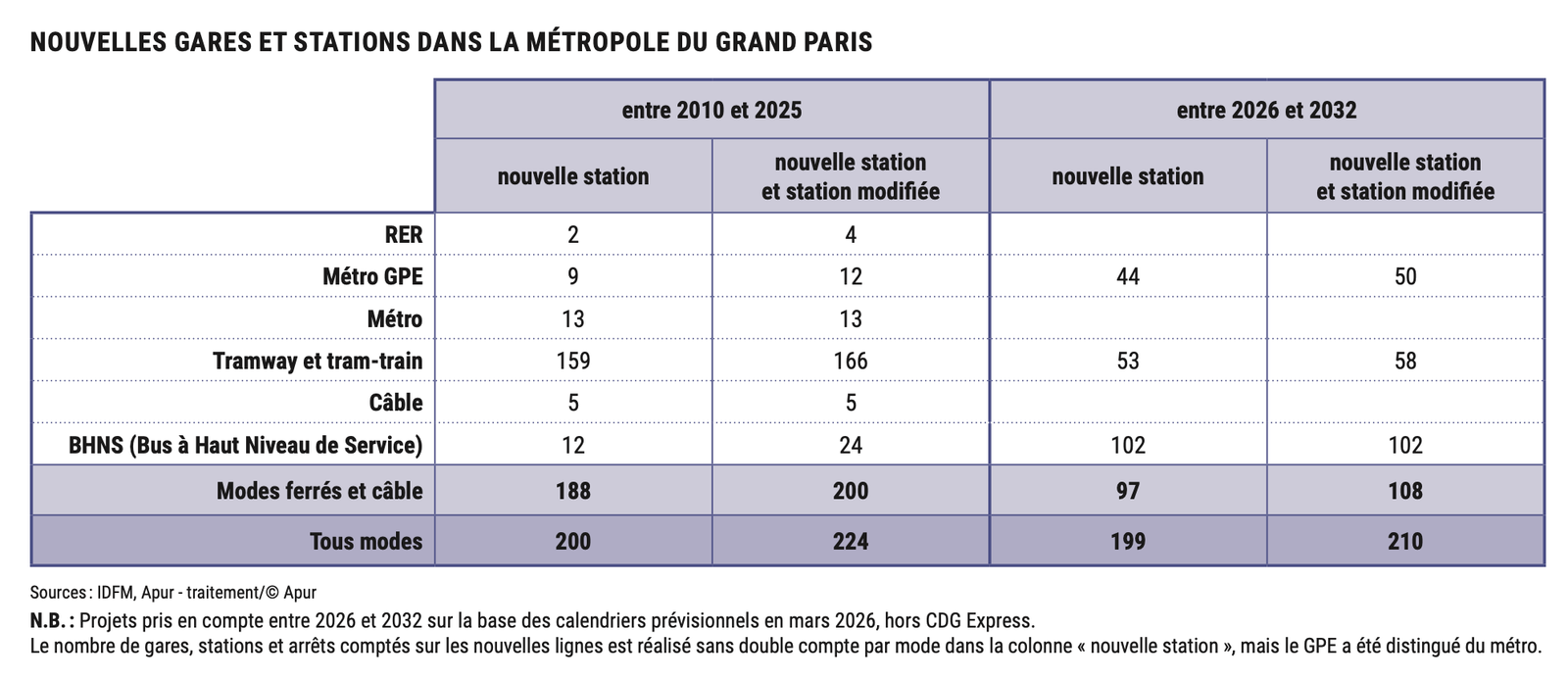
    Between 2010 and 2025, the Métropole du Grand Paris added nearly 160 kilometres of new or extended transit lines and opened 200 new transit stations across the region. These numbers include all modes of transport, including RER, metro, tram, cable cars, and BRT. On top of this, a further 199 new stations are scheduled to open between 2026 and 2032 (a shorter time period), meaning there’s an argument to be made that Paris is getting better and faster at delivering transit.

    Imagine that.

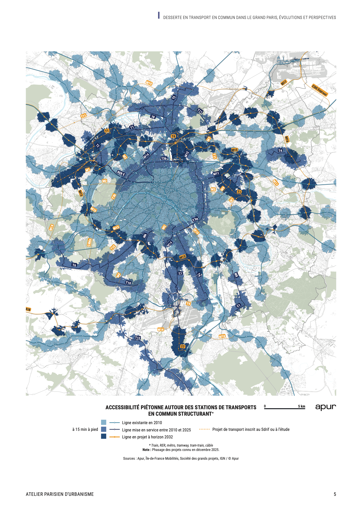
    This, as we have talked about before, is a remarkable achievement and one that is reshaping the Métropole — particularly outside of Paris proper. Take a look. Here’s a recent study and map from Apur that shows how these completed and upcoming lines have impacted, and are expected to impact, transit access in the region:

    The coloured areas represent access to transit within a 15-minute walk (assuming you’re able to walk at a reasonable 4 km/hr). The lightest blue areas are lines/catchment areas that existed in 2010. The medium blue represents lines/areas that came online between 2010 and 2025. And the darkest blue represents lines/areas that are scheduled to come online between 2026 and 2032.

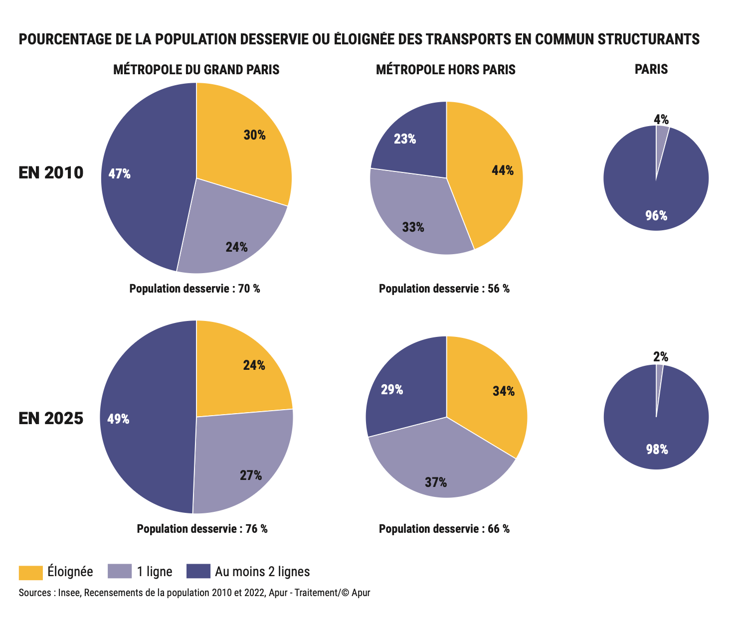
    If you’re familiar with Paris, you’ll be able to tell that the majority of the recent transit expansion has happened outside of the boundaries of Paris. This is important because prior to 2010, all of Paris was already well-served by transit (seriously, 100% of the population was/is within walking distance of at least one transit line).

    However, this is not the case in the rest of the Métropole. In 2010, about 56% of the population (outside of Paris proper) had access to at least one line, with 23% having access to two. As of 2025, this number has increased to 66%. And by 2032, with the opening of the lines currently underway, it is expected that 80% of the population within the entire Métropole will be transit-connected.

    It’s hard to overstate the importance of these changes. The Paris region has long been criticized for the divide that exists between its historic centre and its surrounding suburbs and cities. Historically, this has been a socio-economic divide, and a built form divide. But this divide is now being erased. New infrastructure is stitching the region together, tightening its geography, and encouraging the development of new economic centres.

    Forget the Paris you know. The growth and change are now happening along its edges. Welcome to the new Greater Paris Metropolis.

    P.S. To commemorate the 10th anniversary of the Métropole du Grand Paris (created on January 1, 2016), Apur recently published a book called Atlas de la Métropole du Grand Paris. I haven’t been able to find a site that will ship to Toronto, but if you’re in Paris, you can order or pick one up at the following bookstores.


    Cover photo by Ally Griffin on Unsplash

    Maps and charts from Apur

  • A new opportunity for congestion pricing

    March 27, 2026 · View original


    We’ve been talking about the merits of congestion pricing for as long as I’ve been writing this blog. But it remains politically unpopular, despite the overwhelming evidence that it consistently does what it’s supposed to do: it reduces congestion, shortens commute times, improves air quality, and raises money for alternative modes of transport, among other things.

    The status quo bias is strong, but right now we have an opportunity. Self-driving cars are in the midst of shifting the mobility landscape, and there’s a growing belief that (1) roads are going to need to be more accurately priced to deal with the surge in demand, and (2) this is a moment in time that grants us the opportunity to do it. Here’s a recent tweet by Chris Spoke of Toronto Standard that makes this point and that I agree with.

    The basic idea behind point number two is that many voters don’t like the idea of a congestion charge for themselves, but will probably mind a charge on robot cars a lot less — both because they are robot cars and because there are relatively few of them on the road today. However, at some point, robot cars will form the majority of vehicles on the road, so now would be a good time to establish new practices.

    What do you think?


    Cover photo by Minku Kang on Unsplash

  • In Paris, the bike beat the car

    March 15, 2026 · View original


    Within a week, Paris will know, with near certainty, who its next mayor will be. (The first round of results will be announced this evening.) The two frontrunners are Emmanuel Grégoire (on the left) and Rachida Dati (on the right). Grégoire is the status quo vote, and Dati is the “I want change” vote.

    From a city-building standpoint, one of the ways that this is being presented is as a battle between bikes and cars. Not surprisingly, the current mobility approach has been criticized for creating a divide between wealthier residents in transit-rich central Paris (where only about a quarter of households own a car) and residents in the more car-oriented suburbs.

    Because after 12 years under Mayor Anne Hidalgo it’s pretty clear that “the bike beat the car in Paris.” From 2002 to 2023, car traffic fell by more than half, dedicated cycle lanes expanded sixfold, and today, bike trips outnumber car trips by more than 2 to 1 in the city.

    As an outsider to the city, I can only read about what’s going on, but what I find interesting is that this particular mobility issue doesn’t appear to be as political as the headlines might suggest.

    In fact:

    > Dati has softened her initial criticism of popular cycle lanes and instead focused on concerns over dirty streets. > > “We’re not fighting an ideological battle on [transportation] issues,” Dati told news agency Reuters while greeting shoppers in northern Paris. “We just want things to be organised.”

    And:

    > She [Dati] has promised not to reverse the left’s flagship policy of transforming a once traffic-clogged dual carriageway into a car-free pedestrian walkway along the banks of the Seine, but will renovate those pedestrian spaces.

    Correct me if I’m wrong, but what this tells me is that Parisians actually like the city’s transition away from the car. I’m reminded of last summer in Paris when I was in an Uber and the driver surprised me by saying that these mobility changes needed to be done — bikes are a more efficient form of urban transport and they have greatly reduced pollution within the city.

    General public sentiment also seems to reflect my anecdotal evidence. A recent Keolis-IFOP survey found that more than one in two French people (~56%) would like to see cars play a smaller role in the cities of tomorrow. Importantly, this response also seems to transcend geography and socio-economic divides. The same sentiment is found in Paris and in rural areas.

    This month’s mayoral election will certainly tell us something about Parisian preferences for the status quo versus change. But I’m always encouraged when issues can become less about ideology and more about whether we are accomplishing productive objectives based on, you know, facts and information.


    Cover photo by Irina Nakonechnaya on Unsplash