Daily insights for city builders, delivered every morning at 6 AM ET. I’m Brandon Donnelly — a Toronto-based real estate developer and founder of Globizen. I’ve been writing here since 2013.

Search results for: “light rail”

  • All streetcars are not created equal

    With Toronto preparing to deploy the first batch of its new streetcars this summer, there’s been a lot of talk about streetcars in general. Rob Ford has said he wants to get rid of them all together and I hear a lot of other people expressing similar frustrations: Streetcars are rolling stop signs. Streetcars block 2 lanes of traffic. Why don’t we just use more buses? Streetcars cause traffic. And so on.

    So what should we do?

    First, let me start by saying that buses suck. I’m a huge proponent of public transportation in cities, but there’s nothing quite like a rush hour bus ride to have you question your economic status in life. Bus routes have also been shown to have little economic development value, where as fixed rail lines (such as streetcar, LRT and subway) generally increase surrounding property values and spur investment.

    Second, my view is that streetcars themselves as a transportation technology aren’t the problem. It’s our execution. I’ve touched on this topic before on ATC, but I’d like to reiterate a few points here. 

    The value of light rail is that it’s a relatively inexpensive way (compared to subway) of efficiently moving a lot of people. But in order to do that, you need deploy it in a sensible way. In my mind, that primarily involves 3 things: giving streetcars their own dedicated lanes (grade separation), having a reasonable number of required stops, and streamlining the onboarding and off boarding process. Today, we don’t do a great job at most of these things (although our new streetcars will use a proof of payment model).

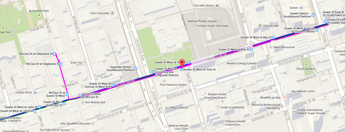
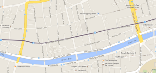
    Take a look at this comparison between Dublin’s Luas light rail system and Toronto’s streetcar system. Both images are at the same scale. Notice the dramatically different stop spacing. Much of the Luas system also runs on its own dedicated lanes.

    Dublin:

    image

    Toronto:

    image

    Every time a Toronto streetcar stops it generates waste. Cars are forced to stop behind it. Everyone on the streetcar has to sit and wait while somebody fumbles through their change looking for a token. But there are other ways to do this. There are ways to make light rail more subway-like, despite the fact that it may be above ground.  And so I don’t think we should be so quick to write off all streetcars.

  • Those evil bikes

    image

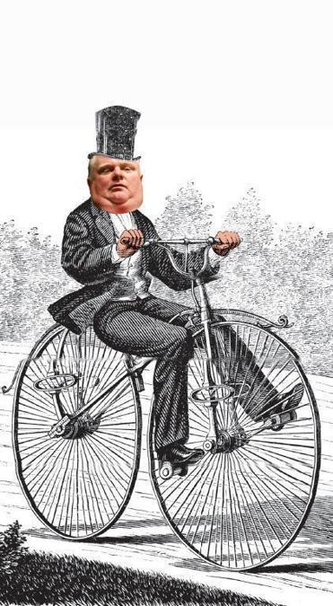
    I just stumbled upon an interesting piece in the Boston Globe (from last December) talking about how the bicycle is “emerging as a new conservative front in the culture wars.

    It starts by talking about Toronto mayor Rob Ford and asks: Who elected this guy? Their response comes down to mode of transport.

    The answer, in large part, comes down to transit. Ford is famously pro-car, and his strongest support came from suburbs outside downtown Toronto, where voters drive into the city during the day and return by car in the evening. One political scientist found that the strongest predictor of whether someone voted for Ford in the 2010 mayoral election was the person’s method of commuting: Car commuters were Ford voters; everyone else wasn’t. Ford repaid their loyalty by declaring on his first day as mayor that the “war on cars” was over; he abolished the vehicle registration tax and announced a plan to kill light rail in the city simply because, he said, streetcars “are just a pain in the rear end.”

    The article then goes on to argue that Ford is at the forefront of a growing conservative movement using bikes as a new political lightning rod. Conservative politicians view cyclists as urbanites (statistically this is true) and therefore not part of their core voter base (statistically this is also true). And so hating on bikes has become a convenient way for them to galvanize their support base.

    But beyond bikes, we’re really talking about a bigger city building issue: How do you unify a city with such divergent priorities? How do we stop this downtown versus the suburbs mentality? These are important questions and I don’t think the answer is to de-amalgamate Toronto. That’s the easy way out.

    Whether we like it or not, the Toronto region functions as one contiguous economic unit and, if we want to be able to effectively compete on the global stage, we’re going to need cohesion. We need to get our house in order. It’s still early days for Toronto’s 2014 mayoral election, but I really hope the next 4 years turn out to be better than the last. I think they will.

  • Transit vehicle capacities compared

    I was cruising the twitter sphere yesterday when I came across the following chart, outlining the various transit vehicle capacities here in Toronto. It was created by Cameron MacLeod of #CodeRedTO, which is a grassroots group advocating for “a rational, affordable, and achievable rapid transit strategy for Toronto.”

    image

    On the left you have the vehicle type and then you have the capacity in terms of number of seats and standing room. The planned capacity is essentially the sum of those two numbers and the “unsafe crush load” is the number of people you could fit if you really put your back into it.

    Articulated buses refer to the longer (1.5x) bendy ones and, similarly, ALRV streetcars are the longer, articulated version of our regular streetcars. The low-floor streetcar is similar to what Toronto will be getting. And SRT is the Scarborough Rapid Transit system.

    The chart also compares between vehicle types: How many cars would you need to move the same number of people? How many buses? And so on. As one example, you would need 15.9 buses or 982 cars to move the same number of people as the Yonge subway line!

    What’s missing from the above chart though is light rail transit (LRT), which is comparable to the linking of up to 3 low-floor streetcars. In the case of the under construction Eglinton Crosstown LRT line, the planned capacity is 750 people!

    This is an hugely important takeaway because many people, including our own Mayor, do not properly distinguish between streetcar and light rail. The two are not one and the same. LRT has the potential to move a lot more people.

    In fact, at 750 people, the Eglinton Crosstown could move more people than the Sheppard subway line, which is only operating on 4 cars (as compared to 6 on our other subway lines).

    So while it’s all fine and dandy to bang our fists on the table and advocate for subways, they don’t make economic sense in all parts of our city. With the Sheppard line, we’ve been leaving capacity on the table and wasting taxpayer money.

    Of course this chart is also useful for those outside of Toronto. What I like about it is that it clearly shows the tool chest available to cities when it comes to building transit. Every city and neighborhood is different. And I think it’s important to have intelligent conversations about what makes sense in each.

    Thank you to Cameron and #CodeRedTO for allowing me to post their work.

  • Turning St Clair and Spadina into LRT

    I’ve talked before about how Toronto doesn’t currently have any true light rail transit lines. LRT does not equal what we have on St Clair Avenue. The stops are spaced far too close together. It’s just a streetcar on its on right of way.

    This is better than a streetcar that doesn’t have its own right of way, but it could be better. So here’s an idea for better optimizing some of the transit infrastructure we already have: let’s convert the St Clair and Spadina streetcar lines into true LRT.

    Here are 3 things we could do.

    1.

    First, we need to get rid of some stops. Let’s take the stop spacing being proposed for Eglinton Avenue and apply it to St Clair Avenue and Spadina Avenue. By stopping less, it means performance goes up. Think about how much time is wasted every time the streetcar has to stop for people to get on and off. This is why New York has express trains.

    Alternatively—and instead of actually getting rid of some stops—we could also just operate two types of stops: rush hour stops and off-peak stops. In the case of off-peak stops, the streetcar would simply skip them during rush hour. The cost of implementing this would be signage and consumer education.

    2.

    Second, we finally roll out a better payment system. While tokens do give me a kind of 1960s nostalgia, I hate change and I hate fumbling with microscopic tokens in my pocket. Why isn’t there an app for this?

    But more importantly, if we had a better payment system we could transfer the point of payment from the actual streetcars to the stops themselves. This would mean that you’d need to pay in order to gain access to the stop itself. The benefit of this though is that it streamlines onboarding. Customers can now just walk onto the streetcar, like they do on the subway.

    And if you’re thinking about those times where you give up waiting for a streetcar and just hail a cab, well we could simply make the fare refundable if you leave at the same stop. This type of system would also open up the possibility of distance based fares (see London, Tokyo, etc.)

    3.

    Third, put the LRT lines on the subway map and operate them with the same rigour. Right now the customer experience gap between subways and streetcars is huge. Subways run on time and streetcars are completely hit or miss. There’s an excuse for streetcars that run mixed in with traffic, but I don’t see why we can’t make light rail (using its own right of way) just as predictable as subways. I used to take the LUAS in Dublin everyday and it was a fantastic experience.

    We really need to start taking transit more seriously in Toronto. I don’t know about you, but I’d much rather be known around the world for having the best transit system than for having a debaucherous mayor.

  • How the Gordie Howe bridge broke a billion dollar monopoly

    February 11, 2026 · View original


    How the Gordie Howe International Bridge came to be is a city and nation-building story worth telling. The Windsor-Detroit crossing is the busiest commercial border crossing in North America. It handles about one-third of the trade.) between Canada and the US, or about $1 billion per day, much of which passes over the Ambassador Bridge.

    This is problematic for a few reasons.

    One, there are concerns about capacity. Two, the bridge is, unfortunately, in the wrong place and doesn’t offer direct highway-to-highway access. A truck coming off the Ambassador Bridge in Windsor has to pass through something like 17 traffic lights before reaching Highway 401. And third, and most importantly, the bridge is privately owned.

    So, at some point, various people in government got together and said, “Hey, this bridge is pretty critical to our respective economies, it might be in our national interests to have a publicly owned bridge.”

    The federal government of Canada reportedly tried to buy the bridge in 2009, but the late Manuel Moroun wanted too much for it, and a deal was not struck. So then, in 2012, the Canadian and US governments approved the construction of a new bridge, now nearing completion and called the Gordie Howe International Bridge.

    However, a second river crossing meant that Moroun would no longer have a monopoly, and so, an aggressive lobbying campaign was mounted. It was so effective that the bridge almost got canceled and funding for it became a “third rail” in Michigan politics. To save the project, the following deal was struck:

    – Canada pays 100% of the ~C$6.4 billion cost to build the bridge. – From the outset, the bridge is a joint binational asset owned equally by the Government of Canada and the State of Michigan, even though Canada is financing the entire project. – Construction jobs and materials are sourced from both sides of the border. – Oversight of the bridge is handled by the International Authority, a board with equal representation (3 members from Canada, 3 from Michigan). – Canada receives 100% of the toll revenue until it recoups its costs; after that, toll revenue will be shared with Michigan.

    In other words, the only way this deal got done was (1) for Michigan not to spend any money on it and (2) for Canada to finance Michigan. This was the solution to dysfunctional politics, where individual interests trump the greater good. I have not looked into and modeled the exact terms under which Canada is financing Michigan, but let’s hope that taxpayers are being fairly compensated for bringing this solution.

    Regardless, there’s no doubt that this is a crucial nation-building project for both Canada and the US. It will be an exciting moment for our countries when it opens and people and goods begin to flow. Based on the current status of construction, my understanding is that this will happen early this year. It’s basically ready.


    Cover photo from Gordie Howe International Bridge

  • The self-driving paradox: walkable cities or super-sprawl?

    November 24, 2025 · View original


    Fred Wilson chose the perfect quote by William Gibson, here, to describe the current status of self-driving cars: “The future is already here — it’s just not very evenly distributed.” That’s how it feels right now.

    Waymo isn’t in Toronto yet, but they are expanding rapidly throughout the US and elsewhere. Last week they announced fully autonomous driving in five new cities: Miami, Dallas, Houston, San Antonio, and Orlando. Autonomy is here, as we have talked about many times. There’s no longer a question.

    But what’s interesting is that we’re at the point in the hype cycle where expectations are not as inflated as they were a number of years ago (at least that’s the way it appears to me). Years ago, everyone in real estate was talking about how it would disrupt parking requirements and reshape the landscape of our cities.

    So when does this happen?

    Fred ended his post by saying that “the downstream effects of this technology and behavior change are going to be profound.” But he doesn’t get into what these changes might be. Let’s do a reminder of that now. Some of the most commonly believed consequences are as follows:

    – Cars consume a vast amount of real estate and also spend the vast majority of their lives just sitting around idle. Switching to a “mobility-as-a-service” model will require dramatically less parking. This is going to force landlords to repurpose the parking they already have and it’s going to encourage developers to build new buildings with reduced parking, or no parking at all. That will be good for housing affordability. – However, the autonomous vehicles will need to park and corral somewhere at some point. My guess is that we will see something akin to rail yards today. This would be a good use for some of our excess parking, though this use won’t require nearly as much. I would also imagine that many of the cars will leave the most valuable and dense parts of a city during off-peak periods. – At the same time, it’s not clear what the winning business model for AVs will be. Will it be a Waymo-like model where the ride-hailing company owns and operates all of the cars? Will it be a Tesla Robotaxi model where individuals own the cars and put them out to work? In this case, maybe the Robotaxis just go back to people’s individual garages. Or will Uber remain the dominant platform? Meaning, an asset-light model that aggregates customer demand remains the highest-value component of the stack. Personally, I can’t see Tesla’s Robotaxi model being very lucrative for individual owners, so I’m inclined to look toward Waymo and Uber. – Street parking will be replaced by a proliferation of pick-up/drop-off zones. This urban design problem will need to be solved as we dramatically increase the number of people getting in and out of AVs on busy urban streets. – In the mid-1990s, Italian physicist Cesare Marchetti remarked that, all throughout history, humans have tended to cap their commute times at about 60 minutes per day. Something like a half hour each way. This became known as Marchetti’s Constant. What this has meant is that as new technologies (streetcars, cars, and so on) allowed us to move faster within that 60 minutes, humans have tended to sprawl further outward. Will AVs do the same, and could they actually break Marchetti’s Constant? – As we all know, the key difference with AVs is that we will no longer need to pay attention to our commute. We could sit in an AV and sleep, work, watch a movie, or do whatever else we’d like. One can think of it like a mobile office or mobile living room. This should, in theory, make commuting long distances a lot more enjoyable and encourage even greater “super sprawl.” – The counterforce to this phenomenon is that if more people are willing to commute long distances in an AV, we will see demand greatly outstrip supply on our roads. In other words, traffic congestion in large cities will get even worse. I think this will force more/most cities to adopt congestion pricing. Politically, it will finally become acceptable, because now we’ll be able to use “the machines” as our scapegoat. They’re overrunning our cities! Ironically, this means that we won’t adopt the thing that makes driving a lot better until we all stop driving.

    So where do these opposing forces ultimately net out? Well, my view (and bias) is that human-scaled walkable communities will always have value. We are social animals. I also think that the experience within our cities will improve dramatically. Pedestrian safety will increase (the data already supports this) and far less space will be dedicated to cars. Good.

    At the same time, I think that reducing commute friction will encourage an exurban explosion. Like the technologies that came before AVs, it’s going to empower humans to further decentralize. What this will do is exacerbate the divide between our urban cores and our suburban and exurban fringes.

    Of course, this is just me surmising. I don’t really know. But AVs are here, and I think it’s time we get back to discussing and planning for the second and third-order effects of this technology.

  • Blue Jays are going to the World Series — and I still made it home

    October 22, 2025 · View original


    This past Monday, approximately 44,770 attendees descended on the SkyDome, I mean Rogers Centre, in downtown Toronto to watch Game 7 of the ALCS between the Blue Jays and the Mariners. I was lucky enough to be one of them. And with one swing of George Springer’s bat, we did it.

    The Blue Jays became only the fourth team in the history of Major League Baseball to come back and win a best-of-seven series after losing the first two games at home. (Baseball is full of fun little stats.)

    This is what makes October baseball so exciting. It’s slow and suspenseful, but then all of a sudden — boom — you completely lose your voice because you’re screaming so hard. I still don’t have mine back at the time of writing this post.

    What a game. What a moment for Toronto.

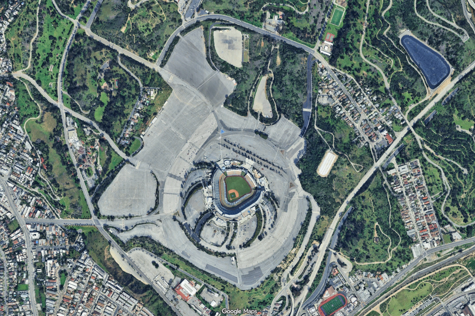
    Now let’s switch gears and think about all of this from an urban mobility standpoint. Forty-five thousand is a lot of people. How do you efficiently move this many people to and from a stadium? One option is you could build a ton of parking.

    Here, for example, is Dodger Stadium in Los Angeles:

    But this is a suboptimal approach, which is why a year ago the LA Times had to write: “Going to Dodger Stadium for the World Series? Five ways to avoid parking and traffic headaches.” In it, they suggest the following: Take the bus, take the Dodger Stadium Express Bus, take an Uber, ride your bike, or walk 30 minutes to the nearest metro station (Chinatown).

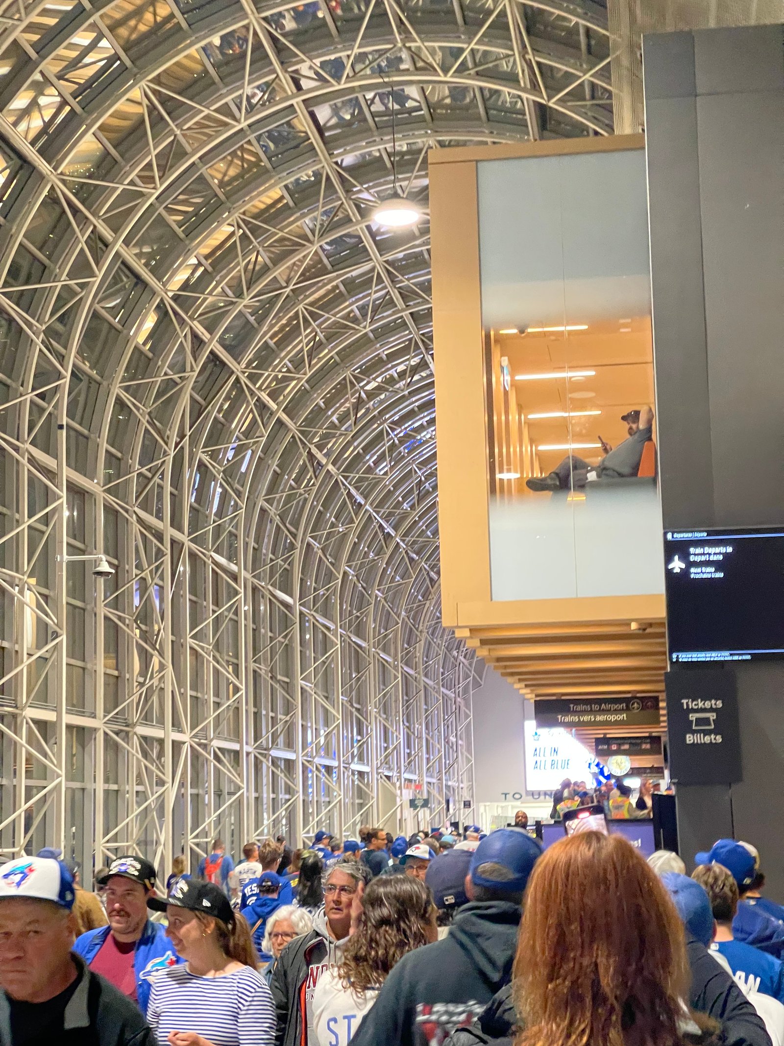
    On Monday, we took the Union Pearson Express from Bloor to Union. The train was absolutely packed, but we got on the first one and we were door-to-door in a little over 30 minutes. After the game, it was pandemonium. People were swinging from light poles, lighting off smoke bombs, and the lineup to get back on the UP Express looked like this:

    But here’s where I need to give a lot of credit to whoever was responsible for keeping things together on Monday night. They had stanchions lined up to accommodate the crowds flooding out of the Rogers Centre, they had staff walking up and down the lines so people could tap on ahead of time, and they had more trains operating. The result was that we waited maybe 10 or so minutes before getting on one.

    Nobody got out of downtown this quickly unless you were on a train or you biked. My friends who had to take Ubers home were stuck for hours. In fact, one driver said, “We’re not moving for a while. You’re better off going into that bar right now and I’ll come back for you later.”

    Sometimes when I write about trains and public transport, people comment that I’m living in the past and that it’s an outdated technology. Look, I’m all for new tech. Bring on the autonomous vehicles and let’s get the global financial system onto the Ethereum blockchain already. But when it comes to urban mobility, trains work. They’re highly efficient at moving the greatest number of people.

    And you really see that in action when there are sudden demand shocks, like what happened on Monday night when the Blue Jays punched their card to the World Series for the first time since 1993. Go Jays!

  • Los Angeles is trying to go from car-first to transit-first

    October 12, 2025 · View original


    The largest urban region in the US, New York, is famously urban. Recently, we talked about how it has the highest share of zero-vehicle households and really stands on its own when it comes to US cities. But what about the country’s second-largest urban region — Los Angeles?

    It probably won’t surprise you that around 88% of households in this city own a car. Transit and other forms of non-car mobility remain deeply entrenched secondary options for most. But what you may not be aware of are all the initiatives that LA is undertaking to transform itself into more of a transit-first region.

    The city opened its first metro line in 1993. Today, it has a system that spans over 109 miles (~175 kilometers) across six lines with 107 stations. It also has wildly successful bus rapid transit (BRT) lines, with ridership levels that are 3x initial projections. The 18-mile Orange Line is viewed as one of, if not the, most successful bus lines in the US.

    In parallel, the city is doing what it needs to do on the land-use side by easing density restrictions and working to intensify around its transit stations. It also has a little extra motivation: Los Angeles has vowed to make the 2028 Summer Olympic Games a “transit-first” event. And with 15+ million visitors expected, there’s going to be no other way to do it.

    Los Angeles has long been known as a car-first city, but don’t be surprised if that changes this century.

    For more on this topic, here’s a recent article by Joseph Shortell, a Senior Analyst at Philadelphia-based Econsult Solutions.

    Cover photo by Studio Trista on Unsplash

  • US office market was showing signs of recovery until the tariffs arrived

    April 15, 2025 · View original


    According to the WSJ, the US office market saw a significant increase in leasing activity in the first quarter of this year. Approximately 115 million square feet of space was leased, which represents a 13% increase from the previous quarter and the highest level since before the pandemic in mid-2019.

    But then, tariffs for everybody! Now tenants are worried that a recession is coming, inflation is going to rise, and that so too will interest rates. Uncertainty is bad for business.

    Here’s where things broadly sit as of the beginning of this year:

    – The national office vacancy rate was 19.7% at the end of February 2025 – San Francisco had the highest vacancy at 27.8% – $7 billion worth of office sales were recorded in the first two months of the year and the average price was $177 per square foot – The cheapest markets are/were in the midwest with Minneapolis-Saint Paul recording the lowest average sale price of $50 per square foot (versus $215 psf a year ago) – Chicago averaged $67 psf – The most expensive markets were places like San Diego ($662 psf), Manhattan ($450 psf), San Francisco ($282 psf), Miami ($239 psf), and Los Angeles ($207 psf) — we continue to see a flight to quality

    Maybe things will get better later this year, or maybe they won’t. It’s impossible to know what comes next in this trade war.

    Cover photo by Delia Little on Unsplash

  • Salt Lake City wants to turn Main Street into a pedestrian promenade

    Last year, I wrote about how Salt Lake City wants to build a new linear park around its downtown. That post can be found, here.

    Fast forward to today, and the city’s Department of Economic Development has just published a new comprehensive 215-page study that supports turning Main Street into a pedestrian promenade.

    Specifically, the area running from South Temple to 400 South, and including 100 South from Main to West Temple:

    As part of the study, they highlight a number of successful case studies from around the world, including 16th Street Mall in Denver, Bourke Street Mall in Melbourne, and Queens Quay here in Toronto.

    In the case of Denver, they cite the one-mile stretch as single-handedly generating over 40% of the city’s total downtown tax revenue! And in the case of Toronto, they refer to Queens Quay as a global destination. (Toronto readers, do you agree?)

    Like most city building initiatives, this vision is will take years to realize. But it’s interesting to note that, of the eight design alternatives included in the study, there is already one clear preference within the local community — option B.

    Option B is a pedestrian/transit mall, but with multi-use trails. In other words, it is a no-cars-allowed alternative that would still allow bicycles and scooters. Here’s the street section:

    If you’d like to download a copy of the full Main Street Pedestrian Promenade Study, click here.