Daily insights for city builders, delivered every morning at 6 AM ET. I’m Brandon Donnelly — a Toronto-based real estate developer and founder of Globizen. I’ve been writing here since 2013.

Tag: urban planning

  • Mega-cities vs. networked cities

    Morning fog by Yijiang Wu on 500px.com

    https://500px.com/embed.js

    Ed Glaeser, Giacomo Ponzetto, and Yimei Zou recently published a new academic paper called, Urban Networks: Spreading the Flow of Goods, People and Ideas

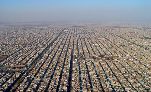
    The paper looks at whether it’s more advantageous to build huge and consolidated mega-cities or build connected networks of smaller urban centers (perhaps connected by high speed rail). As countries like China rapidly urbanize, this is something that many people are thinking about.

    In China, there is a lively urban planning debate
    about whether to facilitate the increased expansion of the vast agglomerations of Beijing and
    Shanghai or whether to focus on creating networks of cities that are smaller, albeit still much
    larger than almost all of the cities of Western Europe. The current government policy favors
    networks, in the hope that connected smaller cities may be free of the extreme downsides of
    mass agglomeration, such as extreme congestion, pollution and high housing costs.

    Like most things, there are real trade-offs. 

    In the paper, they assume that larger cities lead to more urban amenities, which in turn serves as an important magnet for skilled workers. However, for unskilled workers who may not care/benefit from the same urban amenities, it is possible for them to dislike the bigger cities. In this case, the benefits do not outweigh the negatives of urban expansion and an urban divide is created (rich/poor).

    One of the potential negatives is housing.

    The attraction of denser, not larger, mega-cities is determined also by the elasticity of
    housing supply. When it is easy to add extra homes on a narrow plot of land, as in Texas,
    then density becomes more attractive. European urban networks may well be the right
    answer because history and regulation makes it so hard to build in Europe’s older cities.
    Even though China has usually been quite friendly towards skyscrapers, the sheer scale of
    the Chinese population may still make the case for urban networks.

    If you’re interested in this topic, there’s a section (#2) in the paper on the history of urban networks that you might like.

  • Those troublemakers

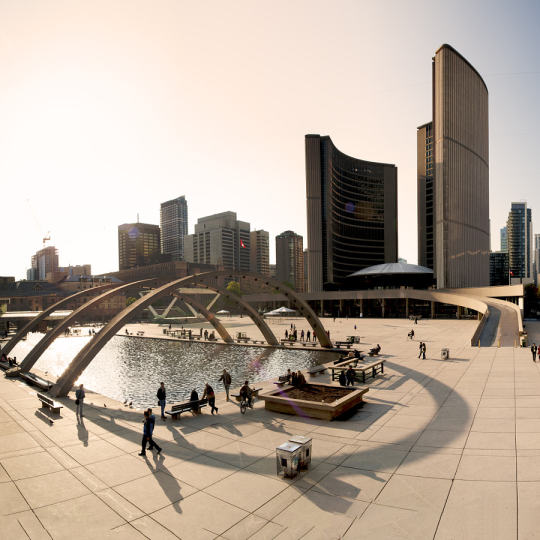
    Toronto City Hall by Sébastien Pacaud on 500px.com

    https://500px.com/embed.js

    Jennifer Keesmaat is the Chief Planner of Toronto. She was hired for this job in 2012.

    She has a Masters in Environmental Studies (Politics and Planning). She is a Registered Professional Planner with the Canadian Institute of Planners. And she was also the founder of 2 (city) planning firms prior to taking the position of Chief Planner for Toronto.

    So presumably, she was hired for this job because she possesses some sort of expertise in the realm of planning. I also presume that she is expected to make her opinions known to other people so that informed planning discussions can occur and decisions can be made.

    So I find it curious that in some circles, and in the media, Jennifer Keesmaat is being branded as a “troublemaker.”

    A lot of the recent chatter stems from the fact that Keesmaat was at odds with Mayor Tory during the Gardiner Expressway East debate (quote via Toronto Life):

    Eventually Tory had enough and pulled Keesmaat into a meeting where he basically told her to zip it. “The mayor has said it is perfectly appropriate for staff to make their opinions public, as Ms. Keesmaat has done,” wrote his communications chief, Amanda Galbraith, in a statement. “It is not appropriate for city staff to campaign against councillors or the mayor on social media or through other public platforms.” Keesmaat counters that she never campaigned. “I stated an opinion,” she says simply.

    But the “troublemaking” didn’t just start with the Gardiner East. Pretty much since the moment she took the position of Chief Planner and launched her own blog (ownyourcity.ca), she was dubbed a shit disturber. (Those bloggers!)

    But if you ask me, these criticisms stem from an old and outdated way of thinking.

    The last thing we need from government is less transparency and more politicking. We should be working towards more, not less, information. Even if that information doesn’t butter our metaphorical bread.

    What do you think?

    I think this will make for a great discussion in the comment section below.

  • #DensityCreep

    The Toronto Star published an article today called: Midtowners battle the rise of the midrise. It’s about a group called The Density Creep Neighborhood Alliance, which was formed in order to fight a 4 storey stacked townhouse project that is currently going through the rezoning process.

    Here’s a snippet from the article:

    “I’m really concerned about my property value going down,” says Lisa Goodwin, 49, a stay-at-home mother of two who has lived in a four-bedroom dwelling on Keewatin Ave. for 19 years. “Right now all the houses are $1.1 to, say, $2.2 (million) but they’re looking at putting in places that are only $500,000.”

    Not surprisingly, social media took hold of this and #DensityCreep quickly started trending on Twitter. BuzzFeed ran a piece called, Toronto Real Estate Is So Preposterous People Are Protesting Condos That “Only” Cost $500K. And somebody even bought densitycreep.com (their site is .ca) and redirected it to NIMBY on Wikipedia.

    There’s so much I could say about this. But you all already know what I’m thinking. So I’ll end with this quote from the article:

    “The simple fact of the matter is that the creation of a more sustainable, equitable, and affordable city requires the development of midrise and other more dense housing options along major roads, subways, and streetcar lines in already built up areas,” says Christopher De Sousa, director of the School of Urban Planning and Regional Planning at Ryerson University.

    We have work to do.

  • The perfect high street

    How do you create and maintain a thriving high street in this era of increasing online shopping? This was one of the questions that Monocle asked at its recent Quality of Life Conference in Lisbon and here’s a video with its recommendations. Click here if you can’t see the video below.

    [youtube https://www.youtube.com/watch?v=Ox2WJwDbuIo?rel=0&w=560&h=315]

  • I’m giving away a free Architect This City t-shirt

    I’m giving away a free t-shirt on April 1st, 2015 exclusively to Architect This City subscribers. There’s no catch. And no this is not an April Fool’s joke! I just want to say thanks to the people who read ATC on a regular basis. It’s that simple.

    So how does it work?

    1. You need to be an Architect This City email subscriber (either daily or weekly). If you’re not yet a subscriber, you have until midnight on Tuesday, March 31st, 2015 to make that happen. You can do that by clicking here. It’s free.
    2. You need to visit architectthiscity.com and pick the t-shirt you want. There are currently 5 different ones to chose from (the original ATC tee comes in both ATC orange and black).
    3. Finally, you need to leave a comment at the bottom of this post telling the community 2 things: which t-shirt you want and your favorite thing about your own city. That’s it.

    On April 1st I will randomly select somebody from the comments, check to see if they’re a subscriber, and then send them a free t-shirt.

    Simple, right? I’m really looking forward to giving away a t-shirt.

  • Toronto approves 755 storeys of new development

    image

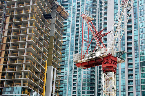
    Earlier this week, Toronto City Council approved the equivalent of 755 storeys of new development, a lot of which will end up in the downtown core. The translates into 6,887 new housing units and roughly 4 million square feet of new commercial space. The Globe and Mail called it the Manhattanization of downtown.

    If you’d like to go through the complete City Council meeting agenda, you can do that here. (I warn you though, it won’t be an exciting read.)

    One notable project that was approved is 50 Bloor Street West, which is a 71-storey mixed-use building in Yorkville adjacent to and on top of Holt Renfrew (It includes a $6 million Section 37 contribution). I mention this one because it’s impressively tall and because it’s a project that I was involved with when I was at Morguard. Watch for Yorkville in the coming years, there’s a lot in the pipeline.

    While I think this is all incredibly exciting, our chief planner, Jennifer Keesmaat, is entirely correct in pointing out that all of this highlights the desperate need for better infrastructure, the most critical of which is a relief subway line that cuts across downtown.

    But to be clear, this isn’t a question of just planning for growth. This is a question of planning for growth and making up for decades of infrastructure disinvestment. That’s the position we’re in today, which means we have a lot of hard work to do. Though I’m confident we’ll get it done.

    The other thing that this level of intensification should highlight for you is that public transit, and other forms of mobility such as biking and car sharing, have to be central to our goals. It’s simply infeasible for everybody to be driving around in a car. We’re currently demonstrating how efficient that ends up being.

    So as Toronto continues to intensify, I think we’ll quickly discover that traffic and private cars aren’t the answer or even the right question to be asking.

    Image: Flickr

  • What use could driverless cars serve beyond just transport?

    image

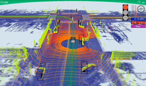
    Here’s further evidence that technology is starting to infiltrate into many other industries, including architecture. London-based architect and designer Pernilla Ohrstedt is currently working on an exhibition for Dezeen and MINI Frontiers that will architecturally visualize the 3D data that driverless cars collect in order to navigate around.

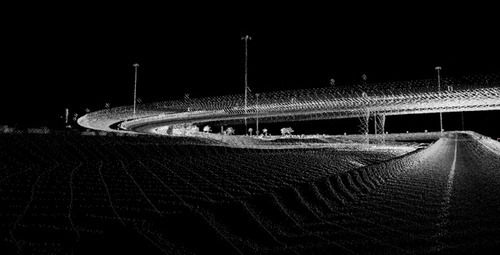
    I had never thought of this before, but as a byproduct of driverless cars, we’re about to start collecting detailed replicas of all of our cities – well beyond the static images we currently have with Google Streetview. In order to navigate by themselves, driverless cars are constantly scanning their surroundings to create a “point cloud” replica of the built environment. This point cloud basically tells the car where they are, where they should drive, and what obstacles might be around.

    It could look something like this:

    image

    Already there are firms like ScanLAB emerging to provide 3D scanning, publishing, and visualization services. But this is obviously just the tip of the iceberg. I can only imagine what innovation will emerge from the passive collection of all this data once driverless cars become commonplace in our cities.

    As one example, it could be a way for us to systematically measure the correlation between the qualities of a street and the vibrancy of its street life. Is there a perfect width? An ideal traffic volume? A right scale? All of this data could make city building more of a science (and perhaps less political).

    My hope though is that this data would be open and accessible to all, so that clever entrepreneurs could build on top of it.

    What are some of your ideas?

    Images: Dezeen

  • Who should zone cities?

    image

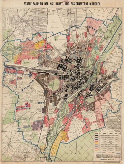
    The Old Urbanist has just published an informative post called “Where Zoning Went Wrong.” In it, he talks about some of the defining characterstics of American city planning and suggests that the delegation of planning authority from states to local municipalities is what has caused many of the challenges that city builders now face.

    But before we get into that discussion, let’s outline the characeristics. By way of Edward Bassett’s handbook on zoning (1922), the Old Urbanist outlines 9 characeristics of American planning. They are:

    1. Approval of the exclusion of commercial activity from residential zones
    2. Failure to disapprove of the exclusion of multifamily from residential zones
    3. Extreme deference to localities
    4. Insistence on a “comprehensive” plan
    5. Irreconcilable conflict between planning and zoning
    6. Heavy reliance on legal process as a substitute for sound policymaking
    7. Rejection of aesthetic concerns
    8. Concern with protecting the wealth of well-to-do homeowners
    9. Lack of comparative focus

    If you’re a planner or city geek, some of these items will be familiar to you – particularly the first one. Single-use zoning (or Euclidean zoning) is widely criticized as being hugely detrimental to cities, which is why mixed-use is so much in vogue right now. We’ve realized that there are tremendous benefits to creating neighborhoods and precincts where people can live, work, play, and learn. And not just do one of those things.

    But one point that somewhat surprised me was number 3: the deference to localities. The Old Urbanist’s argument is that around the world – from Germany to Japan – state and federal governments play a much more active role in city planning as compared to the US. And that the result is a different kind of city. As one example, most other countries don’t have single-family detached-only residential zones. The US does.

    Now, you could argue that it’s partially cultural. The US is all about individualism, whereas many other countries around the world have a greater sense of collectivism. But as the Old Urbanist suggests, it could also be because local municipalities are more prone to NIMBYism, which can ultimately lead to downzoning and more restrictive land use policies. Interesting.

    It was surprising to me though because I’m a firm believer in strong cities. They drive the economy and I generally believe that they deserve to look after themselves. And so could it really be that they need higher levels of government to keep advocacy groups and community opposition in check?

    Immediately I thought of the planning environment here in Toronto and Ontario. The Places to Grow Act, which is largely responsible for the intensification we’re seeing across the region, is provincial legislation. And “the Board” (OMB) that hears appeals arising from the municipal planning level is also provincial. So in other words, provincial decisions trump municipal ones.

    Many people believe that the OMB should be abolished. But probably an equal number of people believe that it’s critical to keeping development moving in Ontario. And, given our discussion here, it could be keeping our land use policies in check.

    But at the same time, I wonder if there isn’t a way to structure local planning such that it doesn’t succumb to individual interests and instead keeps the greater city building agenda at the forefront. If you have any thoughts on this, I’d love to hear from you in the comment section below.

    Image: Old Urbanist

  • The death of planning expertise

    image

    Yesterday a friend of mine sent me this article written by a city planner talking about the death of planning expertise. The article talks specifically about the rise of “community participation” and how it has undermined the modern planning process. (I guess it’s not just architects who feel undermined.)

    …we have lost respect for “experts”—those who have knowledge and/or experience in a particular field—and have replaced it with a kind of “expertise egalitarianism” whereby everyone’s opinion is given equal weight. But it is not only that the layperson’s opinions are given equal weight, experts increasingly face outright hostility. Laypeople attack experts as being arrogant, elitist, and imposing, if not outright threatening, often because the expert insists he or she knows something the other does not. Even more ridiculous, rather than being viewed as helpful or even essential, expertise is viewed as harmful or even antithetical to community participation.

    But to be clear, the author is not arguing for technocratic rule. He simply believes that community input has reached a point where laypeople with only anecdotal evidence are given equal weight as planning experts, and that it’s miring the planning process and causing less than desirable outcomes.

    This topic is interesting to me for 2 reasons.

    First, it’s interesting because we’re basically talking about a form of decentralization, which, just so happens to be one of the macro trends being ushered in by technology and the internet. It used to be that we couldn’t decentralize. Communication costs were too high and the ability to share information in real time wasn’t possible.

    But today we can. So instead of, for example, only getting the news from one source (a newspaper, perhaps), we get it from millions of people on platforms like Twitter. We trust laypeople, just as much as we do “expert” reporters, to tell us and show us what’s happening in the world. Just yesterday I turned to Twitter to see what was happening with Toronto’s torrential rainfall (#TorontoStorm).

    And as a result of this trend, we’re seeing startups like Popularise that are, in some regards, trying to decentralize the planning process. The platform allows communities to decide what they want to see in their neighborhood and then share it. Think your neighborhood could use an organic grocery store? Great, you can spec that on Popularise.

    The second reason I find this topic interesting is because there’s a school of thought (let’s call it the “wisdom of crowds” school of thought, to name it after a book), which believes that in aggregation the opinions of many can actually be better than those of a few so-called experts.

    And in many ways I agree with this—though there are a number of prerequisites that need be met in order for this to hold true. For example, you can’t have groupthink taking place, which I think you could argue is what often happens with NIMBY movements.

    Nonetheless, there’s a shift taking place and it’s impacting not only the planning profession, but many others. In the end though, I don’t think it will make experts irrelevant. In fact, as industries continue to “open up” and as we harvest more and more data (that previously wasn’t available), I think we’ll all be surprised at how beneficial this ends up being. 

    Image: GSAPP

  • Cities without ground

    image

    The “ground plane” is an important reference in architecture. The ground is typically where people walk. The ground is where our fabricated buildings meet the earth. And the ground is where our experience of the urban environment–however good or bad it may be–truly takes shape. Often times I feel that we, city dwellers, spend far too much time worrying about the height of buildings and not enough time worry about the ground floor.

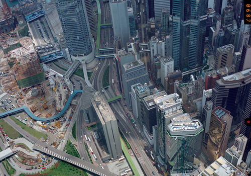
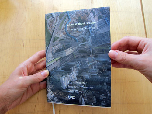
    But what if there were no clearly defined ground plane? This morning I stumbled upon an interesting book called, Cities Without Ground: A Hong Kong Guidebook. The authors call it “a manifesto for a new theory of urban form.” And the argument is that Hong Kong has developed a unique series of public/private spaces that allow it to function as a fully three-dimensional city. 

    image

    Through underground tunnels, above ground walkways, escalators, and other connective infrastructure, Hong Kong is reinventing the way we typically think about cities–both from a user experience and a real estate standpoint. Here’s an excerpt from the Guardian architecture and design blog:

    The phenomenon began in the 1960s, when the Hongkong Land company, one of the main developers in the region, built an elevated walkway to connect a luxury hotel to the second storey of an adjacent shopping mall. An insignificant move, perhaps, but it in fact had the effect of changing the rentable values within the building: suddenly the mall’s second floor units could be rented out for more than those at ground level. It entirely recalibrated the vertical logic of real estate value.

    Now, you could argue that Hong Kong is a unique place. And it is. Other, less dense cities, have found above and below grade walkways to be a destroyer of urban vibrancy. But in Hong Kong it works and, as many other cities around the world focus their energies on urban intensification, we may find that Hong Kong is indeed a new model for urban form.