Daily insights for city builders, delivered every morning at 6 AM ET. I’m Brandon Donnelly — a Toronto-based real estate developer and founder of Globizen. I’ve been writing here since 2013.

Tag: planning

  • Segregation and income inequality in cities

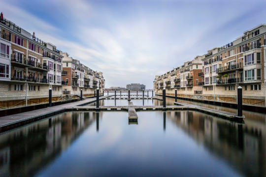
    Photograph Baltimore Harbor by Wes Bunton on 500px

    Baltimore Harbor by Wes Bunton on 500px

    Given what is going on in Baltimore and other cities in the US right now, I thought it would be worthwhile to share an interesting article from City Observatory talking about income disparity and racial segregation in cities.

    There are significant racial income gaps in the United States (as well as in Canada). According to City Observatory, the average black household earns 42% less than the average white household in America. There is, of course, lots of regional variation, but this is what it looks like nationwide.

    The interesting thing about this racial income gap though, is that there’s one factor that seems to account for the bulk (up to 60%) of the variation: residential segregation. In other words, the more segregated a city becomes, the more this black/white income disparity increases.

    Here’s a snippet from Joe Cortright of City Observatory:

    …there are good reasons to believe that high levels of segregation impair the relative economic opportunities available to black Americans. Segregation may have the effect of limiting an individual’s social networks, lowering the quality of public services, decreasing access to good schools, and increasing risk of exposure to crime, all of which may limit or reduce economic success. This is especially true in neighborhoods of concentrated poverty, which tend to be disproportionately neighborhoods of color.

    We also know that there are all kinds of negative externalities associated with income inequality. Therefore, there’s a strong case to be made for addressing segregation and the spatial organization of our cities. 

    I recommend you read the City Observatory article for a more nuanced explanation of the above relationship.

  • What will driverless electric cars mean for cities?

    Photograph T E S L A by Thomas Juel on 500px

    T E S L A by Thomas Juel on 500px

    Yesterday I posted a video about the career of Elon Musk. And it reminded me of something that’s been on my mind as I think about transportation, cities, and the future.

    Elon’s story for why he founded SolarCity, Tesla, and SpaceX is incredibly compelling. He chose problems and industries that he felt would move humanity forward. He felt that we needed sustainable forms of energy production (SolarCity), sustainable forms of transport (Tesla), and a way for humans to occupy other planets (SpaceX). That’s incredible ambition.

    Today though, I just want to focus on the transportation piece.

    Electric and driverless vehicles, I believe, are a step in the right direction. I honestly believe that at some point in the not too distant future we’re going to look back at that time when people used to drive their own cars and wonder how we ever allowed that to happen.

    But fundamentally, I think there still remains a question of how best to plan our cities. 

    There’s lots of talk today about peak car and the death of the automobile. Certainly within planning and urbanist circles, there’s an almost universal belief that planning (most of) our cities around the car, as opposed to people, was a huge mistake. Multimodal solutions with a public transit backbone are now the way forward.

    But will that always be the case as the notion of the “car” evolves?

    Intuitively, driverless vehicles feels like a massive opportunity to leverage data and better optimize our private transport assets. We know that the utilization rate for most private cars is incredibly low and so there’s lots of room to improve how we use and share private vehicles and how we move people around cities.

    But how big is that opportunity? Does a city filled with driverless electric vehicles and with networks like Uber mean that public transportation now becomes less important? And if so, how much less important?

    I can’t help but feel like private and public transport are on a collision course right now. I suppose that isn’t anything new. But this time around I wonder if private transport won’t figure out a way to achieve similar efficiencies to large scale public transport.

  • The high cost of poor land use

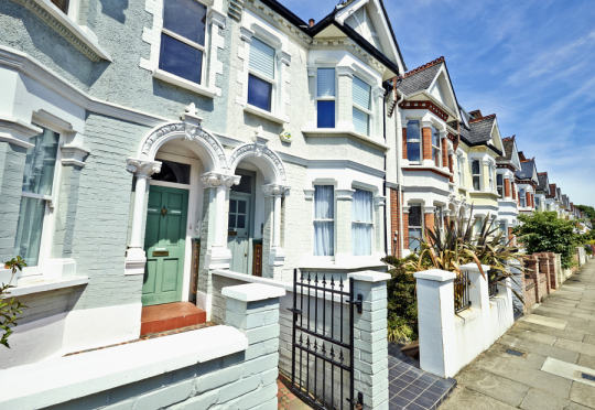
    Photograph London street of early 20th century Edwardian terraced houses by Bombaert Patrick on 500px

    London street of early 20th century Edwardian terraced houses by Bombaert Patrick on 500px

    Over the weekend The Economist published an interesting article called, Space and the city: Poor land use in the world’s greatest cities carries a huge cost. The argument is that land isn’t scarce. It’s the land use policies we have created that are artificially limiting supply and driving up real estate values.

    In fact, land is not really scarce: the entire population of America could fit into Texas with more than an acre for each household to enjoy. What drives prices skyward is a collision between rampant demand and limited supply in the great metropolises like London, Mumbai and New York. In the past ten years real prices in Hong Kong have risen by 150%. Residential property in Mayfair, in central London, can go for as much as £55,000 ($82,000) per square metre. A square mile of Manhattan residential property costs $16.5 billion.

    And part of the reason this has become so prevalent is because of the shifts we’ve seen in our economy and the great return back to cities.

    In the 20th century, tumbling transport costs weakened the gravitational pull of the city; in the 21st, the digital revolution has restored it. Knowledge-intensive industries such as technology and finance thrive on the clustering of workers who share ideas and expertise. The economies and populations of metropolises like London, New York and San Francisco have rebounded as a result.

    So how do we get better at meeting real estate demand in our cities? The Economist has two suggestions.

    One:

    First, they should ensure that city-planning decisions are made from the top down. When decisions are taken at local level, land-use rules tend to be stricter. Individual districts receive fewer of the benefits of a larger metropolitan population (jobs and taxes) than their costs (blocked views and congested streets). Moving housing-supply decisions to city level should mean that due weight is put on the benefits of growth. Any restrictions on building won by one district should be offset by increases elsewhere, so the city as a whole keeps to its development budget.

    Two:

    Second, governments should impose higher taxes on the value of land. In most rich countries, land-value taxes account for a small share of total revenues. Land taxes are efficient. They are difficult to dodge; you cannot stuff land into a bank-vault in Luxembourg. Whereas a high tax on property can discourage investment, a high tax on land creates an incentive to develop unused sites. Land-value taxes can also help cater for newcomers. New infrastructure raises the value of nearby land, automatically feeding through into revenues—which helps to pay for the improvements.

    These recommendations will probably be unsettling for a number of people. 

    I would imagine that many communities would prefer to have planning and growth decisions happen bottom up, as opposed to top down. But I think there’s some truth to this recommendation and I don’t think it has to mean completely excluding bottom up feedback. Communities and individuals are naturally going to look out for their own self-interests. And so I think many would agree that there’s value in having a holistic urban strategy in place.

    Recommendation number two pertaining to land value taxes is a loaded one. So I’m going to save my specific comments for a dedicated post on LVTs. 

    But I will say that I don’t think trying to squeeze landowners into development via taxes is the most efficient and immediate way to address supply shortages. In advance of this, we should be examining the current barriers to development. Because we’re talking about hyper competitive global cities with perpetual supply deficits. And I don’t believe the problem is incentive-based. The problem is finding sites. The problem is finding ways to build.

    What do you all think? This is an interesting topic of discussion.

  • 5 designs (and my pick) for Jack Layton Ferry Terminal in Toronto

    Earlier this week, 5 design proposals were unveiled for Jack Layton Ferry Terminal & Harbour Square Park along Toronto’s waterfront. They are part of an international design competition being organized by Waterfront Toronto – the arm’s length agency in charge of revitalizing this city’s waterfront.

    The first proposal – called Cloud Park – was submitted by Stoss Landscape Urbanism, nARCHITECTS, and ZAS Architects.

    image

    I really like how they integrated water features, pools, and hot tubs into the park and lake. Their proposal made me realize how great it would be to have these functions along the water. It has been done in many other cities around the world. And I think a hot tub could be a big draw during the winter.

    The second proposal was submitted by Clement Blanchet Architecture, RVTR and Batlle i Roig.

    image

    The big ideas here are a grand staircase (”social carpet”) that runs in line with Bay Street and an elevated east-west platform that runs from York Street in the west all the way across the Yonge Street slip in the east. 

    When I first saw this proposal I thought it was by Rem Koolhaas (OMA) and I doubt I’m the only one with that feeling. That’s not a criticism though. I like the work of OMA. But I think that many Torontonians have an intrinsic aversion to things that are elevated near our waterfront. (We’re currently pontificating about whether we should tear down a portion of our elevated urban highway.)

    That said, I think the connection over the Yonge Street slip is an important one. The larger opportunity with this project is to use it as a mechanism to better stitch together our waterfront. I hope we take advantage of that.

    The third proposal – called Civic Canopy – is by Diller Scofidio+Renfro, architectsAlliance, and Hood Design.

    image

    This proposal immediately caught my eye. It’s one of the more sculptural designs and it reminds me of something you might find in Barcelona or Madrid. It also includes a beach (#10 on the site plan shown below).

    image

    The fourth proposal – called Harbour Landing – was submitted by KPMB Architects, West 8, and Greenberg Consultants.

    image

    It consists of an undulating green roof terminal building and a more natural surrounding at the foot of Bay Street.

    Finally, the fifth proposal was submitted by Quadrangle Architects, aLL Design (Will Alsop), and Janet Rosenberg & Studio.

    image

    This proposal consists of a hot pink terminal building running east-west along the water (shown above) and many other features that will strike you as being quintessentially Will Alsop.

    My favorite part of this proposal though is the patterning of the surrounding urban park and the pool located towards the bottom left of the site plan shown below. Can you tell that I would really like to see usable water features along the lake?

    image

    When I first set out to write this post I was determined to pick one design to recommend. And if I were asked to do that I would pick Civic Canopy by Diller Scofidio+Renfro, architectsAlliance, and Hood Design.

    However, as I was going through the designs, I instead found myself taking from all of the proposals and mentally accumulating a list of things that I would love to see happen on this site.

    • Connections to the surrounding area (such as across the Yonge Street slip)
    • Usable water features along and in the lake (pools, hot tubs, fountains, and so on)
    • An iconic terminal building that you can see when you’re out in the lake and on the Toronto Islands
    • Urban spaces that could be truly used and programmed in all seasons

    Do you have a favorite proposal? What are the most important design elements in your opinion?

    Images via Waterfront Toronto

  • Where should Toronto’s relief subway line go?

    Those of you from Toronto might be aware that the city is currently assessing the possibility of a “relief subway line” that would connect the downtown core back up to the Bloor-Danforth subway line in the form of a stretched out “U”.

    The reason this line is being called a “relief line” is that – in addition to providing local service all across downtown and its “shoulders” – it would also relieve much of the pressure that the Yonge-Bloor interchange is facing today. Instead of always having to connect at that location, passengers coming from the east and west would be able to do so sooner as a result of this new subway line (bypassing Yonge-Bloor).

    For those of you who are regular readers of ATC, you might know that I’m a big supporter of this relief line. I believe it should be our number one transit priority. It’s going to cut through areas of the city that have some of the highest population and employment densities, and so it’s an area where I think subway makes sense. The ridership would be there.

    Many people at the city also seem to agree:

    Given that an assessment is currently underway, the city is looking for feedback from the public. One of the ways you can do that is by clicking here. The site will allow you to comment on the potential station locations (shown below using purple circles). I did it this morning and I would encourage you to do the same if you’re from Toronto.

    For clarity, this current study is only for the eastern portion of the relief line (study area is outlined in red below).

    image

    Once you’ve given this some thought, I’d love to have a discussion in the comments about where you think the relief subway line should go (or if you even think it’s a good idea in the first place).

    My initial thought is that it should connect into King station, run along King Street East, merge with Queen Street East near the Don Valley, go through Riverside and Leslieville, and then start making its way north to Danforth Avenue.

    My reasons are as follows:

    • King Street East is the most vibrant pedestrian street on the east side of downtown. There isn’t enough commercial activity further south.
    • King Street would allow it to eventually cut right through the Financial District when it heads westward.
    • The connection to Union station (for GO Transit, VIA Rail, and the Union-Pearson Express Train) would be manageable from King Street. Plus, SmartTrack may feed directly into Union.
    • King Street is roughly the midpoint between Queen Street and Lakeshore Boulevard. And if you place it too far south, it would take away from the proposed Queen’s Quay LRT line.
    • Having it merge into Queen Street near the Don Valley would allow it to service both Regent Park to the north, as well as the West Don Lands neighborhood to the south. It would also allow for a connection to a Cherry Street LRT line servicing the future Portlands neighborhood.
    • Queen & Broadview is emerging as a major node with a significant amount of density in the pipeline. And further north, Dundas & Carlaw is similarly seeing a lot of intensification.

    But I may have missed a few things. These are just my thoughts. What are yours?

  • What’s your complete neighborhood?

    Photograph Toronto - St Lawrence Market by Chris Dufresne on 500px

    Toronto – St Lawrence Market by Chris Dufresne on 500px

    This past Saturday night I was out with a few friends in my neighborhood (St. Lawrence Market area). And I was delighted to see how busy it was. Virtually every bar or club we walked by had a line down the street.

    Being the city geek that I am, I started thinking about two things: (1) how often I get localized to my neighborhood (I have data to back this up) and (2) what makes a “complete neighborhood”, such that you’re even able to be localized?

    In some ways the idea of a “complete neighborhood” is universal. Everybody needs a grocery store and access to food, for example. But in other ways, a “complete neighborhood” is very much a personal thing – you want goods and services that are important to you.

    So today I thought I would do a quick breakdown of the goods, services, and amenities that I really value in my neighborhood and that I think make it more or less “complete.” This list is a combination of universal and personal choices in no particular order. At the end, I summarize some of the things I wish I had.

    What I have:

    • A 5-10 minute walk to subway and streetcar
    • A 24/7 grocery store
    • A world famous food market (St. Lawrence Market)
    • Staple coffee shops (Starbucks and Balzacs)
    • Lots of restaurant and food choices (including decent Mexican, one of my favorite foods, and Pho, for when I feel a cold coming on)
    • 2 drugstores (Shopper’s Drug Mart and a new Rexall)
    • A great gym that’s less than a 10 minute walk away
    • An outdoor/athletic store that also fixes bikes
    • Cool local bar (AAA) where I can watch the Raptors (because I don’t own a TV)
    • After work bar with a good Happy Hour (Pravda)
    • Patios for the summer (all along the Esplanade)
    • All the major banks
    • Nearby recreational amenities (bike trails, waterfront, etc.)
    • Local employment base (Wattpad, BNOTIONS, etc.)
    • Great architecture (from Daniel Libeskind to the classics)
    • High walkability

    What I wish I had:

    • Less chains and a few more independent businesses
    • A hip indie coffee shop where the (male) staff have waxed moustaches
    • A good takeout sushi place
    • A pool that I could walk to (I ride my bike to Regent Park)
    • A liquor store with longer hours (but alas this is Ontario)

    Those are my working lists. What would create a complete neighborhood for you? And how does your current neighborhood hold up?

  • What do you want to read about on Architect This City in 2015?

    Photograph Schönefeld by Vladimir Smirnov on 500px

    Schönefeld by Vladimir Smirnov on 500px

    Though this blog is focused on cities and geared towards city builders, I cover a lot of different topics. 

    I talk about real estate, architecture, planning, transportation, technology, and even personal topics. My primary goal is to create a worldwide community of people passionate about building great cities, but at the same time it’s still a personal blog.

    Usually I just write about whatever is currently on my mind. I never queue up posts and so each post is written the day of. But sometimes I wonder if I’m delivering on what you, the readers, really want to read and talk about. 

    So today I thought I would simply ask: what would you like to see more of on ATC in 2015? Let me know in the comment section below and I’ll try my best to deliver.

  • Banff’s second floor

    image

    I have good news and bad news.

    The bad news is that I took a gnarly spill yesterday afternoon on the mountains. The nose of my snowboard got stuck in deep snow and I fell forward onto my shoulder and then compressed my back. I tore a shoulder ligament and possibly fractured two ribs. So snowboarding season is over for me this year.

    The good news is that I now have more time to relax and enjoy the town of Banff, and then Revelstoke this weekend.

    Banff is a beautiful town. It’s compact, walkable, and surrounded by snow capped mountains. How could you not love it?

    One of the more subtle things that stands out for me though is the ubiquity of second level retail and restaurants. There’s a lot people in the (North American) real estate industry that will tell you that second floor retail just doesn’t work (you want ground floor). And indeed, it can be hard to pull off. As I’ve said before, getting retail right in general can be difficult.

    But in Banff, many of the bars and restaurants are up top. Here are a few examples (there’s an Earls, Boston Pizza, and a Korean restaurant, respectively):

    image
    image
    image

    So why does it work here?

    Given the town’s small footprint and location within Banff National Park, the market is supply constrained. That’s why Parks Canada imposes a number of restrictions on residency. They’re trying to ensure that the people who actually work in the community can find housing and it all doesn’t become second homes.

    So my gut tells me that in order to get enough retail/commercial space to serve the area and its tourists, they had no choice but to go up. They simply ran out of ground floor space. Because if the town was able to instead sprawl outward, I suspect that’s exactly what it would have done. And then more ground floor space would have been created.

    To be fair, most of the second floor examples I came across were bars and restaurants, which is arguably easier to pull off than straight retail. But it’s still something. 

    If any of you are familiar with real estate and planning in Banff or just have a better hypothesis, I’d love to hear from you in the comment section below.

  • A tale of two cities

    image

    Yesterday my friend Darren Davis out of Auckland introduced me to a 3-part blog series that he recently did with Andreas Lindinger out of Vienna, which looked at pedestrian zones and shared spaces across these two cities.

    The first post looks at the redesign of Vienna’s Mariahilferstraße (important shopping street that I’m somewhat glad I get to write and not try and pronounce). The second post looks at Auckland’s overall shared space program. And the third one offers a direct comparison between the two cities. The posts are all hosted on an interesting blog called Vienncouver (Vienna + Vancouver), which I am now following as of this morning.

    Compared to both Auckland and Vienna, Toronto is behind when it comes to pedestrian zones and shared spaces. So it’s interesting to see how other cities have managed to pull it off. It’s also further proof that you don’t have to be a warm climate city to have amazing public spaces.

    Image: Vienna via Vienncouver (notice the cars and pedestrians mixed in)

  • Is Toronto’s urban growth boundary really making the city less affordable?

    image

    This morning the Globe and Mail published an article by Toronto’s chief planner, Jennifer Keesmaat, called Greenbelts make cities more livable, affordable and transit-friendly.

    The headline immediately caught my attention because conventional economic wisdom would suggest that supply constraints – whether natural or artificially created – generally have a negative effect on housing affordability.

    To be clear though, I support Ontario’s greenbelt. I think an urban growth boundary is the right thing to have if we want to build sustainable, walkable, and transit-oriented communities. But I’m also not blind to some of the potential (negative) externalities.

    However, Keesmaat’s article got me wondering just how prevalent those externalities might be and to what extent our greenbelt is actually impacting housing affordability in Toronto. In her article she cites a recent report by the Pembina Institute that very clearly argues the following:

    “There is no shortage of land throughout the GTA [Greater Toronto Area] to build single-family homes for decades to come, but this land is predominantly located far from the City of Toronto and other established centres of employment in the GTA.”

    More specifically, the report found that of all the land available for development in the region (within our growth boundary), 81% of it is projected to still be unused by 2031. This got me thinking: it’s not that there isn’t land still available in the region; it’s that there isn’t land in the areas where demand is the greatest.

    Put differently, young families aren’t clamoring for single family homes in High Park and Leslieville because the greenbelt has restricted their ability to find new housing. They’re doing so because they want to live in neighborhoods like High Park and Leslieville.

    If you dive into the data, the report shows that in 2004 the average price of a detached home in Toronto was about $117,000 more than the rest of the Greater Toronto Area. As of 2013, that spread had grown to about $200,000. And indeed the data shows that it’s the core of the city where home prices seem to be appreciating the fastest.

    image

    So when it comes to housing affordability and supply, the greenbelt may actually be a red herring. Releasing it would not increase the supply of housing in areas where demand is already high, which is probably why this same report also found that – with or without an urban growth boundary – most Canadian cities are seeing similar increases in home prices.

    So what should we be doing?

    I think we should do two things: (1) focus on accommodating more growth in the areas that people already want to live in, and (2) figure out ways to transform the less desirable areas into more desirable ones. This second one will be the hardest, because it’s likely going to mean changing car dependent areas into transit-oriented ones, which is no easy task.

    The good news though is that we are already doing these things. There’s more that I would like to see happen, but we’re headed in the right direction.

    If your city has a greenbelt or you have experience with greenfield development in the Toronto region, I’d love to hear your thoughts in the comments. This is an area of development that I’ve never really been involved with.

    Image: Flickr