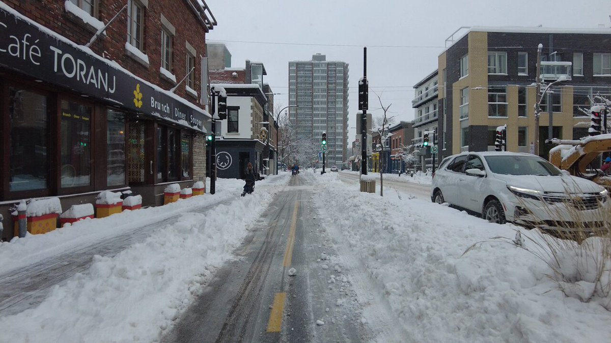
Interesting how people project based on wherever they're from. No one could come to central Montreal in the winter and not see lots of cyclists. Not the same volumes as summer but it's still common and visible.
If you were a city-state only slightly larger in area than the City of Toronto, you would think about space very differently. There would be no option to just sprawl further out. And that is the case for Singapore, which is approximately 734 km2 compared to Toronto's 630 km2.
So it's no wonder that Singapore carefully manages how people use and own cars. Not only were they the first country in the world to implement a congestion charge (road pricing), but they also force people to buy 10-year "Certificates of Entitlement" in order to own one.
These are auctioned off every 2 weeks and the overall supply of them is controlled by the government.
Currently, the starting price for a COE is S$104,000 (roughly the same in Canadian dollars). This is a record high and up nearly 3x compared to 2020 when fewer people wanted to own a car. However, if you'd like a COE that works on all sizes of cars, that is right now S$152,000.
It's hard to imagine a system like this ever flying in a large country like Canada. But if Canada were the size of just Toronto, you can be sure that we would likely have no other choice. That said, this is more or less how we treat new housing: we've made it
Brandon Donnelly
Daily insights for city builders. Published since 2013 by Toronto-based real estate developer Brandon Donnelly.
What's remarkable is the number of people who, at least from these tweets, continue to cycle in the winter. In fact, in the above video, there looks to be more bikes on the road than cars. Plowed lanes certainly help!
According to the city of Montréal, about 80% of the network is maintained for year-round use (717 km of its 900 km network). But I'm sure that there are a lot of people who still can't imagine anyone wanting to cycle in these conditions. So what is the actual winter usage?
Thankfully, Montréal has bike counters. 55 of them to be exact. And all of the data can be viewed, here. The busiest location is Saint Denis and Rue des Carrières. This falls within their Réseau Express Vélo (REV) network, which is a series of protected lanes intended to do what the name suggests.
The daily average for this counter is currently 4,403 riders, but the summer peak looks to be closer to 10,000. And this year, it has seen close to 1.5 million rides in total. This is a significant number. I mean, imagine 1.5 million more car trips on the road.
Looking at yesterday's data, the daily count was 1,292. If you very crudely divide this by my 10,000 summer peak estimate, you get to around 13%. And this happens to line up with what seems to be the city's generally accepted winter cycling retention ratio.
Not surprisingly, fewer people want to cycle in the winter. But the number is not nothing. If you multiple 1,292 cycling trips by 120 days (roughly December to March), that's still over 150,000 trips (I know, I didn't account for weekends). On top of this, the city's winter cycling retention rate appears to be increasing.
So just because you may not want to cycle to work in the winter, it doesn't necessarily mean that others feel the same way.
Back in 2016, the City of Toronto announced plans to run a transit-priority pilot on King Street in the downtown core. What this meant was that cars would be restricted to only certain movements and that streetcars would be given priority. This pilot was ultimately implemented in 2017 and, eventually, it was made permanent. Presumably because it was doing some good for transit flows. But just this week, new data was revealed showing that, in some cases, travel times today are worse (i.e. longer) than they were before the pilot:
CityNews has learned that eastbound travel times from Bathurst to Jarvis during the evening rush hours averaged 19 to 26 minutes before the pilot program in 2017. The latest times show it is now worse with an average of 22 to 29 minutes.
One way to look at this data would be to say, "okay, clearly this transit corridor thing isn't working. Streetcar travel times have gotten worse. So why bother?" But I think the real answer is this: King Street hasn't remained a transit corridor since the pilot. Many/most motorists continue to use it, even though some 22,000 tickets have apparently been issued since the pilot began. Here's a random photo of King Street West taken from my office window one afternoon:
So I think what this data is really saying is that we've probably done very little to actually improve transit flows on King Street since 2016, and that traffic has generally gotten worse during this time. This seems like a more accurate description to me. But of course, it doesn't need to be this way. If really want King Street to be a transit corridor, we have the power to make that happen. It just means spending some money on public realm enhancements, gates, bollards, and the like. The choice is ours.
difficult and expensive for new entrants
.
What's remarkable is the number of people who, at least from these tweets, continue to cycle in the winter. In fact, in the above video, there looks to be more bikes on the road than cars. Plowed lanes certainly help!
According to the city of Montréal, about 80% of the network is maintained for year-round use (717 km of its 900 km network). But I'm sure that there are a lot of people who still can't imagine anyone wanting to cycle in these conditions. So what is the actual winter usage?
Thankfully, Montréal has bike counters. 55 of them to be exact. And all of the data can be viewed, here. The busiest location is Saint Denis and Rue des Carrières. This falls within their Réseau Express Vélo (REV) network, which is a series of protected lanes intended to do what the name suggests.
The daily average for this counter is currently 4,403 riders, but the summer peak looks to be closer to 10,000. And this year, it has seen close to 1.5 million rides in total. This is a significant number. I mean, imagine 1.5 million more car trips on the road.
Looking at yesterday's data, the daily count was 1,292. If you very crudely divide this by my 10,000 summer peak estimate, you get to around 13%. And this happens to line up with what seems to be the city's generally accepted winter cycling retention ratio.
Not surprisingly, fewer people want to cycle in the winter. But the number is not nothing. If you multiple 1,292 cycling trips by 120 days (roughly December to March), that's still over 150,000 trips (I know, I didn't account for weekends). On top of this, the city's winter cycling retention rate appears to be increasing.
So just because you may not want to cycle to work in the winter, it doesn't necessarily mean that others feel the same way.
Back in 2016, the City of Toronto announced plans to run a transit-priority pilot on King Street in the downtown core. What this meant was that cars would be restricted to only certain movements and that streetcars would be given priority. This pilot was ultimately implemented in 2017 and, eventually, it was made permanent. Presumably because it was doing some good for transit flows. But just this week, new data was revealed showing that, in some cases, travel times today are worse (i.e. longer) than they were before the pilot:
CityNews has learned that eastbound travel times from Bathurst to Jarvis during the evening rush hours averaged 19 to 26 minutes before the pilot program in 2017. The latest times show it is now worse with an average of 22 to 29 minutes.
One way to look at this data would be to say, "okay, clearly this transit corridor thing isn't working. Streetcar travel times have gotten worse. So why bother?" But I think the real answer is this: King Street hasn't remained a transit corridor since the pilot. Many/most motorists continue to use it, even though some 22,000 tickets have apparently been issued since the pilot began. Here's a random photo of King Street West taken from my office window one afternoon:
So I think what this data is really saying is that we've probably done very little to actually improve transit flows on King Street since 2016, and that traffic has generally gotten worse during this time. This seems like a more accurate description to me. But of course, it doesn't need to be this way. If really want King Street to be a transit corridor, we have the power to make that happen. It just means spending some money on public realm enhancements, gates, bollards, and the like. The choice is ours.