Daily insights for city builders, delivered every morning at 6 AM ET. I’m Brandon Donnelly — a Toronto-based real estate developer and founder of Globizen. I’ve been writing here since 2013.

Tag: transit

  • Toronto’s Bloor-Danforth subway corridor is a land use crime scene

    image

    Yesterday after my post on leveraging LRT, I stumbled upon an interesting and timely article written by Richard Joy, who is the Executive Director of the Urban Land Institute (Toronto).

    The article talks about some of the transit-oriented development that we’ve seen at various nodes along Toronto’s Yonge subway corridor (St. Clair, Eglinton, Sheppard, and so on). But it goes on to argue that these are exceptions to the rule. For the most part, we’ve missed the boat:

    The tragic history of our massive capital investments into transit infrastructure is massive under-development.

    Indeed, the Bloor-Danforth subway corridor is a land use crime scene.

    His main argument is that until we expand the supply of transit-oriented land (through increased intensification), we will continue to undersupply the kinds of walkable and transit-oriented neighborhoods that many, if not most, people actually prefer. And that, out of necessity, will force people into their cars. Because affordability trumps location preference.

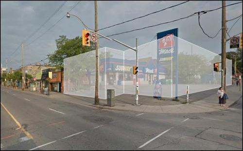
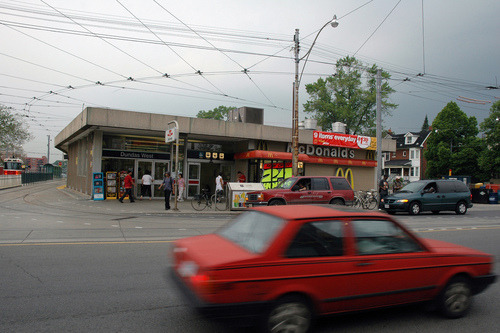
    As one example, he talks about the intersection of Bloor Street and Dundas Street in the west end of the city. Next to Union Station, this is probably the best connected mobility hub in the region. You have the Bloor-Danforth subway line, a streetcar line, and a GO regional rail line which all feed into it. Next year it’ll also become a stop for the new express train to Pearson airport.

    And yet the city has a history of opposing intensification in this location, including the old Giraffe Condominiums proposed by TAS. Does that make sense to you?

    Image: Flickr
  • Leveraging LRT

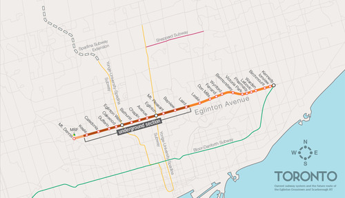
    One of the biggest pieces of infrastructure currently under construction in Toronto is the Crosstown LRT line, which will run on and under Eglinton Avenue right through the heart of midtown. The total length of the line is 19 km, and 10 km of it will be underground along with 12 of its stations.

    Here’s a map:

    image

    But as the Chief Planner of Toronto, Jennifer Keesmaat, rightly pointed out in this blog post earlier this year, it’s important to think of this line, not just as a piece of transit infrastructure, but as a broader city building initiative. With this line comes a tremendous opportunity to rethink and rebuild one of Toronto’s most important avenues.

    I have no doubt that this will happen over the coming years and decades. I mean, just look at the development activity taking place on St. Clair Avenue West right now, which you could argue is the result of its right-of-way streetcar line. But in this instance, what I’m specifically curious about is what will happen at each of the stations along Eglinton Avenue.

    If you take a look at the Stations and Stops page on the Crosstown website, you can see where all of the primary and secondary entrances will be and how each station will generally function. But what is not clear is whether we will be using this opportunity to build additional density on top of them.

    Here’s how they have “blocked out” the primary entrance for Avenue station:

    image

    I have no idea what it’ll become. But if it ends up as single-storey and single-purpose building, then I think we will have missed an opportunity. And the same goes for many, if not all, of the other stations along the Eglinton Crosstown line. Fixed rail is such a massive driver of real estate value, and so it seems silly not to take advantage of that in some way.

    If anyone has any insights into how these stations will or will not be developed, I would love to hear from you in the comment section below.

  • It’s voting day in Toronto

    Today is municipal election day in Toronto.

    About 8 months ago I publicly announced here on ATC who I would be supporting, and my position hasn’t changed. I was disappointed by the fact that he ended up backing away from his initial promise of a true downtown relief subway line (see blog post), but I nonetheless continue to support his candidacy.

    In the words of Mike “Pinball” Clemons, he’s “the right man at the right time.” Click here if you can’t see the video below.

    [youtube https://www.youtube.com/watch?v=ouqv782giyw]

    But I’m not here to try and sway your vote. That is ultimately your decision. However, I am here to encourage you to get out and vote. Regardless of who you might be supporting, I think it’s important that you get out and take a position. So I hope you do that today.

    Happy Monday!

  • Riding the new streetcar

    image

    This afternoon I rode Toronto’s new streetcar for the first time on my way home from Chinatown. I had been meaning to do it for weeks now, but this was my first opportunity.

    The experience was infinitely better than what you get today on our current streetcars. I felt like I was in a new city. The proof-of-payment system makes onboarding much faster and the 4 loading doors means you just get on the train where there’s the most room – instead of getting on at the front and fighting your way to the back.

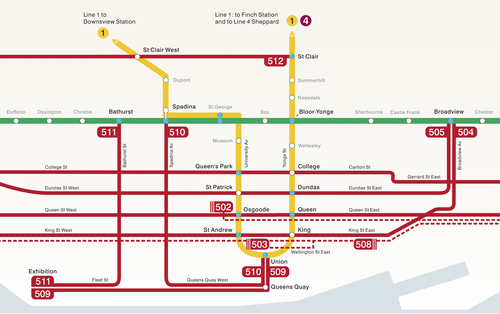
    The other thing I liked is that they now have a map of our streetcar network within the train (see above image). Toronto never used to do this. For whatever reason, we didn’t like mixing subway lines with streetcar lines on the same map. 

    But why be so pedantic?

    For one thing, our subway map looks pathetic without these additional streetcar lines on it. So for the sake of Torontonian morale, please fill it up with what you can.

    But the other reason why I think it’s important to include them is that we shouldn’t be thinking about our cities just in terms of specific technologies (subway, streetcar, and so on). Our cities are now multi-modal. Which means we navigate them using many different means, from subways and streetcars to bikes and Uber cars. What people care about is getting from A to B in the most efficient and enjoyable way possible.

    This may seem like a subtle distinction, but it’s an important one. And maybe, just maybe, these new maps will serve as an important reminder to us that there’s a lot of fixed rail in this city and that it could be far better optimized if we just tried a little harder.

  • Avoiding driving

    If you’ve been reading Architect This City since last winter, you might know that every year I go on one big snowboard trip with a group of guys I went to grad school with at Penn. Last year we went to Jackson Hole and Vail, and this year the plan is to go to Banff and Revelstoke.

    We start planning it by the fall and so already we’ve been trying to sort out the details for this winter’s trip. But as we finalize the plans, one thing I’ve noticed is how I’ve automatically been trying to minimize the amount of driving that we’ll need to do. In fact, in a perfect world, we wouldn’t have to rent a car at all.

    Now, small mountain towns aren’t usually the best for public transit, but there are often ways to get around that. When we were in Jackson, we took the public bus to get to the mountain every day, as did most people who lived or stayed in town.

    This winter, the plan is to fly into Calgary and stay in Banff for the first leg of the trip. So I’ve been trying to figure out if there’s a train that can get us from Calgary to Banff and which hotels offer shuttle buses to the mountains. Because I’d rather not drive, and I know many of my friends feel the same way. It’s an added cost and it gets in the way of après ski.

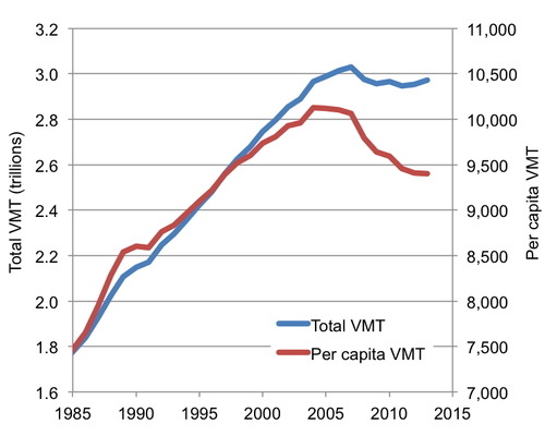
    What’s interesting about this, is that not only do I try and minimize the amount of driving I do here in Toronto, but I do it when I travel as well. And if you’ve been following the macro trends, you might know that many other people feel the same way. That’s why total Vehicle Miles Traveled in the US has been in falling since about the mid-2000s:

    image

    People are falling out of love with driving, and many believe that this shift is permanent. Here’s a recent report from the US PIRG Education Fund talking about just that:

    //platform.twitter.com/widgets.js

    I also think this shift is permanent – until maybe the nature of driving changes and cars start driving themselves. But at that point, it won’t be called driving anymore and there will probably be many other changes. So on this rainy Wednesday morning, my big bold prediction is that future generations will no longer drive.

    What do you think?

  • Multi-modal cities are the new reality

    CityLab published an article last week on multi-modal cities that caught my attention (because it used a picture of Toronto with about 3 or 4 streetcars stacked up along Queen Street). The premise of the article is that all of this car vs. transit debate is actually missing the bigger picture: our cities are multi-modal and we need to be planning for that.

    That’s not to say that the shift away from cars isn’t a good thing. It is. But it’s not as simple as saying that, instead of driving, people should now only take transit. In today’s cities people walk, bike, take streetcars, take buses, take subways, take taxis, take private shuttles, use Uber, and, yes, they still drive.

    From my own experience, this is absolutely how I get around Toronto today. I walk to the gym. I ride my bike whenever I’m going somewhere downtown. I take the subway to my office in midtown because it’s far and I would be too sweaty if I biked there. I use Uber and Hailo when I’m going out at night. And I drive when I need to go to the suburbs or leave the city.

    But the key takeaway here is that we now have a much tougher challenge on our hands. When we were only optimizing for cars – however detrimental to our cities that was – we only had one mode to plan for. Now we have several. Some of which are public and some of which are private.

    However we also have access to technologies that we didn’t have before. We are networked in ways that weren’t possible before and we’re at the dawn of many profound mobility changes, such as driverless cars. (Have you read about Tesla’s new Autopilot feature yet?)

    So as I’ve said before, I really believe that we need to look at this, not as a war on the car, but as a war on inefficiency. The problem we are trying to solve relates to mobility: What’s the best way to move lots of people around dense urban regions? Stop focusing so much on the technologies and focus more on the people.

    Image: Flickr

  • From bicycles to cars in Beijing

    image

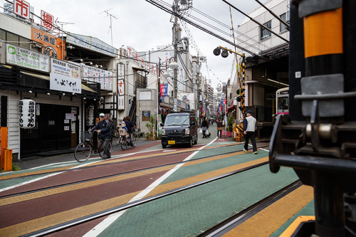
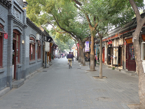
    Earlier this week, a friend of mine shared this TED talk on my Facebook wall talking about the state of climate change in the world. The talk is by Nicholas Stern. And at one point he talks about the incredible urban transformation that has taken place in Beijing over the last couple of decades; specifically, the shift from a bicycle oriented city to a now automobile oriented city.

    I knew that this was the case, but it got me thinking. Because alongside this mobility change, there’s also been – not surprisingly – pronounced changes to the urban fabric of the city. The most significant is perhaps the demolition of the city’s hutongs and siheyuan. Hutongs are basically narrow alleys (see above photo) and siheyuan are the traditional Chinese courtyard houses.

    For centuries, these alleyways and courtyard houses have defined Beijing. And while I realize that not all of them were as glamorous as Melbourne’s laneways, only about 1,000 of Beijing’s original 6,000 hutongs remain (according to Time). Which makes me wonder: Is China making the same mistakes that we made in the 20th century?

    Because as the developed world moves toward transit oriented development, bike lanes, heritage preservation, and compact urban living, China has seemingly gone and done the exact opposite. They got everyone off bicycles and into cars, and they went and erased a scale of urbanism that has been in place for centuries.

    This is not to say that China doesn’t deserve to have the same standard of living as the developed world. It absolutely does. It just seems a bit ironic to me that the things we’ve become sharply critical of, are exactly what China seems to want to recreate.

    Image: Flickr

  • How are you being shaped?

    image

    “We shape the cities, and then our cities shape us.” That’s one of my favorite lines from the documentary The Human Scale, featuring Danish architect and urban designer Jan Gehl. I like it because I don’t think many of us think enough about the way in which the built environment – that we create – ultimately goes on to influence the way we live our lives.

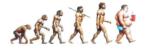
    One of the most interesting connections for me is the link between urban form and public health. There’s been a lot of talk over the years about how suburban sprawl is, or might be, making us fat (among other things). We’ve created environments that are only navigable by cars and that has forced many of us into sedentary lifestyles. We sit in our cars, and then we sit in our offices.

    So today I’d like to conduct a bit of a poll. If you’d like to participate, please share the following 3 things in the comment section below: 1) your city, 2) the type of neighborhood you live in (urban, suburban, rural, etc.), and 3) the amount of time you spend walking or doing something active on an average day.

    Here’s me:

    I live downtown Toronto in the St. Lawrence Market neighborhood (urban). I take the subway to work and the station is a 10 minute walk from my place. So as a bare minimum, I spend at least 20 minutes a day walking. But since I also walk to do most of my regular errands, and since my gym is another 10 minute walk from my place, I’d say I average a good 30-45 minutes of walking each day.

    Now it’s your turn 🙂

    This is a pretty crude survey, but with the advent of things like smartwatches and health monitors, I think we’ll soon have lots of great data on the ways in which our cities might shape our health.

    Image: The Economist

  • The war on the car

    image

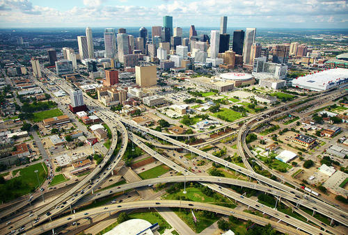
    In today’s post I’d like to focus on the second tweet I embedded in yesterday’s piece about downtown Toronto. Specifically, the fact that almost 75% of downtown residents walk, cycle, or take transit to work, leaving drivers firmly in the minority.

    For me, this then makes me question whether or not we’re optimizing well enough for the majority. However, it’s often not that simple. And that’s because the downtown core is clearly regional in its draw, and the further you move out from the downtown core, the more the modal split flips. In the suburbs, driving is obviously the majority.

    And herein lies the tension and the reason for all this “war on the car” rhetoric: We have a downtown core with completely different mobility preferences than the rest of the region.

    But as Toronto continues to intensify and grow (the population of the Greater Toronto Area is projected to reach almost 9 million by 2036), I truthfully don’t know how we could reasonably expect to (efficiently) move that number of people in private cars. I’ve just never seen it done before.

    Some people think that if we simply got rid of all those damn streetcars on our city streets, that we’d be doing a lot to eliminate traffic congestion. But it’s not that simple. The Highway 401 here in the city is already 18-lanes and one of the widest in the world. And yet it’s perpetually clogged. No streetcars there.

    So I look at this tension as a growing pain. Sooner or later I think we’re going to realize that this war should really be a war on inefficiency. How do we move lots of people around big cities while minimizing waste, maximizing economic output, and enhancing quality of life?

    Now that’s a war worth fighting.

    Image: Helibacon

  • The Globe and Mail: Why Toronto is still a streetcar city

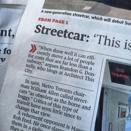
    In anticipation of our new streetcars beginning service this Sunday, the Globe and Mail published an article on Friday called: Why Toronto is still a streetcar city. And I was quoted as saying the following:

    I had no idea that I was going to be cited, but I like the quote that was chosen. The key words are: “when done well.” There are a myriad of different ways in which a city can implement streetcars, and each will have varying degrees of performance.

    So if you’re one of those people who are critical of streetcars, I would encourage you to think about streetcars not just in terms of how they’re implemented today in Toronto, but also in terms of how they could be implemented going forward.

    All streetcars lines are not created equal.