Daily insights for city builders, delivered every morning at 6 AM ET. I’m Brandon Donnelly — a Toronto-based real estate developer and founder of Globizen. I’ve been writing here since 2013.

Tag: public transit

  • Lyft announces subscription plan

    Last week, Lyft announced a new subscription plan

    It costs $299 every 30 days and you get 30 rides included (up to $15 each). So it represents a possible 1/3 discount on rides. If you go over the 30 rides per month or over $15 on any one ride, you simply pay the difference. Though as a subscriber, you get 5% off additional rides.

    Subscriptions are good for business. They can be like an annuity. And I suspect that with the above model, there will be unutilized rides every month that the company is just able to bank. You can’t carryover rides with this plan.

    But moreover, Lyft’s “All-Access Plan” is designed to help you ditch your car. Trade your car payment for a ride subscription plan. So if the numbers didn’t quite work for you before, maybe they do now. Depending on the situation, I can certainly see this plan being cost effective.

    But as ride hailing/sharing continues to nibble away at public transportation and personal vehicle ownership, what will this mean for cities?

  • Lyft reveals plans for bikes and scooters

    On Monday, John Zimmer and Logan Green, the co-founders of Lyft, published this Medium post announcing their “approach to partnering with cities to introduce bike and scooter sharing” to their platform. 

    “Approach to partnering with cities” is undoubtedly a carefully chosen set of words given all the backlash going on right now around dockless scooters.

    Nevertheless, this is an exciting announcement. I could have used a scooter this afternoon to get to a meeting. And this is all part of their larger goal of transforming Lyft into a multi-modal platform – one that will also support conventional public transit.

    Here is an excerpt from the Medium post:

    Transit, bikes, small electric vehicles, and infrastructure such as safe pedestrian paths and bike lanes, all play a large role in decoupling people’s right to mobility from car ownership. We know we can’t accomplish this alone, and we’re committed to working with cities and residents to bring these elements together in the most cohesive way to maximize a reduction in vehicle miles traveled.

    The company has also set the goal that 50% of all trips on the Lyft platform will be shared rides by 2020. It is yet another example of the lines between public transit and ride sharing apps becoming blurrier. 

    Full post can be found, here.

  • Global mobility index

    Below is a short video that was created by the MIT Senseable City Lab, World Economic Forum and TomTom for a study on how people move in 100 cities around the world. They call it the Global Mobility Index.

    It shows congestion levels (using real-time traffic data from TomTom), commute times, and an estimate for the percentage of trips that could be shared if people were willing to wait up to 5 minutes.

    In the case of Toronto, they estimate that 99% of trips could be shared and that it would increase average speeds by ~7.9 km/h and reduce overall traffic levels by ~44.09%.

    Their solution to solving traffic congestion is a cocktail that involves car-sharing, bike-sharing, and public transit. It’s about developing a “mobility portfolio.” Seems sensible.

    I found myself wanting more information and data after watching the video. Still, it was interesting to see what the authors describe as the “pulse of our cities.”

    If you can’t see it below, click here.

    [youtube https://www.youtube.com/watch?v=ciJEHGMtpWc?rel=0&w=560&h=315]

  • Shenzhen has just electrified its entire bus fleet

    image

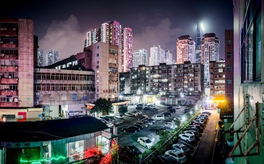
    This is impressive: Shenzhen recently finished converting its entire bus fleet to electric vehicles. That’s 16,359 buses and around 8,000 charging stations according to Electrek.

    It is estimated that this all-electric fleet saves 345,000 tons of fuel per year and reduces carbon emissions by 1.35 million tons.

    Shenzhen is now working on doing the same to its 12,518 taxis. Already 62.5% of them are electric-powered and the goal is 100% by 2020. 

    But let’s not forget that China still generates most of its electricity from coal. Coal represented 72% of its electricity generation in 2015. And in 2014, carbon emissions from China allegedly made up almost 30% of the world .

    Photo by Anton Strogonoff on Unsplash

  • How’s your PTAL these days?

    image

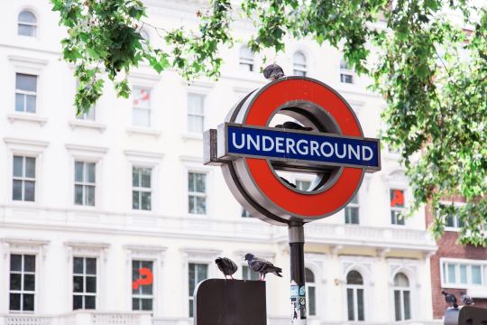
    As I was going through the new London Plan yesterday I noticed a number of references to PTAL. I didn’t know what this was, so I obviously had to look it up.

    It stands for Public Transit Accessibility Level. It’s a methodology that was developed in London in the 90′s. And it’s a measure of access to public transit, or of the density of the public transport network at any given location.

    There are 6 levels, though two of the levels are further subdivided into 2 sub-levels for greater precision:

    • 1a and 1b
    • 2
    • 3
    • 4
    • 5
    • 6a and 6b

    1 is bad. 6 is good. 

    What’s captured in this measure are the walking times from a particular location to the nearest transit access points; the reliability of the available services; the number of services available; and the average wait times.

    Historically, this measure has helped to determine how much density could be built on a particular site, how much parking should be provided, and so on. 

    For example, in the new London Plan, PTAL 5 and 6, as well as Inner London PTAL 4, are expected to see development with no residential parking. Once you move to PTAL 3, the parking maximum moves up to 0.25 spaces per unit. 

    In the draft London Plan you’re also supposed to use the highest existing or planned PTAL. So if transit improvements are planned for the area, you factor those into the calculation.

    Seems quite rationale (though it’s probably not a perfect measure of access and connectivity).

    If you’d like to determine the PTAL for a particular address in Greater London, you can do that here. Unfortunately, I don’t have a calculator for you if you happen to live outside of London. But there is one simple check you can do.

    The PTAL methodology assumes an average walking speed of 4.8 kph. The maximum allowable walk time for buses is 8 minutes and the maximum walk time for subway and light rail is 12 minutes. These numbers translate into distances of 640m and 960m, respectively.

    How far do you have to walk to access good transit?

    Photo by Bruno Martins on Unsplash

  • Uber Express POOL is kind of like public transit

    Uber is currently testing a feature in a few neighborhoods in Boston and San Francisco called Uber Express POOL

    Like the regular version of Uber POOL, this is a shared ride. But with Express POOL the app now automatically generates “smart spots” that are easy to drive to and close to the origin and destination of multiple passengers.

    So instead of a direct pick-up and drop-off, you now need to walk a few blocks to one of these dynamically created “smart spots.” In exchange for the added inconvenience, you get 25% off your fare.

    What’s immediately fascinating about this feature is that it further blurs the line between Uber and public transit. These “smart spots” are effectively low-volume and ephemeral transit stops that pop-up based on demand and then disappear.

    It makes the notion of a fixed stop and transit schedule, particularly in low usage areas, seem inefficient. Now imagine if we created some sort of visual marker on the street every time a “smart spot” was emerging based on demand.

    It is clear that Uber is trying to price these rides so that they are competitive with conventional public transit. And there’s no reason that this technology couldn’t also be applied to larger vehicles, such as buses.

    I find this fascinating. And it’s a perfect example of what we talked about in yesterday’s post. This is software and networks being layered on top of the built environment.

  • The neighborhood of the future

    image

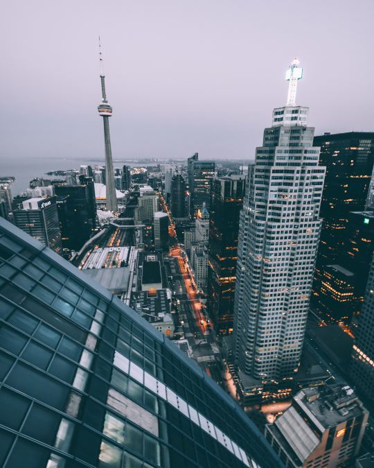
    Daniel Doctoroff (chairman and CEO of Sidewalk Labs and former deputy mayor of New York City) and Eric Schmidt (executive chairman of Alphabet and former CEO of Google) recently contributed a piece to the Globe and Mail about “why Toronto is the ideal place to build a neighborhood of the future.” 

    It’s about the partnership they working on with Waterfront Toronto. I wrote about that announcement, here.

    Here is an excerpt from the Globe article:

    “The eastern waterfront will be a place where residents, companies, startups and local organizations can advance new ideas for improving city life. It’s where a self-driving test shuttle will take its first steps toward becoming a next-generation transit system that’s cheaper, safer and more convenient than private car-ownership. It’s where new insights into advanced construction methods will start to reveal a path toward more affordable housing development. It’s where explorations into renewable energy and sustainable building designs will show promise toward becoming a climate-positive blueprint for cities around the world.”

    These are some of the first details that I have heard about their vision for Toronto’s eastern waterfront. 

    Some of you are probably worried – after reading the above excerpt – that by focusing on self-driving vehicles, we are setting ourselves up to repeat our previous mistakes. But if self-driving vehicles are destined to become a reality (and it certainly feels that way), it is critical that we understand their impact and how they might best dovetail with the public transit systems we already have in place.

    I am thrilled that all of this will be happening right here on our doorstep.

    Photo by Brxxto on Unsplash

  • Slot-based intersections

    If you don’t follow the work of MIT’s Senseable City Lab, I highly recommend that you start. 

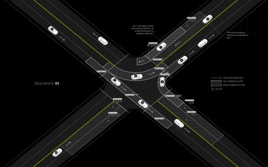
    Earlier this year, researchers from the Massachusetts Institute of Technology, the Swiss Institute of Technology, and the Italian National Research Council developed something that they call “slot-based intersections.” In a world where cars have sensors and drive themselves, it is intended as a more efficient alternative to traditional intersections. Goodbye traffic lights.

    Much like air-traffic control, the way the system works is by assigning individualized time slots to each car for when they may enter an intersection. For example, in the diagram below (Sequence 01) the car approaching from the bottom left (#10) has a “stop distance slot” in front of it reserved for 3 of the cars that are currently in the intersection. The two that are traveling perpendicular to it and the car currently turning left into the same lane as #10 (on the other side of the intersection). The car in the midst of turning right (#5) is exempt because there’s no possibility of collision. 
    image

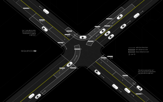
    In Sequence 02 (below) you can see that car #10 is now turning left, which means it has its own time slot in the intersection. Other approaching cars now have a “stop distance slot” dependent on car #10.
    image

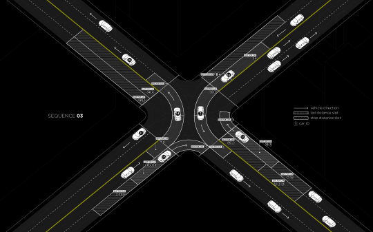
    In all cases, cars making a right turn are able to move freely, provided they will not interfere with any other cars.
    image

    The researchers estimate that real-time slot allocation might double the number of vehicles that a traditional traffic-light intersection can handle today and, in some cases, it might completely eliminate stop and go traffic.

    Often when I write about self-driving vehicles I hear people tell me that cars are still cars. It doesn’t matter whether they are self-driving or not. The same inefficiencies apply. They are not the solution to urban gridlock. Elon Musk was also criticized (following his Master Plan) for not properly understanding urban geography.

    But self-driving cars will create new efficiencies. I am not saying that they are a silver bullet, but I am saying that they will help a great deal. I don’t think that anyone truly understands the extent of these efficiencies, but there are a myriad of possibilities. This Senseable City Lab project is a perfect example.

    What I am grappling with right now is the relationship between self-driving vehicles and traditional forms of public transit. Until we get a handle on the efficiencies and overall impact, it’s hard to ascertain how these different forms of mobility will work together. My gut tells me that the lines are bound to get blurry and that self-driving “cars” will feel less and less like the cars we know today.

    Below is a video that was published along with the research. If you can’t see it, click here.

    [youtube https://www.youtube.com/watch?v=4CZc3erc_l4?rel=0&w=560&h=315]

  • Towards car-free living

    Right now, there’s an apartment building in San Francisco that is trying to encourage car-free living by offering residents a $100 per month credit that can be used for Uber and/or for public transit. Prospective residents can even get a $20 credit to go check out the community. (The program is a partnership with Uber.)

    The reason this leasing strategy caught my attention is because we’re at a point where city builders are now trying to recalibrate themselves to this new emerging world. 

    When I was at the Land & Development conference earlier this month, one developer brought up this exact point. He more or less asked: If you’re starting development on a new building today and you’re expecting approvals in 2 or so years and completion in another 3 or 4 years, what do you think the state of cars/driving will be at that point? Should you really be building all that underground parking?

    These are great question. And they highlight one of the challenges of development. It takes a long time to bring new supply to the market and a lot can change during that time period. My sense is that we are pretty clearly seeing downward pressure on driving and car ownership.

    That said, this isn’t the case in every city or in all parts of a particular city. I just got back from a trip to a Detroit where it’s pretty hard to imagine the city being oriented around anything but the car. But in cities like San Francisco and Toronto, car-free living is already a reality for many people and so we need to respond to that.

    How do you see yourself driving, or not driving, in the next 5 to 10 years?

  • Medellín wins 2016 Lee Kuan Yew World City Prize

    image

    Thanks to my friend Darren Davis, I just recently learned about something called The Lee Kuan Yew World City Prize.

    Named after Singapore’s first Prime Minister, the prize is a biennial award that honors cities who have made, “outstanding achievements and contributions to the creation of liveable, vibrant and sustainable urban communities around the world.” Along with the prize comes $300,000 (Singapore Dollars), which is about $287,000 Canadian as of today.

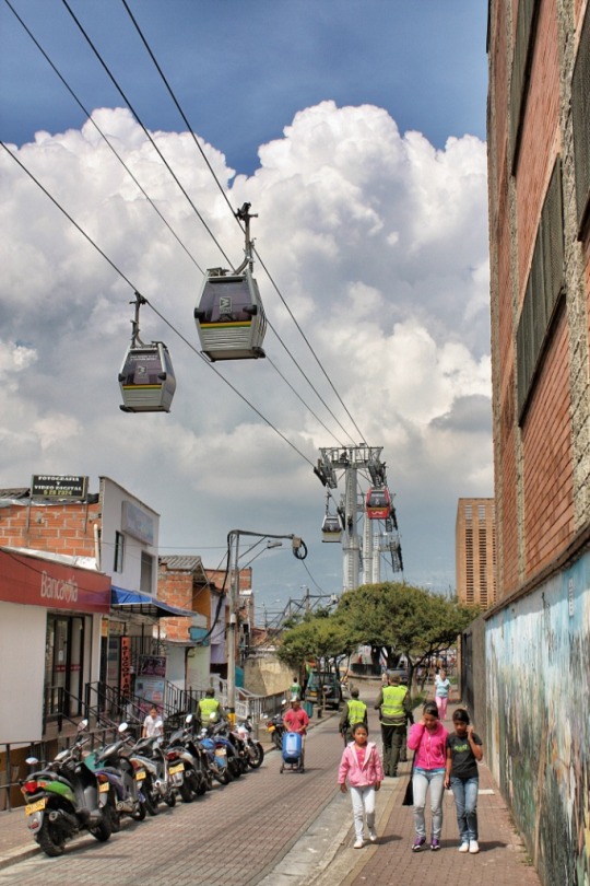
    The 2016 Prize Laureate is Medellín, Colombia.

    Over the past two decades, the city has transformed itself from one of the most dangerous cities in the world to one that has become a model for social inclusion and urban innovation. Here is a video that talks about the transformation. It’s a bit cheesy, but it does provide a high-level overview of their urban initiatives. A lot of them will serve as a reminder about the importance of urban connectivity.

    If you’re a regular reader of this blog, you may also remember that my good friend Alex Feldman (VP at U3 Advisors) wrote a guest post about Medellín after he visited the city for the World Urban Forum almost two years ago. That post was called, What cities could learn from Medellín.

    It’s worth mentioning that the runners-up for this year’s World City Prize were Auckland, Sydney, Toronto, and Vienna. In the case of Toronto, our “far-from-ideal transit” was specifically called out as a negative. Thankfully we are now working on road pricing, which will provide additional funding for transit. 😉

    Image by Jorge Gobbi