Daily insights for city builders, delivered every morning at 6 AM ET. I’m Brandon Donnelly — a Toronto-based real estate developer and founder of Globizen. I’ve been writing here since 2013.

Tag: public space

  • Pedestrian plaza or parking lot?

    It is maybe comforting to know that even Europe wrestles with the decision of whether a grand urban space should be used for pedestrians, or turned into a parking lot. Take, for example, the Grand-Place in Brussels (pictured above).

    Today, it is a UNESCO World Heritage Site and one of the most important tourist destinations in the city. Perhaps its most famous. But during the 1960s, in what Wikipedia calls a “low period of appreciation,” it was a parking lot.

    This lasted until 1972, when a bunch of people from the community got together and lobbied for it to, you know, not be a parking lot. Not surprisingly, local shop owners were worried, at the time, that this would hurt their businesses. This is often the concern.

    Here in Toronto, where we continue to debate the pedestrianization of Kensington Market, we have surveys showing that 94% of visitors to the area support pedestrian-only zones, but that this number drops to 55% when you narrow to people who live/work/own stuff in the area.

    But if your goal is to sell more things to people, then there’s something to be said about listening to what your visitors want. In the case of Grand-Place, pedestrianizing the square made it far more popular as a tourist destination. And I think the same would be true of Kensington Market.

    For some photos of iconic public spaces in Europe being used as parking lots, check out this Politico article.

    Image: Wikipedia Creative Commons

  • Leslie Lookout Park

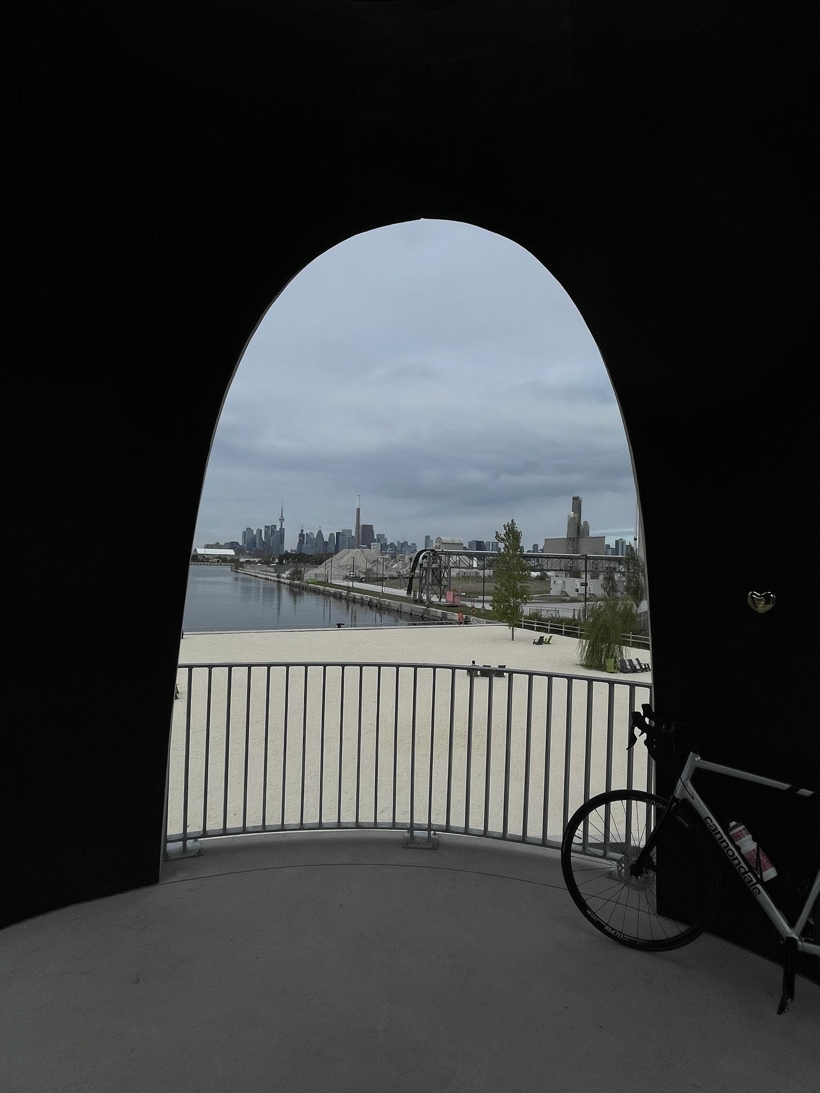
    This morning I rode out to Toronto’s new Leslie Lookout Park, which opened two weeks ago. I came down Cherry Street, crossing the new north bridge, and then I went all along Commissioners Street, crossing its new bridge.

    It’s great to see the Port Lands area continue to develop. Every time I’m down there, it feels more and more real — like an extension of the city. Now we just need to start developing within the blocks.

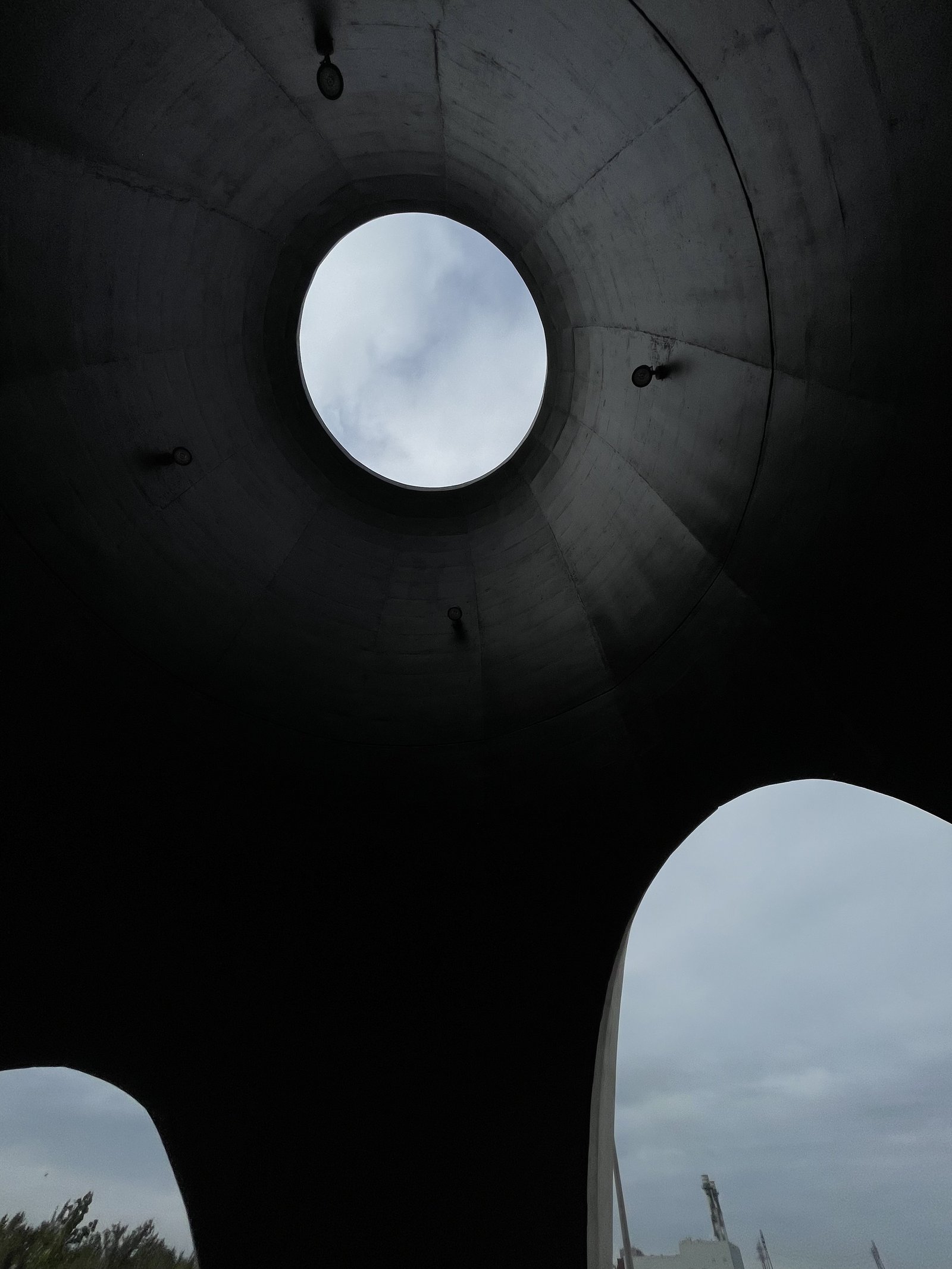
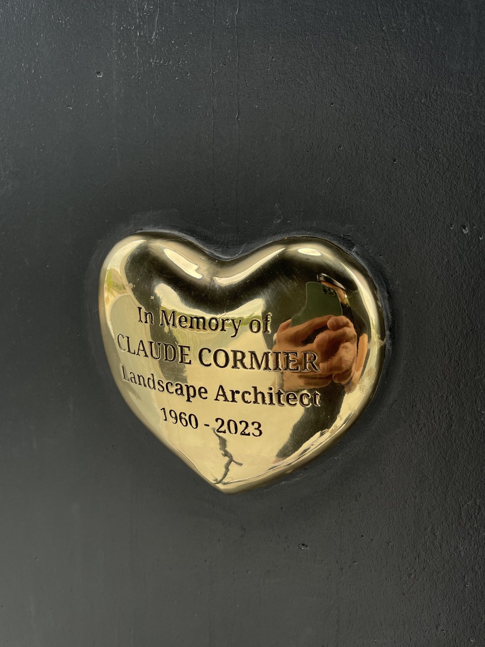
    If you find yourself at Leslie Lookout, make sure you locate Claude Cormier’s heart up in the tower. Claude’s firm CCxA was the landscape architect behind the project; but sadly, he passed away last year.

    Exactly 1 year before the opening of this park.

  • The Bentway Islands

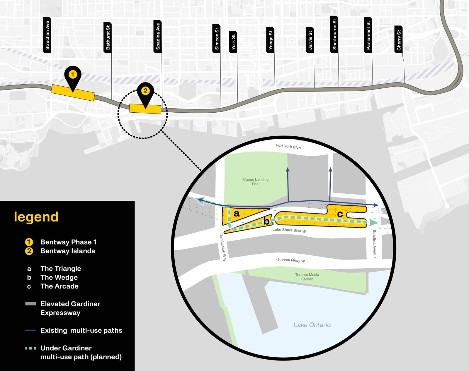
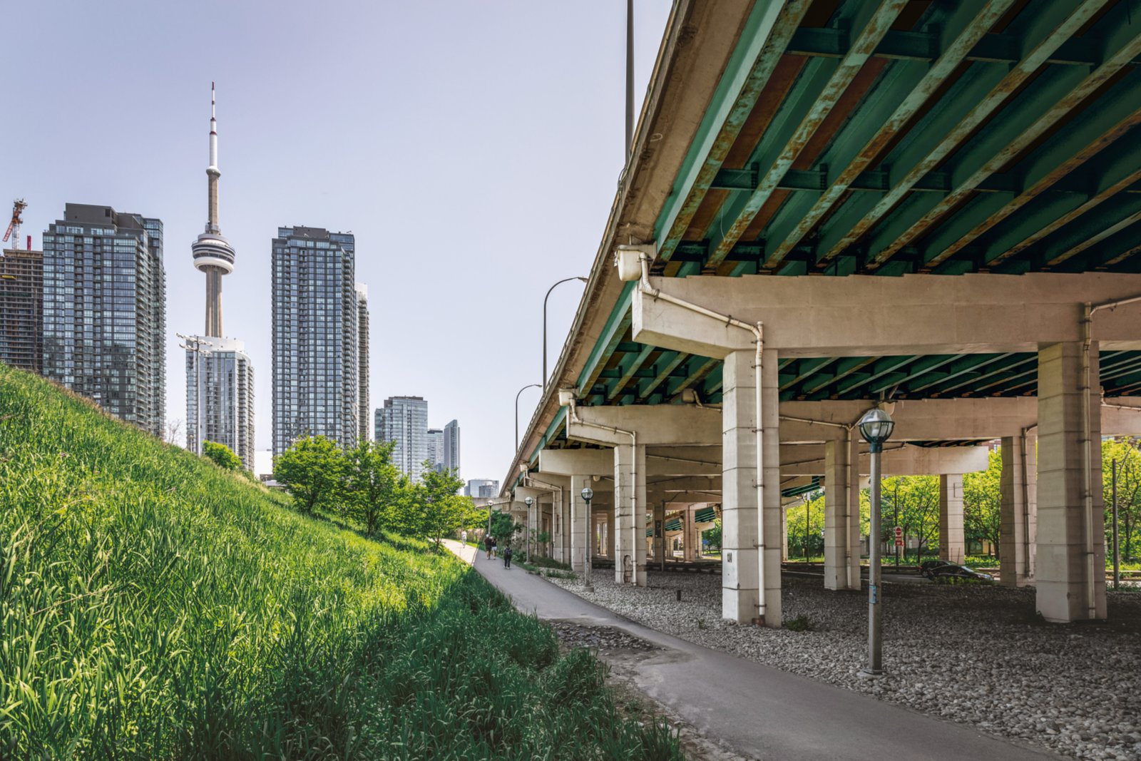
    As many of you know, Toronto has a highly successful public space underneath the Gardiner Expressway called The Bentway. I have ice skated in this space during the winter and I have listened to hard techno in this space during the summer. It has become a public space anchor in the city. Ilana Altman and the team are doing great work. And this week, they just announced that Field Operations (New York) and Brook McIlroy (Toronto) have been hired to design a major expansion. Called The Bentway Islands, this next phase consists of three “islands,” totalling 11,500 m2 (~125,000 ft2).

    Here’s a map:

    And here’s what the spaces look like today:

    Both of these firms do fantastic work, and so I’m excited to see what they come up with. (Field Operations is the firm behind New York’s High Line.) But if I can offer two unsolicited (yet related) suggestions, they would be: 1) Let’s incorporate more commercial uses and 2) let’s aim for these three parcels to not actually feel like urban islands. Generally speaking, the spaces underneath highways aren’t the most desirable. They also tend to be surrounded by inhospitable urban environments. Stitching them in and creating continuity in the fabric of the city (existing example, here) is the best way to make the highway above more or less disappear.

  • NYC 25×25

    There are over 8 million people living in New York City. And if you were to look at the modal split for these people — that is, how they get to work and how they get around — you’ll see that other than Staten Island, the majority of New York City does not rely on cars.

    They walk, bike, take transit, and probably use other things like electric scooters. And in Manhattan, the number of people who drive is particularly low.

    So if you were tasked with coming up with an equitable way to allocate street space, one logical way to do it would be to allocate based on usage. If 5% of people are driving and 95% of people are doing things that require walking, maybe these are the numbers to use.

    The problem, of course, is that cars take up a lot more space than humans and so the math gets a little more nuanced than just a straight 5/95 split.

    And if you look at how most cities have decided to allocate space, this problem is reflected. In the case of New York City, about 75% of its street space is used for cars and the balance is for people to walk around and do stuff (see below chart from The Guardian).

    Because of this mismatch, New York has just launched a new proposal called NYC 25×25.

    The proposal is pretty simple. It is to take 25% of the space that is currently allocated to cars and convert it into space for walking, plazas, green spaces, bus lanes, and dedicated cycle paths (see above chart once more). And the plan is to get it all done by 2025, which seems entirely doable.

    It’s hard to think of a better North American candidate for a shift like this than New York City. It is a city that is already heavily reliant on transit and other forms of mobility. But of course, we shouldn’t stop here.

  • 🏀 Through the fence

    Playground Duperré, Paris

  • New York City makes outdoor dining permanent

    New York City just made its “Open Restaurants” program permanent. Originally set to expire at the end of the October, the al fresco dining program — which allows restaurants to use sidewalks and curb lanes adjacent to their business — is now being thought of as something that will permanently reshape public space in the city.

    Along with this announcement, the City also provided clarity on how heating and enclosures may be used throughout the winter months. Electrical heaters can be used anywhere. But propane heaters can only be used on sidewalks and you’ll need to get a permit from the fire department. Prior to this announcement, there was an outright ban on propane heaters.

    Tents and other enclosures are now permitted, but at least 50% of the side walls needs to remain open for ventilation. Otherwise it gets classified as indoor dining and those rules would then apply. However, fully enclosed structures, such as cool looking Instagrammable domes, are allowed for individual parties provided there’s “adequate ventilation.” Whatever that means.

    This is yet another example of how COVID-19 is forcing us to reconsider the way we think about and use public space within our cities — perhaps forever. And in this particular case, it’ll be interesting to see to what extent cities embrace dining outside in the winter. Some of us already do it when we, for example, après ski. Could the same thing work in our cities?

    Photo by Aleks Marinkovic on Unsplash

  • Us versus them — the reallocation of public space

    On Saturday, Toronto closed a few of its major roads, including Lake Shore Boulevard West, to provide more space for outdoor activities and social distancing. A number of “quiet streets” were also created last week. These now only allow local vehicular traffic. This, of course, isn’t anything novel. Most cities around the world have been reallocating their public space in the wake of this pandemic, with many hoping that some of these changes will stick.

    I rode my bike out to the Humber Bay Shores on the weekend (where I took the above photo) and it was clearly the fix that we needed. Our current waterfront trails simply cannot safely accommodate the volume of people who are out right now on the weekends. I reckon that, under normal circumstances, a good percentage of these runners, cyclists, and rollerbladers would probably be on a patio drinking. That’s not possible right now, so demand for outdoor activities is way up. (Entirely unproven theory.)

    But as is always the case, changes like this make a lot of people grumpy. Traffic got backed up on Lake Shore and the regular “war against the car” narrative flared up. I’m not sure where all these cars were going, but they were out in the sunshine trying to go places. So we have a situation where the reallocation of public space has flipped the supply and demand imbalance to another user — drivers. Now it’s us versus them: “Isn’t there already more than enough room on those big bike trails?”

    I’m frankly tired of this never ending debate, which is why I have argued before that we could use better data and better metrics. How many people are we moving with the decisions we are making? How many people are we accommodating per square meter of space? Where are users of this public space coming from? What performance standards are we trying to meet and/or maintain? What is the most equitable allocation of a finite amount of space?

    But perhaps I’m naive to think that people might listen to facts.

  • A catalyst for Westside development — but not yet

    A new 280 acre park is currently under construction in an old quarry on the westside of Atlanta. It’s called Westside Park. When it opens this spring (that’s at least the target), it will be by far the largest park in the city. But already there are concerns that this investment in new public space could be triggering “rapid gentrification” in the surrounding area.

    So earlier this month, the mayor’s office issued an executive order that put in place a 6-month moratorium on all new construction permits in the communities surrounding the park. The order read like this: “…refuse to accept new applications for rezonings, building permits for new construction, land disturbance permits, special use permits, special administrative permits, subdivisions, replattings, and lot consolidations for non-public projects.”

    The objective is to avoid displacement. And since new development means change, this is a way to stop change. (Don’t you just hate when things go and change?) The problem, of course, is that a moratorium on new housing doesn’t stop change and it does nothing to address the desire to live next to this new amenity. It only stymies the supply of new housing to meet this demand. (It’s also incongruent with the park investment being marketed as a “catalyst for new development.”)

    In fact, Joe Cortright (of City Observatory) and Jenny Schuetz (of the Brookings Institution) have both argued — either directly or indirectly — that the above move could actually increase displacement in the surrounding area; because the moratorium on new housing could simply redirect demand toward the existing housing stock. The order does seem to suggest that you can still renovate an existing property.

    I wonder if any studies have been done on the externalities associated with temporary housing supply moratoriums. If so, I would be interested in reading them.

  • Lisbon’s kiosks anchor public life

    One of my favorite things about Lisbon is the way in which life seems to happen publicly right on the street and in public squares. Its kiosks (or quiosque), like the one you see pictured above, play a major role in that.

    They are tiny; usually only run by one person. But they embody old world charm; usually with a dark green finish and some wrought iron flourishes.

    Supposedly these street anchors fell away during Portugal’s authoritarian period (Estado Novo), as there was concern that this sort of urban fraternizing might lead to new, potentially radical, ideas. (That’s usually a feature of cities.)

    Thankfully, Lisbon’s kiosks have returned and they’re as charming as ever. I like to think that city builders can workaround any type of climate. But the weather here certainly helps this public life. Lisbon is one of the sunniest cities in Europe.

  • Blue Zones

    Over the weekend I learned about Dan Buettner’s Blue Zones. These are cities and parts of the world where, according to Dan, people have a much longer life expectancy. The five regions he identifies as Blue Zones are: Okinawa (Japan); Sardinia (Italy); Nicoya (Costa Rica); Icaria (Greece); and Loma Linda (California).

    Many of you have probably heard of this finding from Malcolm Gladwell. I think he writes about it in Outliers. I had. But I didn’t know about Dan Buettner and his efforts to teach these “secrets” to other regions around the world. 

    I can’t speak for the efficacy of his consulting practice, but I think it’s interesting that some of the characteristics of these Blue Zones include a strong sense of family and community, as well as constant moderate physical activity. In other words, activity that is integral to normal life, such as lots of hills in a mountain town.

    The links between urban form, walking and biking (instead of driving), and health outcomes are something that get a lot of air time. It is, of course, one of the reasons why denser cities are thought to be healthier cities. They encourage more active forms of mobility.

    But what else could we be doing to make physical activity an inseparable part of urban life? In Rio de Janeiro, they often incorporate fitness facilities into their public spaces, whether it’s a parklet or the beach. That probably doesn’t qualify as inseparable, but it’s certainly a start.