Daily insights for city builders, delivered every morning at 6 AM ET. I’m Brandon Donnelly — a Toronto-based real estate developer and founder of Globizen. I’ve been writing here since 2013.

Tag: ontario line

  • Density vs. infrastructure in Liberty Village

    A beautiful new 43-storey rental building was just approved in Toronto’s Liberty Village neighborhood. More info about the project can be found, here. Not surprisingly, some people in the community were against it. Here is a recent article that blogTO published talking about people who live in high-rises not wanting a new high-rise next to them.

    One argument that is being made is that the neighborhood is already full. It has reached its density limit. We also hear this about the City of Toronto as a whole. But we know this isn’t true. Architect Naama Blonder recently did a study that found we could fit another 12 million people within our boundaries with more efficient land use policies.

    This particular site in Liberty Village is also about 400 meters from a future subway stop on the Ontario Line. So it is exactly where we should be putting more density. The problem today is that the area is suffering from a massive infrastructure deficit. The road network is inadequate and the King streetcar hasn’t been prioritized.

    It’s no wonder the area feels full. But the reality is that there are lots of examples of highly livable neighborhoods from around the world with much higher population densities. The difference is that they have the right infrastructure, the right public realms, and the right modal splits.

    Liberty Village will get there as well and it’s already underway. For a preview of the future, check out the City of Toronto’s Public Realm Strategy for the area. It was published in April 2024 and it includes things like new streets, new mid-block connections, and new parks. It is what the area needs and it’s exciting to see it happening.

  • The Ontario Line is happening

    Yesterday afternoon, I took the 504 King streetcar from the Bloor-Dundas West mobility hub down to King & Bathurst to meet a friend at the Wheat Sheaf Tavern. In case you didn’t know, this is believed to be the oldest continually-operating pub in the city. It opened in 1849.

    My streetcar ride took an obscenely long time (over an hour) and so it was the wrong mobility choice for a peak summer afternoon. I should have biked. But once I did finally arrive at Toronto’s oldest pub, it was great to see all of the activity happening right at the intersection for the new King-Bathurst subway station (Ontario Line).

    I’m always a bit cynical when it comes to transit plans. Like, it’s hard for me to believe that something is actually happening. I’m still waiting for SmartTrack to open. So I need constant visual reminders like these:

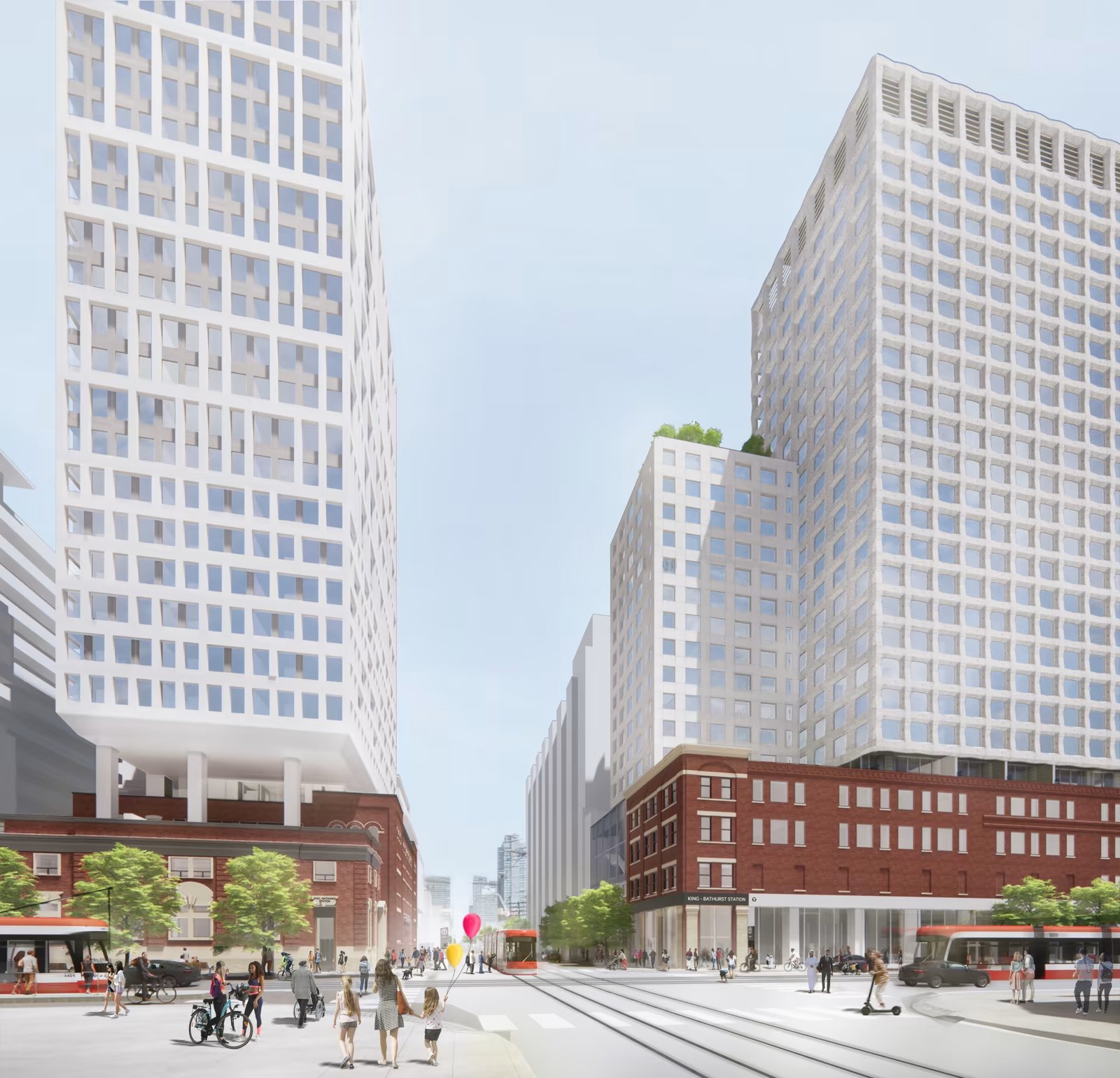
    What you are seeing above is the northeast corner of the intersection, which is where one of the two station entrances will go. Naturally, the station platform and track itself are also aligned on a diagonal so as to minimize “significant construction impacts” to the Wheat Sheaf (southwest corner).

    This stop is also one of Infrastructure Ontario’s Transit-Oriented Communities, which means the intent is to have a private developer build things on top of the station. Directionally, this is, of course, the right approach. It didn’t happen on the Eglinton Crosstown line; but we know that the best way to maximize the value of transit investment is to combine it with smart land use planning (the rail + property model). Density is your friend.

    From what I could glean during my time on the patio at the Wheat Sheaf, all of this appears to be moving forward. And already today, there is a ton of foot traffic in the area — meaning the future transit station should do very well from a ridership perspective. Now we just need this line extended up to the Bloor-Dundas West mobility hub so that the 504 streetcar can be relieved of some of its duties.

    Station Plan/Rendering: Metrolinx and IO

  • Three ways to optimize investments in transit

    Sometimes I’ll hear people in Toronto talk pejoratively about all of the development that’s been happening at Yonge & Eglinton (in midtown). They’ll say it’s too much density.

    But then you come across charts like the ones above (source previously shared here) and you realize that this location is the only section along the new Eglinton Crosstown LRT line that is actually starting to have enough people.

    Based on 2021 Census data, there were about 40k people within 800m of the future Eglinton and Mount Pleasant stations. In contrast, there are many downtown stations along the Ontario Line (also under construction) with around 80k people.

    Why this is important is because if the objective is to get people to ride this new transit and collect a lot of fares, then the single most important factor is going to be the amount of people that live, work, and play adjacent to each station.

    Now, I’m not a transportation planner, but in my mind there are three simple ways to think and go about optimizing for this:

    1. You can look at where population densities are already high and then add new transit to service these densities. This is what is happening with the Ontario Line and it was long overdue. We know that ridership is going to be relatively high because of the chart at the top of this post.
    2. You can look at where there’s existing transit and then work to optimize the land uses around it. This is what we should be doing a better job of along the Bloor-Danforth line, where certain station areas have actually lost people over the last few decades. This is the opposite of what you want next to transit investments.
    3. Lastly, you can also proactively plan new transit while simultaneously encouraging more density. An example of this would be the Vaughan Metropolitan Centre (just north of Toronto). Extend the line and encourage growth. This is good. The only thing with this approach is that it can seem a bit misaligned if you’re currently failing at #1 and #2.

  • Rail + property — let’s try it again, okay?

    The Eglinton Crosstown line is going to open, here in Toronto, sometime next year — I think. And I’m sure that it is going to be a massively beneficial addition to Toronto’s transit network. But at the same time, we should be talking about this:

    Urban transit stations shouldn’t look like this. It’s a missed opportunity, both in terms of the foregone housing (and other uses) that could be on top of these stations and the additional value that could have been captured from these air rights. Transit is a crucial lever for land values and development overall, and so it’s no wonder that many of the best transit authorities around the world think in terms of “rail + property”.

    So what happened here?

    I don’t know exactly. But I do know that nearly a decade ago I called up Metrolinx and said, “Hey, so I’m a developer who can build things. I see that you’re building a number of exciting transit stations along Eglinton. Want me to build on top of them for you?” Now obviously Metrolinx wasn’t going to be able to sole-source to Brandon, but regardless, I thought it should happen and I just hoped to be in the mix.

    In 2015, things did start to happen. Avison Young, on behalf of Metrolinx, issued a request for proposal to developers for 4 sites/stations along the line. There were two at Keele Street, one at Weston Road, and one at Bathurst Street. And at the time, it was thought that these sites could generate somewhere between $14-22 million (speaking of reasonable).

    I think it was also being viewed as a bit of a pilot. If things went well with these 4 initial sites, then this same approach was going to be rolled out across all suitable sites on the line. I’m not sure what happened with the RFP or the broader intent — maybe some of you know — but it clearly didn’t pan out as planned.

    That’s too bad. But I suppose done is better than perfect. Plus, now we’re building the Ontario Line and so we have another opportunity to get it right. And right means lots of density on top of stations — both directly on top and all around it.

  • Agenda-setting headlines

    I am so tired of sensational headlines:

    The Ontario Line will zip across the core and up to Eglinton, easing gridlock and alleviating TTC misery. It will also plow through peaceful Toronto neighbourhoods, displacing homes, businesses and everything in its path.

    I know exactly what business model it is serving and why it is done, but I’ll ask the question anyway: Why do we need to make everything out to be a problem?

    In this case, we’re talking about a new and important piece of city building infrastructure. A subway line that will run through the densest parts of this country and alleviate congestion at key interchanges, as well as broadly across the city.

    It is something that we, as a city, have been griping about for many decades. And now, it is finally happening! Will it involve constructing things? Yes. Will it actually displace “everything in its path?” No.

    But as we all know, this is the way media works today. They set the agenda (i.e. tell us what we should be terrified and/or pissed off about) and then they sell our attention. And an effective way to do that is to make sure that the headlines get us really worked up.

  • Toronto’s downtown streets broke over the weekend

    Canada Day weekend was a lot of fun in Toronto. This city was alive and it felt like people had come far and wide to visit downtown. But it was a good reminder that even if all of our cars were electric and even if they were all able to drive themselves, we would still have this problem:

    I was in an Uber on Saturday afternoon heading over to the west side of downtown and we had no choice but to declare bankruptcy and hop out in the middle of Bay Street. We thought about waiting for the Ontario Line to be ready, but that seemed a bit far out.

    So we rented bikes instead and rode along the waterfront, which was a considerably better experience. But then we couldn’t find any docks with available slots, so we had to ride up into Liberty Village, drop our bikes off there, and then walk back down to Ontario Place.

    Of course, this was still the better option. I’m fairly certain that we’d still be in that Uber had we stuck it out. And maybe not finding a bike dock is just part of life in the big city on a beautiful long weekend in the summer.

    Still, it was frustrating. So I’ll use this opportunity to once again ask our city leaders to reconsider their ban on dockless electric scooters. Toronto clearly needs all the mobility support it can get.

  • The infamous 45-degree angular plane

    The Toronto mid-rise housing typology is known for architectural forms that often end up looking something like this:

    The reason for this is the infamous “45-degree angular plane” that gets applied when new developments abut low-rise residential neighborhoods. It is a way to transition down and mitigate some of the impacts associated with this kind of infill development — usually the concerns are overlook, privacy, and shadowing.

    These are, of course, legitimate concerns. But here’s the other side: Should we really be reducing the number of homes that we can build on our main streets by carving away area like this? Is overlook and shadowing more important than additional housing? Stepping buildings like this also makes constructing them more expensive and cumbersome. Are higher costs the goal?

    It is for reasons like these that some people have been paying attention to the new Danforth Avenue Planning Study that went to Toronto City Council this week. Among other things, the study recommended the relaxation of the 45-degree angular plane standard along a portion of the Danforth.

    This is certainly a step in the right direction. But in my humble opinion, it’s not nearly enough for an area that will ultimately sit at the intersection of two subway lines.

  • Toronto breaks ground on new Ontario Line

    This past weekend it was announced that ground has been broken (i.e. construction has started) on the new Ontario subway line that will connect Exhibition / Ontario Place to the Science Centre by way of the light purple line labeled “C” on the above map. (The other image is a rendering of the proposed Exhibition station.)

    This transit line has gone through many permutations over the years and was previously called the Downtown Relief Line (but that was seen as too downtown-centric); the Yonge Relief Line (still too specific); the Relief Line (not Ontario-specific enough, I guess); and probably a bunch of other names corresponding to various lines on a map.

    So it is exceedingly easy to be cynical when you hear of an announcement like this. Is it really happening? Are we actually building new and much-needed transit? And as you might imagine, if you read through the chatter on Twitter, you will find an overabundance of this sort of cynicism, along with what appears to be a general dissatisfaction with the current state of everything.

    But in my simple view, I reckon that it is far better to be starting construction on an important new transit line than not starting construction on an important new transit line. So this is exciting! Let’s go! If you’d like to learn more, I also tweeted out the initial renderings for the 14 stations that are planned for the Ontario Line.

    Images: Province of Ontario