Daily insights for city builders, delivered every morning at 6 AM ET. I’m Brandon Donnelly — a Toronto-based real estate developer and founder of Globizen. I’ve been writing here since 2013.

Tag: mit

  • The minimum parking problem for on-demand mobility

    There is data to suggest that on-demand (OD) mobility services — such as Uber — are increasing vehicle kilometers traveled (i.e. causing greater traffic congestion) by inducing people away from public transit and other forms of urban mobility. This is potentially even more of an issue right now with most urban transit agencies looking at massive budget shortfalls.

    But there’s potentially another way to look at this problem. A recent study led by Dániel Kondor of the MIT Senseable City Lab has looked at not only vehicle kilometers traveled but also something that the team calls the “minimum parking problem.” What is the minimum amount of parking that you need assuming a world with more on-demand mobility, and eventually autonomous vehicles?

    To try and answer this problem the researchers looked at the small city-state of Singapore. With a population of about 5.6 million people and somewhere around 1 million vehicles, Singapore actually has one of the lowest number of private vehicles per capita in the developed world. Even still, it has some 1.37 million parking spaces taking up valuable room.

    What the team found was that on-demand mobility could reduce parking infrastructure needs in Singapore by as much as 86%. This is the absolute minimum number, which would take the current estimate of 1.37 million spots down to about 189,000 — a significant reduction.

    However, the tradeoff is that it could increase vehicle kilometers traveled by about 24%. Without ample parking, their model assumes that these on-demand vehicles would need to “deadhead” between trips. That is, drive around aimlessly while they wait for their next passenger. Demand isn’t usually neat and tidy.

    However, it’s worth noting that the above percentage increase assumes that if people were instead driving themselves around that they always found a parking spot as soon as they arrived at their destination. This, as we all know, is not often the case, and so this increase is probably a worst case scenario.

    Nevertheless, the team did also find that a 57% reduction in parking could be achieved with only a modest 1.3% increase in vehicle kilometers traveled. This, to me, is meaningful because it says that you could, in theory, cut parking supply in at least half and not much would happen in the way of traffic congestion.

    It would, however, free up a bunch of space for things like bicycle lanes, green space, and other valuable urban amenities. Now, if on-demand vehicles are pulling people away from transit, then maybe we’re no better off. But if the alternative is people driving and parking everywhere they go, then it would seem that there are much better uses for that space.

    Photo by Jordi Moncasi on Unsplash

  • Social and physical segregation in Singapore

    A recent study by the MIT Senseable City Lab has used cellphone data to map both social and physical segregation within Singapore. To start, they used residential sale prices as a proxy for socioeconomic status. They then used call and text records (presumably it was all anonymous) from 1.8 million cellphone users in Singapore (2011) to map who interacted with who. Pictured above is one of those mappings.

    What they discovered was evidence of a “rich club effect.” In other words, the richer the person the less likely they were to interact with people outside of their socioeconomic band. The study calls this their communication segregation index.

    A similar phenomenon was noted as people moved around Singapore. (This is the study’s physical segregation index.) People tend to spend time in spaces alongside people with similar socioeconomic attributes. However, they did notice that this tends to wane during the day as people move around the city — presumably for work and other such things.

    I think it would be interesting to get a bit more granular about the findings in order to try and see, among other things, if certain public spaces are more successful than others at encouraging a broader socioeconomic mix. And it’s probably only a matter of time before we start using tools like this to plan our cities. For more on the study, click here.

    Image: MIT Senseable City Lab

  • Tasty data

    A recent study and research paper by the MIT Senseable City Lab — called, Tasty Data — has discovered that restaurant data alone can be used to accurately predict location-based factors such as daytime population, nighttime population, number of businesses, and overall consumer spending within a specific geography.

    They started by pulling restaurant data from Dianping (Chinese equivalent of Yelp) for 9 Chinese cities: Baoding, Beijing, Chengdu, Hengyang, Kunming, Shenyang, Shenzen, Yueyang, and Zhengzhou. They then paired their Dianping data with other available data (such as aggregated mobile phone data) and used machine learning to search for any correlations.

    Below is a diagram of “nighttime population” in Beijing. They are using a 3 km2 grid.

    If you’re a regular reader of this blog, you’ll know that I like these kinds of studies. By 2020, it is estimated that 1.7MB of data will be created every second by every person on earth. The numbers are staggering. And yet, “official” data sources, such as census data, remain slow and fairly limited. Studies like this one continue to show us what’s next.

    Image: MIT Senseable City Lab

  • The sensing power of taxis

    The latest project out of MIT’s Senseable City Lab examines the “sensing power of taxis” in various cities around the world. Looking at traffic data, they determined how many circulating taxis you would need to equip with sensors if you wanted to capture comprehensive street data across a particular city. This might be useful if you wanted to measure things like air quality, weather, traffic patterns, road quality, and so on.

    What they found is that the sensing power of taxis starts out unexpectedly high. It would only take 10 taxis to cover 1/3 of Manhattan’s streets in a single day. However, because taxis tend to have convergent routes, they also discovered rapid diminishing returns. It would take 30 taxis (or 0.3% of all taxi trips) to cover half of Manhattan in a day, and over 1,000 taxis to cover 85% of it. A similar phenomenon was observed in the other cities that they studied: Singapore, Chicago, San Francisco, Vienna, and Shanghai.

    However, if you look at the percentage of trips needed to scan half of the streets in a city, Manhattan has the lowest rate at 0.3%. Vienna is the highest at 9%. But I’m not sure if this is a function of the utilization rate of their taxis or if it has something to do with urban form. Singapore has a similarly low rate (0.44%), but its street grid looks nothing like that of New York’s.

    Here’s a short video explaining the project:

  • A new way to grow islands

    MIT’s Self Assembly Lab and Invena (which is an organization based out of the Maldives) are trying to invent a system of underwater devices that naturally harness wave energy to restore and/or create new beaches, sandbars, and islands. The hope is that this line of thinking could be scaled up and eventually used a response to sea level rise, as well as other coastal challenges.

    Here’s a short video explaining the initiative:

    With over 40% of the world’s population supposedly living in a coastal area, this is a problem that will need to be addressed. Already we are seeing these concerns start to rear their head in the real estate markets of some particularly vulnerable cities. The team installed their first field experiment in the Maldives this past February and a second one is expected in Q4-2019.

    For more information on the “Growing Islands” project, click here.

  • Forum on Future Cities: Urban Intelligence

    MIT Senseable City Lab and the World Economic Forum’s Global Future Council on Cities and Urbanization are hosting a conference next month on the impact that artificial intelligence is having on our cities. Here is a summary of the event:

    As AI (Artificial Intelligence) becomes ubiquitous, it transforms many aspects of the environment we live in. In cities, AI is opening up a new era of an endlessly reconfigurable environment. Empowered by robust computers and elegant algorithms that can handle massive data sets, cities can make more informed decisions and create feedback loops between humans and the urban environment. It is what we call the raise of UI (urban intelligence).

    The 2019 Forum on Future Cities, organized by MIT Senseable City Lab and the World Economic Forum’s Global Future Council on Cities and Urbanization, will focus on four aspects of the UI transformation: autonomous vehicles, ubiquitous data collection, advanced data analytics, and governing innovation. Panelists include mayors, academics, senior industry leaders and members of civil society to explore such topics from different points of view, highlighting the scientific and technological challenges, the critical collective decisions we as a society will have to make, and the exciting possibilities ahead.

    The forum takes place on April 12th in Cambridge, Massachusetts. And since it looks to deal with many of the topics that we talk about on this blog, I figured that some of you might be interested in attending. If so, you can register here.

  • Good vibrations

    image

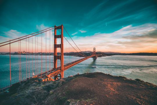
    There are 614,387 bridges in the United States and 55,707 of them are thought to be structurally deficient according to the US Department of Transportation (2016). About 188 million people cross “a deficient bridge” every day in the US (also a 2016 figure).

    Inspections are often infrequent and only visual, and so MIT Senseable City Lab is currently on a mission to come up with a more scientific approach. They believe that there’s a solution in crowd-sourced data and that it’s possible to create a community-driven maintenance program.

    What they discovered through a recent study, called Good Vibrations, is that mobile phone sensors can actually pick up the natural vibrations and oscillations of a bridge. And, that a mobile sensor located within a traveling car is actually 120x more precise than fixed sensors located on the bridge.

    Part of the problem is that fixed sensors have poor spatial coverage. They are located in specific locations. Whereas mobile sensors give you data across the entire span of the bridge as someone crosses it. And if you know how a bridge normally vibrates, you can quickly tell when something is off. 

    Here’s a quick video overview of the study. And here’s what you should do if you want to get involved.

    Photo by Joseph Barrientos on Unsplash

  • Minimum fleet

    Here is an interesting study by the MIT Senseable City Lab, which looks at: “the minimum number of vehicles needed to serve all the trips in New York without delaying passengers’ pick up times.” If you can’t see the embedded video below, click here.

    [youtube https://www.youtube.com/watch?v=nFo64kBGF6o&w=560&h=315]

    This is interesting because it begins to quantify the amount of waste running through the system today and the possible efficiencies brought about by autonomous vehicles. In this model, the current taxi fleet in NYC could be reduced by 40%.

    For more on the study, go here.

  • Global mobility index

    Below is a short video that was created by the MIT Senseable City Lab, World Economic Forum and TomTom for a study on how people move in 100 cities around the world. They call it the Global Mobility Index.

    It shows congestion levels (using real-time traffic data from TomTom), commute times, and an estimate for the percentage of trips that could be shared if people were willing to wait up to 5 minutes.

    In the case of Toronto, they estimate that 99% of trips could be shared and that it would increase average speeds by ~7.9 km/h and reduce overall traffic levels by ~44.09%.

    Their solution to solving traffic congestion is a cocktail that involves car-sharing, bike-sharing, and public transit. It’s about developing a “mobility portfolio.” Seems sensible.

    I found myself wanting more information and data after watching the video. Still, it was interesting to see what the authors describe as the “pulse of our cities.”

    If you can’t see it below, click here.

    [youtube https://www.youtube.com/watch?v=ciJEHGMtpWc?rel=0&w=560&h=315]

  • Smart sewers may soon analyze our poop

    On September 2, 2017, a research project by several MIT laboratories – called Gangnam Poop: Underworlds in Seoul – will debut at the Seoul Biennale of Architecture and Urbanism.

    Here’s an excerpt from the exhibition description:

    A vast reservoir of information on human health and behavior lies in our sewage, and this resource is untapped. We imagine a future in which sewage is mined for information that can inform policy makers, health practitioners, designers, and researchers alike. Such is the idea behind Underworlds: a cross-disciplinary data platform for monitoring urban health patterns, shaping more inclusive public health strategies, and pushing the boundaries of urban epidemiology.

    For this exhibition and “proof of concept”, they analyzed three distinct neighborhoods in Seoul, using an aptly named sewer robot called Luigi. 

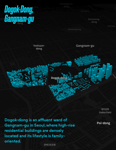
    Gangnam-gu (shown above) is an upper-class high-rise residential area. Mapo-gu is an emerging artist and designer enclave. And Seongbuk-bu is a hillside village with detached houses and an older demographic.

    In each case, they mapped out the bacterial populations found beneath each neighborhood. Interestingly enough, the different areas revealed different bacterial occurrences. You can see those diagrams here.

    I often think of healthcare as being very reactive. A future like the one this exhibition is imagining would be far more proactive. And that would be a very good thing.

    Image and project by MIT Senseable City Lab. Gangnam Poop: Underworlds in Seoul. Commissioned by Seoul Biennale of Architecture and Urbanism