Daily insights for city builders, delivered every morning at 6 AM ET. I’m Brandon Donnelly — a Toronto-based real estate developer and founder of Globizen. I’ve been writing here since 2013.

Tag: manhattan

  • Form follows parking

    “Form follows function” is a famous axiom of 20th century Modern architecture. It is based on the rational notion that architecture and its associated shapes, geometries, and spaces should be a direct result of their function. 

    It was a way of trying to eliminate the arbitrary ornament that had adorned previous architectural movements. In this case, if it had no function, then it should be stripped away.

    There have been many bastardizations of this pithy statement over time, but one of my favorites is: “form follows parking.” Obviously derogatory, it is this idea that much of the built environment is a result of parking requirements, rather than of more human factors.

    We see this in suburban building typologies (large surface parking lots), but also in urban infill projects where the below grade parking begins to dictate the structural grid and layout of the upper floors. It is, of course, necessary in many cases, but there’s also something subversive about parking having such a lasting impact on the spaces we occupy.

    That said, we know where the trend line is headed when it comes to parking. Streetblogs recently posted an article about the scarcity of parking in Manhattan and cited number of interesting stats.

    Because of the city’s bike-share program (introduced in 2013) and because of all of the bike lanes that have been added in recent years, the city has (rightly) removed approximately 2,330 on-street parking spaces in Manhattan south of 125th Street.

    Here’s another set of stats: 

    In 1998, New York City had about 810 parking lots and garages south of 60th street. Together, they accounted for approximately 112,826 parking spaces. As of last year (2016), the number of lots and garages had dropped to about 643 and the number of parking spaces to approximately 95,000. That’s a decline of about 16%, during a period of when the population of Manhattan grew by more than 100,000 people.

    I would also imagine that these pressures are increasing. So it is quite possible that “form follows parking” could be on its way toward obsolescence. I certainly feel it waning.

  • Carriage house disruption

    The Spaces has a post up called: 7 carriage houses on the market in New York City. They’re all quite expensive. The house on East 63rd designed by Paul Rudolph is particularly interesting. But that’s not what I want to talk about.

    As I was going through the photos – that’s what The Spaces does best – I thought of two things.

    First, there’s a segment of the market that is obsessed with living in spaces that were not originally intended to be used as residences. That’s what (hard) lofts are. That’s what carriage houses are. And that’s partially why I would love to live in a laneway house (Toronto vernacular).

    Backhouses, as they are also called, were initially designed to hold horse and carriage. But as horses disappeared from New York City, the structures got repurposed.

    Here’s one theory for how that went about:

    Barry Lewis, an architectural historian, theorizes that rear buildings became residences to accommodate the 19th-century immigrant population that moved into middle-class areas in Lower Manhattan in the 1830’s and into the Village and Brooklyn after the Civil War. “Backhouses seem to belong to the era of houses in Manhattan, not the era of apartments,” Mr. Lewis said. “The property owner probably shoved more immigrant families into the stable or workshed in the back. Other owners may have built a new backhouse just to get the lucrative immigrant rents.

    The second thing I thought about is the potential parallel between this story and the one being written right now. It feels like a transportation revolution is upon us and changes in mobility always seem to rewrite the landscape of the city.

    Hopefully that will mean more laneway houses in Toronto.

  • The spatio-temporal hierarchy of urban form

    I was recently introduced to the work of Brenda Case Scheer – specifically a journal article she wrote called The Anatomy of Sprawl. If you’re the kind of person who enjoys geeking out about cities, this is for you. (Thank you Oliver.)

    What she does in the article is break down the various components / layers of a city according to the rate in which they change. Her “spatio-temporal urban hierarchy” includes: site (slowest rate of change), superstructure, infill, buildings, and objects (fastest rate of change).

    The way to think about this is that the bottom layers of a city – the paths and roads we have chosen to establish – are incredibly persistent. They don’t change all that often.

    On the other hand, buildings do change. Old ones get demolished. New ones get built. There’s a cycle. They too probably feel pretty persistent in many cases, but in comparison to our roads, they change far more frequently.

    The reason why all of this has bearing is because the paths we choose to carve out at the very beginning will ultimately dictate the kind of city that gets built and rebuilt over time.

    The rectangular grid of Manhattan was planned out in 1811. Central Park was missing from this original plan, but it did establish the street network and ownership lots that are now so central to the identity of New York City. That was a 200+ year decision.

    It seems to have worked out just fine for New York. But what if you’re in a position where the existing street network is viewed as failing and/or inappropriate for the future success of the city? 

    Well that’s where things get interesting. Now you need to dig down to some of those base layers and work on changing the (frequently) unchangeable. 

  • VIA 57WEST in New York starts renting apartments

    image

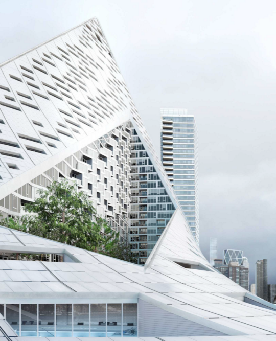
    Bjarke Ingels’ West 57th Street project in New York (developed by The Durst Organization) has just started renting apartments (March 1). 

    Since I’m in the rental business, I thought it would be worthwhile to take a look at the rents – though I tend to obsess over all buildings and not just rental ones.

    Firstly, the project has a total of 709 apartments and 178 different unit types because of the architectural variations in the building. Of these units, 142 of them (20%) have been designated as affordable and were offered up via a lottery to people who fall within certain incomes ranges. 

    Here are the affordable rents via 6sqft.com:

    image

    I don’t know the exact numbers, but Curbed New York speculated – based on what was seen at other buildings on the west side – that the total number of applicants for these 142 units may have reached over 100,000!

    For the market-rate units, the average monthly rents are as follows (via Curbed NY):

    • Studio: $2,770
    • One-bedroom: $3,880
    • Two-bedroom: $6,500
    • Three-bedroom: $11,000
    • Four-bedroom: $16,500

    I wasn’t able to find average unit sizes (to calculate per square foot rents), but I estimate the overall average unit size to be around 1,000 square feet. 

    940,000 sf (total gross floor area)45,000 sf of retail x 0.80 efficiency (lower than average because of the shape of the building) / 709 units = approximately 1,000 sf of rentable area per unit. That’s just my rough guess based on what I could find online.

    Based on the Curbed comment section though, there are certainly some smaller units:

    image

    If anyone has any additional figures, please share them in the comments below. I think there are a few subscribers to this blog who are involved in the project.

    Image from via57west.com

  • New York’s 8-figure apartments

    Whenever you’re starting to feel like real estate prices in your city are getting out of hand, just turn your attention to New York. It’ll make you feel better.

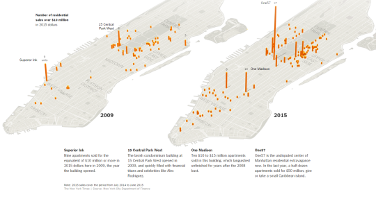
    The New York Times published an interactive overview of the Manhattan real estate market today. It was spurred on by the fact that the average residential sale price in Manhattan just hit $1.7 million (a new record) and that there’s a growing number of 8-figure apartments being bought up.

    Last year half a dozen apartments sold for more than $50 million in the One57 tower at 157 West 57th Street. (The New York Times calls this building the “undisputed center of Manhattan residential extravagance.”)

    Here’s one of their diagrams showing the number of residential sales over $10 million in 2009 and then in 2015:

    image

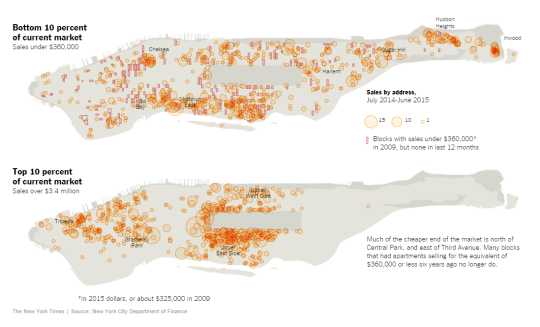
    And here’s another one of their diagrams showing the bottom and top 10% of the current market:

    image

    It’s interesting to see the clustering in certain areas and also the lack of clustering at the high end around the top of Central Park.

  • How immigration shaped Toronto and New York

    One of the things that Joe Berridge reminded me of in his talk yesterday, is that the story of Toronto is really the story of immigration. 

    In his words, Toronto has become the success story that it is precisely because we are good at taking in lots of immigrants and making them economically productive. 

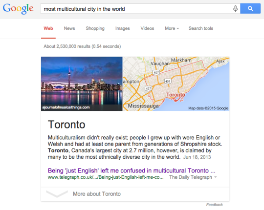
    Sure, there are many things that we could be doing better, but you don’t get to be the most multicultural city on the planet without doing a lot of things right. More than half of this city is now foreign born. The term “visible minority” is quickly expiring.

    image

    And more than anything else, this accomplishment is arguably what has allowed us to become the global city that we are. Click here for a fascinating chart from the Toronto Star that allows you to see the number and source of immigrants that have come to this city over the last half century.

    But of course, Toronto is not alone in this accomplishment.

    Urban economist Edward Glaeser wrote a great essay back in 2005 called Urban Colossus: Why is New York America’s Largest City? It’s an incredibly interesting read for those of you interested in cities and so I definitely recommend it.

    But the crux of his argument is that New York is the largest and most dominant city in America because of geography – specifically its deep harbor – and because of its success in manufacturing.

    What this meant is that New York became the center of shipping in the country and the point of entry for the majority of immigrants coming into the United States. But since transportation costs were still relatively high at the time, most immigrants arrived in New York and stayed in New York.

    Luckily, New York had a robust manufacturing economy – notably because of sugar refining, publishing and printing, and the garment industry. This allowed the waves of immigrants flooding into New York to become economically productive.

    From 1850 to 1920, the population of the New York grew about 800% from roughly 700,000 people to over 5.6 million people.

    So the moral of the story is simply that immigration has and will continue to play a pivotal role in the shaping of our cities. Canada has a sub-replacement fertility rate somewhere around 1.61 births per woman (2012). This is lower than that of United States, which is around 1.88 births per woman.

    That means that without immigration, we do not grow. We shrink. And that’s usually not a great thing for economies.

  • Scootering around New York City

    image

    I am writing this post on a Porter flight from New York back to Toronto.

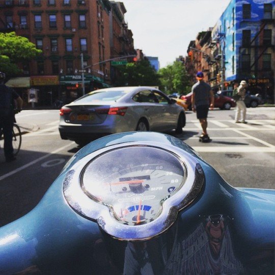
    For my last day in New York, my close friend and I rented scooters and rode all around Manhattan and Brooklyn. It was a great way to cover a lot of ground, but also a great way to still absorb the city. It’s harder to do the latter in a car and I never have any desire to drive in New York.

    Because the great thing about New York is that as a pedestrian you feel like you control the streets. When you’re waiting at a crosswalk, you’re never actually waiting. You walk off the sidewalk and onto the street so that you can assert yourself in front of the cars and wait for an opening. This serves to narrow the portion of road that the cars can actually drive on and reminds the drivers who is boss.

    At the same time, there are many instances throughout the city where New York has purposefully reallocated the space dedicated to pedestrians (and cyclists) and the space dedicated to cars. They’ve created new public spaces, widened the areas where people can walk, and seemingly blanketed the city with bike lanes. And that makes a lot of sense given that in many (most?) areas of the city, pedestrians greatly outnumber cars.

    So does that mean New York is at war with the car? (I’d be curious to know – in the comment section below – if those kinds of discussions take place in the city.)

    I suppose you could spin it that way. But New York also does things for cars. While riding around on the scooter today, I was so impressed by how well timed the streetlights were along the avenues. It made it incredibly easy to go downtown or uptown. In Toronto, I often feel like we time our lights to make driving as slow as possible.

    But make no mistake; New York is not a driving city. 

    New York is about walking, biking, taking transit, and hailing cabs. There is a reason they have the highest transit ridership in the US. The city is built for it. And unless driverless cars and ride sharing completely changes the equation, I will continue to believe that transit is the most efficient backbone for any big city.

  • Walking the West Side Highway

    image

    I am in New York this weekend. Every now and then I need to get my fix of this city. I just love it here.

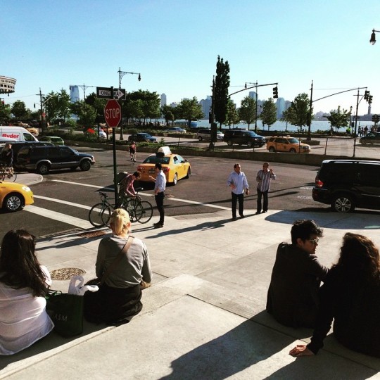
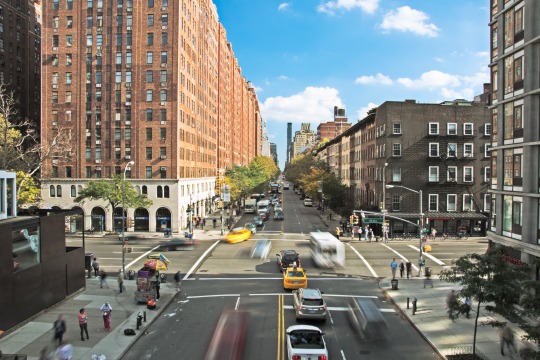
    Given the debate that’s going on in Toronto right now about the elevated Gardiner Expressway, one of the things I wanted to do this weekend was walk the West Side Highway. The West Side Highway runs along the western edge of Manhattan from 72nd Street all the way down to the southern tip of the island. It used to be an elevated highway, but it runs mostly at grade now.

    I’ve been to and on it many times before, but I wanted revisit it with a different lens. Many people in Toronto seem to think that if we remove the Gardiner East and replace it with an enlarged Lake Shore Blvd that it would pose just as much of a physical barrier as an elevated structure.

    So I walked the West Side Highway and filmed this (Hyperlapse) video:

    //platform.twitter.com/widgets.js

    I think it’s a big improvement over an elevated structure. What do you think?

    There is, however, an elevated highway uptown. So tomorrow I plan to travel it on a scooter that I’ve rented to see how the urban fabric changes around it. I suspect it’ll be quite different.

    In case you were wondering, the picture at the top of this post is from the steps at the Whitney Museum. They face the West Side Highway and the water. It’s a great public space, but I’m pretty sure that Renzo Piano wouldn’t have designed it that way (and with that orientation) had there been an elevated highway in front of it.

  • What the largest real estate development project in the United States looks like

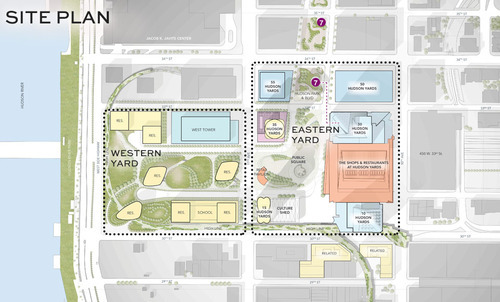
    Urban Land Magazine recently published an interesting article on the Hudson Yards project in New York, which is the largest private real estate development project ever undertaken in the United States. Click here for the article. Thanks to my friend Evan Schlecker for passing it along. It’s a good read.

    The project is being co-developed by Related out of New York and Oxford Properties out of Toronto, and when it’s all said and done, it’ll be over 17 million square feet of commercial and residential space. It’s a $20 billion development project. 

    But beyond just being massive and epic, there are a bunch of other things that make this project unique. You can read about them all in Urban Land, but I’d like to share a few snippets with you all here:

    The first is about the project’s placement on top of a rail yard:

    In order to make use of a site already occupied by a working rail yard—including more than 30 tracks for the Long Island Rail Road and three train tunnels, with a fourth under construction—most of the development will be built atop two steel-and-concrete platforms. That base, and the buildings on it, will be supported by hundreds of concrete-filled caissons, which will be drilled between the rail lines into the bedrock.

    Because the location of the tracks and tunnels limits the placement of caissons, only 38 percent of the site can be used to support buildings.

    The second is about the project’s use of technology:

    Beyond that, a vast number of sensors embedded in the site’s infrastructure will collect mountains of data on everything from temperature and air quality to pedestrian and vehicle traffic. That information, which will be scrutinized in real time by managers in an effort to fine-tune Hudson Yards’ operation, will also be shared with New York University (NYU) researchers, who will turn Hudson Yards into a laboratory for studying urban life and finding ways to improve its quality.

    And the last one is about how it interfaces with the High Line (click here if you don’t know what that is):

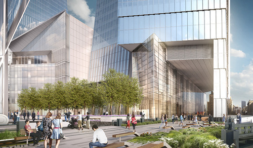
    Pedersen [of Kohn Pedersen Fox Associates] found an intriguing way to address the building’s surroundings. He allowed the High Line—a public park built on a historic freight rail line elevated above the West Side—to penetrate underneath the tower through a 60-foot-long (18.3 m) public passageway, so that the building will interact with the park and its visitors. Inside the building, a dramatic atrium “becomes the terminus of the High Line as it moves from south to north,” he says.

    So there are a lot of interesting and exciting things going on with this project. What’s amazing though is how “vertical” this community will be. You have rail lines below grade. Platforms on top. Retail at grade and across multiple levels. And an elevated linear park cutting through the buildings. Not every city can make this work. New York can.

    Images: Hudson Yards New York

  • Learning from, but not copying, New York’s High Line

    image

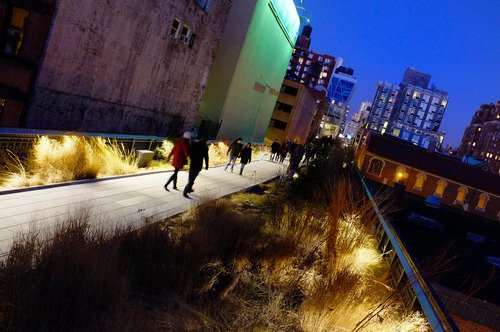
    In 1980, the last train ran on an elevated corridor on the west side of Manhattan known as the High Line. Originally built in the 1930s, the trucking industry had made these trains obsolete and service was halted.

    At this point, neighboring property owners began to lobby for the demolition of the High Line, as they no doubt saw it as an opportunity to increase the value of their land holdings. But thanks to local residents – most notably a man by the name of Peter Obletz – the 1.45 mile-long elevated rail corridor was saved from demolition.

    In 1999, Joshua David and Robert Hammond then decided to form a non-profit with the goal of both preserving and reusing this unused rail corridor. The group was called Friends of the High Line.

    By the early 2000s, Friends of the High Line had successfully made an economic case for transforming the rail line into a public open space and things started moving forward. Initially, it was thought that a public park of this sorts would attract about 400,000 people annually and generate upwards of $286 million in new tax revenues over the following 2 decades (Globe and Mail).

    With these expectations in mind, construction on the new High Line Park began in 2006. The first section opened in 2009 – a decade after Friends of the High Line was formed. And the third, and last section, opened just two weekends ago at the end of September.

    Today the High Line Park attracts 5 million visitors a year and is believed to be directly responsible for about $2.2 billion in new economic activity. The increased tax revenues over the next 2 decades are expected to reach about $980 million. Without a doubt, the High Line has been a huge success. It has become the 2nd most visited cultural attraction in New York (Globe and Mail).

    Which is why every city now wants their own High Line. Philadelphia wants one. Chicago wants one. Mexico City wants one. Seoul wants one. And the list goes on. Here in Toronto, we’ve recently proposed one called the King High Line, which will connect the Liberty Village and West Queen West neighborhoods across a rail corridor.

    While I do believe that this is an important connectivity problem to be solved, I worry about how explicit the references are to the actual High Line. Even the street furniture is the same in their promotional video.

    I worry not only because it means we’re clearly taking on the role of follower, as opposed to leader, but because an elevated park isn’t going to work in all urban contexts the same way that the High Line worked in Chelsea. This is similar to how Frank Gehry can’t magically turn your city into the next Bilbao

    So while I have shown my support by becoming a “Friend of the King High Line” (and I would encourage you to do so as well), it’s important to keep in mind that the problems we’re trying to solve here aren’t necessarily the same ones that New York had to deal with.

    The High Line – from the start – was designed to have an intimate relationship with its surrounding buildings. The tracks rain directly through them so that the trains could easily load and unload their cargo – that was the whole point. So when the High Line was redone, all of a sudden these buildings were able to reconnect themselves to the park in a way that they were already accustomed to doing.

    But in Toronto’s situation, and perhaps in your city, that’s not the case. We’re talking about stitching together two completely disconnected neighborhoods. It’s a noble goal and certainly one that I wholeheartedly believe we should pursue. But I don’t think we should assume that it’s a problem that has already been completely solved for us.

    Image: Flickr