Daily insights for city builders, delivered every morning at 6 AM ET. I’m Brandon Donnelly — a Toronto-based real estate developer and founder of Globizen. I’ve been writing here since 2013.

Tag: high speed rail

  • Canada announces high-speed rail between Quebec City and Toronto — finally!

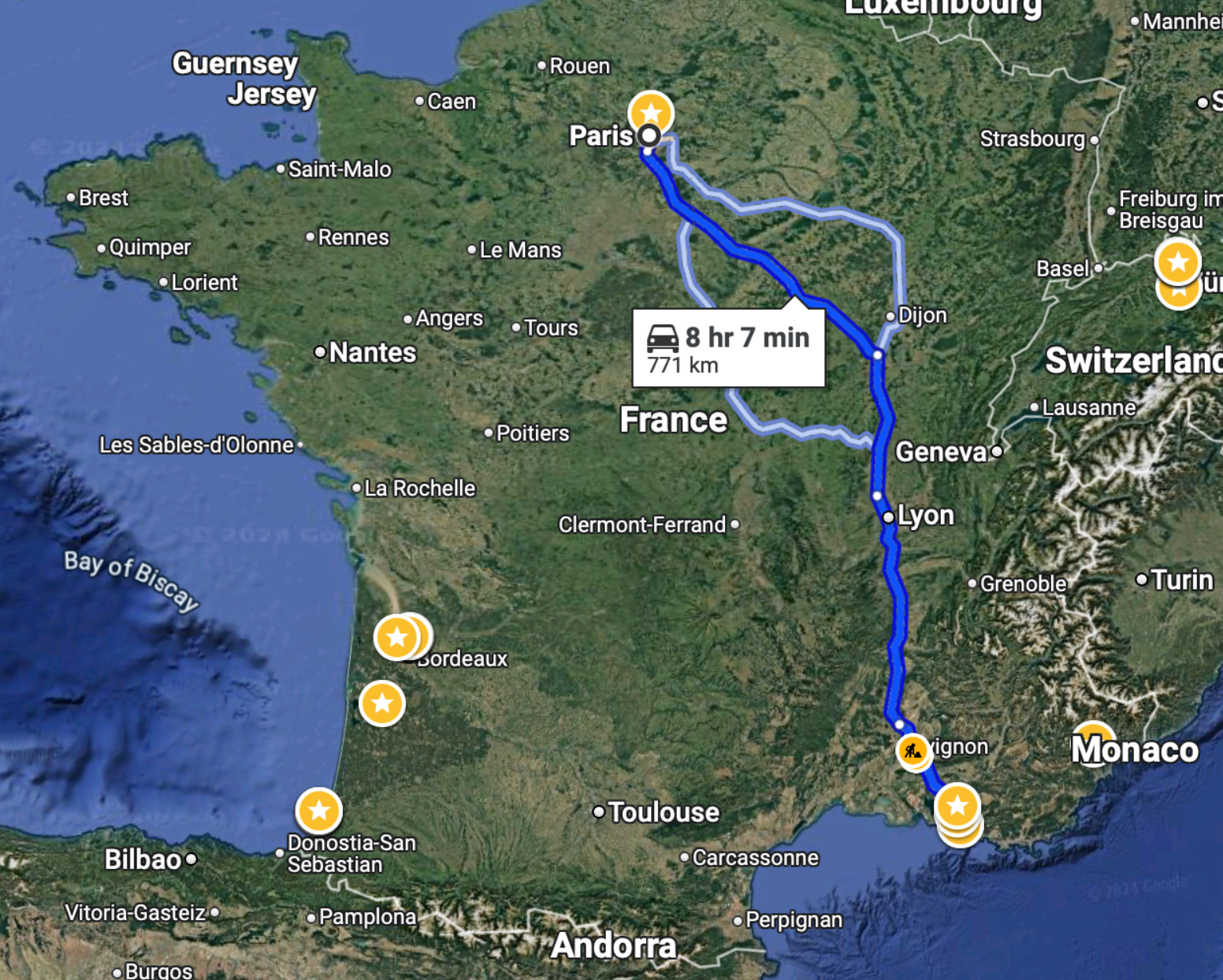
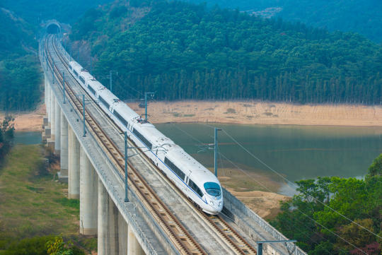
    The train from Paris to Marseille takes just over 3 hours:

    To drive this same distance, it would take just over 8 hours:

    So unless you had a very specific reason, I don’t know why you’d ever want to drive this route. I certainly hate long drives and would avoid this at all costs.

    On a related note, the Canadian government announced this week that it will actually be moving forward with a high-speed train linking Québec City to Toronto, stopping in Peterborough, Ottawa, Montréal, Trois-Rivières, and Laval. And unlike previous announcements, it will actually go pretty fast — upwards of 300 km/h, which is comparable to what the TGV does on the above route.

    There are three consortia currently competing for this contract, but apparently the federal government has already chosen a winning bidder. An announcement is expected next month. At the same time, the project office owns all of the bids, and so there’s a chance that elements from each of them could be used in the final project.

    According to official messaging, the design alone is expected to take some 4 to 5 years, which is an eternity and way too long. But at least we seem to be moving forward. This rail link is a no brainer. It will compress the geography of an importantly bilingual corridor with nearly 20 million people — about half the population of Canada! It’s our megalopolis.

    Now we just need to move forward with urgency and with an unwavering commitment to creating the best high-speed rail service in the world. Let’s not accept mediocrity. And let’s not cancel it once we’ve already sunk millions into it. That would be a terrible outcome for such an obviously important nation-building project.

    LFG.

  • EVs are cool, but what about high-speed rail?

    As many of you know, I am an advocate for high-speed rail in Canada. Specifically along the Windsor-Quebec City corridor, which is the most densely populated part of the country. And so I found this comparison interesting:

    “If there is one project that would create thousands of jobs, improve business productivity, clean up the air, reduce the output of greenhouse gases and cut the demand for endless highway construction, it would be high-speed electric rail between Toronto, Ottawa and Montreal, where population densities are high enough to make the project sensible. Cost estimates are all over the map. The University of Toronto’s Munk School of Global Affairs & Public Policy put the price tag at about $12-billion, which is $2-billion less than the bucks being thrown at the Volkswagen battery plant alone. But forget it – the Canadian government wants more cars, not fewer. Canadian cities will remain car sewers forever.”

    The above excerpt is from this opinion piece talking about EVs and the public subsidies being paid to encourage battery production within Canada. I get that we want to be part of this important mobility shift. But we are way behind when it comes to high-speed rail.

    And by behind, I mean that we don’t have it at all in this country.

  • How far you can travel in Europe by rail in 5 hours

    Here is a neat tool (created by Benjamin Td) that allows you to quickly see how far you can travel in Europe by rail in 5 hours. The way it works is that you just hover over a train station and then the relevant isochrone will show up. Above is what that looks like for Paris’ Gare de Lyon, which has one of if not the largest catchment areas from what I can tell after playing around with the tool for a few minutes. The data being used to power this map is from Deutsche Bahn. And if there’s a transfer on any of the routes, the tool assumes you can make that happen within 20 minutes, which may or may not be realistic. Regardless, it’s fascinating to see just how connected (or disconnected) some cities are. It’s also a shameful reminder that a North American version wouldn’t be nearly as impressive.

  • China is building and megalopolises are now national policy

    Well here are some interesting figures (via MIT Technology Review):

    • In the past two decades, about 400 million people moved into China’s cities — so more than the entire population of the United States
    • By 2035, about 70% of China’s entire population is expected to be urban (up from 60% today and up from 30% two decades ago)
    • To accommodate this scale of growth, China’s national urban development approach has shifted to something that now revolves around city clusters, or megalopolises (term coined by French geographer Jean Gottmann back in the 1950s to describe the Boston-Washington corridor in the Northeastern US)
    • By 2035, there are expected to be five major city clusters (see above)
    • One of the reasons for this is to improve cooperation across the various clusters — less competition and less redundancy
    • But it’s also about creating smaller more manageable cities — is this what one needs to do after a certain scale, go polycentric?
    • To service these clusters, China is rolling out a network of 16 new high-speed rail lines
    • By 2035, China expects to have 200,000 kilometers of rail, with a third of it being high-speed — assuming this happens, China will be home to 60% of the world’s high-speed rail coverage
    • Current cost estimates for the construction of this network comes out to about US$150 million per kilometer
    • 1-2-3 Rule: The plan is that everyone should be able to get around a city within 1 hour; a city cluster within 2 hours; and travel between the country’s clusters inside of 3 hours

    China is building.

  • Toronto is at the center of an emerging megalopolis

    https://500px.com/embed.js

    With the recent talk around downtown Cleveland’s resurgence, I am reminded that for those of us living near the Great Lakes, we are living in one of the most important urban agglomerations in the world: The Great Lakes Megalopolis.

    In 1962, French geographer Jean Gottmann wrote a seminal book called, Megalopolis: The Urbanized Northeastern Seaboard of the United States. And in it, he described the remarkable clustering of cities in the northeast, running from Boston in the north to Washington D.C. in the south. He called this the Northeast Megalopolis.

    The term megalopolis simply refers to a clustering or chain of generally adjacent metropolitan areas.

    Then in the 1960s and 1970s, architect and planner Constantinos Doxiadis started writing about the emergence of what he called the Great Lakes Megalopolis. In his mind, a contiguous urban region was forming that stretched all the way from Chicago in the west to Quebec City in the north east. And at its economic center was the city of Detroit.

    More recently, Richard Florida, as well as others, have been referring to these urban clusters as mega-regions. And in the case of the Great Lakes, Florida broke the area down into two distinct regions: Chi-Pitts in the west and Tor-Buff-Chester in the east. (I think you can guess how the names were derived.)

    According to his research, these two mega-regions have a combined population of almost 60 million people and an economic output equivalent to almost $3 trillion. That places it in line with the Northeast Megalopolis. But according to the Brookings Institution, the output coming from the Great Lakes could be closer to $4.5 trillion.

    Whatever the case may be and whatever you want to call it, the Great Lakes Megalopolis is unquestionably an economic and cultural powerhouse. But this has me wondering whether or not we’re doing enough to unleash its full potential.

    When I attended Joe Berridge’s talk last week on Toronto as a global city, I asked him how he thought we should be organizing our cities and regions. Do city-states make sense? Should we be rethinking the relationship between provinces/states and cities?

    His response was that we should be creating agencies and entities with regional authority (as opposed to fighting to make any constitutional changes). For example, the Toronto region should not have an array of competing transit agencies (as it does today). It should have one regional transit authority that blankets the region. People, ideas, and capital don’t follow borders.

    So with that in mind, what opportunities are there for us to unite the metropolitan areas within the Great Lakes Megalopolis?

    The first idea that comes to my mind is a high speed rail network that seamlessly connects to each city’s local transit network. Imagine a Great Lakes bullet train that could zip you across the region. It would completely reorganize the spatial landscape.

    Here’s an excerpt from a recent report by the Independent Transport Commission called, Ambitions & Opportunities – Understanding the Spatial Effects of High Speed Rail:

    There has been a global shift of economic power and influence from nation states to cities and city-regions. Today’s successful cities collaborate across existing boundaries to form polycentric metropolitan regions. As a result cities function in a much less self-contained manner than they did fifty years ago. Longterm trends in the pattern of urban settlement reflect the interplay between opportunities for dispersal afforded by greater mobility, and economic and social forces promoting concentration.

    But what else could we be doing to empower the Great Lakes Megalopolis? 

    I would love to hear your thoughts in the comment section below. I think there’s a strong case to be made for thinking at the scale of the megalopolis and not just at the scale of our own backyard.

  • A Third Coast Megaregion

    The distance between Chicago and Quebec City is roughly 1,000 miles (or 1,609 km). There are 6 major cities and a population of over 25 million people. You have the 4th and 5th largest cities in North America (Chicago and Toronto); the largest city in Canada; the capital of Canada; 2 different languages; 2 different countries; and 5 different states/provinces.

    image

    Now imagine if all of these 6 cities—Chicago, Detroit, Toronto, Ottawa, Montreal and Quebec City—were effortlessly connected through a high speed rail network, allowing you to travel from one end to the other in just over 5 hours. How would that impact the movement of people, goods and services across the region? How would it change our economies if you could wake up in Detroit and, without any lead time, travel 1 hour and 15 minutes to Toronto for a meeting?