Daily insights for city builders, delivered every morning at 6 AM ET. I’m Brandon Donnelly — a Toronto-based real estate developer and founder of Globizen. I’ve been writing here since 2013.
Retail is one of the hardest – if not the hardest – real estate category to get right. If you don’t have the right setup, the right location, and the right tenant mix, you can fail pretty easily. It’s a bit of an art. And that obviously applies to both landlords and tenants. I mean, we all know what recently happened with Target Canada.
This past weekend I had the opportunity to visit the Aura Condos in Toronto, which is supposedly the tallest and largest residential condominium in Canada. There’s about 1.1 million square feet of residential space across 79 floors and somewhere around 150,000 to 180,000 square feet of retail space (the estimates I found online varied). The main anchors include Bed Bath & Beyond, Marshalls, and Hard Candy Fitness (which also serves as the gym for the residences above).
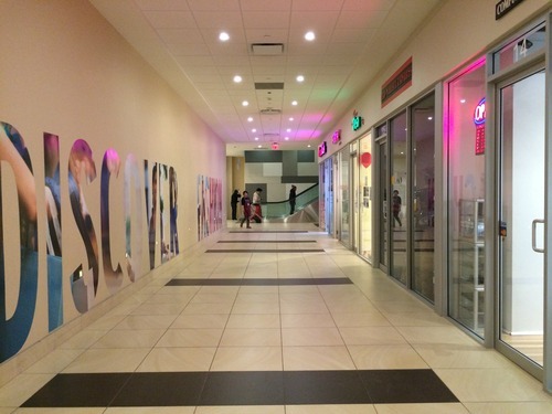
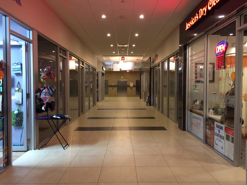
But what’s probably most unique about the retail component of this building is the P1 level (the first underground level). It’s made up of small retail condos, some of which looked to be about 90 square feet. That means that each retail unit is individually owned, just like a residential condominium, and there’s no singular landlord focused on curating the tenant mix and ensuring the entire retail center does well.
Now, I’m told that this approach works perfectly well in other parts of the world and I know that we’re trying it in other parts of the Greater Toronto Area, but I worry about the long term viability of this (P1) space in particular. When I was there on Saturday there was almost no foot traffic and probably half of the retail units were vacant.
Maybe it’s because there isn’t enough employment density in the area. Maybe it’s because it’s not well connected to other P1 level retail. Or maybe it’s because the anchors all sit above this space, as opposed to around it (as they do in traditional malls). Whatever it is, I wasn’t feeling product/market fit.
Back in 2011, blogTO ran an article calling Geary Avenue one of the ugliest streets in Toronto. And it’s certainly up there. It’s an industrial street with a mixture of different building types (lots of autoshops), giant power lines running along the south side of it, and a railway disconnecting it from the city to the south.
But as somebody who used to live around the corner from this street, I’ve had my eye on it for a number of years. Despite the fact that it was never very pretty, it always felt like an area with lots of potential. And sometimes it’s the areas that seem most unlikely to gentrify, that end up doing exactly that.
So whether you call it Dovercourt Park, Dovercourt Village, or some other name, I think it’s only a matter of time before Ossington cool moves north and the area in and around Dovercourt Road and Dupont Street becomes one of the hippest areas in the city. Get ready.
Full disclosure: I own a house very close to this neighborhood.
The Economist recently published an essay called, A Planet of Suburbs – The world is becoming ever more suburban, and the better for it. The argument is basically that the “great urbanization” that everyone loves to talk about these days is actually a misnomer. From Chicago to Chennai, it’s not the urban core that’s growing. It’s the suburbs. And so what we’re seeing should actually be called the great suburbanization.
The basis for this argument is that wealth fuels sprawl. As people become richer, they naturally consume more of everything – including space. It’s a natural market outcome.
Take for example, the path of many of Toronto’s ethnic groups. In the first half of the 20th century, College Street was the Little Italy. Then it shifted north and St. Clair Avenue West became the more authentic Little Italy. Today, many Italians now live north of the city in Woodbridge. In fact, last weekend I was on St. Clair West and was disappointed to learn that one of my favorite butchers had closed up shop and “moved to Woodbridge.”
However, there are also many supporters of the exact opposite outcome. From Edward Glaeser to Alan Ehrenhalt, many have argued that we’re in the midst of a “great inversion.” The suburbs are no longer a threat to urban centers. It’s the urban centers who are threatening the suburbs. The suburbs are dead. Long live the city.
So which is it?
Well, The Economist does cite two examples where true urbanization is actually taking place. It’s happening in Tokyo and London. In both cases, it’s the city center that is growing the fastest – not the suburbs. The explanation for Tokyo is its aging population. And the explanation for London is its restrictive greenbelt, which effectively stops the possibility of any further sprawl.
Here in Toronto – where there is also a greenbelt in place – we know that the population of the downtown core is growing at an incredible pace. A recent report by the city – called Comprehensive to the Core – revealed that the downtown core is growing at 4 times the rate of the rest of the city.
But what about the suburbs?
If we look at the province of Ontario’s growth projections, it is indeed the suburbs which are expected to grow the fastest up until 2036. Here is a diagram showing percentage growth rates:
In absolute numbers, the city of Toronto alone is expected to add about 0.66 million people between 2012 and 2036, and the suburbs are expected to add almost 1.9 million.
There are a number of potential explanations for this differential, but I think it’s largely because land is cheaper in the suburbs, it’s easier to add new housing supply, population densities are lower, and we’re talking about very different land areas.
The city of Toronto is 630 square kilometers. If you tack on the suburbs, the Greater Toronto Area is 7,124 square kilometers. That means Toronto makes up less than 9% of the total land area. And yet it is expected to contribute 25% of the region’s population growth.
Still, the suburbs are where the bulk of the population growth is expected to happen over the coming decades.
However, the “great inversion” that authors like Alan Ehrenhalt have been talking about should not really be interpreted as the death of the suburbs. What he’s instead talking about is a socioeconomic or demographic reversal: center cities used to be poor and now they’re becoming rich.
What we are seeing is a reversal in which the words “inner city,” which a generation ago connoted poverty and slums, [are going to mean] the home of wealthier people and people who have a choice about where they live, and the suburbs are going to be the home of immigrants and poorer people. And Census figures show that that’s taking place.
In this context, we are still living through the great urbanization. We’re seeing a shift in consumer preference and a shift in where wealth is choosing to locate. That’s a profound change.
And while we’re obviously still suburbanizing, I don’t agree that we’re better for it. In fact, left unchecked, this demographic inversion could actually prove to be quite damaging to our suburbs.
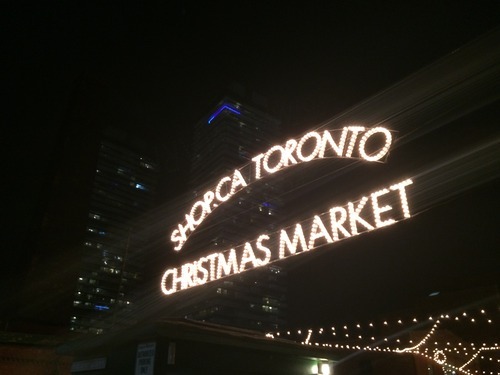
Yesterday evening I went to the Toronto Christmas Market in the Distillery District. I had actually never been before, but it was something that I had been meaning to check out for a few years now. And it was wonderful. If you’ve never been, I would highly recommend you go. This past weekend was the opening weekend and it runs all throughout Advent until Sunday, December 21st.
For those of who might not be aware, the Christmas Market festivity is a longstanding tradition that originated primarily in German-speaking Europe. Accounts of a “December market” were found as early as the end of the 13th century. The Toronto Christmas Market is a slightly more recent tradition (it’s only about 5 years old), but it was already selected as one of the world’s best.
But Christmas carollers and hot toddies aside, the Market is also a fantastic opportunity to see the Distillery District in all its glory. Every time I visit the Distillery, I can’t help but feel how lucky we are to have a district like this in the city. The architecture and scale of the place is incredible and – alongside the Toronto Islands and Kensington Market, sometimes – it’s pretty much the only car free zone we have.
However as someone who lived near the Distillery District in its early days, I remember how much of an “island” it was when it first opened. It felt disconnected from the rest of the city and the only way to get people there was to hold a special event. The retailers and galleries struggled and many didn’t last.
With all the condos that have been built, literally on top of the neighborhood, that has changed dramatically. Today the area has become much more balanced as a mixed-use community. But the real tipping point, I think, will come next year when Toronto hosts the Pan Am Games and the West Don Lands neighborhood starts to come online just to the east of Cherry Street.
Now all of a sudden the Distillery District won’t feel like the edge of downtown anymore, it will feel more like the middle of it. As my friend Alex Bozikovic of the Globe and Mail pointed out to me this weekend, the Pan Am Games are going to put the east side of downtown on people’s radars. And I would completely agree. Once that happens, the Distillery District will finally start to reach its maximum potential.
Yesterday UrbanToronto.ca published a post talking about Melbourne’s laneways (something I also wrote about here on ATC a few months ago). As part of their post, they included the video that I’ve embedded below. I think it does a good job of showing the vibe and energy in these repurposed laneways, and so I wanted to share it with you all as well. What are your thoughts on these spaces? I think they’re great.
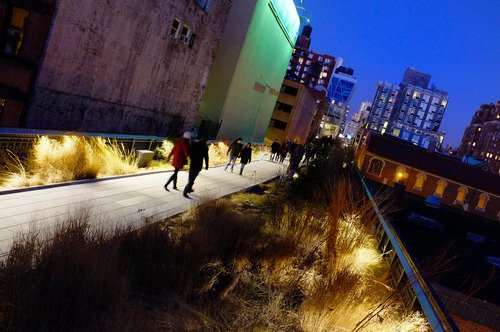
In 1980, the last train ran on an elevated corridor on the west side of Manhattan known as the High Line. Originally built in the 1930s, the trucking industry had made these trains obsolete and service was halted.
At this point, neighboring property owners began to lobby for the demolition of the High Line, as they no doubt saw it as an opportunity to increase the value of their land holdings. But thanks to local residents – most notably a man by the name of Peter Obletz – the 1.45 mile-long elevated rail corridor was saved from demolition.
In 1999, Joshua David and Robert Hammond then decided to form a non-profit with the goal of both preserving and reusing this unused rail corridor. The group was called Friends of the High Line.
By the early 2000s, Friends of the High Line had successfully made an economic case for transforming the rail line into a public open space and things started moving forward. Initially, it was thought that a public park of this sorts would attract about 400,000 people annually and generate upwards of $286 million in new tax revenues over the following 2 decades (Globe and Mail).
With these expectations in mind, construction on the new High Line Park began in 2006. The first section opened in 2009 – a decade after Friends of the High Line was formed. And the third, and last section, opened just two weekends ago at the end of September.
Today the High Line Park attracts 5 million visitors a year and is believed to be directly responsible for about $2.2 billion in new economic activity. The increased tax revenues over the next 2 decades are expected to reach about $980 million. Without a doubt, the High Line has been a huge success. It has become the 2nd most visited cultural attraction in New York (Globe and Mail).
Which is why every city now wants their own High Line. Philadelphia wants one. Chicago wants one. Mexico City wants one. Seoul wants one. And the list goes on. Here in Toronto, we’ve recently proposed one called the King High Line, which will connect the Liberty Village and West Queen West neighborhoods across a rail corridor.
While I do believe that this is an important connectivity problem to be solved, I worry about how explicit the references are to the actual High Line. Even the street furniture is the same in their promotional video.
I worry not only because it means we’re clearly taking on the role of follower, as opposed to leader, but because an elevated park isn’t going to work in all urban contexts the same way that the High Line worked in Chelsea. This is similar to how Frank Gehry can’t magically turn your city into the next Bilbao.
So while I have shown my support by becoming a “Friend of the King High Line” (and I would encourage you to do so as well), it’s important to keep in mind that the problems we’re trying to solve here aren’t necessarily the same ones that New York had to deal with.
The High Line – from the start – was designed to have an intimate relationship with its surrounding buildings. The tracks rain directly through them so that the trains could easily load and unload their cargo – that was the whole point. So when the High Line was redone, all of a sudden these buildings were able to reconnect themselves to the park in a way that they were already accustomed to doing.
But in Toronto’s situation, and perhaps in your city, that’s not the case. We’re talking about stitching together two completely disconnected neighborhoods. It’s a noble goal and certainly one that I wholeheartedly believe we should pursue. But I don’t think we should assume that it’s a problem that has already been completely solved for us.
“We shape the cities, and then our cities shape us.” That’s one of my favorite lines from the documentary The Human Scale, featuring Danish architect and urban designer Jan Gehl. I like it because I don’t think many of us think enough about the way in which the built environment – that we create – ultimately goes on to influence the way we live our lives.
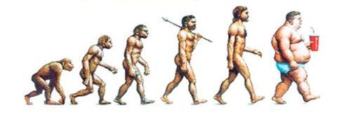
One of the most interesting connections for me is the link between urban form and public health. There’s been a lot of talk over the years about how suburban sprawl is, or might be, making us fat (among other things). We’ve created environments that are only navigable by cars and that has forced many of us into sedentary lifestyles. We sit in our cars, and then we sit in our offices.
So today I’d like to conduct a bit of a poll. If you’d like to participate, please share the following 3 things in the comment section below: 1) your city, 2) the type of neighborhood you live in (urban, suburban, rural, etc.), and 3) the amount of time you spend walking or doing something active on an average day.
Here’s me:
I live downtown Toronto in the St. Lawrence Market neighborhood (urban). I take the subway to work and the station is a 10 minute walk from my place. So as a bare minimum, I spend at least 20 minutes a day walking. But since I also walk to do most of my regular errands, and since my gym is another 10 minute walk from my place, I’d say I average a good 30-45 minutes of walking each day.
Now it’s your turn 🙂
This is a pretty crude survey, but with the advent of things like smartwatches and health monitors, I think we’ll soon have lots of great data on the ways in which our cities might shape our health.
In today’s post I’d like to focus on the second tweet I embedded in yesterday’s piece about downtown Toronto. Specifically, the fact that almost 75% of downtown residents walk, cycle, or take transit to work, leaving drivers firmly in the minority.
For me, this then makes me question whether or not we’re optimizing well enough for the majority. However, it’s often not that simple. And that’s because the downtown core is clearly regional in its draw, and the further you move out from the downtown core, the more the modal split flips. In the suburbs, driving is obviously the majority.
And herein lies the tension and the reason for all this “war on the car” rhetoric: We have a downtown core with completely different mobility preferences than the rest of the region.
But as Toronto continues to intensify and grow (the population of the Greater Toronto Area is projected to reach almost 9 million by 2036), I truthfully don’t know how we could reasonably expect to (efficiently) move that number of people in private cars. I’ve just never seen it done before.
Some people think that if we simply got rid of all those damn streetcars on our city streets, that we’d be doing a lot to eliminate traffic congestion. But it’s not that simple. The Highway 401 here in the city is already 18-lanes and one of the widest in the world. And yet it’s perpetually clogged. No streetcars there.
So I look at this tension as a growing pain. Sooner or later I think we’re going to realize that this war should really be a war on inefficiency. How do we move lots of people around big cities while minimizing waste, maximizing economic output, and enhancing quality of life?
To put things into perspective, consider that the downtown core (including King West, King East, and the Portlands) is estimated to be responsible for 51% of the entire wealth generated in this city. And yet its physical area is easily less than 10% of the entire city (which is about 630 square kilometers).
I was out for a bike ride last night and, on my way home, I decided to try out the new dedicated bike lane on Adelaide Street. Usually I would take King Street, but it was completely full because of Caribana parties.
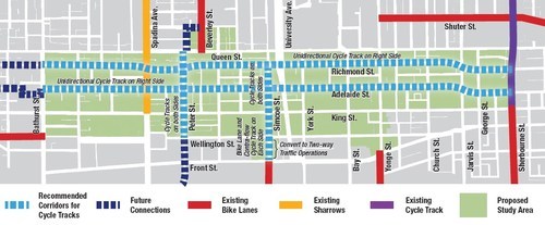
For those of you who may not be aware, the city of Toronto is currently piloting two dedicated bike lanes on Adelaide Street and Richmond Street in the downtown core. Both streets are one-way and because the lanes were so big to begin with (highway-like spacing), I’m told that these new bike lanes didn’t even eat up a driving lane.
Here’s a map of the pilot area:
Given that dedicated bike lanes are a scarce resource here in Toronto, I have to say that it was rather luxurious having my own piece of road. And because there’s no longer any fear of parked car doors swinging open, I was able to ride a lot faster than I normally would.
But as my friend Evgeny pointed out earlier this week, there’s a big difference between dedicated and grade separated bike lanes. Indeed, on my trip from Bathurst Street to Church Street last night, I encountered 3 cars parked in my lane.
So, I hope that these bike lanes become a permanent fixture downtown, but that the city makes them grade-separated. I’m sure people will use them. At the same time, I think they could also act as a catalyst for more pedestrian life along both of these streets.
If you haven’t yet tried them out, I would encourage you to do so. The city is tracking usage and so you would be supporting the cause. And if there’s anybody parked in your lane, below is one way to handle it. It’s a video by Casey Neistat out of New York. If you can’t see it below, click here.