Daily insights for city builders, delivered every morning at 6 AM ET. I’m Brandon Donnelly — a Toronto-based real estate developer and founder of Globizen. I’ve been writing here since 2013.

Tag: city planning

  • Q&A on reimagining public spaces

    I received an email from an ATC reader yesterday who is working on a publication about reimagining public spaces in Toronto. She sent me a few questions and specifically wanted to talk about the Yonge Redux project, which I wrote about a month ago. After I responded to her questions, I figured I should just share them publicly. So here they are:

    How would citizens from different age groups benefit from the Yonge Redux project?

    I would bet you that this stretch of Yonge Street experiences more pedestrian traffic than it does car traffic. And yet we’ve allocated space in the opposite direction: cars have more space than pedestrians do. So what this project is really about is reallocating the street, or public right-of-way, so that the dominant uses are actually prioritized through urban design. It doesn’t need to be more complicated than that. Ultimately, this will benefit people both young and old.

    Do you know what kind of professionals are needed to complete a project like this?

    You’d need an architect/designer – one who is awesome at landscape/urban design work. gh3 here in the city comes to mind as a firm I like, if you want an example. You’d need a bunch of engineers to deal with stormwater management and other infrastructure items. You’d likely need a transportation/traffic consultant to assess traffic flows in the area and prove that this project won’t cause the entire city to come to a grinding halt (it won’t). You would need someone to manage the day-to-day of the entire project. And this is just naming a few of the professionals/consultants that you’d probably end up needing.

    You’d also have to work closely with the city, the local councillor, and the local community. It’s inevitable that some of the businesses will worry about the loss of potential customers – so that would need to be worked through.

    What are some areas in Toronto that, in your opinion, need reimagining in the next few years?

    My feeling is that Toronto is still at the early stages of this shift towards better public spaces and a better public realm. But in many ways, projects like Yonge Redux are much easier sells compared to the other areas that could use a face lift. Yonge Street is already urban and pedestrian friendly. The real challenge is going to be dealing with the areas outside of the core – most of which, frankly, aren’t that welcoming to pedestrians and aren’t all that urban. What do we do with those? And do the local communities even want them transformed? They’re going to be much harder to reimagine (though I’m not saying we won’t be able to do it).

    Where do you see the future of Toronto’s public spaces in the next 50 years?

    All signs point to a more dense, more urban, and more transit-oriented city. With that shift, we’re going to increasingly realize the importance of incredible public spaces. So if we continue down this path, I reckon our public spaces will only get better. I’m optimistic about the future.

    How would you personally approach a project like this?

    My understanding is that this project has legs. It just has to work through the city bureaucracy at this point. Jennifer Keesmaat supports it.
  • From bicycles to cars in Beijing

    image

    Earlier this week, a friend of mine shared this TED talk on my Facebook wall talking about the state of climate change in the world. The talk is by Nicholas Stern. And at one point he talks about the incredible urban transformation that has taken place in Beijing over the last couple of decades; specifically, the shift from a bicycle oriented city to a now automobile oriented city.

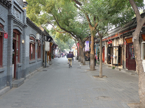
    I knew that this was the case, but it got me thinking. Because alongside this mobility change, there’s also been – not surprisingly – pronounced changes to the urban fabric of the city. The most significant is perhaps the demolition of the city’s hutongs and siheyuan. Hutongs are basically narrow alleys (see above photo) and siheyuan are the traditional Chinese courtyard houses.

    For centuries, these alleyways and courtyard houses have defined Beijing. And while I realize that not all of them were as glamorous as Melbourne’s laneways, only about 1,000 of Beijing’s original 6,000 hutongs remain (according to Time). Which makes me wonder: Is China making the same mistakes that we made in the 20th century?

    Because as the developed world moves toward transit oriented development, bike lanes, heritage preservation, and compact urban living, China has seemingly gone and done the exact opposite. They got everyone off bicycles and into cars, and they went and erased a scale of urbanism that has been in place for centuries.

    This is not to say that China doesn’t deserve to have the same standard of living as the developed world. It absolutely does. It just seems a bit ironic to me that the things we’ve become sharply critical of, are exactly what China seems to want to recreate.

    Image: Flickr

  • Toronto approves 755 storeys of new development

    image

    Earlier this week, Toronto City Council approved the equivalent of 755 storeys of new development, a lot of which will end up in the downtown core. The translates into 6,887 new housing units and roughly 4 million square feet of new commercial space. The Globe and Mail called it the Manhattanization of downtown.

    If you’d like to go through the complete City Council meeting agenda, you can do that here. (I warn you though, it won’t be an exciting read.)

    One notable project that was approved is 50 Bloor Street West, which is a 71-storey mixed-use building in Yorkville adjacent to and on top of Holt Renfrew (It includes a $6 million Section 37 contribution). I mention this one because it’s impressively tall and because it’s a project that I was involved with when I was at Morguard. Watch for Yorkville in the coming years, there’s a lot in the pipeline.

    While I think this is all incredibly exciting, our chief planner, Jennifer Keesmaat, is entirely correct in pointing out that all of this highlights the desperate need for better infrastructure, the most critical of which is a relief subway line that cuts across downtown.

    But to be clear, this isn’t a question of just planning for growth. This is a question of planning for growth and making up for decades of infrastructure disinvestment. That’s the position we’re in today, which means we have a lot of hard work to do. Though I’m confident we’ll get it done.

    The other thing that this level of intensification should highlight for you is that public transit, and other forms of mobility such as biking and car sharing, have to be central to our goals. It’s simply infeasible for everybody to be driving around in a car. We’re currently demonstrating how efficient that ends up being.

    So as Toronto continues to intensify, I think we’ll quickly discover that traffic and private cars aren’t the answer or even the right question to be asking.

    Image: Flickr

  • Streetcars are just a tool

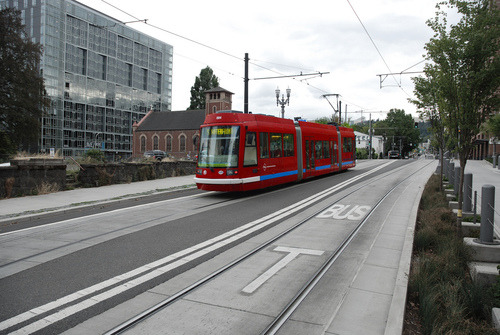
    Earlier this month the Toronto Star published an article talking about the resurgence of streetcars in American cities. According to the Star, 89 cities in the US are currently implementing or at least considering building some form of surface-rail system.

    But the article also goes on to argue that it could be a snobbish fad. Streetcars are new. They’re shiny. And they make yuppies –  who don’t like taking buses – feel better about themselves. But is the ROI really there? Is the economic impact of streetcars as big as people are making it out to be?

    To support this argument, the Star quoted transportation planner Jarrett Walker, who I’ve mentioned here before on Architect This City. But according to a follow-up post that Walker did on his blog, it would appear that he was misrepresented in the article. Here’s a snippet of his response:

    Here’s the bottom line. Streetcars are just a tool. They can be used in smart ways and in stupid ways. Asking a transit planner for an opinion about a transit technology is like asking a carpenter what his favorite tool is. A good carpenter sees his tools as tools and choses the right one for the task at hand. He doesn’t use his screwdriver to pound nails just because he is a “screwdriver advocate” or “hammer opponent”. Yet the Toronto Star assumes that nobody involved in transit debates is as smart as your average competent carpenter.

    I wanted to share this because I think it’s a great way to approach transportation planning and because I think it gets at a larger issue that we continue to face here in Toronto: We keep politicizing mobility tools. Cyclists have become pinkos. Streetcars are a war on the car. And the list goes on. How about we just look at the problem, and figure out what solution would work best?

    Image: Flickr

  • Make no little plans

    “Make no little plans. They have no magic to stir men’s blood and probably themselves will not be realized. Make big plans; aim high in hope and work, remembering that a noble, logical diagram once recorded will never die, but long after we are gone will be a living thing, asserting itself with ever-growing insistency. Remember that our sons and grandsons are going to do things that would stagger us. Let your watchword be order and your beacon beauty. Think big.”

    -Daniel Burnham, Chicago architect. (1846-1912)

    I’m a big fan of Chicago. Having now visited the city, I can say that everyone was right when they told me that I was going to love it. It has great art and architecture, great food (with some of the largest portions I’ve ever seen), great nightlife, and great people. 

    But I don’t want to talk about any of these things today. Instead, I want to talk about something much more specific that stood out to me last weekend: Chicago’s relationship to both the water and the street.

    While Chicago and my hometown of Toronto share many similarities– including being situated on a Great Lake and having rivers flow through the middle of them–the relationship to these bodies of water is remarkably different. Here is a photo of people kayaking in the Chicago River on a Friday afternoon:

    image

    What impressed me about Chicago is how intimate and urban the relationship is with the lake and its rivers. If you look at the photo above, you’ll see that many of the buildings are built right up against the river, but that there’s space allocated for riverwalks, patios, and so on. It’s all about engaging and connecting with the water.

    Toronto on the other hand, is only recently starting to reacquaint itself with its bodies of water. We spent much of the second half of the 20th century with our back turned to the lake and without a strong urban connection to the Don River. And if I had to guess why it’s because we built highways along them.

    We built the Gardiner Expressway adjacent to Lake Ontario and we built the Don Valley Parkway adjacent to the Don River. This fundamentally changed our orientation and largely precluded us, I think, from creating the same kind of waterside urbanity offered in Chicago.

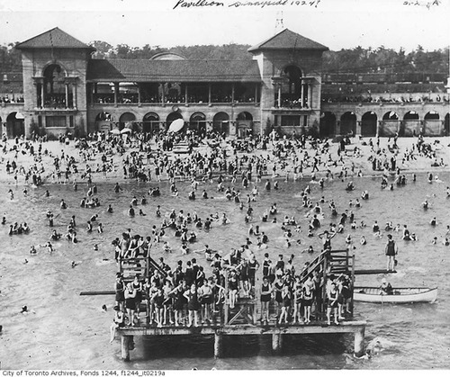
    As an example, consider that in the first half of the 20th century, Toronto’s Parkdale neighborhood – which today still has a questionable reputation – was actually an affluent and desirable waterfront community filled with beautiful Victorian mansions. It was well connected to the waterfront, and so the area flourished. Here’s what Sunnyside Pavilion used to look like:

    image

    But then in the 1950s we built the Gardiner Expressway, disconnecting Parkdale from the lakefront and destroying many of its amenities, such as the Sunnyside Amusement Park. In turn, the rich people left and their large Victorian mansions got chopped up into rooming houses and other rental housing stock. And in my view, Parkdale still hasn’t fully recovered from this. 

    Highways are divisive. There’s no question.

    So unless you can afford to bury them, it comes down to trade offs: Do you want to make it easier for people to drive in from the suburbs or do you want a truly spectacular water or riverfront? In the 1950s we chose the former. But even still today, the thought of tearing down–even a portion of the Gardiner Expressway–is fraught with opposition. I guess not much has changed.

    image

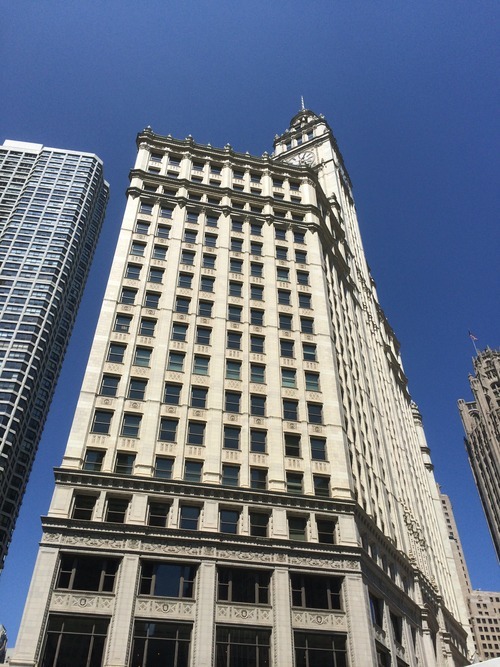
    The second way that Chicago impressed me is through the relationship that many of its buildings hold to the street. They come down to ground level with authority and with great retail presence, and often make no amends about their mass and impressiveness. This frames the street and creates a level of urbanity that isn’t always found in Toronto – particularly outside of the downtown core.

    In Toronto, the trend today is towards street level podiums, significant setbacks, and delicate point towers that minimize the impact of their height and allow for natural light to reach street level. It’s well-intentioned and perfectly appropriate in many urban settings. But sometimes you need a little urban assertiveness. Sometimes you want to impress and impose. And Chicago does that.

    What I’m getting at is that Chicago architect Daniel Burnham was on to something. He famously advocated for man (that was the era) to think big. Make no little plans, he said. And it’s admirable advice. Toronto is going through a tremendous transformation right now. We’re North America’s boomtown, which is a title that Chicago would have held at one point.

    But as we build for the future, let’s remember that, long after we’re gone, we’re going to be judged based on the plans we are making today. So why not make them big ones.

  • Who should zone cities?

    image

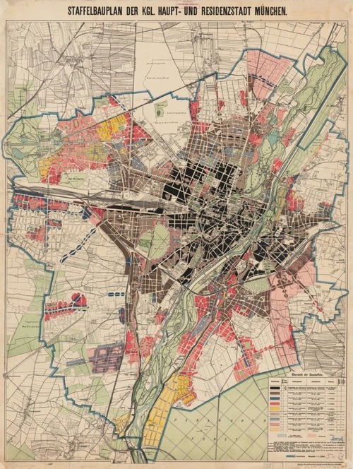
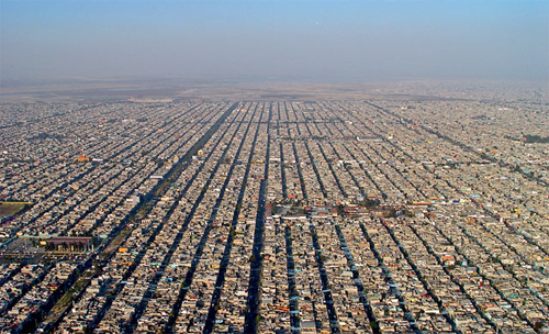
    The Old Urbanist has just published an informative post called “Where Zoning Went Wrong.” In it, he talks about some of the defining characterstics of American city planning and suggests that the delegation of planning authority from states to local municipalities is what has caused many of the challenges that city builders now face.

    But before we get into that discussion, let’s outline the characeristics. By way of Edward Bassett’s handbook on zoning (1922), the Old Urbanist outlines 9 characeristics of American planning. They are:

    1. Approval of the exclusion of commercial activity from residential zones
    2. Failure to disapprove of the exclusion of multifamily from residential zones
    3. Extreme deference to localities
    4. Insistence on a “comprehensive” plan
    5. Irreconcilable conflict between planning and zoning
    6. Heavy reliance on legal process as a substitute for sound policymaking
    7. Rejection of aesthetic concerns
    8. Concern with protecting the wealth of well-to-do homeowners
    9. Lack of comparative focus

    If you’re a planner or city geek, some of these items will be familiar to you – particularly the first one. Single-use zoning (or Euclidean zoning) is widely criticized as being hugely detrimental to cities, which is why mixed-use is so much in vogue right now. We’ve realized that there are tremendous benefits to creating neighborhoods and precincts where people can live, work, play, and learn. And not just do one of those things.

    But one point that somewhat surprised me was number 3: the deference to localities. The Old Urbanist’s argument is that around the world – from Germany to Japan – state and federal governments play a much more active role in city planning as compared to the US. And that the result is a different kind of city. As one example, most other countries don’t have single-family detached-only residential zones. The US does.

    Now, you could argue that it’s partially cultural. The US is all about individualism, whereas many other countries around the world have a greater sense of collectivism. But as the Old Urbanist suggests, it could also be because local municipalities are more prone to NIMBYism, which can ultimately lead to downzoning and more restrictive land use policies. Interesting.

    It was surprising to me though because I’m a firm believer in strong cities. They drive the economy and I generally believe that they deserve to look after themselves. And so could it really be that they need higher levels of government to keep advocacy groups and community opposition in check?

    Immediately I thought of the planning environment here in Toronto and Ontario. The Places to Grow Act, which is largely responsible for the intensification we’re seeing across the region, is provincial legislation. And “the Board” (OMB) that hears appeals arising from the municipal planning level is also provincial. So in other words, provincial decisions trump municipal ones.

    Many people believe that the OMB should be abolished. But probably an equal number of people believe that it’s critical to keeping development moving in Ontario. And, given our discussion here, it could be keeping our land use policies in check.

    But at the same time, I wonder if there isn’t a way to structure local planning such that it doesn’t succumb to individual interests and instead keeps the greater city building agenda at the forefront. If you have any thoughts on this, I’d love to hear from you in the comment section below.

    Image: Old Urbanist

  • Architect This City is The Guardian Cities blog of the week

    image

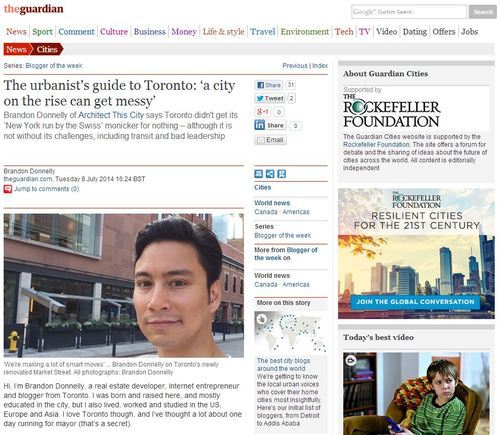
    ATC was featured in The Guardian Cities today as the city blog of the week. It’s a Q&A about Toronto and the idea is for it to be an “urbanist’s guide” to the city. They asked me to be playful and humorous in my responses, and so I tried to do just that.

    But my underlying message was that–despite being an awesome city–Toronto needs to get its act together with respect to mobility and transportation. I also recorded a video talking about this problem, which I believe will be released in the next week or so.

    A big thanks to The Guardian Cities for asking me to participate and to Athlyn Cathcart-Keays for continuing to be an avid supporter of Architect This City.

  • A data-driven approach to city building

    Yesterday I wrote a post talking about the rise of community involvement in the city planning process and how many people feel that it’s undermining the expertise of trained city planners.

    My position is that community participation is only going to become more pronounced and that it’s likely a natural outcome given the internet and what we’re seeing with many other industries.

    So instead of lamenting, I think we as city builders need to figure out how to create better frameworks and processes for dealing with the changes that are currently underway.

    Because it’s not just community involvement that’s getting in the way of city building, it’s also politics. In too many cases we are allowing self interest to get in the way of rational city building.

    But what I was starting to get at yesterday is that as city building becomes more open and transparent, and we find new ways to collect and leverage decentralized data (traffic flows, public space usage, and so on), I think it’ll open up the possibility of a more data-driven approach to city building.

    Cities are complex systems and in the past we’ve made a lot of mistakes because our assumptions were incorrect. We assumed, for example, that building more highways would quickly solve congestion. It didn’t.

    But with more openness, more transparency, and more data at our disposal, I’m hopeful that we’ll discover countless ways to build better cities. And when that happens, I think we’ll find that the naysayers don’t have as much to say.

  • The death of planning expertise

    image

    Yesterday a friend of mine sent me this article written by a city planner talking about the death of planning expertise. The article talks specifically about the rise of “community participation” and how it has undermined the modern planning process. (I guess it’s not just architects who feel undermined.)

    …we have lost respect for “experts”—those who have knowledge and/or experience in a particular field—and have replaced it with a kind of “expertise egalitarianism” whereby everyone’s opinion is given equal weight. But it is not only that the layperson’s opinions are given equal weight, experts increasingly face outright hostility. Laypeople attack experts as being arrogant, elitist, and imposing, if not outright threatening, often because the expert insists he or she knows something the other does not. Even more ridiculous, rather than being viewed as helpful or even essential, expertise is viewed as harmful or even antithetical to community participation.

    But to be clear, the author is not arguing for technocratic rule. He simply believes that community input has reached a point where laypeople with only anecdotal evidence are given equal weight as planning experts, and that it’s miring the planning process and causing less than desirable outcomes.

    This topic is interesting to me for 2 reasons.

    First, it’s interesting because we’re basically talking about a form of decentralization, which, just so happens to be one of the macro trends being ushered in by technology and the internet. It used to be that we couldn’t decentralize. Communication costs were too high and the ability to share information in real time wasn’t possible.

    But today we can. So instead of, for example, only getting the news from one source (a newspaper, perhaps), we get it from millions of people on platforms like Twitter. We trust laypeople, just as much as we do “expert” reporters, to tell us and show us what’s happening in the world. Just yesterday I turned to Twitter to see what was happening with Toronto’s torrential rainfall (#TorontoStorm).

    And as a result of this trend, we’re seeing startups like Popularise that are, in some regards, trying to decentralize the planning process. The platform allows communities to decide what they want to see in their neighborhood and then share it. Think your neighborhood could use an organic grocery store? Great, you can spec that on Popularise.

    The second reason I find this topic interesting is because there’s a school of thought (let’s call it the “wisdom of crowds” school of thought, to name it after a book), which believes that in aggregation the opinions of many can actually be better than those of a few so-called experts.

    And in many ways I agree with this—though there are a number of prerequisites that need be met in order for this to hold true. For example, you can’t have groupthink taking place, which I think you could argue is what often happens with NIMBY movements.

    Nonetheless, there’s a shift taking place and it’s impacting not only the planning profession, but many others. In the end though, I don’t think it will make experts irrelevant. In fact, as industries continue to “open up” and as we harvest more and more data (that previously wasn’t available), I think we’ll all be surprised at how beneficial this ends up being. 

    Image: GSAPP

  • How mobile apps are going to help us build better cities

    image

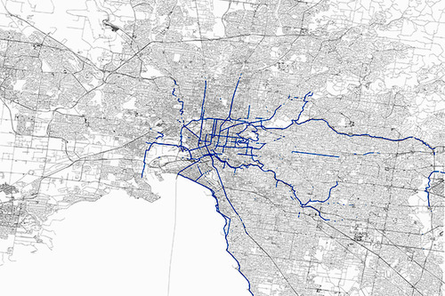
    Some of you might know that I’ve recently started using a mobile app called Strava. It’s a platform that allows you to track your runs and bike rides, as well as those of your friends. It tells you your speed, elevation changes, and it also maps your trips–among many other things. Here’s what my 50 km ‘Ride for Heart’ looks like from last Sunday.

    But what’s even more interesting is how cities are starting to use the data this app collects:

    For $20,000 a year, transportation planners and others can access Strava Metro, which provides an unprecedented look at where and how people are biking. It can tell them where they speed up and slow down, for example, or where they might stay in the street or ride on a crosswalk. That information can reveal where bike lanes or traffic calming measures would be useful, and if those already installed are effective.

    It’s a perfect example of how “tech” is infiltrating so many other sectors. Mobile technology and networks are generating huge amounts of data and it’s happening at an increasing rate. We’re gaining insights into the way people live that simply wasn’t possible before. Some of this information will inevitably be misused, but a lot of it will be used to improve the way we live our lives.

    I know that the City of Toronto also has its own proprietary cycling app and is hoping to collect similar sorts of data from it. But intuitively, I don’t think they’ll be able to compete with the scale of a platform like Strava. Though I certainly applaud the initiative.

    The information age is an exciting time.

    Image: Strava via Wired