Daily insights for city builders, delivered every morning at 6 AM ET. I’m Brandon Donnelly — a Toronto-based real estate developer and founder of Globizen. I’ve been writing here since 2013.

Tag: city planning

  • The high cost of poor land use

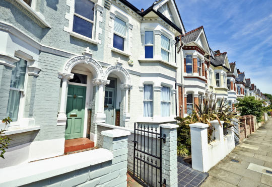
    Photograph London street of early 20th century Edwardian terraced houses by Bombaert Patrick on 500px

    London street of early 20th century Edwardian terraced houses by Bombaert Patrick on 500px

    Over the weekend The Economist published an interesting article called, Space and the city: Poor land use in the world’s greatest cities carries a huge cost. The argument is that land isn’t scarce. It’s the land use policies we have created that are artificially limiting supply and driving up real estate values.

    In fact, land is not really scarce: the entire population of America could fit into Texas with more than an acre for each household to enjoy. What drives prices skyward is a collision between rampant demand and limited supply in the great metropolises like London, Mumbai and New York. In the past ten years real prices in Hong Kong have risen by 150%. Residential property in Mayfair, in central London, can go for as much as £55,000 ($82,000) per square metre. A square mile of Manhattan residential property costs $16.5 billion.

    And part of the reason this has become so prevalent is because of the shifts we’ve seen in our economy and the great return back to cities.

    In the 20th century, tumbling transport costs weakened the gravitational pull of the city; in the 21st, the digital revolution has restored it. Knowledge-intensive industries such as technology and finance thrive on the clustering of workers who share ideas and expertise. The economies and populations of metropolises like London, New York and San Francisco have rebounded as a result.

    So how do we get better at meeting real estate demand in our cities? The Economist has two suggestions.

    One:

    First, they should ensure that city-planning decisions are made from the top down. When decisions are taken at local level, land-use rules tend to be stricter. Individual districts receive fewer of the benefits of a larger metropolitan population (jobs and taxes) than their costs (blocked views and congested streets). Moving housing-supply decisions to city level should mean that due weight is put on the benefits of growth. Any restrictions on building won by one district should be offset by increases elsewhere, so the city as a whole keeps to its development budget.

    Two:

    Second, governments should impose higher taxes on the value of land. In most rich countries, land-value taxes account for a small share of total revenues. Land taxes are efficient. They are difficult to dodge; you cannot stuff land into a bank-vault in Luxembourg. Whereas a high tax on property can discourage investment, a high tax on land creates an incentive to develop unused sites. Land-value taxes can also help cater for newcomers. New infrastructure raises the value of nearby land, automatically feeding through into revenues—which helps to pay for the improvements.

    These recommendations will probably be unsettling for a number of people. 

    I would imagine that many communities would prefer to have planning and growth decisions happen bottom up, as opposed to top down. But I think there’s some truth to this recommendation and I don’t think it has to mean completely excluding bottom up feedback. Communities and individuals are naturally going to look out for their own self-interests. And so I think many would agree that there’s value in having a holistic urban strategy in place.

    Recommendation number two pertaining to land value taxes is a loaded one. So I’m going to save my specific comments for a dedicated post on LVTs. 

    But I will say that I don’t think trying to squeeze landowners into development via taxes is the most efficient and immediate way to address supply shortages. In advance of this, we should be examining the current barriers to development. Because we’re talking about hyper competitive global cities with perpetual supply deficits. And I don’t believe the problem is incentive-based. The problem is finding sites. The problem is finding ways to build.

    What do you all think? This is an interesting topic of discussion.

  • I’m giving away a free Architect This City t-shirt

    I’m giving away a free t-shirt on April 1st, 2015 exclusively to Architect This City subscribers. There’s no catch. And no this is not an April Fool’s joke! I just want to say thanks to the people who read ATC on a regular basis. It’s that simple.

    So how does it work?

    1. You need to be an Architect This City email subscriber (either daily or weekly). If you’re not yet a subscriber, you have until midnight on Tuesday, March 31st, 2015 to make that happen. You can do that by clicking here. It’s free.
    2. You need to visit architectthiscity.com and pick the t-shirt you want. There are currently 5 different ones to chose from (the original ATC tee comes in both ATC orange and black).
    3. Finally, you need to leave a comment at the bottom of this post telling the community 2 things: which t-shirt you want and your favorite thing about your own city. That’s it.

    On April 1st I will randomly select somebody from the comments, check to see if they’re a subscriber, and then send them a free t-shirt.

    Simple, right? I’m really looking forward to giving away a t-shirt.

  • What’s your complete neighborhood?

    Photograph Toronto - St Lawrence Market by Chris Dufresne on 500px

    Toronto – St Lawrence Market by Chris Dufresne on 500px

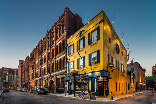
    This past Saturday night I was out with a few friends in my neighborhood (St. Lawrence Market area). And I was delighted to see how busy it was. Virtually every bar or club we walked by had a line down the street.

    Being the city geek that I am, I started thinking about two things: (1) how often I get localized to my neighborhood (I have data to back this up) and (2) what makes a “complete neighborhood”, such that you’re even able to be localized?

    In some ways the idea of a “complete neighborhood” is universal. Everybody needs a grocery store and access to food, for example. But in other ways, a “complete neighborhood” is very much a personal thing – you want goods and services that are important to you.

    So today I thought I would do a quick breakdown of the goods, services, and amenities that I really value in my neighborhood and that I think make it more or less “complete.” This list is a combination of universal and personal choices in no particular order. At the end, I summarize some of the things I wish I had.

    What I have:

    • A 5-10 minute walk to subway and streetcar
    • A 24/7 grocery store
    • A world famous food market (St. Lawrence Market)
    • Staple coffee shops (Starbucks and Balzacs)
    • Lots of restaurant and food choices (including decent Mexican, one of my favorite foods, and Pho, for when I feel a cold coming on)
    • 2 drugstores (Shopper’s Drug Mart and a new Rexall)
    • A great gym that’s less than a 10 minute walk away
    • An outdoor/athletic store that also fixes bikes
    • Cool local bar (AAA) where I can watch the Raptors (because I don’t own a TV)
    • After work bar with a good Happy Hour (Pravda)
    • Patios for the summer (all along the Esplanade)
    • All the major banks
    • Nearby recreational amenities (bike trails, waterfront, etc.)
    • Local employment base (Wattpad, BNOTIONS, etc.)
    • Great architecture (from Daniel Libeskind to the classics)
    • High walkability

    What I wish I had:

    • Less chains and a few more independent businesses
    • A hip indie coffee shop where the (male) staff have waxed moustaches
    • A good takeout sushi place
    • A pool that I could walk to (I ride my bike to Regent Park)
    • A liquor store with longer hours (but alas this is Ontario)

    Those are my working lists. What would create a complete neighborhood for you? And how does your current neighborhood hold up?

  • Rethinking single family neighborhoods

    image

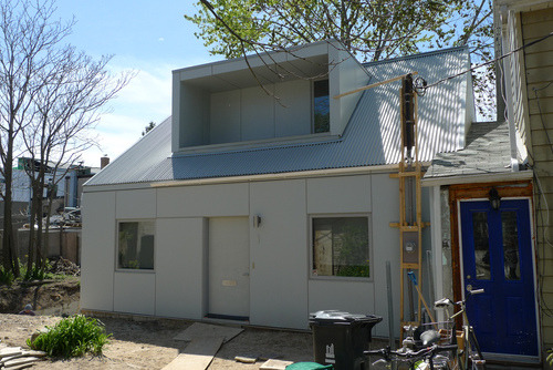
    Earlier this week a good friend of mine sent me a scanned article from this month’s issue of Urban Land Magazine called: Rethinking PADs–Private Accessory Dwellings. He said, I know you have a thing for PADs, so here you go. 

    PADs, or private accessory dwellings, is simply another term for nanny flat or laneway house. Whatever you want to call it, the concept is the same. It’s about taking a single family house and adding an additional dwelling onto that same lot. 

    In many cities around the world, this is not allowed. Each lot is to have only one dwelling unit. And that’s because the single family home – particularly in North America – has been considered sacrosanct.

    But as I’ve argued and demonstrated before, I think we’re on the cusp of this changing. Here’s a snippet from the Urban Land article (unfortunately, I don’t think the full article is available online):

    “If PADs can be added in appropriate scale and number, existing housing, zoned land, and current infrastructure could be efficiently used to increase housing supply and to stabilize and even reduce housing prices. Moreover, since PADs are by definition smaller than existing dwellings, they will attract both younger and older residents who will enrich the intergenerational composition of both urban and suburban communities.”

    I’m happy to see Urban Land (the magazine of the Urban Land Institute) giving this topic some air time. There are a number of social, economic, and environmental benefits to intensifying single family neighborhoods. And the most progressive cities in the world are already doing it.

    What is your city’s position on accessory dwellings? Toronto doesn’t support them. But there are instances where people have gotten them approved.

    Image: Kensington Market Laneway House, Toronto via Flickr

  • A tale of two cities

    image

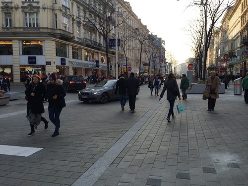
    Yesterday my friend Darren Davis out of Auckland introduced me to a 3-part blog series that he recently did with Andreas Lindinger out of Vienna, which looked at pedestrian zones and shared spaces across these two cities.

    The first post looks at the redesign of Vienna’s Mariahilferstraße (important shopping street that I’m somewhat glad I get to write and not try and pronounce). The second post looks at Auckland’s overall shared space program. And the third one offers a direct comparison between the two cities. The posts are all hosted on an interesting blog called Vienncouver (Vienna + Vancouver), which I am now following as of this morning.

    Compared to both Auckland and Vienna, Toronto is behind when it comes to pedestrian zones and shared spaces. So it’s interesting to see how other cities have managed to pull it off. It’s also further proof that you don’t have to be a warm climate city to have amazing public spaces.

    Image: Vienna via Vienncouver (notice the cars and pedestrians mixed in)

  • Is Toronto’s urban growth boundary really making the city less affordable?

    image

    This morning the Globe and Mail published an article by Toronto’s chief planner, Jennifer Keesmaat, called Greenbelts make cities more livable, affordable and transit-friendly.

    The headline immediately caught my attention because conventional economic wisdom would suggest that supply constraints – whether natural or artificially created – generally have a negative effect on housing affordability.

    To be clear though, I support Ontario’s greenbelt. I think an urban growth boundary is the right thing to have if we want to build sustainable, walkable, and transit-oriented communities. But I’m also not blind to some of the potential (negative) externalities.

    However, Keesmaat’s article got me wondering just how prevalent those externalities might be and to what extent our greenbelt is actually impacting housing affordability in Toronto. In her article she cites a recent report by the Pembina Institute that very clearly argues the following:

    “There is no shortage of land throughout the GTA [Greater Toronto Area] to build single-family homes for decades to come, but this land is predominantly located far from the City of Toronto and other established centres of employment in the GTA.”

    More specifically, the report found that of all the land available for development in the region (within our growth boundary), 81% of it is projected to still be unused by 2031. This got me thinking: it’s not that there isn’t land still available in the region; it’s that there isn’t land in the areas where demand is the greatest.

    Put differently, young families aren’t clamoring for single family homes in High Park and Leslieville because the greenbelt has restricted their ability to find new housing. They’re doing so because they want to live in neighborhoods like High Park and Leslieville.

    If you dive into the data, the report shows that in 2004 the average price of a detached home in Toronto was about $117,000 more than the rest of the Greater Toronto Area. As of 2013, that spread had grown to about $200,000. And indeed the data shows that it’s the core of the city where home prices seem to be appreciating the fastest.

    image

    So when it comes to housing affordability and supply, the greenbelt may actually be a red herring. Releasing it would not increase the supply of housing in areas where demand is already high, which is probably why this same report also found that – with or without an urban growth boundary – most Canadian cities are seeing similar increases in home prices.

    So what should we be doing?

    I think we should do two things: (1) focus on accommodating more growth in the areas that people already want to live in, and (2) figure out ways to transform the less desirable areas into more desirable ones. This second one will be the hardest, because it’s likely going to mean changing car dependent areas into transit-oriented ones, which is no easy task.

    The good news though is that we are already doing these things. There’s more that I would like to see happen, but we’re headed in the right direction.

    If your city has a greenbelt or you have experience with greenfield development in the Toronto region, I’d love to hear your thoughts in the comments. This is an area of development that I’ve never really been involved with.

    Image: Flickr

  • Do you know where you spend your time?

    Yesterday my friend Sachin Monga published a really great article on Medium called, 2014: My Year in Review. It was broken down into a few sections that included everything from his favorite blog posts of the year to all of the images he posted on Instagram. He called it “a stream of personal observations, data, and highlights for the year.”

    And it put my end of the year blog post to shame.

    One section that really stood out for me though was Places & Transit. Using a mobile app called Moves, Sachin extracted an incredible data set for where he physically spent his time and how he got around in 2014. I can’t believe I haven’t heard of this app yet – it’s totally in my wheelhouse. But I’m clearly late to the party. Facebook bought them in the first half of last year.

    The data set included how many hours he spent at home and at work. His top 3 most visited coffee shops. His top 5 most visited friends. How many nights he stayed in a hotel. His average daily commute time. And his total distance walked and cycled, among many other things. It was fascinating. I love data – especially when it was previously impossible or difficult to collect it.

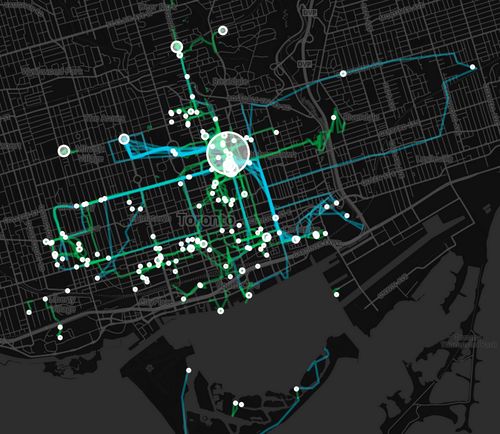
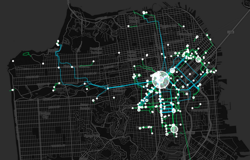
    He was also able to translate his data into a set of beautiful maps, showing where he spent his time and how he got around. Here is his personal map for Toronto. The larger the circle, the more often he was there. Blue lines are cycling. And green lines are walking.

    image

    And here’s San Francisco (where he now lives):

    image

    After reading his post, I immediately downloaded Moves. And I can’t wait to see how my personal map of Toronto will look like in a few weeks and months. Once I have enough data points, I’ll be sure to share it with you all here.

    In the interim, do you have any ideas for what this kind of data might be used for? I can certainly think of many. Let us know in the comment section below.

  • Making city planning cool again

    image

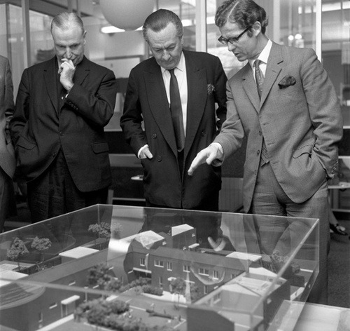
    This morning my friend Mackenzie Keast – who is famous and was on the radio in Toronto today talking about The Laneway Project – sent me an interesting article from the Guardian talking about the marginalization and growing irrelevance of city planners. It’s called: For the sake of our cities, it’s time to make town planning cool again.

    The gist of the article is as follows:

    While the cult of the star architect has soared over the decades and property developers have displaced bankers as the new super-rich, the figure of the local town planner has become comic shorthand for a certain kind of faceless, under-whelming dullard.

    But what really stood out for me are the following two things. First, that people are genuinely interested in cities. I would say that it’s almost trendy to be into cities these days.

    Urbanism may have displaced cultural theory as the favoured subject of the academic hipster, but talented young men and women rarely consider becoming town planners.

    And second, that we’ve made it difficult for these same interested people to participate in the planning process.

    Planners have become simultaneously under-respected and over-professionalised. Their training and practice too often leaves them able to communicate effectively only with other planners and professionals, working in an abstract language that alienates them from people. People are occasionally allowed into the professional planner’s world, but in highly mediated terms dictated by the profession.

    This stands out for me because I think that architecture is in a somewhat similar position. I often joke that the more architecture training someone has, the more likely they’re going to like buildings that the rest of the world doesn’t. It all becomes quite insular – just like the Guardian is arguing with respect to planning.

    And that may in fact be the reason for the marginalization of both planners and architects (minus the few starchitects that have a distinct brand and can command a premium). If the general public doesn’t like what you do or understand how you create value, why should they care?

    I’ve written before about the future of the architecture profession, as well as the reasons for why I decided to never practice architecture. So I won’t repeat it all here.

    But I will say that it had nothing to do with me not loving architecture. Because I do and always will. Instead, it was about recognizing that professions are not set in stone. Just like pretty much everything else in this world, they can and will be reinvented.

    Image: The Guardian / PA

  • Who are you planning for?

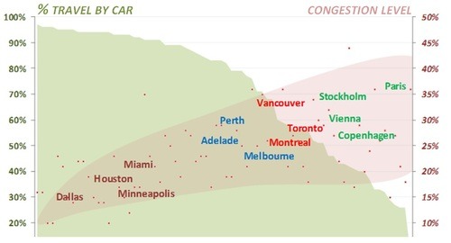
    I just came across the following chart via City Clock:

    It came from a study that looked at 74 cities in terms of two measures: the percentage of people that travel by car and the traffic congestion levels within those cities.

    The way to read the chart is to first look at the red dots. Each dot represents one of the cities studied. The position of the red dot corresponds to that city’s congestion levels. So for example, if we were to take Toronto, the congestion level is 27%.

    If you then take that same dot and draw a vertical line to the top of the green shaded area, you get the percentage of people who travel by car. In the case of Toronto, it is 56%.

    What’s interesting about this chart is that as congestion levels rise, it forces people out of their cars. In other words, the cities with the highest congestion levels also have the lowest auto share percentages.

    But the other way I interpret this chart is that the decision is almost binary: you’re either planning for cars or you’re planning for people. Based on this data, it’s hard to have both.

  • What the largest real estate development project in the United States looks like

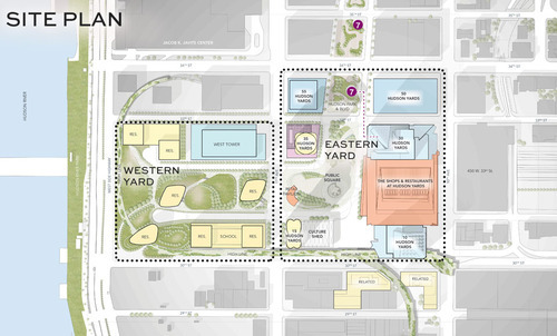
    Urban Land Magazine recently published an interesting article on the Hudson Yards project in New York, which is the largest private real estate development project ever undertaken in the United States. Click here for the article. Thanks to my friend Evan Schlecker for passing it along. It’s a good read.

    The project is being co-developed by Related out of New York and Oxford Properties out of Toronto, and when it’s all said and done, it’ll be over 17 million square feet of commercial and residential space. It’s a $20 billion development project. 

    But beyond just being massive and epic, there are a bunch of other things that make this project unique. You can read about them all in Urban Land, but I’d like to share a few snippets with you all here:

    The first is about the project’s placement on top of a rail yard:

    In order to make use of a site already occupied by a working rail yard—including more than 30 tracks for the Long Island Rail Road and three train tunnels, with a fourth under construction—most of the development will be built atop two steel-and-concrete platforms. That base, and the buildings on it, will be supported by hundreds of concrete-filled caissons, which will be drilled between the rail lines into the bedrock.

    Because the location of the tracks and tunnels limits the placement of caissons, only 38 percent of the site can be used to support buildings.

    The second is about the project’s use of technology:

    Beyond that, a vast number of sensors embedded in the site’s infrastructure will collect mountains of data on everything from temperature and air quality to pedestrian and vehicle traffic. That information, which will be scrutinized in real time by managers in an effort to fine-tune Hudson Yards’ operation, will also be shared with New York University (NYU) researchers, who will turn Hudson Yards into a laboratory for studying urban life and finding ways to improve its quality.

    And the last one is about how it interfaces with the High Line (click here if you don’t know what that is):

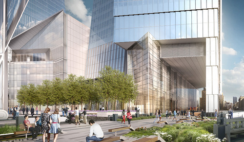
    Pedersen [of Kohn Pedersen Fox Associates] found an intriguing way to address the building’s surroundings. He allowed the High Line—a public park built on a historic freight rail line elevated above the West Side—to penetrate underneath the tower through a 60-foot-long (18.3 m) public passageway, so that the building will interact with the park and its visitors. Inside the building, a dramatic atrium “becomes the terminus of the High Line as it moves from south to north,” he says.

    So there are a lot of interesting and exciting things going on with this project. What’s amazing though is how “vertical” this community will be. You have rail lines below grade. Platforms on top. Retail at grade and across multiple levels. And an elevated linear park cutting through the buildings. Not every city can make this work. New York can.

    Images: Hudson Yards New York