Daily insights for city builders, delivered every morning at 6 AM ET. I’m Brandon Donnelly — a Toronto-based real estate developer and founder of Globizen. I’ve been writing here since 2013.

Tag: bathurst street

  • Building under the Gardiner Expressway

    For a very long time, there was a great debate in Toronto about whether or not the elevated Gardiner Expressway should be removed from downtown and replaced with something else. As recently as five years ago, that debate was centered around removing the eastern portion of the expressway and replacing it with a large surface boulevard.

    But that ship has sailed. A controversial decision was made not to remove the “Gardiner East,” but instead reroute it (that wasn’t my first choice). At the same time, wonderful new city building initiatives, such as The Bentway, have started to reclaim the long overlooked spaces that sit underneath it.

    Another good example of this is the “West Block,” which was recently unveiled at the northeast corner of Bathurst St and Lake Shore Blvd W. New retail uses (such as the above LCBO) and new public spaces (note the above stair/seating combo) have been tucked underneath the expressway’s structure, creating a beautiful contrast between old and new.

    It reminds me of some of the urban spaces that you might find in other dense urban centers such as Tokyo, because this may be the first fully fledged retail space located underneath the Gardiner. I think it is. But here’s what’s counterintuitive: the more we embrace the Gardiner in these ways, the more it will recede into the background.

    At some point in the near future, these spaces will be filled with people. People eating outside at restaurants. People sitting on the above steps enjoying an illegal drink (because of our antiquated liquor laws). And when that happens, I’m sure most won’t even consider what’s above their head.
  • An Honest Farewell

    image

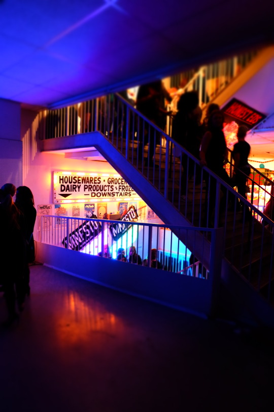
    I spent Saturday evening at Honest Ed’s for An Honest Farewell. It was a lot of fun. There were many familiar faces. And it felt very Toronto. See above photo.

    But part of me felt a bit phony pretending to celebrate the end of 68 years of operations. Truth be told, I’m not sure I ever bought anything from Honest Ed’s. Had it turned into a 3 floor super club sooner, perhaps I would have spent a bit more time there over the years.

    To me, Honest Ed’s was great big signage. 

    When I was a kid, my mom used to work on Bathurst Street just north of Bloor and I would go downtown with her early in the morning before school. It would still be dark out and I remember being so captivated by the bright lights of Honest Ed’s. That’s what the city meant to me. Lights. Flash. Excitement. It was where I wanted to be.

    A portion of the signage is being preserved and moved to Yonge and Dundas. But otherwise, this past weekend was the official end of an era. What matters now is the future of Mirvish Village. And the future is exciting.

    I’ll end with an excerpt from a recent Globe and Mail article by Alex Bozikovic:

    “The new development at Mirvish Village, after two years of conversation between developers Westbank, locals and the city, is inching closer to approval, with a new proposal submitted in January to the city. Westbank paid $72-million for the site, a big number, and yet the result is as good as private development gets in Toronto. It features meaningful preservation of heritage buildings, a serious sustainability agenda, and affordable housing – not to mention an architectural and leasing strategy geared at making the place as lively as possible, even a bit weird.”

  • Event: Community Consultation for Mirvish Village

    image

    One June 13, 2016 from 6:30 to 9:00 pm, the City of Toronto will be hosting a community consultation meeting for the proposed redevelopment of Honest Ed’s / Mirvish Village

    The meeting will be held at the Bickford Centre Auditorium at 777 Bloor Street West (across from Christie Pits Park).

    The purpose of the meeting is to present Westbank’s revised development proposal, which was submitted to the city last month. Their first proposal was submitted last summer (July 2015). 

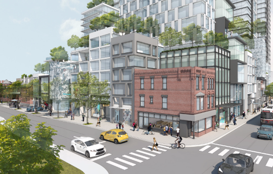
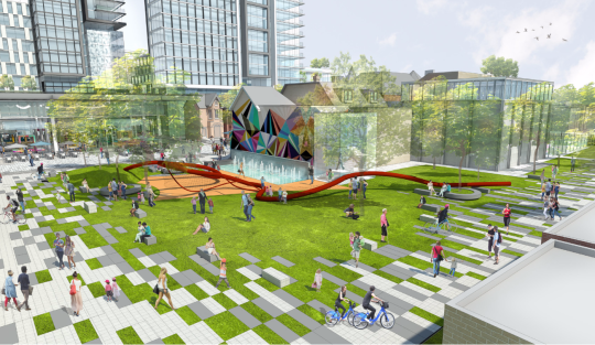
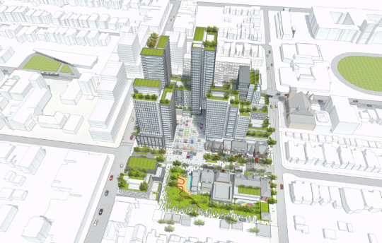
    Some of the key changes include a new on-site public park, the retention of additional heritage buildings (now 21 in total), more pedestrian porosity, and the retention of Honest Ed’s alley in its current location.

    I consider Westbank to be one of the most thoughtful developers in the city and so I’m pretty excited to see this one evolve. I’m planning to attend the community meeting and maybe I’ll see you there.

    Below are a couple of other renderings to give you a taste.

    imageimageimage

  • Toronto’s concession roads

    I’m late in writing this blog post because I was up in Collingwood for the day snowboarding. I’m exhausted, but I do have something to say.

    One of the things I always find interesting when I’m driving north of the city is how far Toronto’s major north-south streets extend. Go out to Aurora or Newmarket and you’ll still come across many familiar faces such as Jane, Keele, Dufferin, Bathurst and Yonge Street. And the distance between each of them is exactly the same as it is in the city: 2 kilometres.

    This may not seem like much of a big deal, but have you ever wondered how this street grid was established?

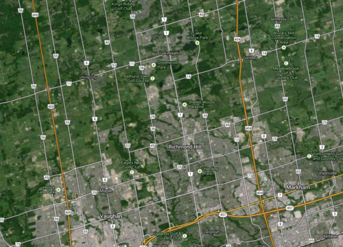
    These streets are actually concession roads. And they were used to subdivide undeveloped land in Upper and Lower Canada into a grid that could then be further subdivided into farming lots. Each square of the grid is 2 km x 2 km, or 1,000 acres.

    Look at a map of the Greater Toronto Area and you’ll see it:

    image

    But what I find most intriguing about this grid system is that it was designed around farming—not our current use case. The intent was to further subdivide each 1,000 acre lot into smaller 100 acre farming lots. And these concession roads were for access—they weren’t city blocks.

    By comparison, there’s another city that’s famously run off a regular street grid. You may have heard of it. It’s called New York. And its street grid was established in the Commissioner’s Plan of 1811. Some even go so far as to say that it’s “the single most important document in New York’s development.” 

    But New York’s grid is much different than the one I’m talking about. Because of its smaller scale (20 blocks a mile going north-south), New York’s was decidedly urban. It was meant for city building.

    Now, in the case of Toronto, concession roads obviously never stopped us from developing a thriving city. We filled in each square to make them as urban as we needed them to be. But as planning ideals changed, so did the infilling of those squares. Our grid was flexible enough to accommodate everything from farm land to suburban subdivisions.

    But I can’t help but wonder how the Greater Toronto Area would have turned out had we, quite simply, chosen a different size of square. What if instead of 2 km x 2 km, we had made them 1 km x 1 km? Or what if we made them even smaller? What would the Toronto region look like today?

    Sometimes it may seem like a simple decision, but in reality the implications are huge.