Daily insights for city builders, delivered every morning at 6 AM ET. I’m Brandon Donnelly — a Toronto-based real estate developer and founder of Globizen. I’ve been writing here since 2013.
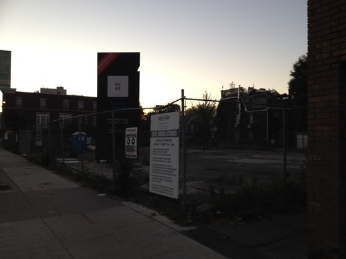
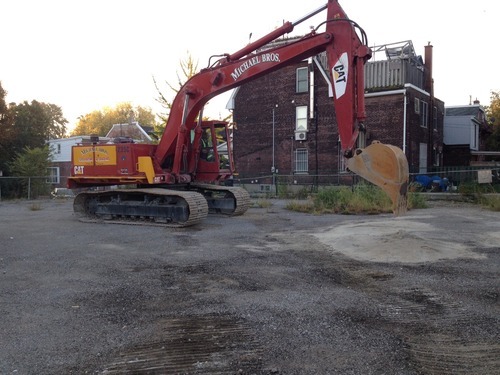
Below was the scene at the DUKE Condos site in The Junction last Saturday morning at 7:00AM. Michael Bros. mobilized their equipment to begin site preparation so that shoring and excavation can begin. The plan is to be at the bottom of the hole by the beginning of next year.
We’re all very excited in the office and so I half jokingly told our VP Construction that I would meet him on-site at 7:15AM with beers. He responded with a one word email saying: champagne. In the end, I decided to go swimming instead (probably a better decision), but I am sure we’ll have a drink soon.
There are still some killer suites available at DUKE, so feel free to drop into the sales office at 2800 Dundas Street West, give the sales team a call at 416-800-7738, or tweet the TAS team with any questions.
Depending on where you live, street numbering may not be something you’ve given a lot of thought to. In Canada, and in many other places in the world, the convention is usually to start on one end of the street and count up – with even numbers on one side and odd numbers on the other.
In many cities in the US, they’re even more rational. The streets themselves are numbered and the addresses indicate location. For example in Philadelphia, where I used to live, if you were going to let’s say 1750 Walnut Street, you would know that it’s between the cross streets of 17th Street and 18th Street. It’s a kind of hyper-rational approach, which lets you know precisely the number of blocks you need to go to get to your destination.
But not all countries and cities are this rational.
According to this Economist article – which a friend of mine forwarded me over the weekend – Costa Rica actually had no street numbering system until about 2012. Which means that directions were all based on landmarks: “100 metres south of the McDonald’s.” It seems almost hard to believe. But I guess that’s why ¼ of all mail was getting lost.
Of course, there are also lots of variations in between these two extremes.
Japan numbers its buildings, but they’re often clustered together in blocks and have no particular order or logic to them. Brasilia (Brazil) also assigns numbers based on sectors, quadrants, and blocks. And in Ireland, where I also used to live, they actually never adopted postal/zip codes. They’re one of the few developed countries in the world not to do that – though it’s coming next year.
If your city or country has a unique numbering system or you’ve come across one in your travels, I would love to hear from you in the comment section below.
There are obviously practical reasons to adopt an easy to understand numbering system. People need to be able to figure out where they’re going. But I would also imagine that there are spatial implications to the way you number and the way you organize your city.
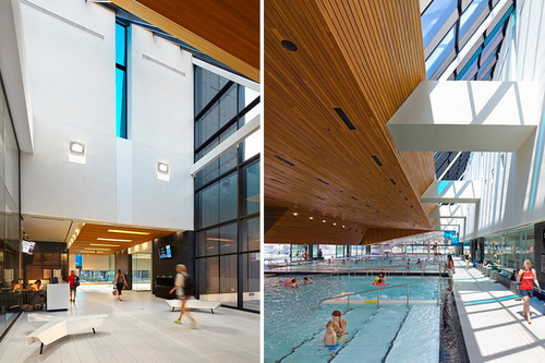
Yesterday morning I went for a swim at the new Regent Park Aquatic Centre. I used to swim regularly when I was in grad school in the US, but it fell off when I moved back to Toronto and there wasn’t a convenient place for me to walk to. Having to drive to a gym or to a pool can really cut hurt how often you’re able to go.
In any case, the pool was fantastic. On the west side of it are glass sliding doors that face the park. And since yesterday was such a beautiful day, they were all open while everyone was swimming lanes. The wooden ceiling also gives the space a nice, warm feel.
The biggest surprise for me though was the universal change rooms. I had never been in a co-ed change room before – or one that was completely open and visible to the pool (there are small private rooms so you can actually change). For families, it makes a lot of sense. Everyone can go in together and it’s easy to watch your kids in the pool from within the change room.
After my swim, I rode my bike around Regent Park and tweeted this out:
What’s happening in Regent Park is incredibly exciting. To me, it feels like a return to the fundamentals of city building. They’ve reconnected the old street grid – which had previously been removed to create the old “towers in a park” scheme – and they’re clearly working towards a proper urban neighborhood with retail at grade and buildings pushed right up against the street.
A big measure of success, though, will be how animated the streets become and how well the retail does. Because all of that isn’t quite there yet. But we’re on our way. And already I feel like we’re about to forget what the old Regent Park used to be like. Toronto may have lived with that neighborhood for over 60 years, but future generations will barely know it existed.
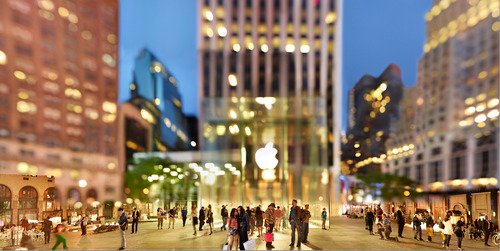
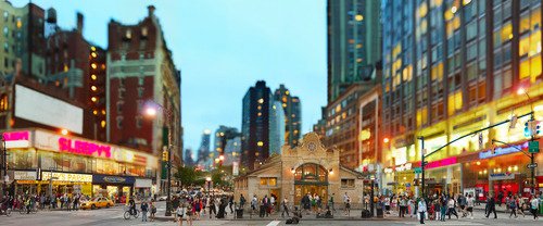
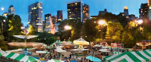
New York photographer Jeff Chien-Hsing Liao has an upcoming solo exhibition at the Museum of the City of New York next month called Assembled Realities. I just heard about it through CityLab.
Pushing the boundaries of traditional documentary photography, Liao (b. 1977) creates large-scale panoramas by combining multiple exposures of the same location taken over the course of several hours. The resulting composite photographs are often fantastical; complex, hyper-real views that no single shot—or the eye—could capture.
I love how his photos begin to distort reality and how they focus your attention – in many cases – on New York’s vibrant street life. I thought you might all enjoy them as well.
Earlier this week, a friend of mine shared this TED talk on my Facebook wall talking about the state of climate change in the world. The talk is by Nicholas Stern. And at one point he talks about the incredible urban transformation that has taken place in Beijing over the last couple of decades; specifically, the shift from a bicycle oriented city to a now automobile oriented city.
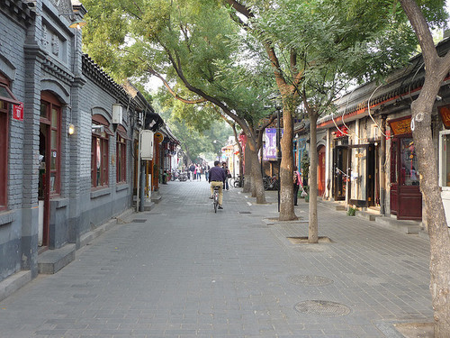
I knew that this was the case, but it got me thinking. Because alongside this mobility change, there’s also been – not surprisingly – pronounced changes to the urban fabric of the city. The most significant is perhaps the demolition of the city’s hutongs and siheyuan. Hutongs are basically narrow alleys (see above photo) and siheyuan are the traditional Chinese courtyard houses.
For centuries, these alleyways and courtyard houses have defined Beijing. And while I realize that not all of them were as glamorous as Melbourne’s laneways, only about 1,000 of Beijing’s original 6,000 hutongs remain (according to Time). Which makes me wonder: Is China making the same mistakes that we made in the 20th century?
Because as the developed world moves toward transit oriented development, bike lanes, heritage preservation, and compact urban living, China has seemingly gone and done the exact opposite. They got everyone off bicycles and into cars, and they went and erased a scale of urbanism that has been in place for centuries.
This is not to say that China doesn’t deserve to have the same standard of living as the developed world. It absolutely does. It just seems a bit ironic to me that the things we’ve become sharply critical of, are exactly what China seems to want to recreate.
“We shape the cities, and then our cities shape us.” That’s one of my favorite lines from the documentary The Human Scale, featuring Danish architect and urban designer Jan Gehl. I like it because I don’t think many of us think enough about the way in which the built environment – that we create – ultimately goes on to influence the way we live our lives.
One of the most interesting connections for me is the link between urban form and public health. There’s been a lot of talk over the years about how suburban sprawl is, or might be, making us fat (among other things). We’ve created environments that are only navigable by cars and that has forced many of us into sedentary lifestyles. We sit in our cars, and then we sit in our offices.
So today I’d like to conduct a bit of a poll. If you’d like to participate, please share the following 3 things in the comment section below: 1) your city, 2) the type of neighborhood you live in (urban, suburban, rural, etc.), and 3) the amount of time you spend walking or doing something active on an average day.
Here’s me:
I live downtown Toronto in the St. Lawrence Market neighborhood (urban). I take the subway to work and the station is a 10 minute walk from my place. So as a bare minimum, I spend at least 20 minutes a day walking. But since I also walk to do most of my regular errands, and since my gym is another 10 minute walk from my place, I’d say I average a good 30-45 minutes of walking each day.
Now it’s your turn 🙂
This is a pretty crude survey, but with the advent of things like smartwatches and health monitors, I think we’ll soon have lots of great data on the ways in which our cities might shape our health.
Last month Oxford Properties submitted a site plan application for the redevelopment of the rundown Cumberland Terrace in Toronto’s Yorkville neighborhood. If you’d like to browse the full application (including all the drawings), you can do that here.
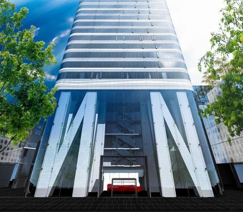
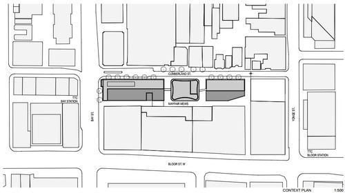
The proposal is a departure from previous plans and now includes 3 buildings: a 4.5 storey building, a 2.5 storey building, and a midblock 54 storey residential tower (the lobby is shown above). There will be both retail and residential uses.
For those of you familiar with the mall, it should go without saying that Cumberland Terrace is in desperate need of redevelopment. So I’m not going to talk about that today. Instead, I’d like to mention 2 other points that stood out to me about the application.
The first is the 2 midblock connections on either side of the tower, running from Cumberland Street to Mayfair Mews in the rear (see below). Yorkville has a history of intimate laneways, and so it’s nice to see some of this being carried through in a new development. It also opens up the opportunity for an improved Mayfair Mews.
Secondly, it’s somewhat surprising to see that the 54 storey residential tower is being proposed as rental. Toronto doesn’t build a lot of purpose-built rental apartment buildings. There are some (from the likes of Morguard and Concert Properties), but we haven’t done it at scale for decades. And that’s largely because the demand for condos has been so great.
But recently I’ve been noticing a renewed interest from the real estate community in multi-family rental assets. Cadillac Fairview also proposed a 65 storey rental building at the north west corner of Yonge Street & Queen Street last year – though they later withdrew their application.
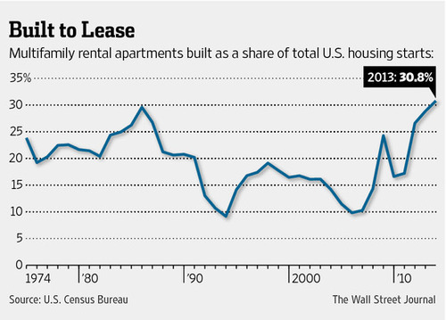
In the US, rental apartments as a share of all new housing is also at record highs – over 30%. And that’s partly because credit remains tight (certainly compared to pre-2008) and economic growth has been tepid. But also because of demographic changes. People are having fewer children, later in life, and so many are putting off buying.
So I think we’re going to see even more rental apartments being built in Toronto in the coming years.
Seattle recently installed its first protected downtown bike lane on Second Avenue. Here’s a short video of it in action (pay attention to the signalling setup and the pedestrians that walk into the bike lanes). Click here if you can’t see the video below.
Shortly after it opened, they quickly discovered that the left green arrow and solid green circle (shown above) were confusing drivers. The intent was for the left green arrow to signal that you could turn and for the solid circle to signal that you could drive straight ahead.
But even with the accompanying sign, drivers kept getting confused and thought a green circle meant you could go wherever you want.
So the Seattle Department of Transportation quickly adjusted and changed the green circle to a north arrow. And it seems to have fixed the problem. I think it goes to show how important the details can be with these things.
Some of you told me that yesterday’s post on careers was actually quite sad. That it came across as if I were advocating for people, not to do what they love, but to instead do what makes them the most money. But that was not my intention.
There were a lot of reasons why I got into real estate development, and perhaps I oversimplified yesterday. But a lot of it actually came down to the fact that I’m passionate about building great cities (hence this blog).
And I thought it was ultimately unfair that some investment-banker-turned-developer, who doesn’t really care about cities, might end up having more say over the built environment than me, the architect.
So I decided to sacrifice designing individual buildings in the hope that I’d one day be able to give back to cities on a much larger scale. And I still hope to be able to do that.
In any case, to end the week on a more fun note, I thought I would do a post called Fun Friday and link to 2 city tours: one of Brisbane, Australia, and one of Porto Alegre, Brazil.
But these aren’t just any city tours. They are by local skateboarders showing you their city. I posted one for Toronto about 8 months ago, so some of you might be familiar with the series.
I love how differently skateboarders look at the urban environment. I hope you can appreciate it as well.
Right now the Toronto International Film Festival is going on in the city. It’s actually one of my favorite times in Toronto. There’s so much going on and the city generally does things that it doesn’t normally allow, but that it should do all throughout the year, such as extending last call at bars and closing down streets to cars.
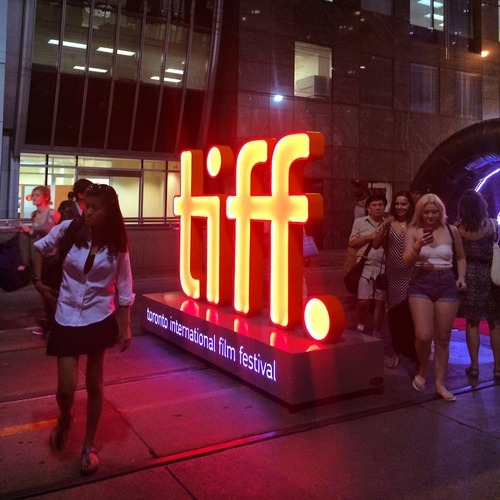
This year, King Street between University Avenue and Peter Street has been made pedestrian-only. It encompasses an area known as the Entertainment District and includes the Bell Lightbox, which is the TIFF HQ. The street was closed last Thursday and will reopen this Monday. So it’s a 4 day thing, that TIFF is calling “Festival Street.”
Some people – like me – are really excited about this. Here’s s picture I tweeted out on Thursday night. Given the engagement (retweets/favorites), I think there are others who feel the same way I do:
But there are others who are furious that their commute was disrupted last week and that we’re inconveniencing locals for the sake of hosting one of the top film festivals in the world. (King Street typically moves about 60,000 people per day on the streetcar and 20,000 vehicles.)
But when I walked the entire 650 meter stretch on Thursday night, it was completely full of people. There were people playing large-scale chess. There were people eating at picnic benches. And there were lots of people just enjoying a wonderful summer stroll in the city.
And all I could think about is that this is an unmet need in the city. King Street is a wonderful place to be right now and we don’t have an equivalent during the other 361 days of the year here in Toronto. So rather than be upset that we’ve closed down 6 blocks of downtown, I’m only upset that we don’t do more of this and make it permanent during the rest of the year.
I’m not necessarily saying that King Street is the best place to do this. Yonge Street initially strikes me as being a better place to start. But I am saying that if we have to reconfigure things to make our city more awesome for when guests come over, that maybe we should think about how to make it more awesome all the time.