Daily insights for city builders, delivered every morning at 6 AM ET. I’m Brandon Donnelly — a Toronto-based real estate developer and founder of Globizen. I’ve been writing here since 2013.

Tag: quebec city

  • Canada announces high-speed rail between Quebec City and Toronto — finally!

    The train from Paris to Marseille takes just over 3 hours:

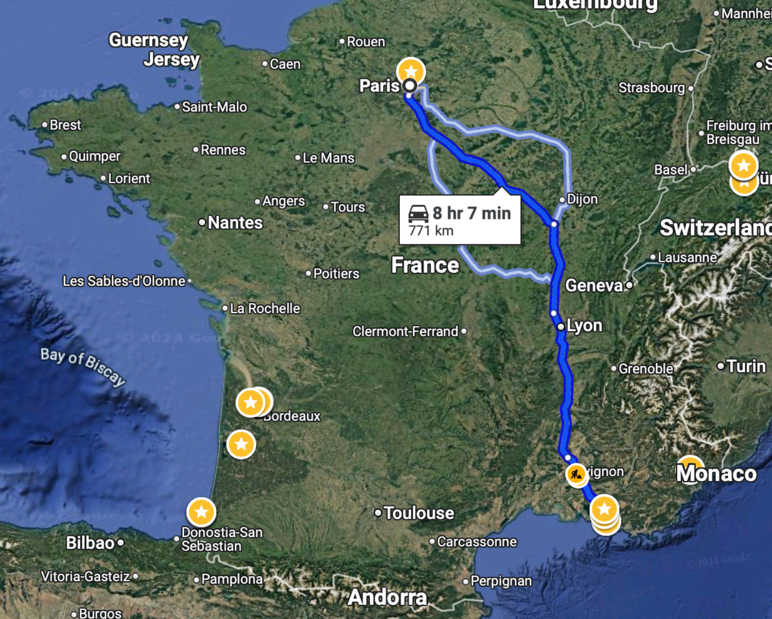
    To drive this same distance, it would take just over 8 hours:

    So unless you had a very specific reason, I don’t know why you’d ever want to drive this route. I certainly hate long drives and would avoid this at all costs.

    On a related note, the Canadian government announced this week that it will actually be moving forward with a high-speed train linking Québec City to Toronto, stopping in Peterborough, Ottawa, Montréal, Trois-Rivières, and Laval. And unlike previous announcements, it will actually go pretty fast — upwards of 300 km/h, which is comparable to what the TGV does on the above route.

    There are three consortia currently competing for this contract, but apparently the federal government has already chosen a winning bidder. An announcement is expected next month. At the same time, the project office owns all of the bids, and so there’s a chance that elements from each of them could be used in the final project.

    According to official messaging, the design alone is expected to take some 4 to 5 years, which is an eternity and way too long. But at least we seem to be moving forward. This rail link is a no brainer. It will compress the geography of an importantly bilingual corridor with nearly 20 million people — about half the population of Canada! It’s our megalopolis.

    Now we just need to move forward with urgency and with an unwavering commitment to creating the best high-speed rail service in the world. Let’s not accept mediocrity. And let’s not cancel it once we’ve already sunk millions into it. That would be a terrible outcome for such an obviously important nation-building project.

    LFG.

  • Toronto-Montréal should be a 2 hour high-speed train ride

    The Quebec City-Windsor corridor is the most densely populated region in Canada. The last time I checked Wikipedia, it was reported to house about 18 million people, or about half of Canada’s entire population.

    So it is not surprising that there have been numerous high-speed rail studies for this corridor over the decades, as well as studies for other important links in Alberta (Edmonton-Calgary) and other parts of the country.

    And yet, Canada remains the only G7 country without any high-speed rail. Though to be fair, the US doesn’t have all that much either; certainly with respect to the size of its population.

    However, there is some good news. In March of this year, the Government of Canada announced a Request for Expression of Interest related to high frequency rail service between Quebec City and Toronto. More information, over here.

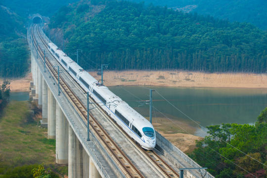
    But from what I have read, it’ll be a faster upgraded service (~200 km/h), but not true high-speed rail (~250-300 km/h). I took the TGV from Marseille to Paris last summer, and this is how fast we were going:

    If we’re going to do this, let’s be the absolute best in the world and not settle for mediocrity.

  • Why cities are where they are

    I’ve always been fascinated by questions around the origin and location of cities. How did they get their start and why did they get founded where they did? Access to water and resources are obvious factors. But it could have also been for defensive reasons. 

    In some cases, the location makes intuitive sense. Quebec City, for instance, is founded on high ground at the point “where the river narrows.” Both of these elements come in handy when you’re trying to fend off intruders. But in other cases, the exact location of a city or town may not be as obvious.

    Thankfully, Wendover Productions – which is a YouTube channel entirely focused on explaining how the world works – recently published a video called: Why Cities Are Where They Are. (Video embedded below.) It’s about 16 minutes long and it has gotten over 1 million views at the time of writing this post.

    [youtube https://www.youtube.com/watch?v=3PWWtqfwacQ?rel=0&w=560&h=315]

    They also have a video that I watched today called: The Economics of Airline Class. It covers why airlines don’t care about coach and don’t make money off coach travellers. The real estate developer in me enjoyed the part about revenue per square foot for each “class” section of the plane.

  • What food is your city famous for?

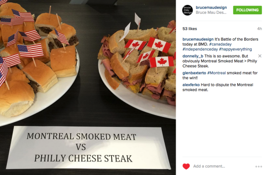
    Yesterday I came across the above Instagram post by Bruce Mau Design, which pitted the Philadelphia Cheese Steak sandwich against the Montreal Smoked Meat sandwich in a “battle of borders.” It was to celebrate both Canada Day and American Independence Day.

    I thought this was an awesome idea, so I tweeted out the photo. Then Daniel Kay Hertz – who is a Senior Fellow at City Observatory and from Chicago – asked me: “Is there a Toronto equivalent?

    And that got me thinking. 

    Montreal has smoked meat, bagels, and poutine. Philly has the cheese steak. Chicago has deep dish pizza. Quebec City has maple sugar and tourtiere (a kind of meat pie). New Orleans has po’boy sandwiches. Boston has clam chowder. Austin has tacos. Seattle has crab. And the list goes on.

    But what is the quintessentially Toronto dish? Asian fusion food? Peameal bacon sandwiches from the St. Lawrence Market? I really don’t know. So I think we should decide on one right now. Think of it as an exercise in city branding.

    Leave your suggestion in the comments below and we’ll have a vote.

  • Toronto is at the center of an emerging megalopolis

    https://500px.com/embed.js

    With the recent talk around downtown Cleveland’s resurgence, I am reminded that for those of us living near the Great Lakes, we are living in one of the most important urban agglomerations in the world: The Great Lakes Megalopolis.

    In 1962, French geographer Jean Gottmann wrote a seminal book called, Megalopolis: The Urbanized Northeastern Seaboard of the United States. And in it, he described the remarkable clustering of cities in the northeast, running from Boston in the north to Washington D.C. in the south. He called this the Northeast Megalopolis.

    The term megalopolis simply refers to a clustering or chain of generally adjacent metropolitan areas.

    Then in the 1960s and 1970s, architect and planner Constantinos Doxiadis started writing about the emergence of what he called the Great Lakes Megalopolis. In his mind, a contiguous urban region was forming that stretched all the way from Chicago in the west to Quebec City in the north east. And at its economic center was the city of Detroit.

    More recently, Richard Florida, as well as others, have been referring to these urban clusters as mega-regions. And in the case of the Great Lakes, Florida broke the area down into two distinct regions: Chi-Pitts in the west and Tor-Buff-Chester in the east. (I think you can guess how the names were derived.)

    According to his research, these two mega-regions have a combined population of almost 60 million people and an economic output equivalent to almost $3 trillion. That places it in line with the Northeast Megalopolis. But according to the Brookings Institution, the output coming from the Great Lakes could be closer to $4.5 trillion.

    Whatever the case may be and whatever you want to call it, the Great Lakes Megalopolis is unquestionably an economic and cultural powerhouse. But this has me wondering whether or not we’re doing enough to unleash its full potential.

    When I attended Joe Berridge’s talk last week on Toronto as a global city, I asked him how he thought we should be organizing our cities and regions. Do city-states make sense? Should we be rethinking the relationship between provinces/states and cities?

    His response was that we should be creating agencies and entities with regional authority (as opposed to fighting to make any constitutional changes). For example, the Toronto region should not have an array of competing transit agencies (as it does today). It should have one regional transit authority that blankets the region. People, ideas, and capital don’t follow borders.

    So with that in mind, what opportunities are there for us to unite the metropolitan areas within the Great Lakes Megalopolis?

    The first idea that comes to my mind is a high speed rail network that seamlessly connects to each city’s local transit network. Imagine a Great Lakes bullet train that could zip you across the region. It would completely reorganize the spatial landscape.

    Here’s an excerpt from a recent report by the Independent Transport Commission called, Ambitions & Opportunities – Understanding the Spatial Effects of High Speed Rail:

    There has been a global shift of economic power and influence from nation states to cities and city-regions. Today’s successful cities collaborate across existing boundaries to form polycentric metropolitan regions. As a result cities function in a much less self-contained manner than they did fifty years ago. Longterm trends in the pattern of urban settlement reflect the interplay between opportunities for dispersal afforded by greater mobility, and economic and social forces promoting concentration.

    But what else could we be doing to empower the Great Lakes Megalopolis? 

    I would love to hear your thoughts in the comment section below. I think there’s a strong case to be made for thinking at the scale of the megalopolis and not just at the scale of our own backyard.

  • From seigneurial land tenure to condominium plans

    One of the things I noticed this past weekend when I was on my Porter Escape in Quebec City was that there’s still evidence of the seigneurial land use system. I saw it on île d’Orléans.

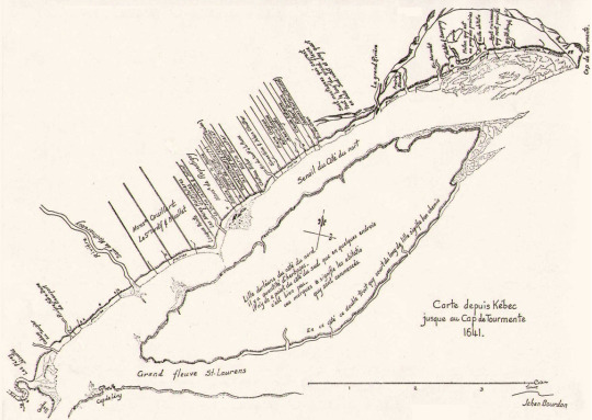
    Established in 1627 in New France, the seigneurial system was a feudal way of distributing land and creating subsistence farming for those who occupied it. It was ultimately abolished in 1854, but you can still see vestiges of it.

    With the seigneurial system, a typical farming lot was a long and narrow strip of land emanating from the water, which in this particular case was the St. Lawrence River. Here’s a map from 1641 showing what that looks like:

    image

    The reasoning behind this spatial arrangement was rather simple. By having long narrow lots, it meant that you could maximize the number of farmers who had direct access to water. This was needed for navigation, but also for many other obvious reasons. This was an efficient layout.

    At the same time, the long strips meant that each farmer had access to a broad cross section of different kinds of land. They had fertile land for growing, land for their home, and frequently land with trees so that they had material to build, fuel to burn, and so on. It also meant that, despite the overall lot sizes, people actually lived fairly close to each other. It created communities.

    Of course, there’s a lot more to the seigneurial system than just its physical form and there are reasons it was eventually abolished. But today I just want to focus on spatial layout. Because I think there are parallels to how we continue to plan our communities.

    If you live in a city you’ve probably come across a narrow rowhouse, a narrow townhouse, and/or a long and narrow condominium – which many people like to pejoratively refer to as a “bowling alley” plan. In these cases, the width of the home could be somewhere between 10 and 13 feet.

    If you stop and think about this, it’s exactly the same spatial principles as the seigneurial land use system. But instead of maximizing the number of people with access to the St. Lawrence River, it’s about maximizing the number of people who front onto the street and who have access to natural light.

    In tight urban conditions, it’s not uncommon to have no “side yard windows.” In my case, I live in a condominium with 20′ feet of windows on one side only. The other 3 sides of my box have none. And that’s a fairly common urban condition.

    I find this interesting because as much as the world is rapidly changing, some things don’t actually change all that much.

    Image: Wikipedia

  • Day 1 in Quebec City

    I just checked into the Chateau Laurier Quebec after a busy day touring the city. I don’t have a ton of time to write this post before dinner (though I have a few post ideas brewing). I did however want to share some of the day’s events and some of my photos.

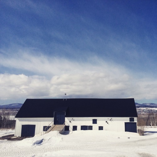
    After I landed I went straight to Île d’Orléans. I had never been there before so I’m glad I got the opportunity. It’s about twice the size of Manhattan and it has a population that hovers somewhere between 7,000 and 10,000 people depending on the season.

    The first stop was a “sugar shack”, which is apparently a big deal in Quebec and in the springtime. The place was packed. Here I had a traditional Quebec lunch (which was great) and I learned that all of the Canadian stereotypes are actually true. We really do put maple syrup on everything.

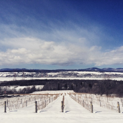
    After lunch I then asked if we could stop at a few of the local wineries. I love wine and I love wine culture.

    imageimageimage

    I picked up one bottle of “wine” from Cassis Monna & Filles. It’s actually made from black currants though, which I was told was illegal to grow in North America for a long time. It’s far more popular in Europe.

    The winery is run by a father and his two daughters. And I thought they did a great job with their brand story and their overall identity.

    After leaving the island, I then went to the Montmorency Falls. I had no idea Quebec had falls, but they do. And the vertical drop is bigger than that of Niagara Falls.

    image

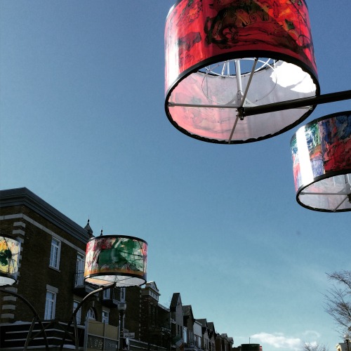
    Finally, I finished the afternoon with a quick tour of downtown and the OMA designed expansion to the fine arts museums. It has one aggressive cantilever.

    Here’s a video of the project. Click here if you can’t see it below. 

    [vimeo 111133943 w=500 h=281]

    If you’re interested, you can also follow my social posts on the Porter Escapes website by clicking here.

  • Architect This City x Porter Escapes (in Québec City)

    Towards the end of last year I received a one line email from a reader asking me what I thought about Porter (the airline that operates out of Toronto’s island airport downtown).

    I followed suit and responded with one line: “I’m a big fan.” I then pasted a few links to posts I had written where I talked about Porter, the island airport, and why I think they are good for Toronto.

    It turns out that was the right answer 😉

    Because today I’m excited to announce a fun collaboration between Architect This City and Porter Escapes. This weekend I get to explore Québec City and do something I love to do, which is photograph cities, think about cities, and write about cities. (And eat poutine.)

    Here are my travel essentials for the weekend (I wish it was a better photo):

    image

    The first thing I should tell you though is that Porter Escapes is different than simply Porter. Porter Escapes is their “packaged vacation” company, so it’s designed for people who want a simple way to book entire getaways (flight, hotel, activities, and so on).

    In my case, I’m going to be staying at the Château Laurier. I also have a bunch of activities planned out for Saturday during the day. Stay tuned.

    I had initially planned to squeeze in some snowboarding at Le Massif and try out the nicely branded train that goes from Québec City right to the mountain. But my back and shoulder are still tender from my spill in Banff.

    Still, I hope you’ll follow along on Twitter, Instagram, and Snapchat, and using #PorterEscapes. And if you happen to be in Québec City this weekend, let’s grab a pint and poutine.

    I’ve also been told that Porter Escapes will be launching a special promotion over the next few days for escapes specifically to Québec City.

    Note: I’m supposed to tell you that it’ll be at a price point that you should never expect to see again (i.e. it’ll be a steal).

    Happy Friday 🙂

  • A Third Coast Megaregion

    The distance between Chicago and Quebec City is roughly 1,000 miles (or 1,609 km). There are 6 major cities and a population of over 25 million people. You have the 4th and 5th largest cities in North America (Chicago and Toronto); the largest city in Canada; the capital of Canada; 2 different languages; 2 different countries; and 5 different states/provinces.

    image

    Now imagine if all of these 6 cities—Chicago, Detroit, Toronto, Ottawa, Montreal and Quebec City—were effortlessly connected through a high speed rail network, allowing you to travel from one end to the other in just over 5 hours. How would that impact the movement of people, goods and services across the region? How would it change our economies if you could wake up in Detroit and, without any lead time, travel 1 hour and 15 minutes to Toronto for a meeting?