Daily insights for city builders, delivered every morning at 6 AM ET. I’m Brandon Donnelly — a Toronto-based real estate developer and founder of Globizen. I’ve been writing here since 2013.

Tag: photography

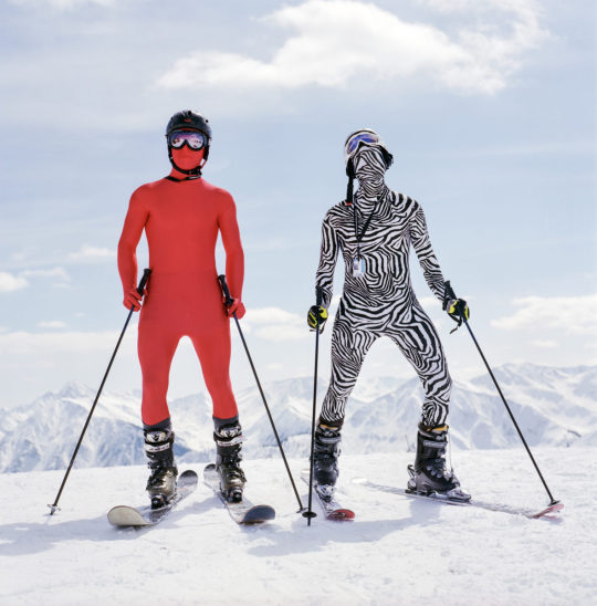
  • Unusual ski-spots around the world

    “Like so many sports that humans do,” he [Kari Medig] says, “skiing can seem absurd: sliding over the miracle of frozen water, slipping down steep mountains wearing layers of crazy clothes—it really is a strange thing to do.”

    I love skiing (well snowboarding to be exact). And I love photography. So here is an interesting photo essay from FvF about “the unexpected diversity of the ski community.” It features the work of Canadian photographer Kari Medig.

    Kari’s career is centered around photographing unusual ski-spots around the world. He has discovered that every locale has its own unique subculture. In some places, skiing is about status. But in other places, people depend on it for their livelihood.

    Eventually Kari hopes to turn this lifelong ski project into a book. I sure hope he does that. I bet it would do very well on Kickstarter. (On a largely unrelated note, his photos of Rio de Janeiro are at least 100x better than mine.)

    Image: Kari Medig
  • Documenting a city

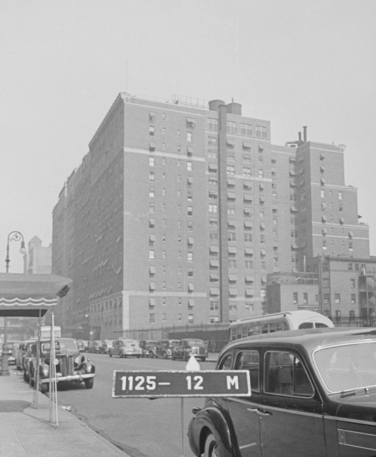
    Starting in the late 1930s, New York City began hiring photographers to document each and every building in the city. It did this to improve the accuracy of its tax assessments, and so every photo was taken with a sign board indicating the building’s block and lot number. The photos looked like this (taken from here):

    image

    The initiative produced over 700,000 black and white photos, all of which have been recently digitized according to the New York Times. The Times also recently published this interactive piece where they go back to these archival photos to see how the city has and hasn’t changed. 

    In the late 1930s and early 1940s, documenting a city and its buildings was clearly a manual endeavor. Today we have Google Street View (launched in 2007), which has now photographed much of the world. Many countries, including all of North America, are reported as having “mostly full coverage.”

    But already autonomous vehicles (and their supporting services) are starting to scan and map our cities in new ways. So it will be interesting to see what ends up getting built on top of this data. I am certain it will empower much more than just better tax assessments.

    Happy New Year, friends. Thanks for reading over the last year.

  • Man behind the map

    For those of you who are regular readers of this blog, you’ll know that I love to snowboard and that I leave Ontario every winter in search of fresh lines. It is an annual tradition that has been going on for over a decade.

    One of the things I wish I had been more diligent about is collecting all of the trail maps. I am sure I have a number of old ratty ones in some of my snowboard bags and snow pants, but none of them are probably worth keeping.

    That’s why I think this is a terrific Kickstarter campaign by James Niehues. Over the last 30 years, James has researched, photographed, and painted almost every ski map in use across North America. Yes, these maps are all painted by hand. 

    If you would like to back James’ project – a hardcover coffee table book of his work – you can do that here.

    https://www.kickstarter.com/projects/orsc/james-niehues-the-man-behind-the-map/widget/video.html

  • Leica Store Kyoto

    Yesterday I sent out this tweet about the, relatively new, Apple store in Kyoto

    It is the first in the city and I like what they did with the facade of the building. It is decidedly modern and yet there are hints of a local vernacular.

    Photographer Jonathan Castellino responded and suggested that I check out the new(ish) Leica store, which is also in Kyoto. 

    So here is that store (if you can’t see the video below, click here):

    [youtube https://www.youtube.com/watch?v=ouckkaj3XVc&w=560&h=315]

    I shoot on the Fujifilm X-T3, but Leica certainly makes some exquisite (and expensive) cameras. The Leica Store Kyoto does not deviate from that recipe.

  • Before & After — Miami Beach

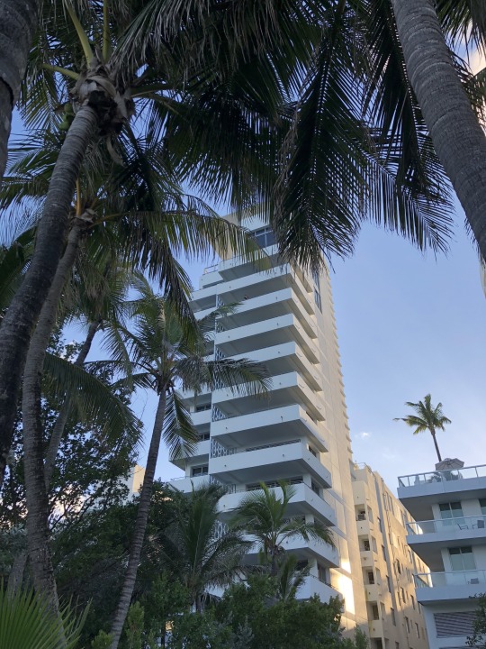
    We switched coasts today. Here is a photo of our Miami Beach hotel taken from the boardwalk with my iPhone:

    image

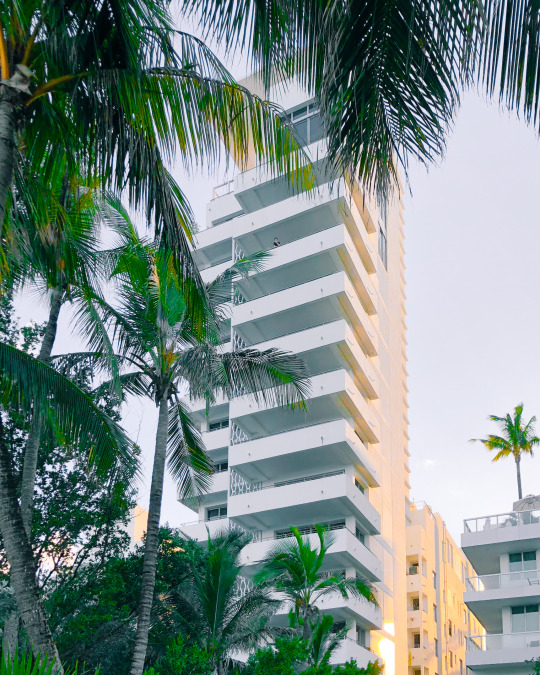
    And here is the after:

    image

    I took it into Lightroom. Fixed the alignment of the building. Whitened it, but brought out the beautiful warm sunset light on the north elevation. And I took the greenery in the foreground out of the shadows.

    The balconies remind me of one of Donald Judd’s “Untitled” pieces. He was one of my favorite artists. I also like the one dude leaning over that upper balcony. It gives the photo a tranquil feel, which is not usually how one would describe Miami Beach.

  • Toronto: 2000 vs. 2025

    Last week, Joe Berridge, Partner at Urban Strategies, gave a presentation at the Institute on Municipal Finance & Governance titled, Toronto: The Accidental Metropolis. I’ve seen Joe give similar presentations to this one before, and I always thoroughly enjoy his focus on Toronto’s position as a global city.

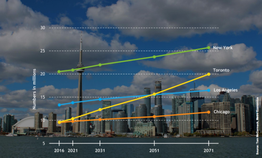
    Here is a slide from the presentation that projects out Toronto’s population to 2071 and compares it to the largest cities in the US.

    image

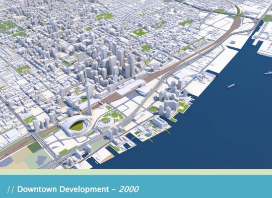
    But the two slides that have been really making the rounds online are the following ones. The first is a rendering of what downtown Toronto looked like in 2000. 

    image

    I remember this time clearly. Queen West seemed to end at Spadina. King West and Ossington weren’t things. And “Richmond and Adelaide” felt like the greatest club district in the world. (If you’re not from Toronto, these references will likely mean nothing to you. Sorry.)

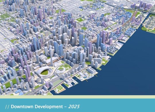
    The second slide is a rendering of what Toronto will look like in 2025. The transformation is just incredible.

    image

    I’ve seen some people comment that the Toronto of 2000 was relatively affordable; the Toronto of 2018 is unaffordable; and the Toronto of 2025 will be even more unaffordable with all of this new development.

    But I don’t understand that logic. Considering the growth rate shown in the first slide, imagine how unaffordable this city would be if we weren’t building new places for people to live and new places for people to work.

    For the full slide deck, go here. And for recent aerial photos of Toronto’s downtown core, check out my Instagram page.

  • Photography heli tour

    Tonight I went a photography heli tour with @normandthegang

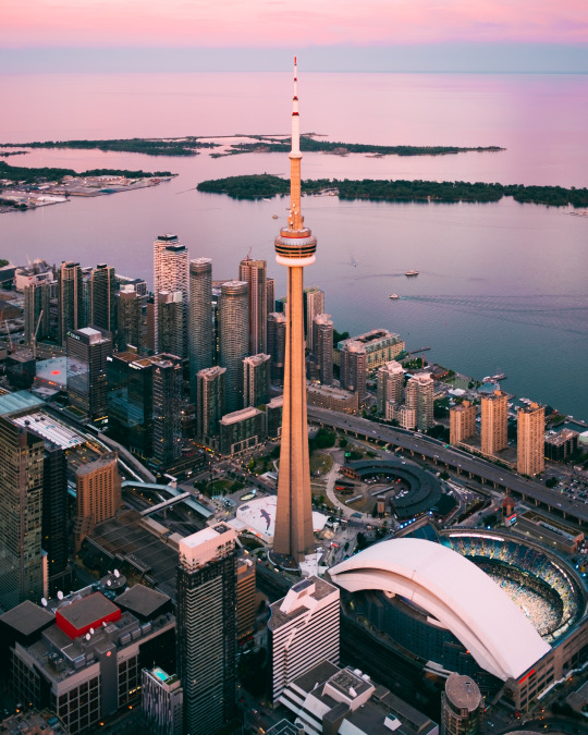
    I took almost 500 photos, including a bunch of aerials of our development sites. And we got lucky with a pretty spectacular pink sunset. 

    Here is a photo that I took of the CN Tower with my Fuji X Series (35mm prime lens):

    Lake Ontario actually looked like that. This is not post-production chicanery. Follow me on Instagram to see the rest of the photo series.

    Thanks again for the invite Norm. That was a lot of fun. 

  • DANCHI DREAMS

    Below is an interesting Kickstarter project by photographer and art director Cody Ellingham. I think many of you will appreciate it. It is a photobook of Japanese public housing apartments, which are known as Danchi. All of the photos were taken by Cory at night, hence the dream part. The book is about the promise that these projects represented in the post-war years, but it is also about their decline in the subsequent decades.

    https://www.kickstarter.com/projects/cbje/danchi-dreams-a-photobook-of-japanese-public-housi/widget/video.html

  • Urban American life before the car

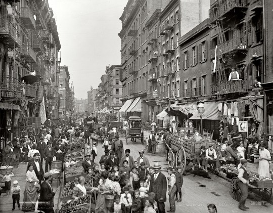
    This morning I stumbled upon an old (2013) post from Rebel Metropolis that documents urban American life through street photos taken before the automobile. 

    Above is Little Italy, New York City, 1900. All of the photos in the post are from Shorpy

    The photos are beautiful architecturally and from a photography standpoint. But as is pointed out in the post, they also speak to a different kind of street:

    What’s more, the street here is not purely the thoroughfare – it is the essential common gathering place for demonstrations, for buying and selling food, for children to play in, for celebration, for lingering and people watching.

    That sounds like a great street. And now I am off to start my day. Because I have meetings all around the city today, I’ll be driving to the office. 

  • Tropical Tobermory

    image

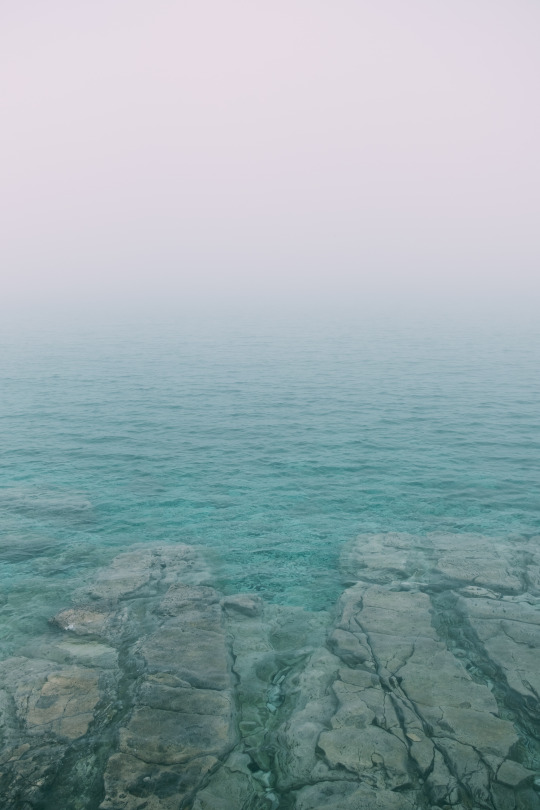
    I am in Tobermory at the tip of the Bruce Peninsula right now. 

    Above is a photo of the shoreline along Little Dunks Bay that I took with my Fuji. The water looks positively tropical, but it’s probably about 4 degrees celsius. It was perfect for chilling our ciders after a 2 hour hike through the woods.

    Sadly, I forgot the charger for my MacBook Pro back in the city, and so this – some photography – is all you’re going to get from me until I am back at my desk on Sunday evening.