Daily insights for city builders, delivered every morning at 6 AM ET. I’m Brandon Donnelly — a Toronto-based real estate developer and founder of Globizen. I’ve been writing here since 2013.

Tag: location data

  • Location data companies Foursquare and Factual announce merger

    This week it was announced that Foursquare and Factual are planning to merge. Both use location data to improve advertising and overall business intelligence. But unlike Foursquare, Factual doesn’t have a consumer-facing app. So most of us probably haven’t heard of them before. But they are some of the data and tech behind many of the companies that we do all know, including Starbucks.

    I have long been fascinated by location-based startups — like Foursquare — because they are inherently spatial. And how we move about our cities and spaces is rich with information. Companies want this data because, among other things, it is a register of intent. Me going somewhere signals certain things, including where else my kind might want to go.

    But location data can also be used for many other things beyond advertising and retail analytics. Foursquare has started sharing aggregated and anonymized foot traffic data with local governments and public health officials in the fight against COVID-19. That data is currently powering http://www.visitdata.org. Foursquare is also publishing a regular insights report.

    Here is a chart from them showing casino visits in Clark County since March 1:

    In many ways this chart is fairly obvious. In fact, it actually mirrors my own journey into isolation. After the NBA shutdown on Wednesday, March 11, things started to feel pretty real and on Friday I was working from home. But there’s a lot more that can be done with location data and there’s a lot more that will be done going forward. I am confident that will help not only business, but also society more broadly.

  • Mapping spring breakers

    The following video was published last week showing the “secondary locations of anonymized mobile devices that were active at a single Ft. Lauderdale beach during spring break.” Said differently, the company used anonymized mobile phone data to see where spring breakers went after they left the beach. This was in order to better understand how they may have contributed to the spread of COVID-19. If you can’t see the video below, click here.

    The video is astonishing for two reasons. One, it shows you the extreme reach of just one beach in South Florida. Imagine if they had analyzed all of the beaches up and down the coast. And two, a lot of you are probably freaked out that this sort of mobile phone data is available to private companies. If you’d like to learn more about how this all works, check out this opinion piece from the New York Times.

  • Rules for location data

    The CEO of Foursquare — Jeff Glueck — published an interesting op-ed in the New York Times today, calling on Congress to regulate the location data industry. Currently, there are no formal rules in place.

    In case you’re not aware, Foursquare is one of the largest independent companies operating in this space. I have written about them many times before on the blog.

    Here’s an excerpt from Jeff’s op-ed explaining why this matters:

    But location data can also be abused. Bounty hunters were able to buy the current location of a cellphone for $300, Vice reported, because telecom companies sold the real-time location of phones to shady companies. And apps that track location data may turn around and sell that data, revealing someone’s every movement — whether it is to a retail store, an abortion clinic or a gay bar. Bloomberg Businessweek recently reported on a company with thousands of cameras selling car locations to debt collectors and others; there is no “opt-in” involved, and it’s illegal in all states to cover your license plate.

    I am writing about this today because I think it’s relevant to city building. Location data is inherently spatial. It is how we exist in cities. So it shouldn’t come as a surprise to any of you that this is valuable information — hence why it is being abused.

    Here we have a company advocating for more, not less, regulation. They, of course, want it to be sensible. But I still think it says things about the current location data environment. To learn about the specifics of what Jeff is proposing, click here.

  • Using tweets to measure social connectedness in cities

    This recent study used geotagged tweets to measure social connectedness within American cities. There are two measures: (1) concentrated mobility and (2) equitable mobility. The first measures the extent to which social connections (geotagged tweets) are concentrated in a set of places within the city. And the second looks at the degree in which people move between neighborhoods in roughly similar proportions. These measures are the y-axis and the x-axis, respectively, in this graph:

    So how do you read this chart?

    Well if you look at New York, you’ll see that it is relatively high in concentrated mobility, but the lowest in terms of equitable mobility. This means that social connections are highly concentrated and that there’s low connectedness to other neighborhoods within the city. Miami, on the other hand, is the opposite. It’s also an outlier. Few hubs. But its social connections appear to cross neighborhoods and spread across the city.

    Perhaps not surprisingly, the study found that the size of a city seems to have the biggest impact on social connectedness. Which makes sense — it becomes harder to get around and so people start to localize. I am reminded of this whenever my friends in Los Angeles tell me they never go to the beach because it’s simply too difficult and too time consuming to get across the city.

    This also became clear to me after I started playing around with the Moves App back in 2015. The app no longer exists, but it was an activity tracker that allowed you to map where you, well, moved. And the more time you spent in one place, the more concentrated the activity would become. They depicted this through larger and larger circles. Example maps, here. My maps revealed that I need to branch out into different neighborhoods more often.

    To download a full copy of the study, click here.

    Chart: CityLab

  • Meet Replica

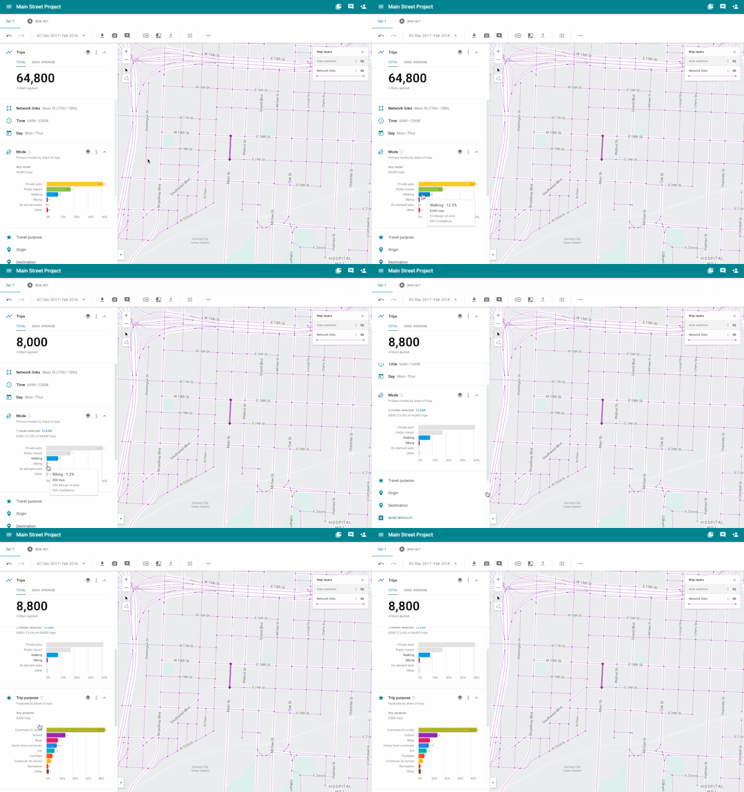
    Sidewalk Labs is currently building out a platform called Replica that will support them in their development plans here in Toronto. Replica is

    “a user-friendly modeling tool that uses anonymized mobile location data to give planning agencies a comprehensive portrait of how, when, and why people travel in urban areas.”

    Here is a preview of the Replica dashboard showing a section of Main Street in Kansas City. I hope the animated GIF shows up for you.

    The platform uses a combination of mobile location data (~5% of the population) and on-the-ground checks, typical stuff like manual traffic counts and transit boardings.

    The goal is to understand in real-time who is using a street, as well as how (driving? cycling?) and why (going to work?).

    Their introductory blog post obviously stresses the importance of personal privacy, but I am curious how they determine where people are going.

    I suppose if they pair journeys with destinations (and the durations at those destinations) they can make reasonable assumptions around the why.

    I think the benefits to all of this are clear. But does any or all of this worry you from a privacy standpoint?

  • Introducing Polyform Labs

    image

    A few weeks ago I had coffee with a friend of mine who is a partner at a Toronto-based enterprise software company called Polyform Labs. Their products are geared towards the commercial real estate industry and, since I’m a big proponent of introducing more technology into the real estate space, I thought I would share a little bit about them with you all today.

    The first of their 4 main products is called Lingo, which is a machine learning tool that helps companies quickly review legal documents and contracts. In the case of commercial real estate firms, the most obvious use case is leases. These documents are often hundreds of pages long and, if you have a big portfolio of properties, I’m sure you can imagine how quickly these pages add up.

    What’s neat about Lingo is that you basically upload a lease and then the tool interprets and summarizes all of the clauses for you. It then tells you where you’re potentially exposed and where your risk factors are. And if by chance it gets it wrong, you can correct it and the system will actually get smarter – hence the machine learning part.

    I’m not going to go through their entire product line, but I did also want to mention one more called Aura. They call it a “location-aware loyalty engine”. And you may have heard of similar products out there in the marketplace. What it does is use the MAC address on mobile phones (which is a unique, but anonymous, identifier) to track how people and crowds move through spaces.

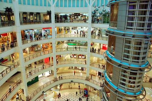
    The most common use case I’ve come across is within shopping malls and retail spaces. It’s used to determine which stores have the most foot traffic, which departments and aisles draw the most people, how long people stay in each store, where they buy, and so on. So even if you didn’t already know about this technology, you may have already been giving up your location data. There are lots of mall landlords using it.

    And it’s producing some interesting data. For example, as soon as somebody buys one thing in a mall, their propensity to buy something else grows exponentially. This is what the data tells us and I can certainly relate to it from my own experience. So as a mall landlord and tenant, you are obviously trying to figure out ways to encourage people to make that first purchase. 

    The other use case that (obviously) came to my mind was with respect to city planning and urban design. How could we harvest anonymous location data to improve the way we design both our private and public spaces? Imagine if we had this data for subway stations, public parks, public plazas, and so on. I bet we would discover all kinds of ways to improve the experience within our cities. I’d like to see the location data for Trinity Bellwoods Park in Toronto on a sunny summer day.

    But I digress.

    If you’d like learn to more about Polyform Labs and their real estate products, click here

    Image: WPC