Daily insights for city builders, delivered every morning at 6 AM ET. I’m Brandon Donnelly — a Toronto-based real estate developer and founder of Globizen. I’ve been writing here since 2013.
I rediscovered the maps and work of Alasdair Rae this morning. (He has appeared on this blog before in posts like this one here.) Alasdair works in the Department of Urban Studies and Planning at the University of Sheffield and is author of the blog, Stats, Maps n Pix. Recently, he’s been publishing maps showing population densities around the world. He also gets into the details of how they’re made. They are pretty cool to see.
Here are the Great Lakes.
a little bit more mopping up of this thread, just to share a few final outputs – first up is a map of the eastern Great Lakes, this time with some labels – I didn't add labels to any of the others but I may do in future pic.twitter.com/TfjAvF08CQ
And here is Brazil, as well as a map of the world (without any land shown). Canada and the United States barely register on this second one.
and, as a little experiment, I did one with just spikes – no land. I think this makes it easier to see some places – e.g. check out New Zealand or Hawaii, or even Reykjavík if you look closely. pic.twitter.com/qKxSLd120i
Dezeen just published the below video of Chicago’s revitalized riverfront. The Chicago Riverwalk extension and renovation was completed in 2016 by Boston-based Sasaki Associates and Ross Barney Architects, and the video is by Chang Kim. It does a great job showcasing the city’s enviable connection to the water. If you can’t see it below, click here.
On a separate but somewhat related note, I am continually impressed by the work that is coming from filmmakers, vloggers and YouTubers like Casey Neistat and Sam Kolder (who, by the way, is from Toronto). Individual content creators continue to change the way we all consume content and, consequently, the way companies now need to market.
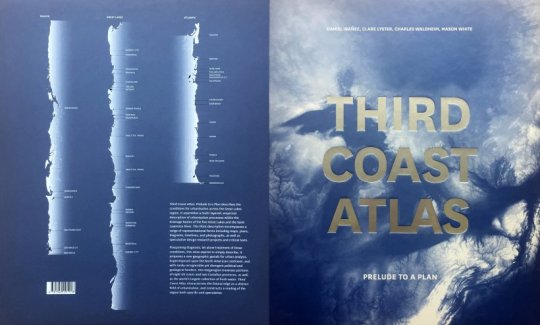
Daniel Ibañez, Clare Lyster, Charles Waldheim, and Mason White have just published a book analyzing the Great Lakes and the Saint Lawrence River. It’s called, Third Coast Atlas: Prelude to a Plan.
The Great Lakes represent the world’s largest collection of freshwater; a feature that is likely to become
only
more valuable. Their coastline is longer than the Atlantic and the Pacific coastlines of the US, combined. Hence the name “Third Coast.”
The reason the book is called a “prelude to a plan” is that it doesn’t propose a plan or a path forward. Instead, it is focused on analyzing the current state. Here is an excerpt about the book taken from the Daniels Faculty:
Third Coast Atlas: Prelude to a Plan describes the conditions for urbanization across the Great Lakes region. It assembles a multi-layered, empirical description of urbanization processes within the drainage basins of the five Great Lakes and the Saint Lawrence River. This thick description encompasses a range of representational forms including maps, plans, diagrams, timelines, and photographs, as well as speculative design research projects and critical texts.
I find this topic fascinating and I suspect that many of you might as well. It’s also an important one. So I wanted to get it on your radar. If you happen to be in Toronto next week, the launch/book signing is happening this Tuesday, October 24, 2017.
A few weeks ago I wrote a post talking about megalopolises and the importance of the Great Lakes region in North America. And I suggested that high speed rail could be one way to better stitch together the region.
To some, I’m sure this sounded like a bit of a pipe dream. But thinking at the megalopolitan scale is something that I think we are going to need to do. Other parts of the world certainly are.
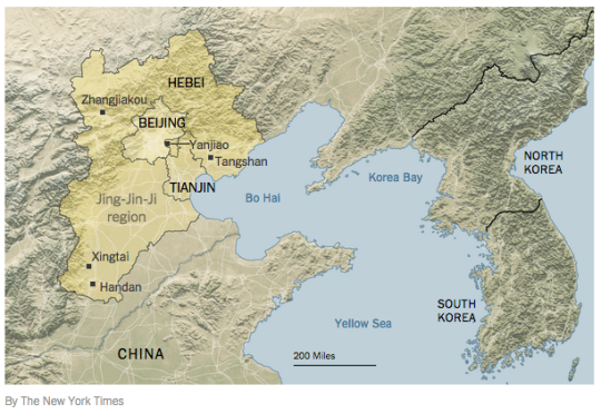
As part of the plan, a high-speed rail network is being built that will bring the region’s major cities within an hour’s commute. The objective is to compete with the Pearl River Delta and the Yangtze River Delta regions in the south.
It’s a scale of planning and development that most people aren’t used to thinking about. But it’s happening right now.
“Make no little plans. They have no magic to stir men’s blood and probably themselves will not be realized. Make big plans; aim high in hope and work, remembering that a noble, logical diagram once recorded will never die, but long after we are gone will be a living thing, asserting itself with ever-growing insistency. Remember that our sons and grandsons are going to do things that would stagger us. Let your watchword be order and your beacon beauty. Think big.”
-Daniel Burnham, Chicago architect. (1846-1912)
I’m a big fan of Chicago. Having now visited the city, I can say that everyone was right when they told me that I was going to love it. It has great art and architecture, great food (with some of the largest portions I’ve ever seen), great nightlife, and great people.
But I don’t want to talk about any of these things today. Instead, I want to talk about something much more specific that stood out to me last weekend: Chicago’s relationship to both the water and the street.
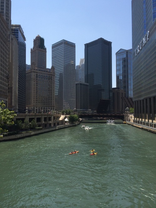
While Chicago and my hometown of Toronto share many similarities– including being situated on a Great Lake and having rivers flow through the middle of them–the relationship to these bodies of water is remarkably different. Here is a photo of people kayaking in the Chicago River on a Friday afternoon:
What impressed me about Chicago is how intimate and urban the relationship is with the lake and its rivers. If you look at the photo above, you’ll see that many of the buildings are built right up against the river, but that there’s space allocated for riverwalks, patios, and so on. It’s all about engaging and connecting with the water.
Toronto on the other hand, is only recently starting to reacquaint itself with its bodies of water. We spent much of the second half of the 20th century with our back turned to the lake and without a strong urban connection to the Don River. And if I had to guess why it’s because we built highways along them.
We built the Gardiner Expressway adjacent to Lake Ontario and we built the Don Valley Parkway adjacent to the Don River. This fundamentally changed our orientation and largely precluded us, I think, from creating the same kind of waterside urbanity offered in Chicago.
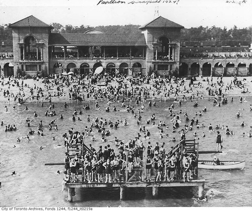
As an example, consider that in the first half of the 20th century, Toronto’s Parkdale neighborhood – which today still has a questionable reputation – was actually an affluent and desirable waterfront community filled with beautiful Victorian mansions. It was well connected to the waterfront, and so the area flourished. Here’s what Sunnyside Pavilion used to look like:
But then in the 1950s we built the Gardiner Expressway, disconnecting Parkdale from the lakefront and destroying many of its amenities, such as the Sunnyside Amusement Park. In turn, the rich people left and their large Victorian mansions got chopped up into rooming houses and other rental housing stock. And in my view, Parkdale still hasn’t fully recovered from this.
Highways are divisive. There’s no question.
So unless you can afford to bury them, it comes down to trade offs: Do you want to make it easier for people to drive in from the suburbs or do you want a truly spectacular water or riverfront? In the 1950s we chose the former. But even still today, the thought of tearing down–even a portion of the Gardiner Expressway–is fraught with opposition. I guess not much has changed.
The second way that Chicago impressed me is through the relationship that many of its buildings hold to the street. They come down to ground level with authority and with great retail presence, and often make no amends about their mass and impressiveness. This frames the street and creates a level of urbanity that isn’t always found in Toronto – particularly outside of the downtown core.
In Toronto, the trend today is towards street level podiums, significant setbacks, and delicate point towers that minimize the impact of their height and allow for natural light to reach street level. It’s well-intentioned and perfectly appropriate in many urban settings. But sometimes you need a little urban assertiveness. Sometimes you want to impress and impose. And Chicago does that.
What I’m getting at is that Chicago architect Daniel Burnham was on to something. He famously advocated for man (that was the era) to think big. Make no little plans, he said. And it’s admirable advice. Toronto is going through a tremendous transformation right now. We’re North America’s boomtown, which is a title that Chicago would have held at one point.
But as we build for the future, let’s remember that, long after we’re gone, we’re going to be judged based on the plans we are making today. So why not make them big ones.
Before visiting Chicago for the first time, everybody told me that I was going to love the city. They would tell me that it’s similar to Toronto, except that it has better architecture and a better waterfront. Having now visited the city, I not surprisingly have a lot to say on this matter. But I need another day or so to formulate my thoughts.
In the interim, I thought it would be fun to host a little competition. Given that both Chicago and Toronto are Great Lake cities of comparable size (and formally sister cities), I’d like to know: Which city, do you think, has the better skyline? Please respond in the comment section below and make sure to include your location (so we all know if you might have a hometown bias).
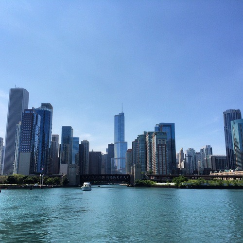
To help you make your assessment, here are a few photos. Below is one that I took of the Chicago skyline from the architecture boat cruise we went on yesterday afternoon. The building directly in the center is the Trump Chicago.
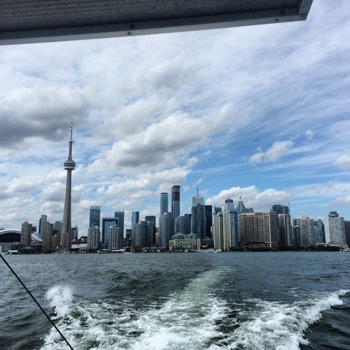
And here’s a photo of the Toronto skyline that I took from a water taxi earlier this summer.
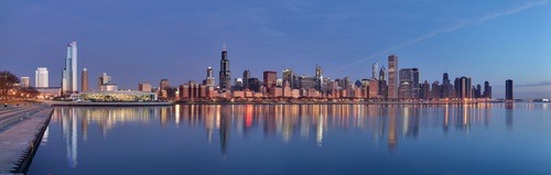
But since these photos only represent one particular vantage point (me on a boat), here’s a set panoramic photos that I found online (Chicago & Toronto). I want to be as fair as possible.
I think this one could go either way. But I personally like the variety that the lit up CN Tower and Sky Dome (Rogers Centre) bring to Toronto’s skyline. Overall, it feels a lot more modern and exciting to me. So I pick Toronto. What about you?
I’m flying out to Chicago this morning, and so I don’t have a lot of time to write. But I am taking my iPad with me and I plan to continue writing every day that I’m there. As some of you might remember, I’ve never been to Chicago before. This will be my first time. So I’m expecting lots of writing inspiration.
That said, I’m going for a bachelor party and so I may not get the chance to geek out about the city as much as I normally would. There certainly won’t be any any Frank Lloyd Wright pilgrimages taking place. However, I have convinced the group that the architecture boat cruise will be a great way to see the city and a nice way to start off the day following a late night.
If you’re from Chicago (or just know the city well) and have some must-see recommendations, I’d love to hear from you in the comment section below. I’m excited to visit Chicago because it’s another Great Lakes city and I’m told it’s somewhat similar to Toronto. It’ll be interesting to see how they compare and differ.
This may sound crazy, but I’ve never been to Chicago. It’s on my list, but I just haven’t gotten around to it and I’ve never had a specific reason to go. Hopefully I can make it this summer.
Lately though, I’ve found myself reading more and more about the city. Given that it’s also a Great Lakes city and it’s of comparable size, Chicago is an interesting case study for Toronto. But one thing that seems to keep coming up, is the need for zoning reform.
About a month ago I wrote a post called “The tale of 2 Chicagos”, which was inspired by the blogging of Aaron Renn (The Urbanophile) and Daniel Hertz (City Notes). The discussion was around the prevalence of single-family zoning in most parts of Chicago and how it’s creating a supply constrained market (driving up prices).
When places in and around downtown become more desirable, developers build more housing, and more people get to live there. But when non-downtown neighborhoods become more desirable, developers can’t build more housing: it’s against the law. So instead, they profit by tearing down old two-flats and building mansions in their place. And as a result, fewer people get to live in those neighborhoods, even as more and more people want to.
Effectively, his argument is that gentrification leads to a loss of housing units. Developers can’t build more housing, so they replace housing. And it all stems from a restrictive zoning code that aims to maintain the character and scale of established neighborhoods. I get that, but you could easily argue that it exacerbates the negatives of gentrification.
It strikes me that Toronto and Chicago are in somewhat similar places in terms of their growth. Without any real natural barriers, both cities had the luxury of being able to develop through horizontal sprawl when they were younger.
But with people now returning to city centers, we’re faced with a series of difficult decisions: How do we balance preservation and growth? How do we balance low-density with high-density? How do we maintain the character of what people love while still creating an inclusive city?
It absolutely can be done, but it’s going to mean embracing a certain amount of change. And that’s not always an easy sell.
[vimeo 70039050 w=500 h=375]
The Great Lakes Century
Since 2009, architecture firm SOM has been working on promoting awareness and developing a 100-year vision for the Great Lakes and St. Lawrence River Basin region. With 20% of the world’s surface fresh water and with over 50 million people living in the region, it’s an hugely important discussion to be having.
The video above is called the Great Lakes Century and it’s a good overview of the region’s importance, as well as SOM’s goals. If you happen to be in Chicago, there’s also an exhibition going on right now at the Chicago Architecture Foundation. It’s calledGreat Cities, Great Lakes, Great Basin.