


Shot on a DJI Mavic Mini and edited in Lightroom.
Daily insights for city builders, delivered every morning at 6 AM ET. I’m Brandon Donnelly — a Toronto-based real estate developer and founder of Globizen. I’ve been writing here since 2013.
Shot on a DJI Mavic Mini and edited in Lightroom.
Many of you have probably visited or seen videos of the Maeklong Railway Market in Bangkok. (I’ve done the latter, not the former.) It is one of the largest seafood markets in Thailand and it is literally housed on the railway’s tracks. Every time a train passes through, the entire market needs to be pulled up and relocated. Even the awnings that cover the market need to be collapsed. The videos I’ve seen have all been taken from grade. But the below video (via Vala Afshar on Twitter), showing the market in plan view (from what was likely a drone), is arguably even more impactful. There isn’t a foot of wasted space.
Toronto-based Drone Delivery Canada has just signed a $2.5 million agreement with the Moose Cree First Nation. This will bring the company’s drone delivery platform to the Moosonee and Moose Factory communities in northern Ontario (about 19 km south of James Bay).
Here is an excerpt from a recent Techvibes article:
“This agreement is representative of the large ‘Remote Communities’ market that we see penetrating over the next three to five years,” said Tony Di Benedetto, CEO of DDC. “The Remote Communities market is only one segment of the overall total addressable market in Canada. In addition to Canada, DDC is working with other customers around the globe to licence our FLYTE software and drone delivery technology.”
DDC’s Sparrow drone is able to handle 5 kg (~11 pound) payloads and will be used to transport letters, parcels, medical supplies, and other general necessities.
This is a big deal for Moose Factory because the island can only be accessed by boat in the summer, ice road in the winter, and by helicopter during the rest of the year. And this is not a unique situation for remote communities.
Suboptimal infrastructure and connectivity is a common problem and generally results in a higher cost of living, among other things. So this strikes me as something that should have meaningful impact on the quality of life in these communities.
Dezeen, the architecture and design magazine, has a documentary out called Elevation – How Drones Will Change Cities. It premiered in Hong Kong in March and is supposed to be widely available this month. I’m not exactly sure when that is happening, but below is a trailer. If you can’t see it below click here.
[youtube https://www.youtube.com/watch?v=YSlep5XCpaw&w=560&h=315]
Included in the trailer is footage of a delivery drone concept by design consultancy PriestmanGoode called Dragonfly. Norman Foster also talks about the development of “aerial highways.” It’s 2018 and we were promised flying cars by this point. But flying drones, similar to what’s in the above trailer, seem more probable right now.
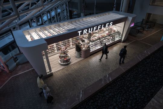
Sidewalk Labs recently ran a thought experiment where they came up with 5 possible scenarios for the future of retail and, more specifically, what they may mean for our streetscapes. You can read all about them here, but my mind lumps them into 3 broad categories.
First, there’s the temporary/pop-up/independent scenario. This one is all about flexibility and speed. It’s about web-first retailers who don’t have, need or want permanent stores and about empowering small scale business owners. This makes sense. The internet has decentralizing forces.
The second one takes retail in the opposite direction. It’s about going all in on physical stores; upsizing them and making them even more over the top and Instagram-able. This one also seems intuitive given that we’re already seeing this trend with malls. Many/most are dying and the surviving ones are trying to go as high end as possible.
The last scenario takes vacant and underutilized retail on the fringe and turns them into “digital dispensaries.” This one is entirely utilitarian and void of any streetscape/urban considerations. It’s about autonomous electric vehicles picking up your goods through drive-thrus and on-demand drones dispatching your toilet paper after you hit that Amazon Dash Button.
This feels like a good list. I think you could argue that the writing is on the wall for all of these scenarios.
Photo by Lance Anderson on Unsplash
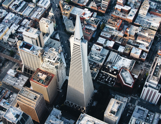
Real estate companies often have a need for aerial photography. Perhaps you want to showcase an existing building. Perhaps you want to capture the views from a future/proposed building. Or perhaps you’d like to document a building under construction.
Usually in the latter case, you have to find a neighboring building and negotiate some sort of agreement so that you can place a camera on it and document your construction site. This is probably still the solution if you want a clean time lapse video.
But drones have opened up a new world of possibility and today I thought I would share with you a company called DroneBase. They’ll probably hate that I’m making this reference, but one way to describe them is Uber for drones. They connect a “large network of drone pilots” to customers needing drone footage for commercial or creative purposes.
If you take a look at their website, you’ll see that they cater a lot to the real estate and construction industries. I’m not sure how active they are in Toronto and Canada right now, but if they aren’t that active I’m sure it’s only a matter of time before they are.
And over time, I am sure that a network like this will only mean faster, better, and more affordable aerial footage.
Keeping with yesterday’s theme of urban density, here is a photo by Andy Yeung that I am embedding via his 500px page:
The photo is of Hong Kong and it was taken using a drone. Click here for other photos from his “Urban Jungle” drone series.
If you remember the maps from yesterday, you might remember that Hong Kong had a peak residential density of around 111,100 people per square kilometre (2013).
Above is what that generally looks like.
