Daily insights for city builders, delivered every morning at 6 AM ET. I’m Brandon Donnelly — a Toronto-based real estate developer and founder of Globizen. I’ve been writing here since 2013.
It is often difficult to grasp. This is why when you look at an empty piece of land, it can sometimes be difficult to visualize actually fitting a building on it. And why when you look at an empty room, it’s common to think, “there’s no way that furniture will fit in here.” But in the end, it does fit.
It also tends to be relative. Here in North America, it is common to argue over things like parking space dimensions and drive aisle widths. We’ll say things like, “well, people like their big cars.” But then you travel to Europe and you find streets like this:
And this:
The first is only marginally bigger than the width of a parking space in Toronto (2.6 meters). And the latter is only marginally bigger than the width of a typical two-way drive aisle (6 meters). So are these too small? Well, it depends on your perspective.
If your basis of measurement is the size of cars, then these streets will seem too small. Cars also keep getting bigger, so you have this inflation factor to deal with. But if your basis of measurement is something else, such as walkability, then maybe they’re just right.
Traffic congestion and a lack of affordable housing are two clearly defined problems facing most, if not all, major cities. We know they exist. We call them crises. And yet, we can’t seem to implement effective solutions, even though we know what they are. Why is that? In her new book, On The Housing Crisis: Land, Development, Democracy, Jerusalem Demsas makes the argument that it is a failure of local democracy. There is a disconnect between what we say we want to happen and what we are actually doing. This resonates with me. In my mind, it’s looking upstream at what is bottlenecking us from making the decisions that will produce better outcomes for our cities. So after reading this conversation with her about the new book, I decided to buy a copy.
I was very impressed by Bordeaux’s tramway network. It felt like no matter where you were in the city, there was a tram gracefully passing you by. Here’s a high-level summary of the system:
The network has 4 lines and a total route length of 77.5 km.
The first line opened in 2003.
The network has 130 stops, which crudely results in an average stop spacing of around 600 m.
The system pioneered ground-level power supply for the trains, which means no overhead wires. Supposedly this caused some issues upfront, but now it seems to be working just fine.
Most of the network runs on a dedicated right-of-way (en site propre). Meaning, the trains don’t compete with car traffic. Many of the lines are quite beautiful too – see above video.
In 2018, the network carried close to 100 million people. This is in a city of ~260k people and a metro area of ~1.4 million people (2020).
The key differentiators for me are (1) the stop spacing and (2) the fact that most of the system runs on its own dedicated right-of-way. These are two reasons why Toronto’s streetcars perform so poorly. They stop too frequently. And most of the lines have to compete with traffic.
So why bother? Walking can be faster.
Bordeaux shows that — if you implement light rail correctly — you can actually move a ton people efficiently. With surface rail, you can also build out a robust network in a relatively short period of time.
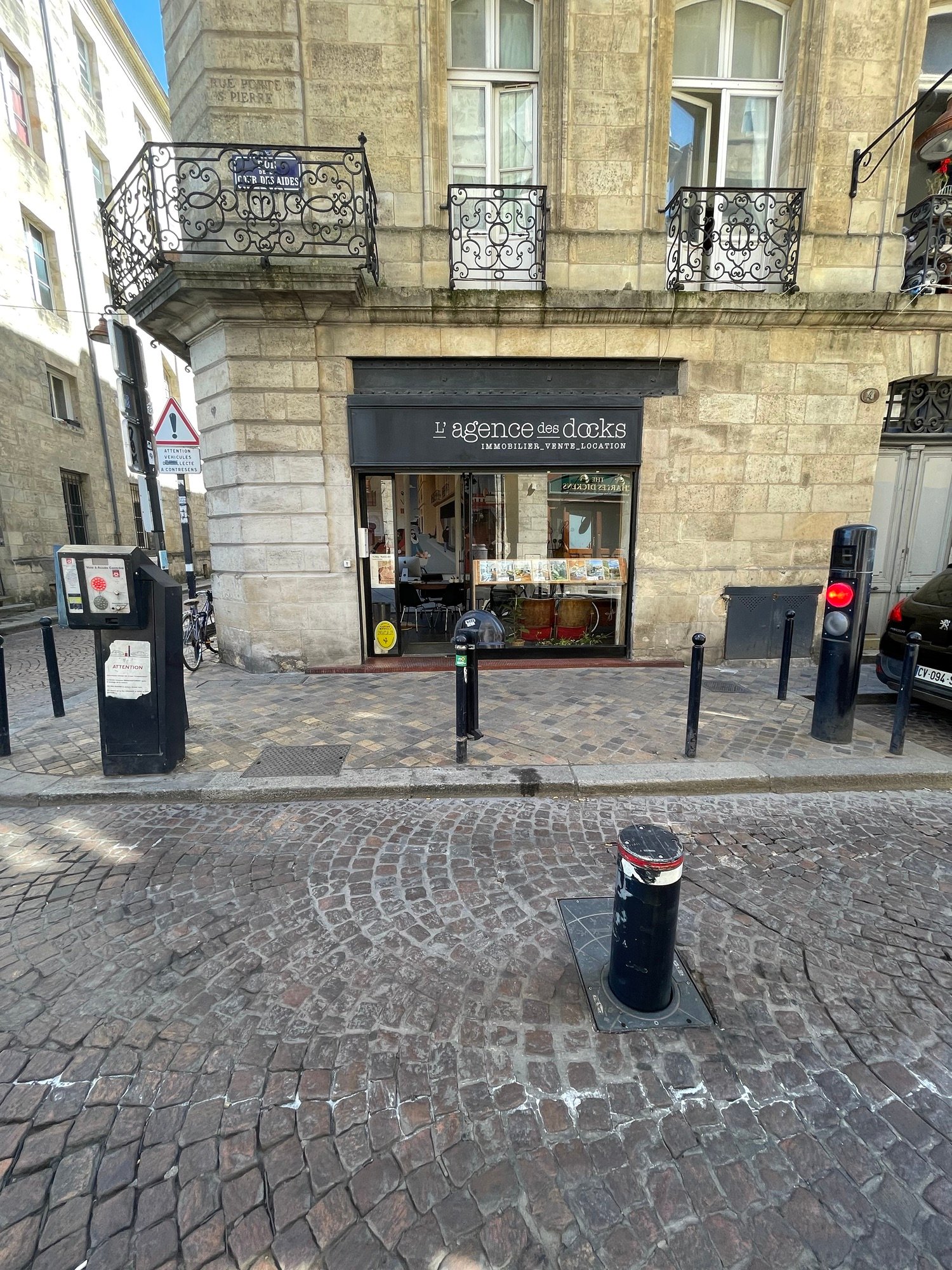
The mighty — and automatic — bollard is an important city-building tool that isn’t employed nearly enough in North America. It’s typically used to control car access to small pedestrian-only or pedestrian-first streets. But I guess if you don’t have any of these, then you may not feel the need to install such a device. The above photos are from Bordeaux. And if you want to gain access, you need to hit the intercom button and explain why you’re local traffic. Can you think of any streets in your city that could use a system like this? I can think of many in Toronto.
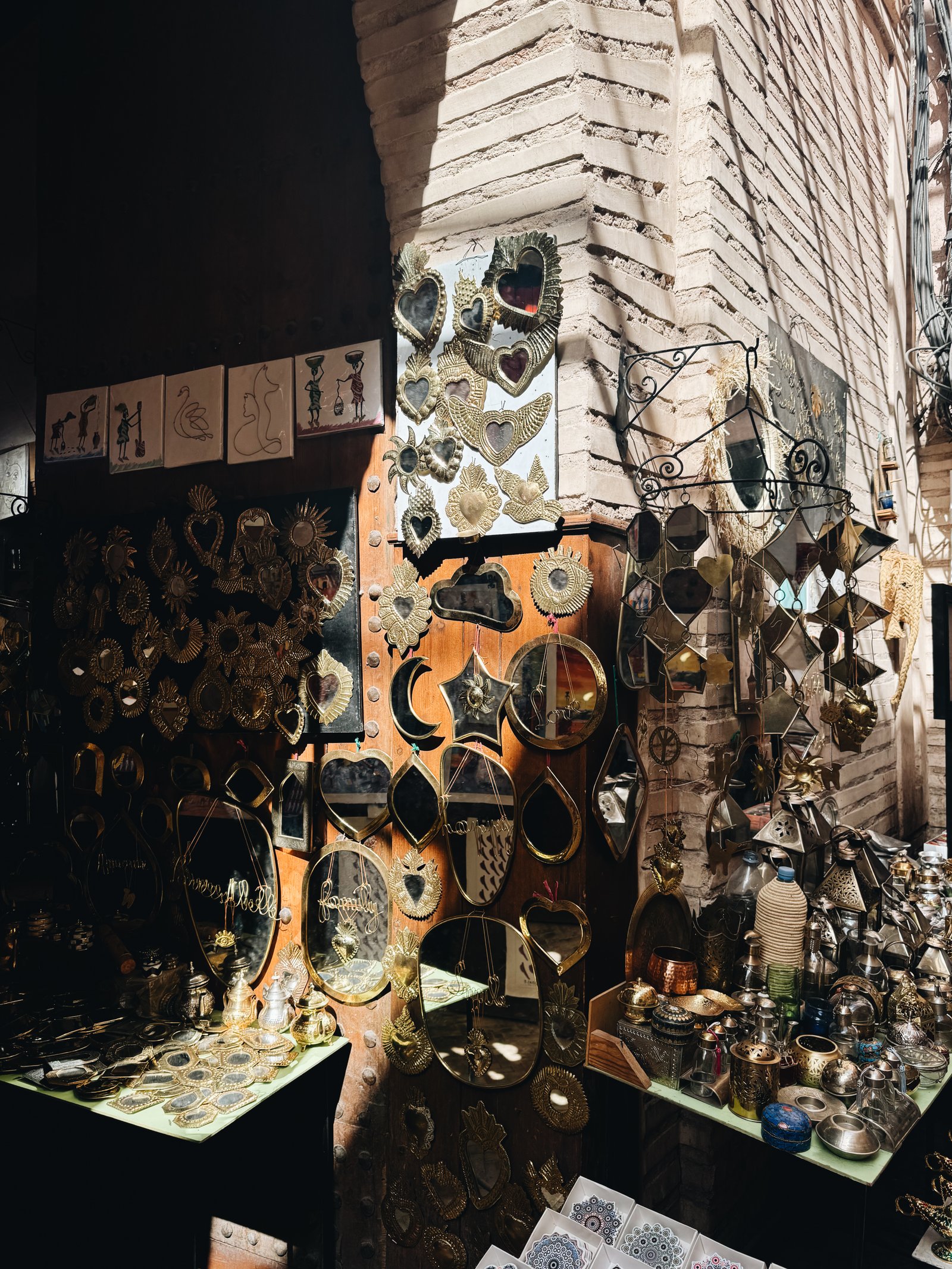
Marrakech is one of the most frenetic, vibrant, and exciting cities that I have been to in a long time. Walking through the Medina means walking on streets that are only a few meters wide, but that are still somehow filled to the brim.
Filled with a beautiful cacophony of people, smells, and merchants, selling everything from leather sandals to engine parts. Filled with an endless supply of people vying aggressively for your attention (and who all seem to coincidentally have a relative in Toronto). And filled with motorbikes that are liable to ride over your feet if only you let your guard down for a second.
Sensory overload. It is at the same time exhausting and one of the coolest experiences ever.
Another name for these streets would be “shared streets,” which is a way of saying that the formal distinctions between areas dedicated to pedestrians, cyclists, and motorists have been removed. While they are intended to be pedestrian-oriented, the overall approach is that all users just, you know, figure it out. Today, this is viewed as an enlightened approach to street design. Though it’s clearly not a new one.
I will, however, be the first to admit that it’s easy to feel like an uptight Canadian in the Medina of Marrakech. This thought definitely crossed my mind: “I can’t believe they let motorbikes rip through these tiny streets.” You can see why somebody at some point felt it might be a good idea to carefully segregate uses.
At the same time, the architecture of Morocco feels like the perfect complement to these chaotic streets. Notably inward facing, the central feature of a traditional riad is its courtyard. These spaces offer much-needed protection from the hot Moroccan sun, but they also allow for family privacy, which is something that is important in this culture.
The result is that you immediately feel it every time you walk inside. You have now entered a beautiful and calm oasis in the middle of a frenetic and exciting city.
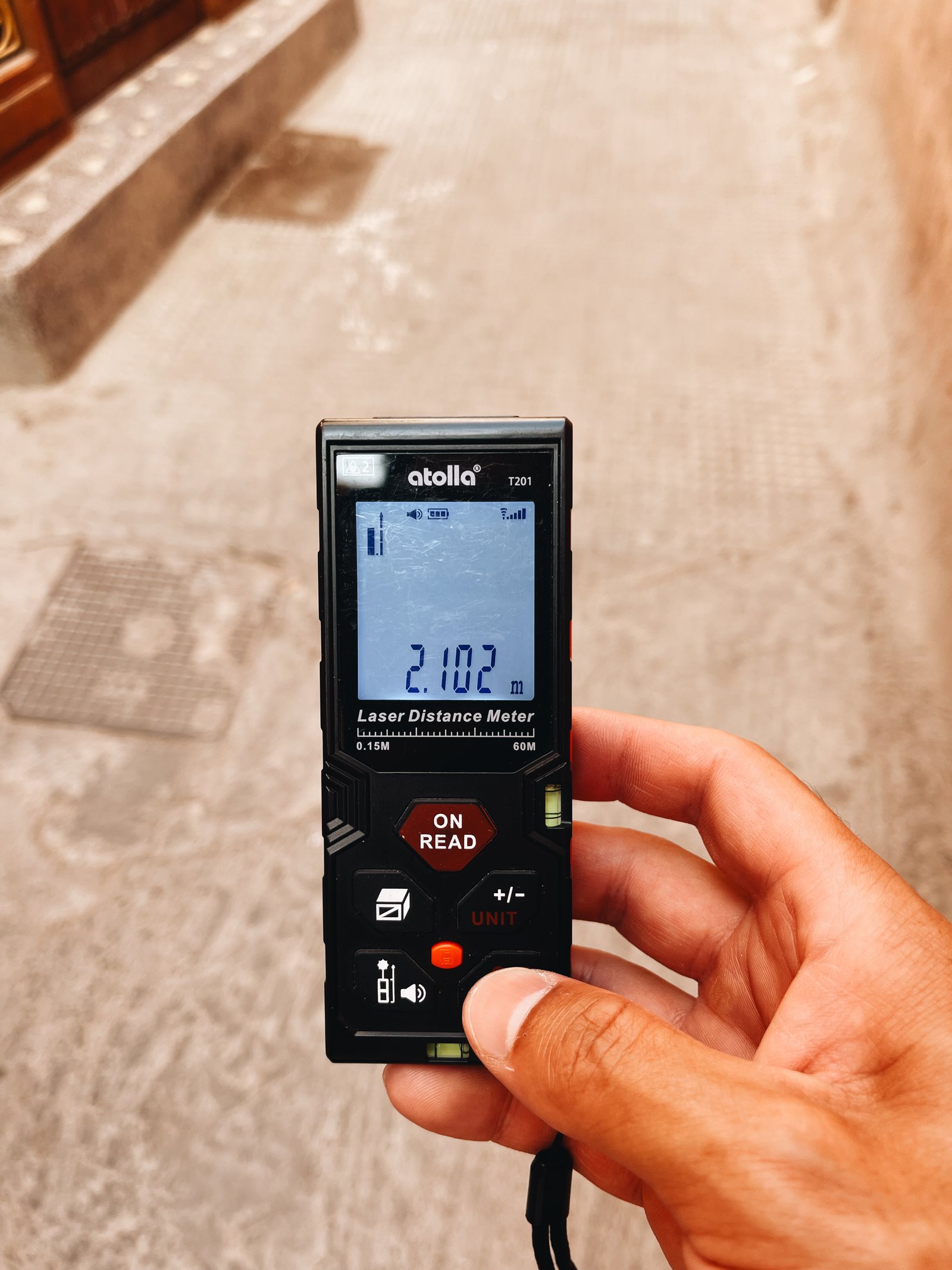
The street in front of our hotel is about 8.3m wide. (I actually measured it.) And this is generous for Palma’s Old Town. The building directly in front of us is also 6 storeys tall and has exactly zero setbacks and stepbacks. It is one straight elevation all the way up. In other words, it is an urban condition that does not follow any of today’s generally accepted rules of planning. The street should be wider. And the building should have a bunch of stepbacks, right? Maybe not. Lots of people seem to love this kind of dense, unplanned, and walkable built form in Europe. Eating outside on a narrow street is a feature. But for whatever reason, when people return home, many don’t seem to want it anymore, or worse, they actively oppose it. It’s an interesting dynamic that I don’t fully understand. Because personally, I enjoy visiting places that I could see myself living in. What about you?
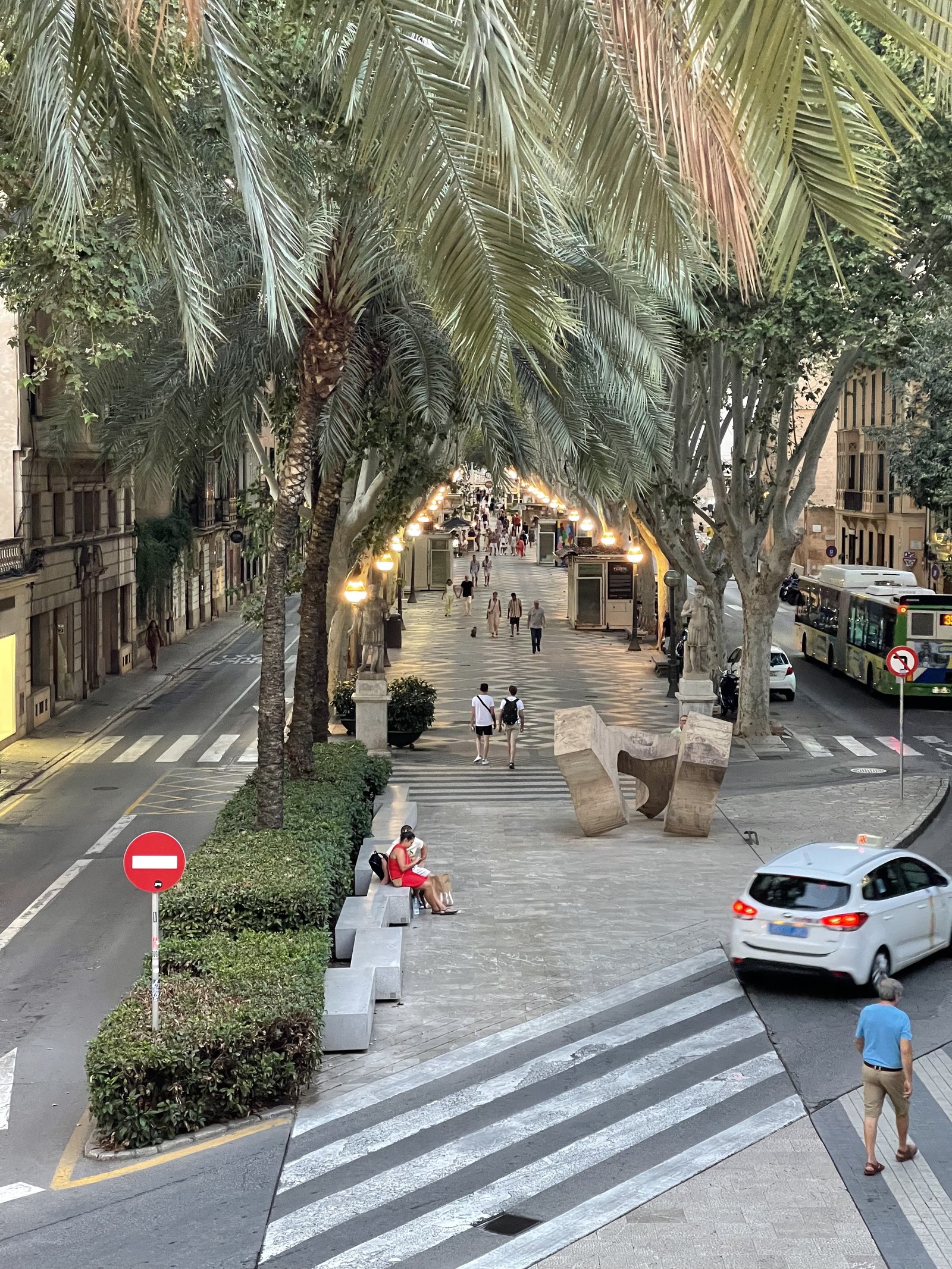
It’s hard to think of Barcelona and not think of its famed street, La Rambla. But this same street design (and name) also appears in other cities throughout Spain. The above two streets are in Palma. The first is also called La Rambla (which is supposedly derived from an old Arabic word meaning sandy riverbed) and the second is called the Paseo del Borne. Both follow the exact same urban design principles. They’re broad tree-lined streets with a large center median dedicated to only pedestrians. All car traffic is relegated to the sides. What’s great about this design is the following. One, it reallocates public space according to who uses it the most (i.e. pedestrians). Two, it consolidates the main pedestrian realm (in lieu of just having larger sidewalks on either side of the street). And three, it establishes a clear hierarchy for the street. Pedestrians are most important here, and that’s why they get the center position. It’s surprising that more cities don’t adopt this same design.
Roncesvalles Avenue is a successful north-south main street in the west end of Toronto. I say successful, because it is truly a great street. It has transit, bike lanes, a fine-grained built form, and lots of interesting retail:
But it is somewhat unique in that a large section of it is a one-sided retail street. Meaning, it looks like this:
This obviously isn’t a fatal flaw. It remains a wonderful street. And there are lots of examples of thriving one-sided retail streets. Ocean Drive in Miami Beach immediately comes to mind (notwithstanding the fact that locals tend not to go to it).
But conventional retail wisdom does dictate that two sides are better than one. Consider this 2023 report by Cushman & Wakefield ranking the top global main streets across the world. All of the streets that I have been to before are two-sided:
5th Avenue in New York between 49th and 60th (above 60th is, incidentally, when the street converts to single-sided because of Central Park)
Montenapoleone in Milan
The main street of Tsim Sha Tsui in Hong Kong
New Bond Street in London
Avenues des Champs-Élysées in Paris
Grafton Street in in Dublin
Passeig de Gracia in Barcelona
Bloor Street in Toronto
These are all two-sided retail streets.
None of this is to say that the west side of Roncesvalles has nothing going on. It has a diverse mixture of uses, including churches, libraries, apartments, and many other things. But I think there is still an argument to be made that it has been hamstrung by restrictive zoning.
That said, Roncevalles is defined as a “major street” in Toronto’s Official Plan and so it does fall under the city’s new Major Street Study. Maybe that changes things.
One of the commitments that Paris made for this summer’s Olympics was ensure that every single competition venue was served and accessible by public transport. In fact, if you look on their website, it clearly says “no venues in the Paris region are accessible by motorized vehicles.”
L.A. mayor Karen Bass said Saturday the city is working on expanding its public transportation system to hold a “no-car Games” in four years, which means spectators will have to take public transportation to all Olympic venues. To accomplish this, she added that L.A. will need more than 3,000 buses and plans to borrow them from around the U.S.
Of course, the built environment of Los Angeles is slightly different than that of Paris’. One was built around the car, and the other was not. And I think the success of Paris 2024 shows how a robust public transport system is uniquely equipped to absorb significant demand shocks when needed.
Not only was the audacious gamble of organizing the first Olympic Games completely accessible by low-carbon public transport, on bicycle and on foot successful. Not only was transportation to the many competition venues scattered around Paris and its surrounding region fluid. But the transit network and its agents also proved their ability to ensure, thanks to planned initiatives and adapted resources, fast, reliable and even pleasant travel. What’s more, the Paris Olympics offered the pleasing spectacle of a large city mostly freed, for a time, from the clutches and nuisances of automobile traffic.
But regardless of built form, both of these examples represent one of the positive externalities associated with hosting the games. They force cities toward massive positive change, and that’s always a good thing.
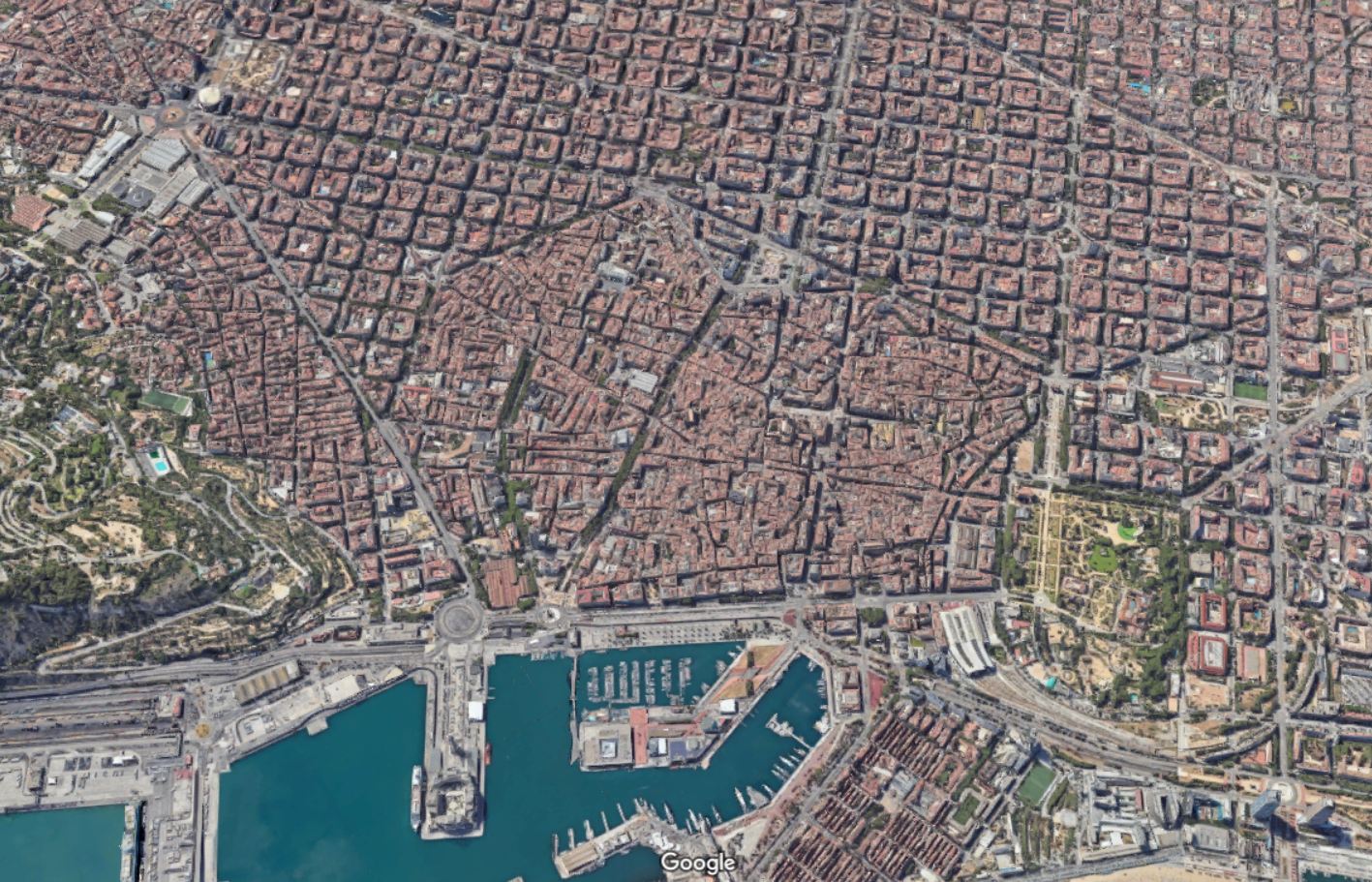
Let’s continue with our theme of city blocks and talk about another city with a noteworthy street grid: Barcelona. Up until the middle of the 19th century, Barcelona was a tiny medieval city hemmed in by 6 km of walls and totalling just over 2 square kilometers. If you look at a map of the city today, it’s pretty easy to see where this was:
This was of course done for military purposes. Barcelona’s medieval walls helped the city resist siege after siege. But the result was also overcrowding, unsanitary conditions, and a generally low life expectancy. So after much debate, it was eventually decided that the walls would need to come down and that the city would need to expand outward.
This then raised the question: how should it be done?
Enter a civil engineer named Ildefons Cerdà. Created in 1860, the Cerdá Plan for Barcelona was a continuous grid of blocks intended to guide the future growth of the city, similar to what the Commissioners’ Plan did for Manhattan. The blocks measured exactly 113.3 by 113.3 meters and each was to have a central open space of at least 800 square meters.
In his original plan, the streets were to be 35 meters wide. But supposedly these were narrowed to no more than 20 to 30 meters due to criticism from the public. Wide streets and more lanes were, I guess, not seen as a benefit in the second half of the 19th century. Either this, or landowners simply wanted bigger buildings.
The Cerdá Plan got approved in 1860 and, today, the city looks like this:
One particularly unique feature of this plan was that the blocks all had/have chamfered corners. This improved visibility at the intersections, as well as created opportunities for public spaces and other uses. For better or for worse, today, you’ll find parking for cars and scooters, bike share stations, ramps leading to underground garages, patios, and more.
The heights of the buildings on each block were also intended to be capped at a consistent height. But even with relatively few tall buildings, the Cerdà Plan led to one of the densest cities in Europe. Today, it is also viewed as a highly livable and desirable city. Hence why the city announced a total ban on short-term rentals. Too popular.
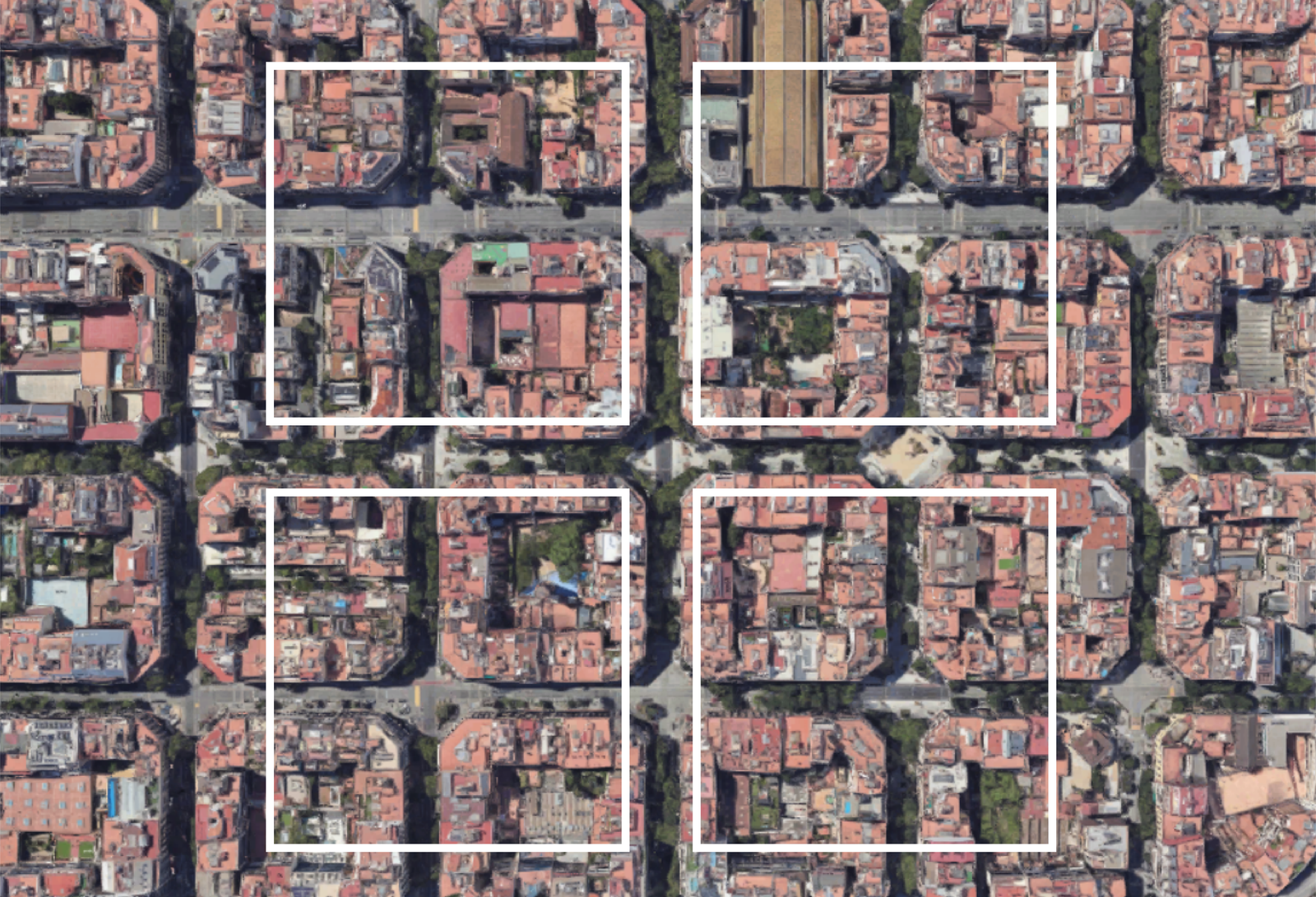
Now for a comparison. Last week we spoke about Salt Lake City’s large city blocks (here and here). And so for fun, here’s what these blocks would look like on top of Barcelona:
The most obvious takeaway is that Salt Lake City has larger city blocks than Barcelona, and that’s one reason why, objectively, Barcelona is more walkable and urban than SLC. But I think you could also view this graphic as a tremendous opportunity.
Barcelona is in the midst of rethinking its urban fabric around something called “superblocks.” The idea here is to cluster blocks together and then concentrate transit and vehicular traffic along its edges, creating a more pedestrian-focused center. For example, in its largest form, a superblock might be a 3 x 3 grid, creating a grouping of 9 city blocks.
But it doesn’t necessarily need to be a 3 x 3 grid. Other permutations are possible and the city plans to eventually introduce over 500 of them.
The first superblock was implemented in 2017 and, not surprisingly, it improved air quality, increased quietness, and led to a significant decrease in car usage (-92%). Interestingly enough, it only led to a moderate increase in car traffic on surrounding streets (+3%). Traffic can be a funny thing.
Creating superblocks out of smaller blocks is naturally easier than the opposite. You have an existing grid to work with. But there’s no reason that the opposite can’t also be done. And I think that’s one way to look at Salt Lake City’s street grid. It already has its superblocks. Now it’s just a question of creating all of its smaller blocks.